Our first day back on the trail after Denver brought us to the James Peak Wilderness, just before the last 13,000 ft peak on the trail.
To save time this morning and get back to the trail as quickly as possible, CareFree and I had trail food for breakfast, rather than going to a restaurant.
We started trying to hitch out of town at 8 am, and despite traffic going slow because of road construction, no one seemed willing to pick us up. After about 20 minutes, one of the construction workers offered to give us a ride up to Berthoud Pass “in an hour” when he left town to go to Denver.
Almost half an hour later, we finally got our ride, from a guy named John. He was sympathetic to hikers (and hitchhikers in general), since he’d been on a bikepacking trip in Europe in 1989 and got lots of support from locals.
About 20 minutes later, CareFree and I were at Berthoud Pass, and began our hike up the somewhat steep climb towards Mount Flora.
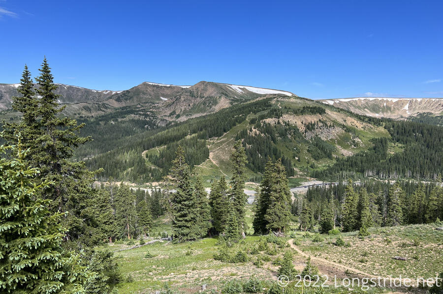
It was a beautiful day out, mostly clear, but with a few clouds out that added a bit of spice to the sky.
Recently, CareFree finished a six-week cycling trip across Germany, Finland, and Norway, cycling almost 1600 miles from her home in Germany to the northernmost point in Europe, Nordkapp. With the trail at over 10,000 feet (and going above 13,000 feet this section), and the vast majority of her cycling trip near sea level, we both expected CareFree to have issues with altitude, since her only acclimation was a few days in Denver (at 5,000 feet), and overnight in Winter Park (at 8,700 feet).
Despite that, though, she outhiked me the whole day, taking an early lead from the trailhead and staying ahead most of the day.
As we approached the summit of Mount Flora, two fighter jets zoomed through the sky to the south. They were unfortunately too far away to make for good photos.
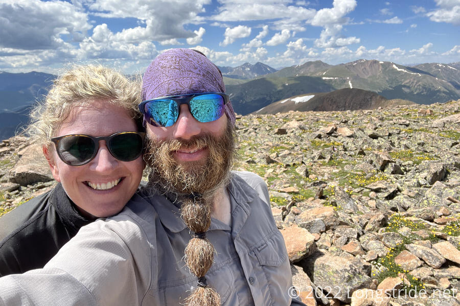
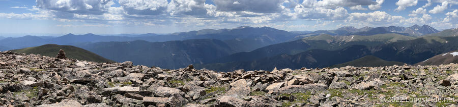
We took a break at the summit of Mount Flora, where we had great views all around.
The trail coming down from the summit became quite rocky: the trail itself was a somewhat worn rock path in the midst of a sea of rocks, making it occasionally hard to follow the trail. It wasn’t too bad if you took your time, but going too fast could easily overshoot you past a turn in the trail.
On our way down from the summit, we met a couple in the middle of their multi-year hike of the CDT. This year, they were hiking the roughly 300 miles from Steamboat Springs to Twin Lakes. Previously, they had completed the Pacific Crest Trail with a 25 year gap between sections.
The rocky stretch lasted about an hour, with a little bit of snow to make things interesting, before turning back onto dirt trail. A little while later, the trail entered the James Peak Wilderness, crossing a rickety bridge over a creek. It then began climbed up a short hump, before dropping back down via some steep switchbacks to Fall River.
At the river, we stopped for a break, and I was a bit distressed to find that my water bladder appeared to be leaking: the bottom of my pack was far wetter than it should have been, and the pouch my water bladder was in was completely soaked. This would be a bit of an inconvenient place for it to have sprung a leak, since I doubt it’d be possible to replace it if necessary until Steamboat Springs, at least a week ahead.
From the river, the trail began a steep uphill towards James Peak. We took it slow and steady, but at least to me, it felt faster than this morning’s uphill out of Berthoud Pass.
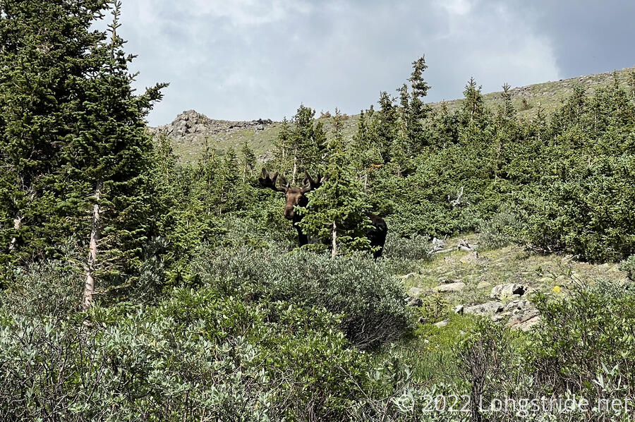
As storm clouds began to gather to the north, we were surprised to see a moose, maybe 50 feet off the trail, “hiding” behind a tree. (It was not a very effective hiding spot.) It was the closest I’ve ever been to a moose.
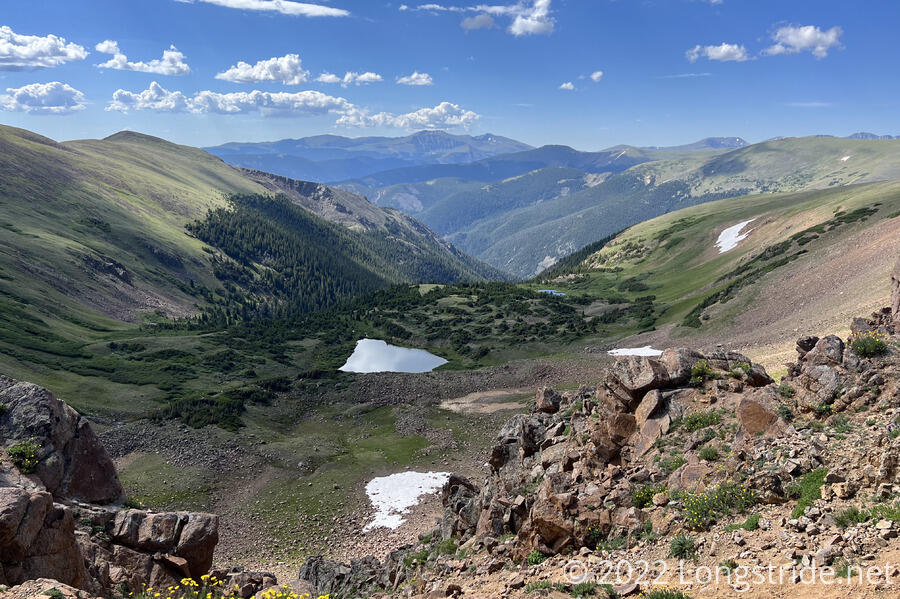
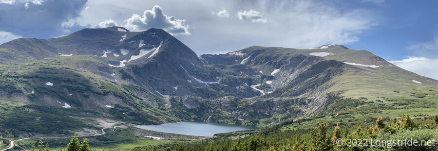
The storm clouds grew darker, and we picked up our pace a bit. To the north, Loch Lomand stood at the base of Mount Bancroft, fed by waterfalls cascading down the mountain. I felt it was the most scenic part of the day.
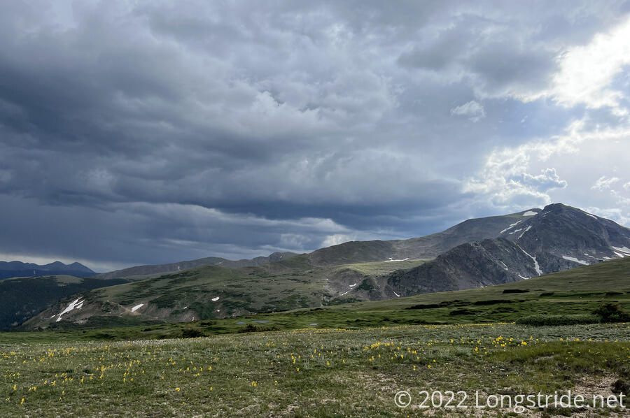
At some point, we left the James Peak Wilderness, only to re-enter it again as James Peak itself loomed in the distance. The clouds darkened, and we decided we needed to stop hiking before it actually began raining. Fortunately for us, we found a workable flat patch of land next to some trees that provided protection from the wind. (Though, from a not entirely helpful direction, given where the brewing storm was coming from.) I set up camp, while CareFree went ahead a bit to get water.
In the process of setting up camp, I discovered that my water bladder was definitely leaking from the water hose connector. I suspected I didn’t get it fully plugged in when I refilled it; tomorrow will answer the question of whether that was the problem or not.
Near the tail end of dinner, we got a short light rain, but nothing serious, and a little nub of a rainbow appeared after the rain stopped. I wasn’t entirely convinced James Peak got any rain at all, but, better to play it safe, especially since it was CareFree’s first day on trail. It was already 5:30 when we stopped, and if we’d gone any further, we’d have gotten to camp quite late.
We didn’t go as far as we’d planned today, but we figured we’d be able to make up the distance tomorrow with slightly lighter packs and some relatively flatter terrain.
First thing tomorrow, though, we’ll summit James Peak, both the last thirteener on-trail, and the last time the trail itself is above 13,000 feet.