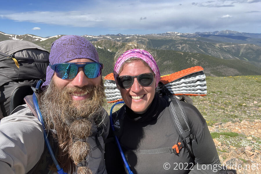
Today took me over James Peak, the last thirteener on the trail.
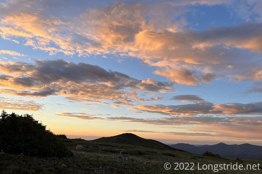
It was windy overnight, and my tent flapped pretty significantly, though nowhere near as bad as it did in the early days of Colorado. A few clouds left over from yesterday’s weather lingered, providing a quite colorful sunrise.
CareFree and I got up around six, and after briefly stopping at the creek just north of our campsite to get more water, resumed our hike up to James Peak a little after 7:30. After a rather steep climb yesterday to the relatively flat area we camped at, the trail resumed with an even steeper climb up to the summit.
I had a bit of a rough time with the combination of altitude and steepness, and the two mile hike to the summit took me almost an hour and a half.
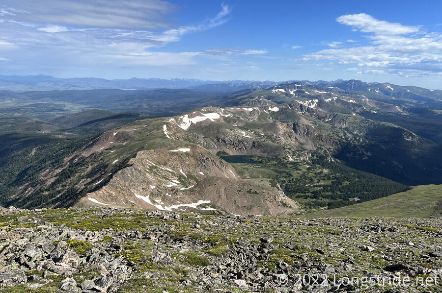
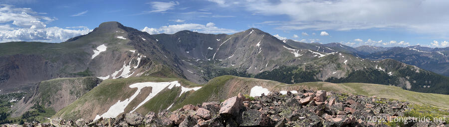
From James Peak, we had a fantastic view of the area, including several ridges that joined at the summit.
We’d seen a pair of hikers ahead of us on the climb up to the summit. By the time we got there, they were long gone. We saw them off in the distance on one of the ridges that the CDT did not follow, and wondered where they were going.
At 13,294 ft, James Peak is the last thirteener on the trail. Once we dropped down the north side of the mountain, it would be the last time the trail approached 13,000 feet. I breathed a sigh of relief; hopefully the trail would become a little bit easier now that it would never be this high again.
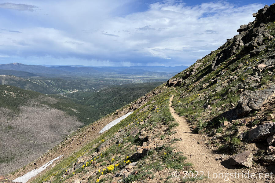
The summit area was rather rocky, and this extended down the steep north face of the mountain. Eventually, the trail leveled out a little bit, following a narrow ledge carved out of the side of a slope. We were able to see the towns of Winter Park and Fraser along this stretch of trail.
We stopped for a break at Rogers Pass, where a dirt road branched off from the trail. We briefly contemplated taking the road, which reconnected with the CDT further north, but decided against the roadwalk, instead opting for the more scenic trail. (The road also would also have involved more elevation change, which I was hoping to keep to a minimum since the the trail was still fairly high up.)
From the pass, the trail climbed up a bit, heading towards a ridge with a steep drop-off to the east. A short distance off-trail was Heartbeat Peak. The peak was likely named from Heart Lake below it, but the pink rocks around the summit also fit the theme. I decided to go off-trail to summit the peak, while CareFree continued ahead on the CDT. Looking back from the summit, James Peak stood prominently.
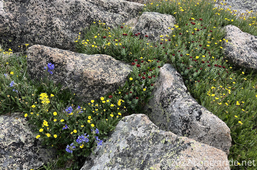
Once the trail reached near the edge of the ridge, it sort of faded away. Rather than a clear trail, there were occasional cairns to follow, but mostly the trail ran cross-country. The ground was mostly small flowering plants and rough rocks, and while it wasn’t especially difficult or strenuous to hike, our pace slowed considerably.
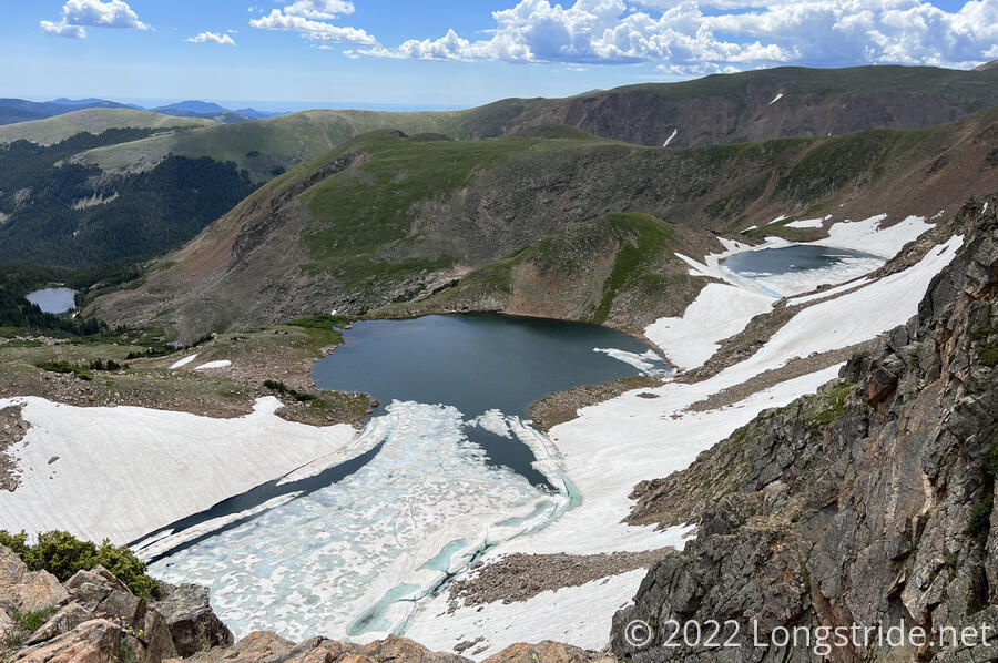
While there was no snow near the trail, the slopes below the ridge still had a fair amount left. The aptly-named Iceberg Lakes exemplified this: a partially frozen-over lake drained into a larger, more frozen-over lake.
The trail continued to be quite beautiful, though rough and slow going, and while I didn’t regret skipping the road, it was clearly visible in the valley to the west, taunting us. A day-hiker heading southbound boosted our spirits: he’d hiked the Pacific Crest Trail last year, and was giving out various chocolate bars to the CDT hikers he passed.
Eventually, the ridge we were on became sufficiently annoying, and we were clearly not going to meet the mileage goal we had for the day. (Also, CareFree had begun feeling the effects of her relatively sudden and significant change in altitude.) We dropped down from the ridge to the road, which improved our pace quite a bit.
We stopped for a second break at a parking area at Rollins Pass, just before the Indian Peaks Wilderness. Now over five hours into the day, we’d only hiked 8.5 miles, not even half of what we’d expected to do today.
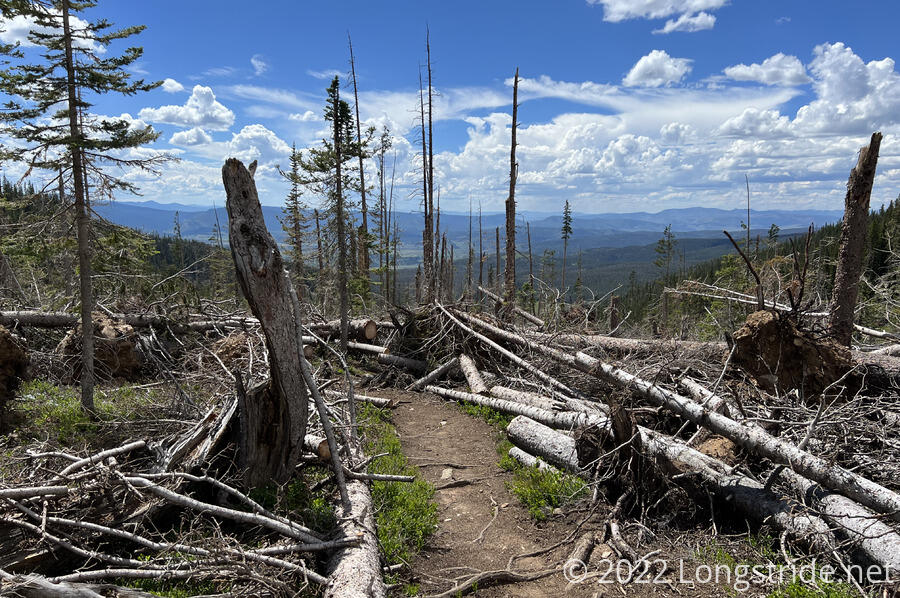
Entering the Wilderness, we followed the trail up a steep grassy slope, which led to a saddle, and a steep slope down into a valley. Reaching the treeline, we were greeted with one of the largest — if not the largest — areas of blowdowns I’ve seen on the trail. A severe windstorm in September 2020 had rendered a mile and a half of the trail completely impassable. Fortunately, trail crews had since cleared the fallen trees from the trail, and the magnitude of their effort was plainly visible.
We stopped for a snack on a wooden bridge across a creek. The sound of water flowing under the bridge was nice and calming, and though it might have been nice to be able to stop there for the day, we still had three hours of daylight, and stopping here would have made for a likely intolerably long day tomorrow.
We pressed on. Shortly after leaving the bridge, an extremely loud thunderclap rang out, seeming to have come from directly overhead. Over the next half hour, we got a few more (but much quieter) thunderclaps, but fortunately, no rain. Shortly before six, we reached one of the very few campsites actually directly indicated on our trail guide, adjacent to Hamilton Creek, and managed to get the tent set up just before a light rain started.
We relaxed a bit in the tent while it rained. Once it stopped, we got out and cooked our dinner, finishing just before it started raining again.
With a long day planned for tomorrow — 26 miles to Grand Lake — we turned in early for the night, hoping to get up and go as early as we can in the morning. This is the problem with booking lodging so far ahead of time; you never really know what the trail is going to be like until you’re actually there. Yesterday and today have been rougher than I expected; hopefully we’ll get a reprieve tomorrow.