Twenty miles and a handful of on- and off-trail mountain summits brought me closer to my next trail town, Fraiser.
It was pretty cold this morning, probably because I camped next to a fairly large creek. As with yesterday, I wanted to start at 6 am, though today was because I was going to be hiking 20 miles and wanted to be done at a somewhat reasonable time. Of course, I didn’t start hiking until 7:30.
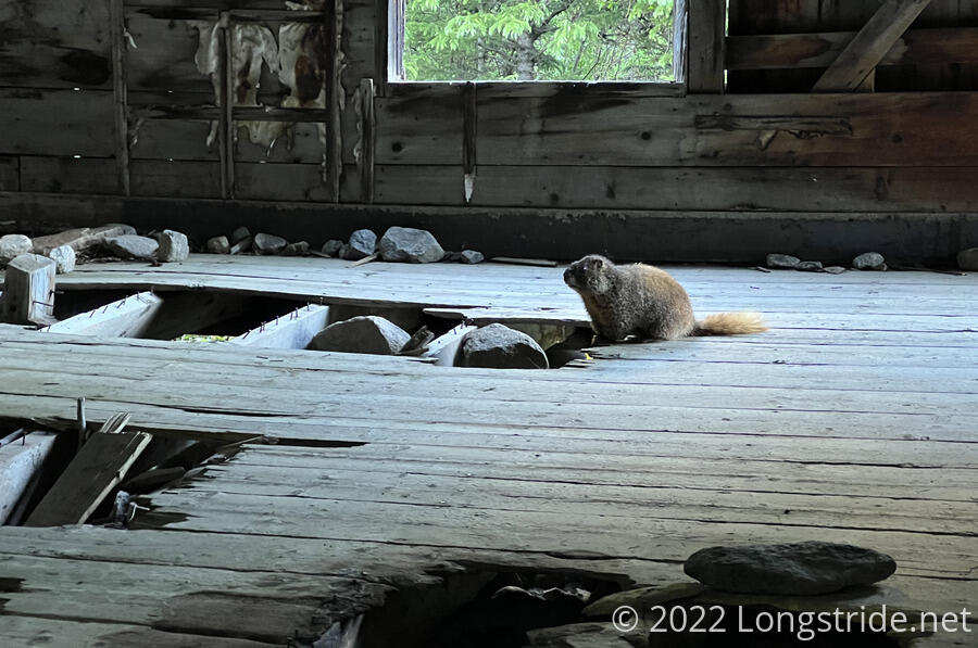
As with yesterday, I started off on a dirt road. This time, however, I got to go downhill. The road was fairly well-maintained, and not too steep, and I made very good time. On my way, I passed the ruins of a house, which a marmot had claimed as its own.
After reaching a road junction and parking lot, the trail turned onto a paved bike path that ran parallel to I-70 for several miles. An information board at the parking lot indicated that Grays and Torreys Peaks, which I summited yesterday, were named after botanists Asa Gray and John Torrey.
Early on, a few bikers passed me going south. After that I didn’t see anyone else on the bike path. It was pretty nicely secluded, with trees on both sides of the bike path for most of the three miles I was on it.
The trail split off from the bike path, following a trail through the woods, and then over a bridge over fairly big creek. Briefly following a road, the trail passed under Interstate 70; this seemed a fitting balance to the Appalachian Trail, which crosses over I-70 in Maryland on a dedicated bridge.
The trail then entered a rather large trail head parking lot. Now about six miles in, I decided to stop for a break. I sought out the only shade available, which was behind the trailhead information kiosk, and conveniently near the porta-potties. (Neither were especially clean, but the one designated for women was absolutely disgusting.) The back of the kiosk made for a convenient bench, which inconsiderate dog owners used to stash several bags of dog waste “out-of-sight” (but certainly not out-of-smell).
A large, bright orange sign at the trailhead warned skiers (and everyone else as well) that avalanche blasting may occur at any time using long-range weaponry, and that any projectiles found should be left alone and reported.
Fortunately, I did not find any unexploded ordnance.
As I was finishing up, another hiker, Blackout, arrived at the trailhead. He was a few hours behind me yesterday, and got stuck on the ridge between Edwards and Grays during a thunderstorm.
The parking lot was full of cars, and the trail beyond full of day hikers. From the trailhead, the trail started off on a relatively flat and easy trail, and then turned steeply uphill to follow a stream valley. The trail followed the stream valley for quite awhile, alternating between gentle and steep ascents. True to form, I found myself hiking uphill with a full pack (though only two days of food) faster than all of the day hikers, passing several of the hikers that had started up the trail while I was on break.
Eventually, the CDT turned off the trail at an unsigned junction, and I had solitude for most of the rest of the day, and a more mellow climb, at least for a while.
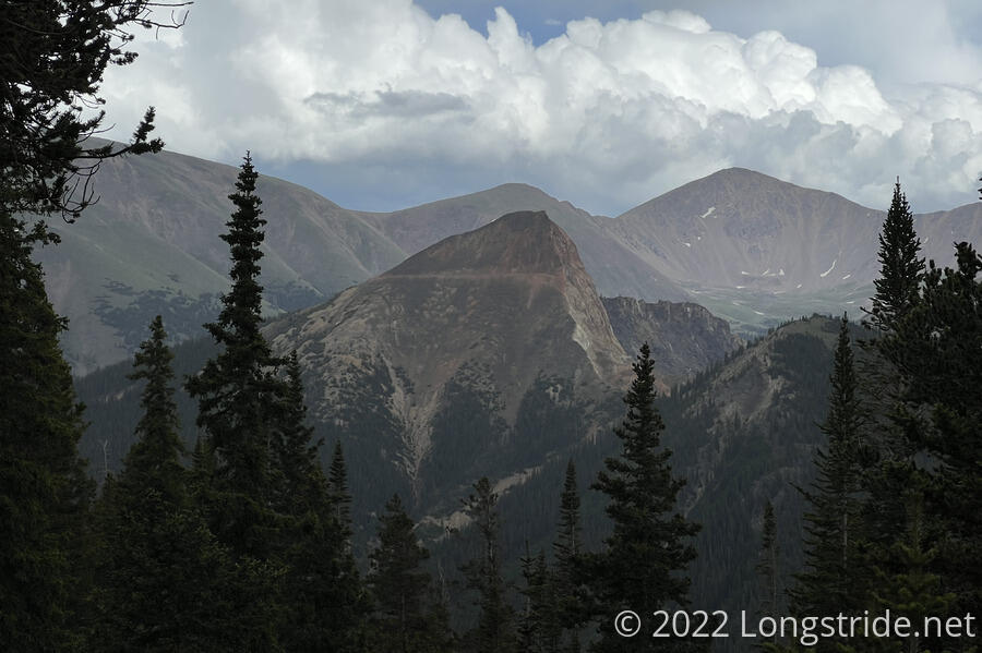
After crossing over a saddle to another valley, the trail began a more steep climb, eventually switchbacking up the side of Hassell Peak. About forty minutes before I got to the summit, I could see another hiker already near the top. When the switchbacks turned me temporarily away from Hassell’s summit, I was now heading in the direction of a storm cloud. I picked up my pace a bit to try and get away from it.
Near the summit, I ran into the hiker I’d seen earlier,. The Austrian. He had made it to the summit, but his knee was giving him problems, and he didn’t trust it much on downhills. So he was returning to town to deal with it.
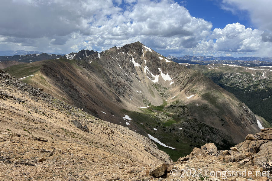
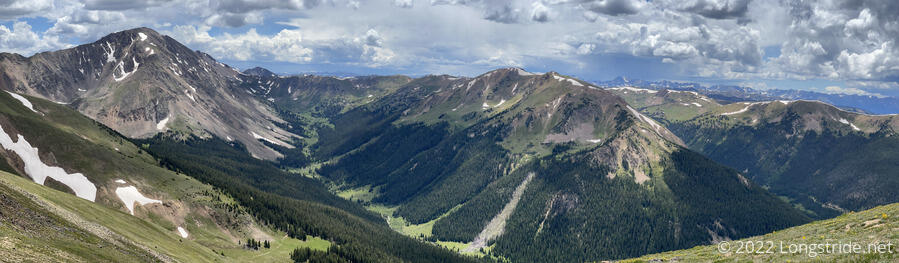
The view from Hassell Peak was pretty great, but with storm clouds advancing and the wind picking up, I didn’t linger too long. I continued north, away from the dark clouds.
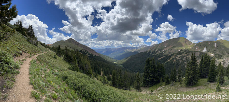
After leaving the peak, the trail largely followed the top of a ridge for many miles as the ridge gradually descended. I had great views in all directions, slowly changing as I advanced north.
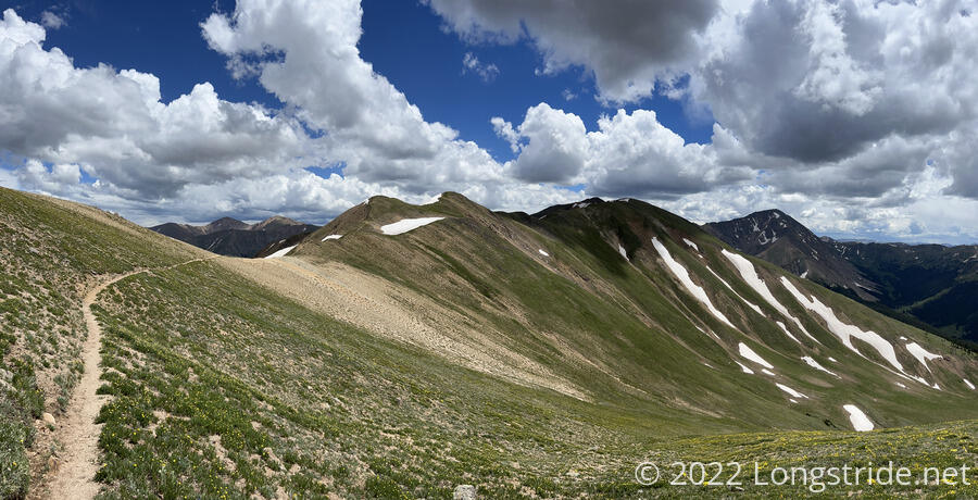
Along the way, I passed under a set of power lines strung up on wooden towers, which seemed to confirm my suspicion yesterday that the wooden remnants on Argentine Pass were old power line towers.
Later, I came across a small trail magic cache with some candy, electrolyte drink mix, and a box of sardines with olive oil.
I continued along the ridge, diverging from the trail (which wrapped around the side of the mountain) to climb up to Bobtail Peak, a short distance off the trail. Climbing up to the peak from the south was pretty easy; there wasn’t a whole lot of vegetation to worry about and the climb was only a bit steeper than the ridge had been so far. However, getting back down required dropping off the ridge, partially sliding down a steep and somewhat loose slope to get back to the trail. (Following the ridge further wasn’t an option: it became extremely steep and rocky, and definitely not hikeable.)
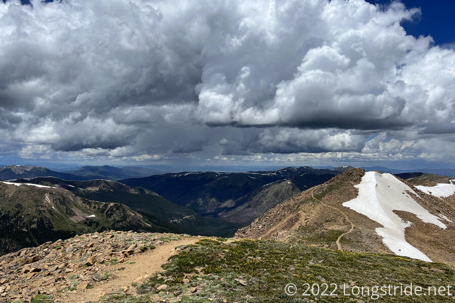
Meanwhile, dark clouds continued to build ahead of me as the trail rejoined the ridge.
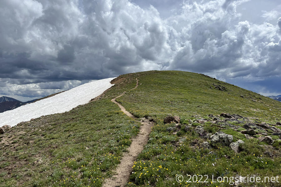
After summiting an unnamed peak, I rather steeply dropped off the ridge. As the sky darkened, I cut across a snow field, avoiding a switchback and saving about a tenth of a mile.
Stopping for a break shortly after, I put on my rain jacket and pack cover as a few raindrops fell and the clouds continued to darken. I’d been lucky so far today to only have had to deal with a few short sessions of barely-worth-thinking-about rain, but now it seemed my luck was going to run out.
And it did rain on me for a short while, but fortunately, not very hard, and only for about twenty minutes or so. The sun came out, and there was a little bit of a rainbow.
While it was raining, I hiked towards something that was making a very loud and somewhat unpleasant droning sound. I wasn’t sure what it was at first, but as I got closer, I could see in a valley below the trail a factory of some sort. I guessed it was probably a mining facility of some sort, given the scars on a nearby mountain.
By the time I stopped for the day at a campsite just off the trail, the sun had come out and the skies cleared up. It felt like the first time in a while that it wasn’t absolutely miserable at camp. Most of the campsite was under tree cover, but there was enough unshaded area that I was able to dry out my sleeping bag in the sun.
The rest of the evening was mostly uneventful. I forgot to zip up one of my tent doors while I was putting stuff in my tent, so after dinner, I had to evict a spider and a rather large ant.
Tomorrow: A short day to Berthoud Pass, hitch into Fraser, and a train ride to Denver.