Today, I left Rawlins to begin what should be a four and a half day stretch to South Pass City, my next resupply point.
The section north of Rawlins begins the Great Divide Basin section of the CDT. The Great Divide Basin is an endorheic watershed, which means that it has no outlets. Any water that falls in the basin stays in the basin (or evaporates). Directly on the continental divide, the Great Divide Basin is the only place along the CDT where the divide splits in two, going around the basin. (Note that the Great Divide Basin is separate from the Great Basin, also an endorheic basin.)
The next hundred miles is a very dry section, with no tree cover. Expecting constant sun exposure, I wanted to leave town as early as possible, so that I could get as much hiking in while the sun was lower in the sky.
But, the soft bed and Internet access made it hard actually get going. I wanted to start hiking at six, and I didn’t leave my room until 7:45.
Yesterday, I saw a banner somewhere advertising that the Rawlins Lions Club was doing a pancake breakfast this morning. It turns out that the location where they were having the breakfast was only a couple blocks away from my motel. If I had realized it was so close, given how late I wound up leaving, that might’ve been motivation for getting started earlier so I could have all you can eat pancakes again. (The Lions Club pancake breakfast in Winter Park was terrific, and I had no reason to suspect this one wouldn’t be.)
Continuing the roadwalk from the day before yesterday, the trail headed north on a road out of town, passing both a Wyoming State Penitentiary, and a cemetery. A fence with barb wire adjacent to the sidewalk isolated the prison compound, but the fence had a gate that was chained “shut”; it had a gap wide enough that a person could easily squeeze through.
For a good portion of the two and a half miles along the highway, I regretted not just staying at the 1st Choice both nights; it was a better room, and I could have cut off a mile or two of back-and-forth, since it was almost a straight line from the 1st Choice to where the trail turned off the highway onto a dirt road.
A large, orange sign with faded, weathered photos announced that access to 19 miles of trail ahead were via a donated easement. I’d initially misunderstood that as being the next 19 miles. If only. I’m not quite sure yet how far the private land stretches, but it made for a bit of a nuisance finding a campsite today. More on that later.
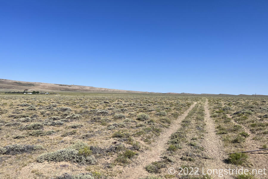
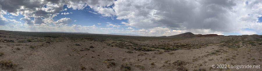
I followed the dirt road through a flat expanse of desert scrub, with no shade. Only the mountains in the distance broke the flatness.
A bit south of a parking lot with a few massive piles of gravel, the trail veered off the road, heading into the scrub on a completely indistinct trail. I would have completely missed it if I hadn’t known to look for it; I almost didn’t even see the CDT marker, on a fiberglass pole that had been snapped off at its base. I opted to just stay on the road, which reconnected to the CDT on the far side of the parking lot. I suspect the trail detoured around it because there seems to be a nearby mine. The detour only saved me a tenth of a mile, but probably a lot more than that in time, since the dirt road is still faster than bushwhacking through desert scrub.
I continued following the road north, into an area being used as a cow pasture. A particularly intransigent cow insisted on standing right on the trail, forcing me to detour around. I accidentally hit a cactus with the side of my boot, just hard enough for one of its spines to just barely poke my foot.
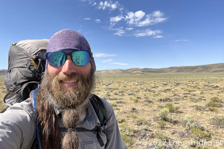
Continuing up the dirt track, I could seem some farm buildings down a larger road. Far ahead, the hills formed ripples.
Around ten, I stopped for a break just before the road to the farm. It was quite bright and sunny out, though a light breeze helped. Some clouds forming to the south taunted me.
An hour later, a few miles up the dirt road, I missed a turn off the road; as before, the trail turned off the road onto an indistinct path. When I realized my mistake, I just went cross-country in the direction the trail was heading (and attempted to avoid stepping on a cactus again). I arrived at a small grove of trees, the only shade near the trail all day, and stopped there for another break. The shade — and the breeze which picked up — were refreshing. I was tempted to take a nap, but refrained from doing so.
The trail climbed up a small hill, and became somewhat indistinct, causing me to wander a bit off-trail for a little while. Then, it went through a barbwire fence with no gate. Fortunately, someone had propped up the bottom wire of the fence with a rock so it was possible to crawl under, but it very much felt like an unnecessary bit of adversity.
The indistinctness of the trail continued most of the way to today’s water source, a small fenced-in pumped spring, where I stopped again, only a mile and a half after my last break.
The spring collected in a half-sunken container, and the water level was so low it took some effort to collect water; I needed to hold open my water bag so that the pressure of the water in the container didn’t collapse the bag. I was only going to collect enough to drink and top off, but then I considered that the next water source was 16 miles ahead. I wasn’t ready to commit to either a 28-mile day, nor the six more hours of hiking to get there, nor carrying sufficient water to allow stopping short of that distance (especially considering I had an extra two days of food for the next section). I decided that, even though there was no shade at the spring, it’d be a good idea to cook dinner here. At the least, that’d get the sun a little lower in the sky, and a dinner’s worth of weight out of my pack.
While I was there, for about an hour and a half, another hiker — Trainwreck — came and went. The clouds increased, but did nothing to block the sun. One of them briefly drizzled on me.
Now lighter by the weight of one dinner, I set a goal to make it to the water source in 16 miles. If I could make it there, there ought to be a good campsite, and I’d have plenty of water to start the day.
Just past the spring was a great campsite — it would have been perfect had I not zeroed yesterday and gone for a short day. Past that, the trail continued on a dirt path, but at some point, diverged from path. With no obvious markers, I kept following the path, since it was clear from footprints that other people were going this way as well. This led me somewhat substantially off trail, but at least I was aimed in the right direction, so I was still making forward progress.
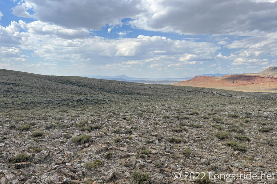
Once I did make it back to the “trail”, it was still somewhat difficult to follow. The trail itself was indistinct. There were markers, but nearly all of them had fallen over (or more likely, been knocked over by cows using them as scratching posts). There were small cairns where there were markers, but it was hard to distinguish small rock piles that marked the trail from the natural rocks and scrub. It made for slow going, bushwhacking through uneven terrain, having to constantly check the map to ensure I was going in the right direction, and also having to watch out for the numerous tiny cactuses all over the place. This was no trail, it was a bushwhack through the desert.
Eventually, the trail reached a highway — the same one I’d walked on to leave Rawlins. If I’d been willing to do more paved roadwalk, I could have just walked down the highway and saved a couple of miles. I followed the highway for a bit, skipping past a turn-off where the trail was indicated to go on my map because apparently, the trail went through the private property of someone who actually took exception to hikers being on their land. The recommendation was to proceed much further down the highway and turn off onto another road, eventually intersecting with the trail many miles ahead. I was prepared to do this, however, I spotted a sign for the “old” route of the CDT, and followed that, crawling under another barbwire fence in the process.
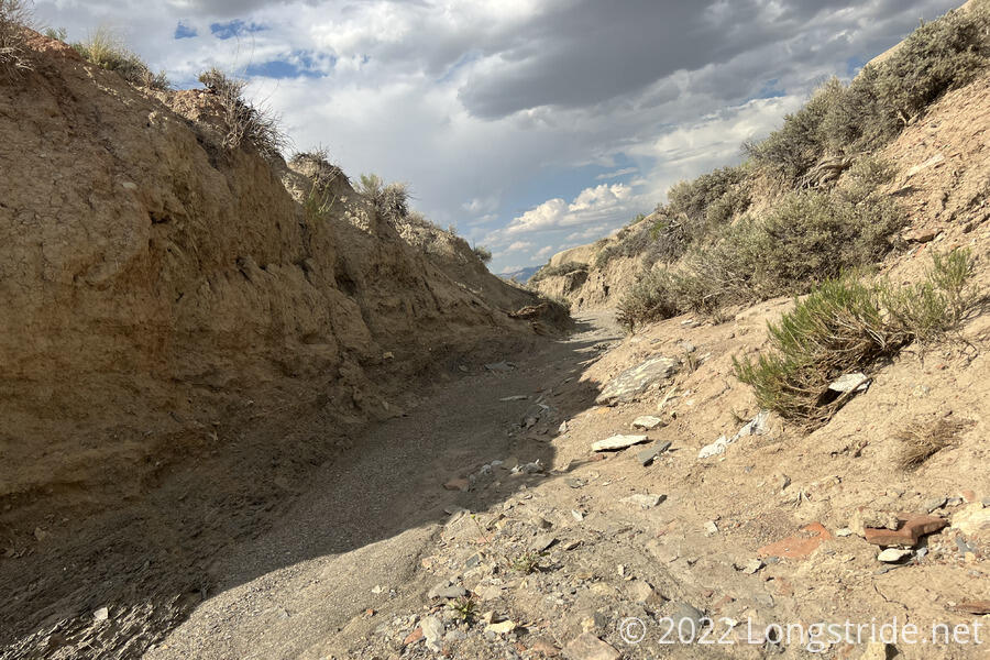
The trail here clearly hadn’t been used extensively, and it was hard to follow. A few hard-to-see posts remained, so between that and my map, I had an idea of what direction I needed to go. After crossing a deep drainage ditch, I reached a dirt track that shot off to the north-west.
The track started off a little better than the trail had been, but then I wound up a tenth of a mile off-trail following the wrong marginal dirt track through the scrub. Once back on-trail, the track seemed almost designed to be irritating. It looked like a straight line off in the distance, but it actually wobbled back and forth. It felt like it added half as much side-to-side distance as forward distance. Tired, I stopped for a break, a bit demoralized. The clouds that had been building drizzled on me again.
Once I started, again, about half an hour later, I was fairly confident I wasn’t going to get anywhere near the next water source.
The trail began going through a patchwork of public and private land. There were trail signs that marked the boundary, unusual in that they were marked as “public” on one side and “private, stay on the trail”, on the other. However, most of these signs were knocked over (by cows, likely; there were cow pies everywhere), and it was hard to keep track of whether I was in public land or not. The stormclouds grew, raining off in the distance.
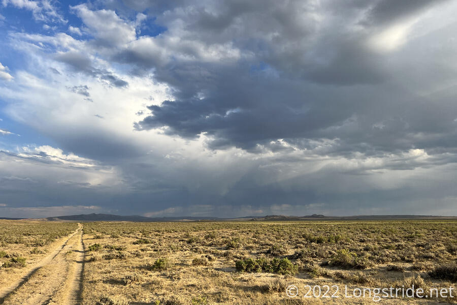
8 pm approached, and I began looking for a campsite. This was difficult, since the public easement across private land was only thirty feet wide. (It was unclear if this was thirty feet in total, or thirty feet from the trail’s centerline. I assumed the former, out of an abundance of caution.)
As I was heading up a hill, I saw a curious sight, a tent planted directly on the trail. This was normally not something I’d ever consider, but given the situation — just a few minutes before sunset, and literally nowhere else that was actually suitable — I was open to the idea myself. About five minutes later, I found a place where there was just barely enough of a cleared flat area next to the trail that I could set up — though I still had to avoid cactuses and cow pies.
My minimum goal for the day was 25 miles, which I just barely met. If I left town a little bit earlier, or was able to hike another 20 minutes, today could’ve been a marathon. Still, despite leaving town late, I’m happy that I got as far as I did. The next water source is only about three miles ahead, so that means it’s only about an hour away, not too far tomorrow before I can refill my water.