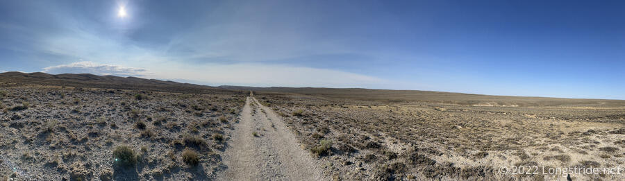
Another dirt road marathon, along the straightest stretch of trail I’ve ever hiked, took me deep into the Great Divide Basin.
Surprisingly, it rained overnight, starting just before midnight. I left two of the doors on my tent open for airflow, but because the wind blew rain in on one side, I had to close the second door on that side. Still though, by morning, everything was completely dry, and you couldn’t even tell that it rained.
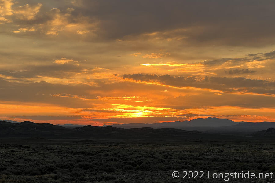
I set an alarm for 5:15 this morning, and actually managed to get up without hitting the snooze button. Just over an hour later, I was hiking, continuing northwest along the dirt track I’ve been following since yesterday afternoon. Some leftover clouds made for a fiery sunrise, and a light breeze made for a nice morning.
The trail continued along the dirt track for a few more miles, straight except for where it curved around some hills. After joining a proper dirt road for a short while (with some cows hanging around), the trail arrived at Bull Spring. Like yesterday’s Fish Pond Spring, there was a solar pump and sunken well, though the container was nearly full. While waiting for my water to filter, the sun rose up above the clouds, turning the pump on, and water spilled out of the overflow.
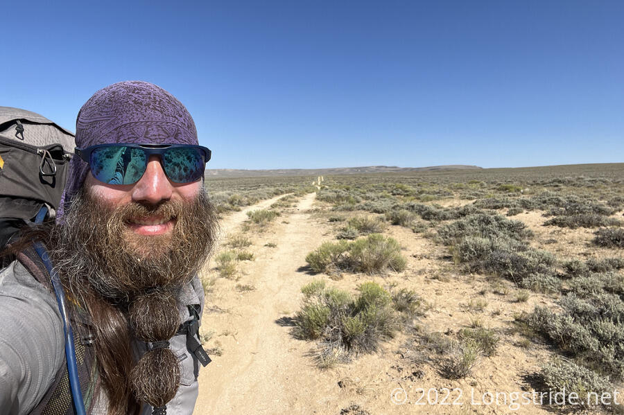
Shortly before I got started again, I also met Pecorino, who also hiked the Pacific Crest Trail in 2018, though we never met then.
Overgrown sagebrush made for a little maze leaving the spring, but once through the bush, I was back on a long, straight double-track through a flat expanse filled with sagebrush and cow pies. The trail was sort-of on the side of a hill; several small groups of cows grazed in the large plain below.
For a few miles, the trail continued in a straight line, just barely gaining elevation. A dead cow next to the trail created quite a stink. A small water cache from a local Baptist church had some water (though I didn’t need, or take, any). Both Pecorino and Trainwreck passed, with Trainwreck practically flying down the trail.
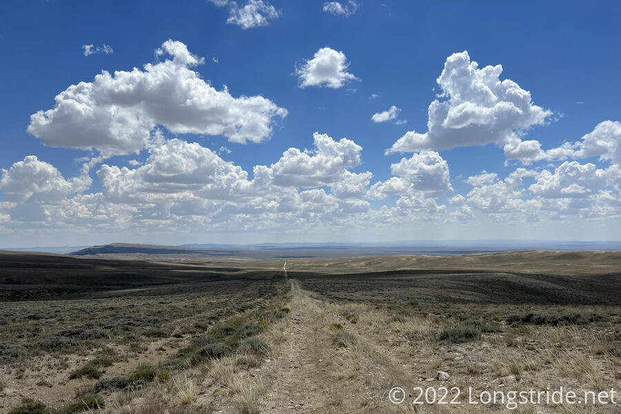
After miles of being flat, the trail climbed up over ridge, with false summit after false summit. It was a bit frustrating, and with the seeming unending monotony of the never-changing view, this felt like one of the most boring stretches of trail I’ve ever been on. At least, the uphill climb didn’t last long, and it transitioned to a many-miles-long gentle downhill. And, I did manage to hike more than twelve miles by noon.
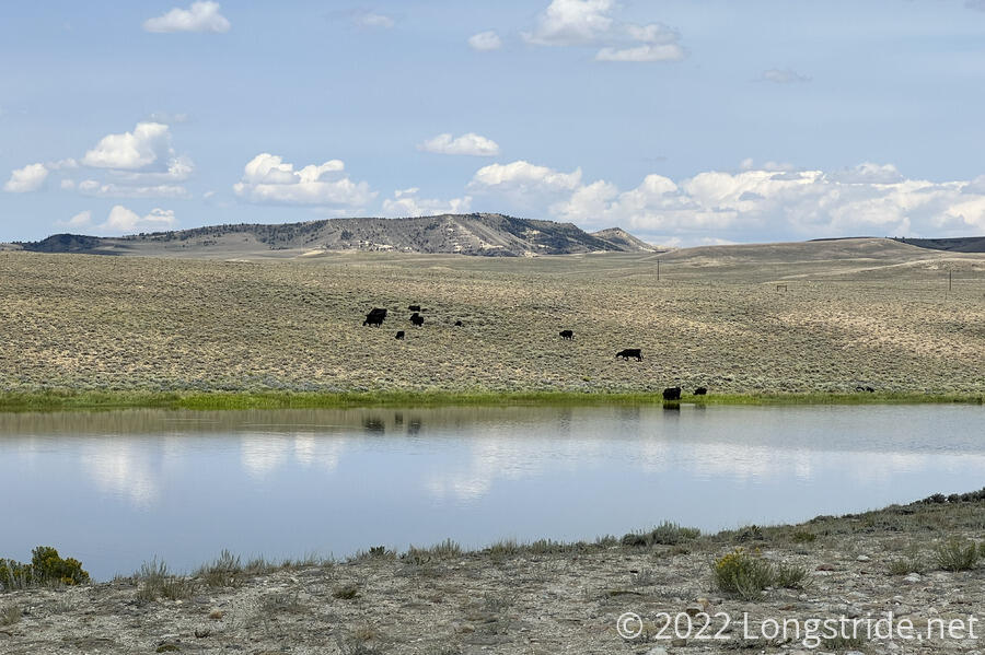
Shortly after 2, I reached the A&M Reservoir, more than 17 miles from where I started. This was the largest body of water I’ve seen since a reservoir a few miles south of Rawlins. A sign described it as part of a habitat development project, with a fence surrounding the reservoir to keep out livestock and wild horses. The fence did not work as advertised; there were cows on the far side grazing and drinking from the reservoir, and tracks and dung near the small beach I collected water at.
Though there was no shade (except for an occasional cloud that briefly blocked the sun), I decided this would be a good place to take a long break and cook dinner. There was plenty of water, and the next water source was in another nine miles. I spent about two hours there; the sun slowly marched across the sky, becoming slightly less intense in the late afternoon.
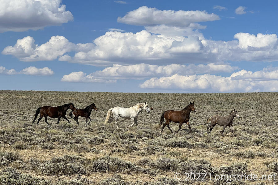
About half an hour after I left, still following the same straight-line dirt road, I passed a herd of seven wild horses, running in the brush towards the south.
Shortly after that, the trail turned off the road and veered off onto singletrack. I should have just stayed on the road, but I was tired of the monotony. That monotony, though, was still better than the somewhat sandy scrub the “trail” wandered through for two miles before crossing the road again.
At a crossroads, the single-track the trail followed widened to a sandy doubletrack, which was quite tiring on my feet. Eventually, I got off the road and just followed the cow path next to the road, which had a more firm surface, even if it wasn’t quite as straight. A mile or two later, I passed through an electric fence, which I think is my first on any trail.
About half an hour before sunset, and a little more than a marathon from my campsite this morning, I reached a piped spring near the trail. With the next water in nearly 14 miles, I stopped to get enough water to make it there tomorrow. This was a bit of a nuisance, as there was no where to hang my water bag, and I had to hold it up myself to get my water to filter.
Unfortunately, there wasn’t anywhere near the spring to camp. Comments in my trail guide mentioned a shade tree a quarter-mile north. About that far was a road junction, so I guessed that there’d probably be enough space around the intersection to set up.
There was no tree that I could see, but plenty of space at the intersection. The sun now having set, I quickly set my tent up.
With another marathon accomplished today, I’m now roughly five or ten miles short of halfway through the Great Divide Basin. If I can keep up this pace, it should only take another two and a half days.
One of my goals this hike was to do a thirty-five mile day, just to break my 33.8-mile PCT distance record. Given the terrain, and the Basin’s reputation, if I accomplish this, it’ll happen somewhere in the Basin, tomorrow or the day after.
Exhausted, partially from the distance and mind-numbingness of the trail today, and also from the unending sun, I set an early alarm to try and get started before sunrise.