Twenty miles on dirt roads and trails took me through a remote but beautiful area as I continued to wind my way north towards Ennis.
When I woke up, it was a little warmer than I expected. Not only that, my tent was completely dry and my sleeping bag was only very slightly moist. Given all the plants around, I was quite surprised that everything was so dry. But, I wasn’t anywhere near water, and I was in the middle of a stand of trees, which is probably what helped warm things up a little bit and keep the humidity down.
In any case, the weather being both dry and not cold made it easier for me to get up and get started more efficiently, and I was actually able to start hiking a few minutes before seven.
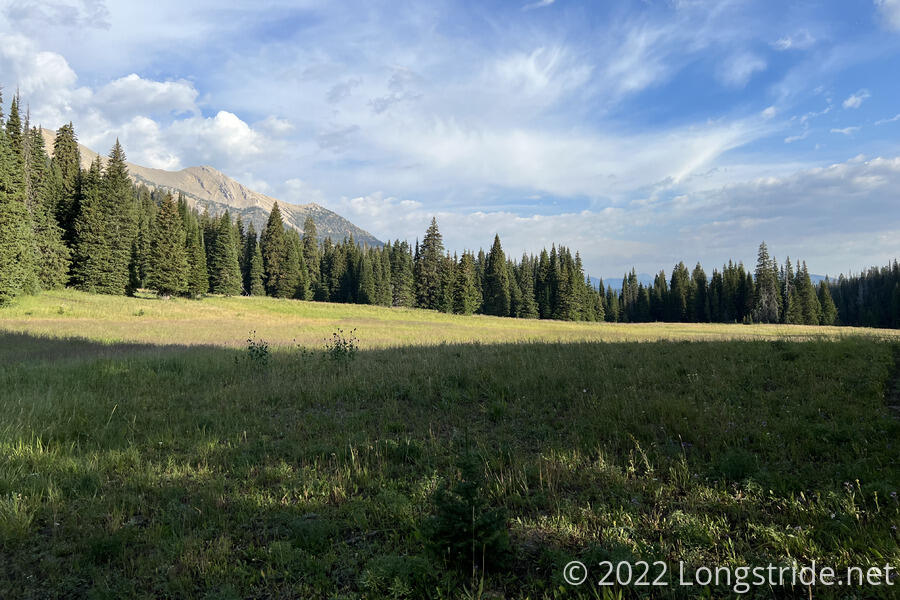
Continuing to head uphill, the trail alternated between forest and meadow, with the meadow gradually winning out as the trail climbed. Going through a small clearing, I caught sight of a buck.
The quiet, calm stillness of the morning was broken by a small airplane flying over the ridge to my left, heading north. Not a minute later, two more planes flew by, over the ridge to my right, also heading north. Over the next twenty minutes, six more airplanes flew by, all heading north, roughly in the direction of Big Sky.
The trail passed through a meadow around Lightning Lake, fairly small, located near the top of the drainage. The grass in the meadow was damp, even an hour after sunrise. I was glad I didn’t camp here last night; as much as I wish I had been able to hike extra distance to the lake yesterday, it would likely have been a cold, humid night.
Past the lake, the trail began downhill, still heading north, through a damp, overgrown meadow. This was decidedly unfun. The trail was a narrow ditch, often obscured by tall grasses, and my legs, socks, and shoes got a cold wash and covered with seeds.
After making it through the meadow, I re-entered forest, and the trail itself became a lot nicer to hike on. Eventually, the trail went through a one mile square parcel of private property, and a signed warned that the national forest trail would be on private land and to stay on the trail.
Shortly before the trail joined a dirt road, I met a couple, Jim and Barb, who had hiked the CDT in 2008, and were out for a weekend trip with friends. I stopped to chat with them for about ten minutes. I asked them about the route we have planned, and they confirmed it looked reasonable. They also kindly gave me a bottle of water to supplement what I had since my filter was so slow, and they had more than they needed.
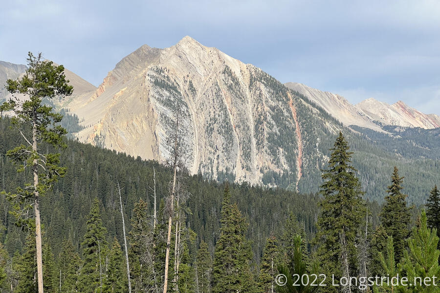
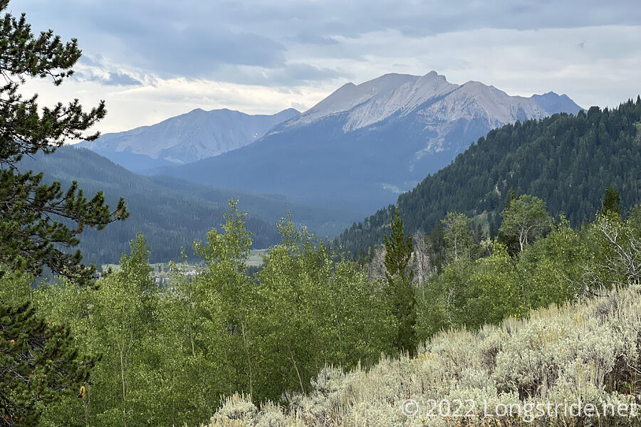
The dirt road continued downhill. A sign warned to watch for falling trees, and that workers were retrieving logs. From the distance, I could hear heavy equipment doing something, but I couldn’t actually see what. But, from above the trees, a line of white, rocky mountains stood tall, with deep erosion scars cut into their steep sides. Leaving the dirt road, the trail exited the private land.
After six or seven miles, I stopped for a break at a creek, using the opportunity to collect and filter water. (I didn’t need more water right then, but if the filter was going to be glacially slow, I couldn’t afford to waste break time by not filtering water.) Fortunately, it seemed a little faster than yesterday.
Further ahead, I passed through another short area of private land, and the trail led through a trailhead and parking lot, joining another dirt road. As I passed through, a woman rode a motorbike into the parking lot, carring a dog in her backpack.
The road to the trailhead led to a forest service road, which I then followed for a few miles. Along the way, I passed a Cadillac SUV (which seemed quite out of place on the dirt road), several car camping campsites, and no small number of people with ATVs. I passed an ATV that had stopped to talk with two rangers in a Forest Service truck heading towards the trailhead; later, the ATV passed me, and the rider quipped that even on foot, I was beating them. Later, on their way back from the trailhead, the rangers stopped to chat with me, mostly, it seemed, to make sure that I had a plan and knew where I was going.
Turning off the forest service road onto another dirt road, I began heading uphill. I departed the road to take a faint trail to cut a long switchback, saving about half a mile, but turning what would have been a “leisurely” roadwalk into a very steep climb.
The shortcut put me on an ATV trail that wound its way up a mountain. A light drizzle started to fall, and off in the distance, I could see dark clouds with rain, so I stopped to put my pack cover and rain jacket on. The rain picked up, just as I expected, but very quickly tapered off, so I stopped again to take off the rain jacket, which became unnecessary and too hot.
A little while later, a car drove up behind me. In it were an older couple from upstate New York, who were out driving — exploring — because the wife had injured her back yesterday and was unable to stand for very long. So they had lots of extra snacks, which they shared, giving me an apple, two cheese sticks, and two liters of water. About a tenth of a mile later, the road ended at a trailhead and small parking lot, where they had stopped to stretch their legs and take pictures. There were a few large rocks that provided a place not on the ground to sit, so with a good view and a nice breeze blowing, I stopped to take a snack break as well.
The wind picked up a bit, and rainclouds continued to gather in the south and east. I would definitely have been rained on if I had been a few hours behind.
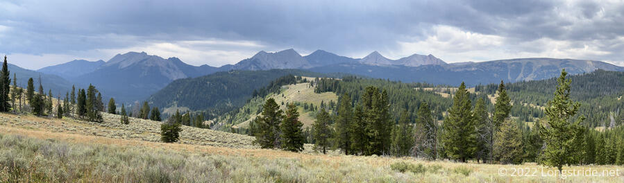
The (ATV) trail continued winding through the hills, usually with a good view to the east. The sky darkened to the north as the wind continued to pick up, though based on how the clouds were moving, I felt like I was going to be lucky enough to avoid getting rained on.
Feeling unusually tired, I stopped to try and take a short nap, sitting down on the ground next to the road. It wasn’t very restful — I didn’t want to get my sleeping pad out since it still seemed like there was a chance of rain — but it was at least a much-needed break. A few drops fell, but the clouds did get a lot lighter by the time I got up and pushed on.
With my breaks being somewhat long, and especially with this extra one, I expected Fuck-It and Velveeta to have caught up, if they were behind. They hadn’t, so I was still no closer to figuring out what was up with them.
About 20 minutes after my break, a light rain started to fall. A few strong gusts of wind blew heavy rain in, and then the heavy rain just as quickly blew out. It continued to drizzle for a short while, and then stopped.
Shortly after, I reached a six-way junction with several trails. Not entirely certain which trail I wanted, I guessed between the two that looked like they were going in roughly the right direction. About a tenth of a mile down what became a steep cyclist trail convinced me I went the wrong way — it was far steeper than I expected from the elevation profile (and actally getting away from the junction made it clear on the map I was going the wrong way). I probably could have made that trail work, but it might have been longer, and definitely would have involved extra elevation gain, so I returned to the junction and took the other alternative, a dirt road with a “no motor vehicles” sign that had fallen into disuse, and had become nearly entirely grassed-over. At least the grass was short, but it was still wet.
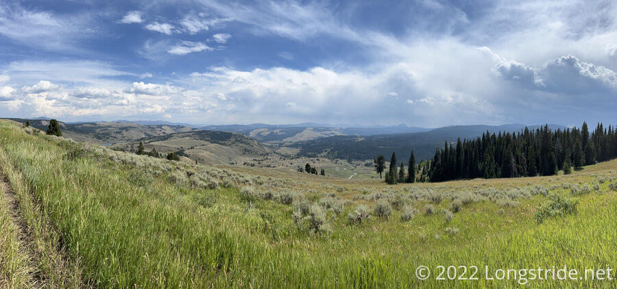
The grassy road wound its way along the side of the mountain, gradually heading downhill, until it reached a junction. “Ahead”, the road bed was clear, but entirely grassed over and looked completely unused. To the right, a faint trail headed more steeply downhill, and a sign with an arrow vaguely pointed in that direction. I guessed that downhill was the direction I wanted, which was reinforced by another sign a third of a mile pointing me off that trail and towards another. This mountain seemed to have an extensive network of trails and old roads, not all of which were on my map.
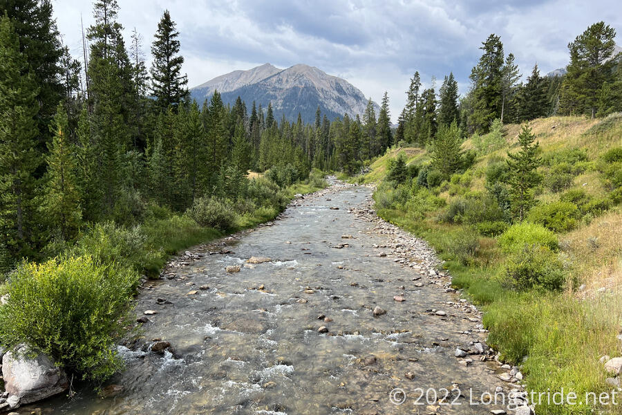
I continued winding my way downhill, passing by an abandoned campsite with the remains of a fire ring, and a trail that led to what looked like a more recent campsite underneath some trees near a creek, complete with cut logs for seats and tables.
I crossed the creek, Buck Creek, and again turned uphill, following the creek at a distance up a fairly wide valley, the trail again cycling between forest and meadow. After an hour, at an intersection with a long-abandoned road, I found a vaguely acceptable campsite. (There were a lot of wildflowers and grass I needed to work around, and the ground was a little rocky, but it was flat enough to work.) It was a little early to stop — only 6:30, with sunset just under two hours away — but I was running on fumes. I’d only had two snack breaks today, which wasn’t enough given I’d hiked over 20 miles (and carrying extra water most of that distance).
A bit uphill from Buck Creek, and vaguely surrounded by trees, I’m a little optimistic I’ll wind up with a dry tent tomorrow.
As I was finishing setting up my tent, Velveeta passed by. It turns out, I’d passed them when I returned to the road from the pit toilet at Raynolds Pass, not seeing that they were downhill by Madison River. They were behind me the rest of the day, stopped at the same place I did to get beer, got several more beers after turning off the highway, and stopped at the trailhead. Fuck-It continued to have problems with his feet, and bailed, getting a ride to town. Velveeta continued uphill, wanting to get another mile or two in before sunset.
Today was harder than it should’ve been, since for most of the day I was lugging around what would, in normal circumstances, have been a lot of extra water. But with my water filter being so slow, getting to camp with enough water to start cooking dinner is essential, since otherwise I’m just sitting around doing nothing waiting for water to filter before I can eat. (At least this way, I can filter water for tomorrow while I cook dinner.)
Today did have one tiny milestone. I passed 45° N sometime this morning, which makes me once again closer to the north pole than the equator.