A shorter day today through forests and high ridges sets me up for going into town tomorrow evening.
It was a bit windy overnight, but the nearby trees blocked most of it. Still, it was noticeably colder this morning than yesterday, and a little humid. My tent had some condensation on the roof when I woke up, but I was surprised to find it had all dried off by the time I packed the tent up. It was cool enough, actually, that for the first time since Colorado, I started hiking with both my fleece and pants legs on. It warmed quickly, though; even though the sun hadn’t yet risen above the ridge to the east, I took them off half an hour after I left camp because I started to overheat on the uphill.
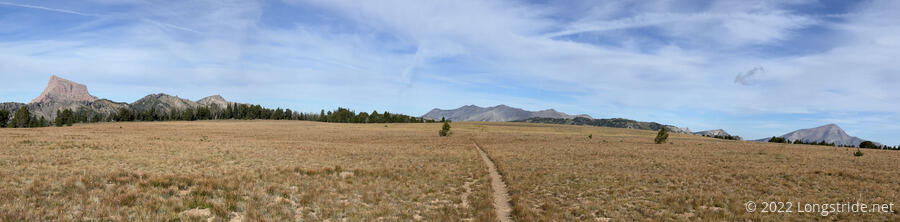
From my campsite, the trail continued to roughly follow Buck Creek upstream, with a moderate uphill. Eventually, the trail turned away from the creek, much more steeply climbing uphill, until finally leveling out in a meadow shortly below the ridge.
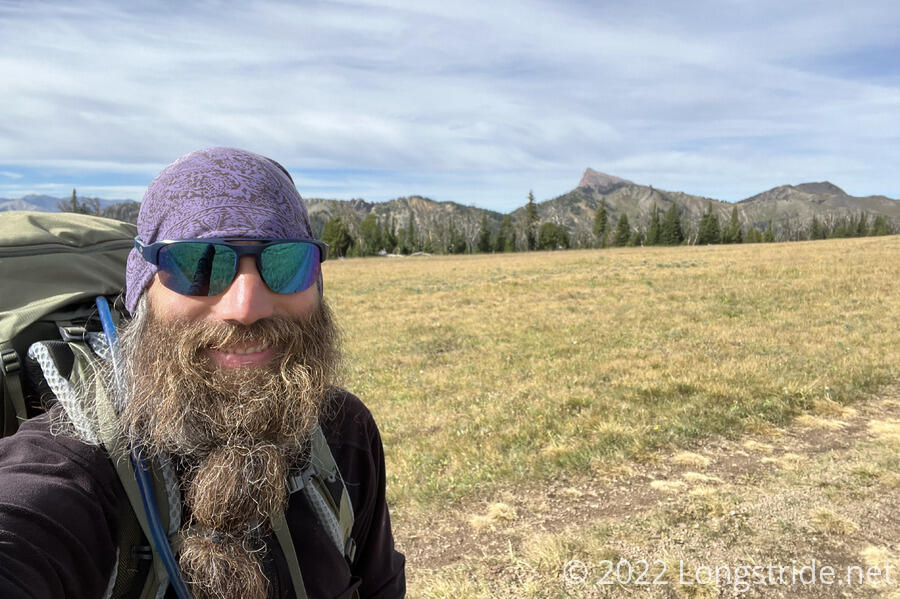
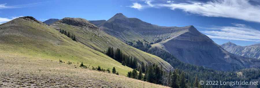
One final climb brought me to a large flat plateau. I followed a dirt road along the middle of this mountaintop meadow, with nearby peaks on both sides now visible. A bit off-trail, a metal ski ramp stood in a field, presumably waiting for the next winter snow.
It had been a little breezy during the climb up, but now, without anything nearby to block it, the wind considerably picked up, making it actually somewhat cold. The sun, partially obscured by thin clouds, was insufficient to warm things up, and I briefly stopped to put my fleece back on. (There was also really poor cell service, and I stood around in the cold wind trying to check messages a bit too long before finally continuing.)
As I followed the road, I passed a bunch of orange flags and leftover tape for the “Big Sky Biggie”, an amusingly-named 60-mile bike race based out of Big Sky that was held yesterday. I suppose they haven’t had time to come back and clean up all of the race markers yet.
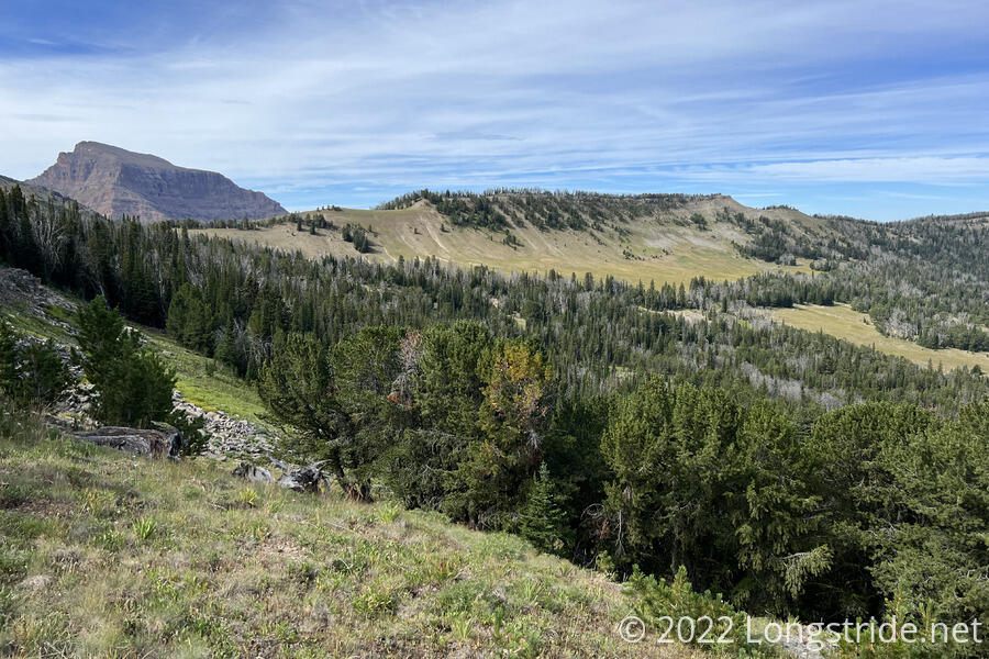
Reaching the end of the plateau, the trail began to climb towards a small pass, and I stopped along the road for a short break. Off in the distance, towards Big Sky, a cell tower glinted in the sunlight.
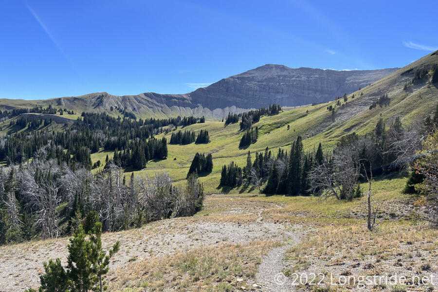
After crossing the pass, the trail began a steep descent on a very loose, rocky trail. The views, however, vaguely reminded me of the Pasayten Wilderness, at the north end of the Pacific Crest Trail (though maybe with more green and less snow).
The steep downhill leveled out, and the trail meandered through forest and meadow, crossing several creeks. A few times, the trail became indistinct, especially in a few places where it detoured around fallen trees. This trail was clearly not frequently hiked. The sun now much higher in the sky, the cold, windy morning seemed an almost distant memory; it was again hot.
The trail continued generally downhill for a while, following a creek and crossing over many of its tributaries, eventually turning uphill near a property boundary sign for the Yellowstone Club, a private residential, ski, and golf club. I passed Velveeta, who was taking a break near a creek, and then, to my dismay (from the “stay on the trail” sign), lost the trail, it having become indistinct while crossing a meadow above a creek. It didn’t take too long to get back on trail, though: I just went roughly in the direction my map indicated, which then got me to a set of tire tracks that led across the creek and up to an obvious trail.
As the trail took me above a flat meadow three people leading nine horses laden with bulky saddlebags passed, and in the meadow I saw a small tent city — three or four large tents — and a couple of picnic tables in the process of being deconstructed. I have no way of confirming, but I suspect it had something to do with yesterday’s bike race.
A short distance past the tents, I stopped at a well-shaded creek, and cooked dinner. It was still the early afternoon, however, I decided that today was going to need to be a shorter day. Up ahead, there’s a roughly five mile stretch through private land that then leads into a roadwalk, and I didn’t want to get stuck in that stretch and not be able to camp. Stopping for dinner also meant I’d need to carry less water for tonight, which would make the rest of the day easier.
While I cooked, Velveeta passed, as did a lot of other day hikers, some on horseback. I had conversations with most of them; one person misunderstood what I was doing, and thought that someone was paying me to scout out a route for the CDT (which would have been awesome if true).
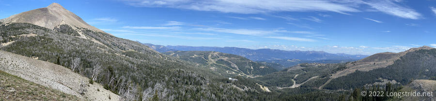
Leaving the creek, I continued uphill, crossing through a meadow, and then eventually, up onto a narrow ridge that provided a full-circle view of the surrounding mountains.
Most prominent was Lone Mountain, the tallest mountain in the area, which had a road or trail switchbacking up its side to its summit.
The trail followed the ridge down, into a forest. At around 9,000 feet, fall color was begining to show, with some of the ground foliage starting to turn yellow and orange. As I progress north, it won’t be too long before fall colors are everywhere.
During a short jog out of the forest, the trail steeply descended a narrow ridge that cut between two drainages filled with loose rocks and largely stripped of vegetation.
About halfway down the steep descent, the trail left Yellowstone Club land, joining the Jack Creek Trail as it entered the Beaverhead-Deerlodge National Forest. A surprisingly large, prominent sign warned that the trail was leaving private land.
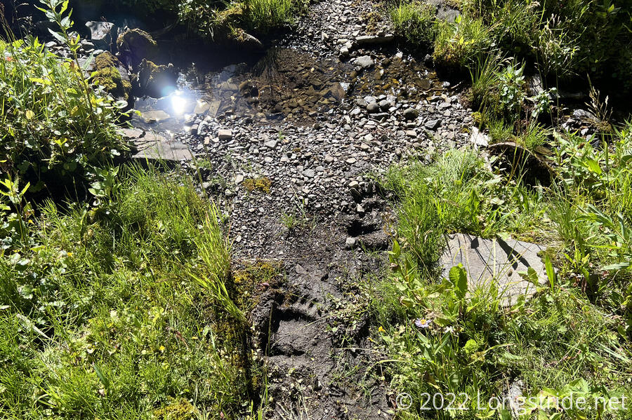
Continuing down the hill, I crossed a couple of creeks. At one of them, a pair of fresh bear prints was pressed into the soft dirt where the trail crossed. I didn’t see any other signs of bears for the rest of the day, but I was glad I wasn’t going to be creating food odors at my campsite by cooking.
The trail crossed a few more creeks, and went through an area of annoying blowdowns. Nothing terrible, it just served to make the section a little slower. The downhill, though, was surprisingly long; I was glad I was going down and not up. The trail went through a nice forest, with occasional views into a valley containing the South Fork Jack Creek. The forest, though was surprisingly dense, with a lot of deadfall near the trail, which largely cut across a steep slope. This meant there was a complete lack of any place that could even remotely serve as a campsite, which was a little concerning.
After crossing the South Fork Jack Creek, I went up a short hill to a dirt road, where I found Velveeta sitting. He said he’d gone about a quarter mile down the road and saw a private property sign, and came back to the trail junction while deciding what to do next. He also saw a bear scurrying up the hillside near where I saw the bear prints.
Not really having a better place to go, we set up our tents in a tight space just off of the road. I didn’t think it was likely anyone would be driving past, but we still tried to get our tents as far from the road as possible.
A short day today, only about 16 or 17 miles, I wish I could have gone further, but the next several miles are on private property, and I doubted I’d make it through by sunset. I was rather sluggish on the uphills anyway, so taking it a bit shorter today isn’t the worst idea. But that does leave me with over 20 miles to get to Ennis tomorrow, unless I stop at the free campground a couple of miles before the road into town.
I settled in for the evening before sunset, and the temperature dropped quite rapidly once the sun dipped below the mountains. Not even 9 pm, and my hands are already cold while in my tent.