A long day today took me to the town of Ennis, with some surprising trail magic along the way!
It was cold this morning, to the point that I’m considering getting a lightweight sleeping bag liner to keep warm. (Or, possibly, just start keeping all of the tent doors closed, which would keep it warmer at the expense of also increasing moisture levels inside.)
Heading north on the dirt road I camped next to, I passed a private property sign for the Jack Creek Preserve Foundation that Velveeta mentioned yesterday. Conveniently, the sign had a mile marker on it. After about half a mile, the trail diverged from the road, heading downhill on a singletrack trail.
Once on trail, I soon left the forest, heading into a long, scenic meadow. The grass on both sides of the trail was more than knee-high, sometimes even waist- or chest-high, and it would have been quite a nuisance had it not been dry.
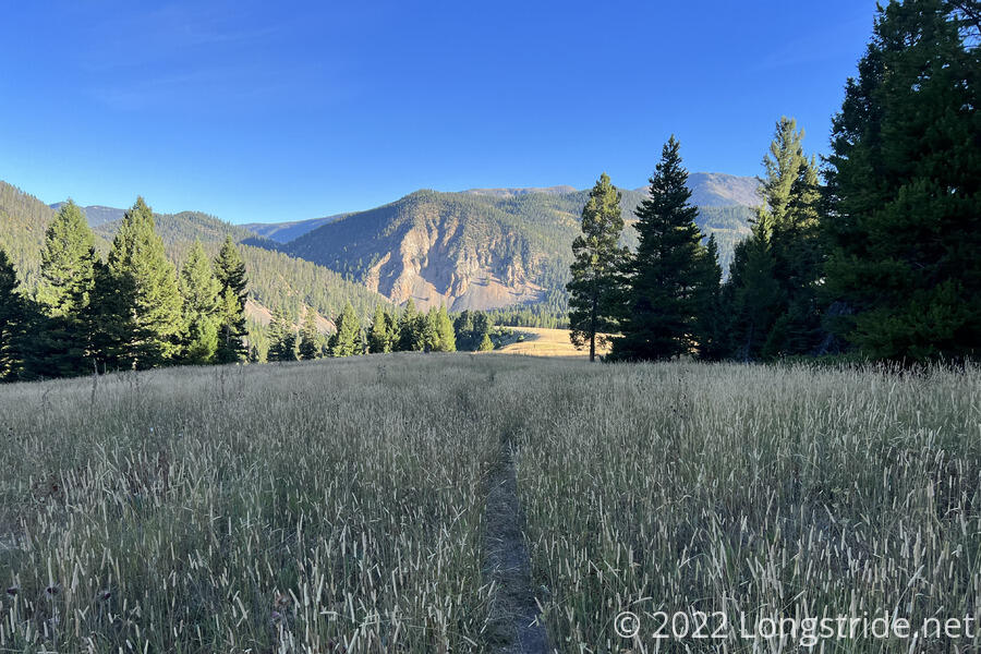
After two miles of the grassy meadow, the trail descended back into forest, passing what would have been a very nice campsite that had a “No Camping” sign, located just uphill from the bridge crossing over Jack Creek.
A sign board for the Jack Creek Preserve Foundation explained its purpose as a wildlife conservation preserve that also serves to bridge two disjoint portions of the Lee Metcalf Wilderness in the nearby national forest. (I’d entered the Lee Metcalf Wilderness two days ago on my way up to Lightning Lake, exited it temporarily yesterday going through the Yellowstone Club land, and left it for good going up to the road yesterday evening.)
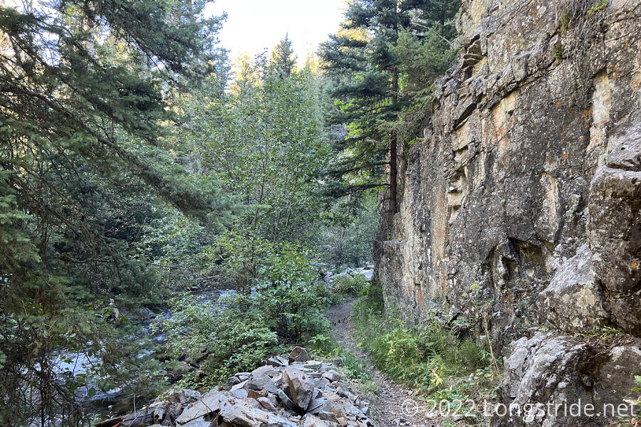
For the next while, the trail continued through forest, wedged between Jack Creek on the south, and a steep, rocky mountain on the north. There was frequently easy access to the creek, and the trail itself was quite easy to hike. Several no-camping signs attempted to dissuade camping, but frankly, most of the “campsites” so marked were so overgrown that I can’t imagine anyone even thinking of trying to camp there.
The trail followed Jack Creek for a few more miles, eventually ending at a parking lot. I continued west, following Jack Creek Road down the creek’s valley. After five miles through a nature preserve, the otherwise quiet and idyllic nature sounds of birds chirping and creeks flowing were rudely interrupted by heavy construction equipment lumbering around at a ranch next to the road.
Not lumbering were the dozens of dump trucks that zoomed up and down the road (presumably to the property with the construction equipment) far faster than seemed safe. It’s one of the few times I actually felt unsafe while on a roadwalk.
A bit past the construction site, I reached where the trail turned off the road, just catching up with Velveeta. From here, the route I had been intending to follow takes a somewhat circuitous path north into the Spanish Peaks, a short mountain range that is supposed to be quite beautiful, and then west towards Ennis Lake. (Some routings of the Big Sky Alternate enter the Spanish Peaks somewhat further east and travel through them longer.)
But, I was tired, and (literally) ahead of me was an option to continue on the roadwalk, which would both be several miles shorter and not involve several thousand additional feet of elevation gain and loss. So as Velveeta headed off towards the mountains, I continued west, along the road, heading to Ennis. A little while later, I stopped for a break in the drainage ditch next to the road, staying well clear of the dump trucks that continued to pass.
I continued following the road and Jack Creek down an increasingly narrow valley, for several more miles. A car, heading towards where I came from, stopped, and asked if the road went to the highway. “No, no, it does not,” I said; I assumed they must have just made a wrong turn somewhere, because the only way to get to a highway was from the direction they came form.
A little while later, the mountains the creek cut through ended, and the area around the road opened up. Another dirt road split off from Jack Creek Road, and fortunately, that was where all the dump trucks were going. Once I passed that split, road traffic dropped to a much more reasonable level.
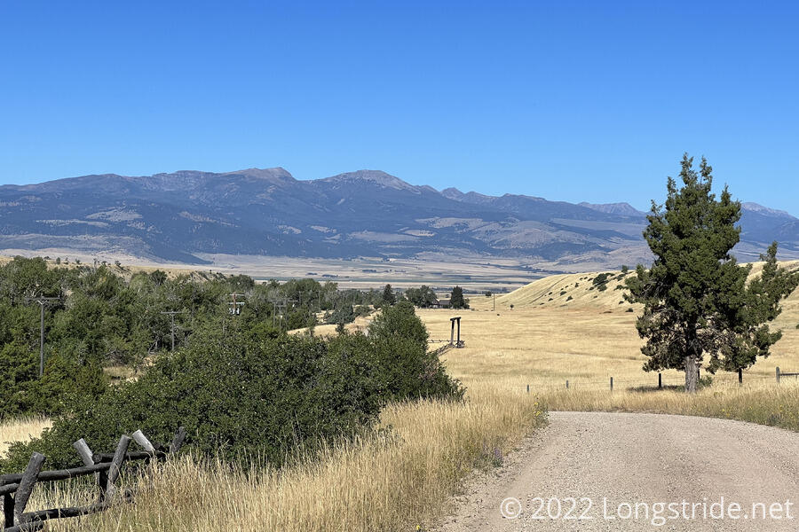
Jack Creek Road is lined on both sides with ranches; though how many of them were actual ranches, as opposed to being just for vanity was unclear. What was neat, though, were all of the many styles of entrance gates and unique names.
The road, mostly straight, but with a few curves following the contours of the valley. A few trees and bushes provided some greenery, but most of the grass had turned amber, and gave the impression of going through a dry landscape. Dry, that is, except for one ranch which had an ostentatious lush green lawn surrounding their entrance gate.
One of the infrequent cars driving down the road stopped and offered to give me a lift down the road to cut a few miles off my hike. I told him I appreciated the offer, but I needed to stay on foot in order to have a continuous footpath from Mexico to Canada.
Later, I stopped for a second break, roughly 13 miles in, under a tree and next to a bridge over Jack Creek. (The water was probably fine, but with all of the ranches around, I didn’t want to risk filtering polluted water if I didn’t have to, since I planned on being in town this evening.)
Eventually, Jack Creek Road made a sharp turn to the north, becoming Ennis Lake Road, and taking a northeasterly turn as it meandered through a small community. (If I’d wanted, I could have walked directly to Ennis from there, which would have been shorter for today, but would have added another mile or two to the total roadwalk distance I’d have to do.) A bit further on, the road briefly became paved, around a cluster of homes, and then returned to dirt.
With the road drawing near Ennis Lake, I passed a BLM day-use picnic area, a parking lot with with a pit toilet and some picnic tables and benches.
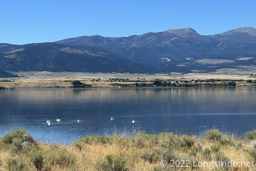
Once the road reached the lake, I was able to see a small flock of swans floating near the shore. Later, I saw a couple of large flocks of ducks.
The guy that passed me and offered me a ride earlier passed me again, this time from further up the road. We chatted for a bit, and I explained a bit more what I was doing; he was impressed, and offered to give me money to help. I wasn’t terribly interested in accepting cash, so I declined. He asked if I needed anything; I said cold soda or beer would be great; he offered vodka, which — especially in the unshaded heat of a roadwalk — was a bit strong.
About five minutes later after we parted ways, he drove back again, wanting to make sure that I knew which direction I was going. (The shortest route to Ennis was indeed behind me, but I wasn’t going to hike into Ennis; I planned on hitching into town from the highway up ahead.) I got his name this time — Jason. Jason then gave me $5, which I finally accepted out of politeness.
About twenty minutes later, another truck passed. Its occupants, Brett and Mark, were Jason’s cousins. Apparently, he had called them, and told them that if they saw me, they should give me some cash because he likes me. So they stopped and gave me $20.
On the AT and PCT, I’ve had people offer to give me cash, but never with this level of effort. It’s really rather humbling. Jason, Brett, and Mark, thanks again!
After another half hour, I finished following the east shore of Ennis Lake, crossing the lake — and the Madison River — on a bridge. A road leading downstream along the Madison is where I would have come from had I taken my intended route through the Spanish Peaks.
Turning west, I began following the north shore of Ennis Lake, stopping at a large BLM beach and picnic area on the shore. I sat down in the only shade available — next to the side of the pit toilet — and had a snack.
About to leave the beach were a group of half a dozen guys with two SUVs and a boat. One of them, Eric, stopped to chat, and then gave me two cans of beer before they left. I drank one, planning to save the other for tonight. When I was leaving, I discovered it had a tiny pinhole leak (possibly it hit something sharp on the ground when I knocked it over). I didn’t want to carry a leaking can of beer, so I did the only thing I could — drink it then.
Nearing town, I had cell service. Checking the weather, I was surprised to find that after yesterday’s cold weather, the temperature is forecast to be over 90° F for the next week! (Though fortunately, that’s the forecast for Ennis, and I should be at a higher elevation — and further north — after I leave town.)
Continuing further down the road, I passed a couple of residential areas (or they could have been lakefront rental properties, I couldn’t really tell). They all had lush green grass, compared to the amber and brown grass most everywhere else today, and it all seemed rather out of place and wasteful. Then again, the brown grass also seemed out of place, being so close to a lake.
Around 4:45, I passed the free Meadow Lake Campground. On the off chance that Fuck-It was there (since that was a possibility that had been discussed), I looked around a bit to see if I could find him. Deciding he wasn’t there (and there was no chance that Velveeta would be there already), I continued down the road, and made a reservation at a motel in Ennis. It was more expensive than I expected, as much as I’d have expected to pay in Colorado.
About fifteen minutes later, I could see the highway into Ennis — the same highway I walked along at Earthquake Lake, could have taken from West Yellowstone, and crossed just south of Old Faithful. A long line of cars was proceeding slowly down the road, so this was both the most road traffic I’d seen in weeks, and also, the most orderly driving I’d seen on a highway in a long time. Once I reached the highway, it was clear why everyone was driving so slowly: there was road construction.
I had the two fastest hitches ever going to and from Steamboat Springs, but even that couldn’t prepare me for my ride to Ennis. In absolutely fortuitous timing, as I crossed the highway, a group of people in an SUV, who had stopped at the intersection prior to turning on the highway, were getting back into their car. While I was crossing the highway, almost as a joke, I stuck my thumb out. They asked if I needed a ride into town before I’d even finished crossing the highway.
Half an hour later, I was checked into my motel, the Sportsman’s Lodge. After a shower, I got dinner in their restaurant, and was advised that, while they normally serve breakfast, they wouldn’t have any tomorrow because the town is “dead” on Tuesdays.
I also arranged for the possibility of staying a second night, but I’ll confirm that tomorrow morning; my last zero was in Pinedale, so I’ve now hiked 18 days in a row (and over 330 miles) without a break. It’s time for a rest.