On my way to Cuba, NM, the trail crossed a short stretch of desert, quickly returning to forested mountains.
I got up just before sunrise, but was a little slow leaving my tent, and didn’t get to breakfast until 20 minutes after it started. Still, I had a good meal, as well as good company — I ate breakfast with Cool Joe and Yellow Card, and one of the women that had talked with us last night came over to visit as well. We’d discussed trail names last night, and inspired by our stories, so she adopted one for herself, “Lil Bear”.
After breakfast, I took down my tent; both my tent and sleeping bag were bone dry after a night in the warmer desert. (I don’t know how long that’s going to last, though; getting to Cuba is going to involve climbing up and over another mountain range.) I made one more visit to the visitor center, for water, and soda from the gift shop, and then was on my way out.
Leaving Ghost Ranch, my trail guide’s directions were a little vague. (Frankly, the southbound directions in general have been pretty bad or nonexistent. Often the line on the map is sufficient, but not always.) Fortunately, an employee was able to point me in the right direction, and off I went, down a dirt road used by one of Ghost Ranch’s tours, until I turned off on a rather well-signed nature interpretive trail.
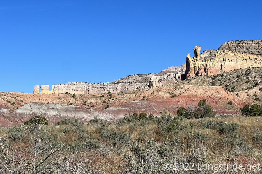
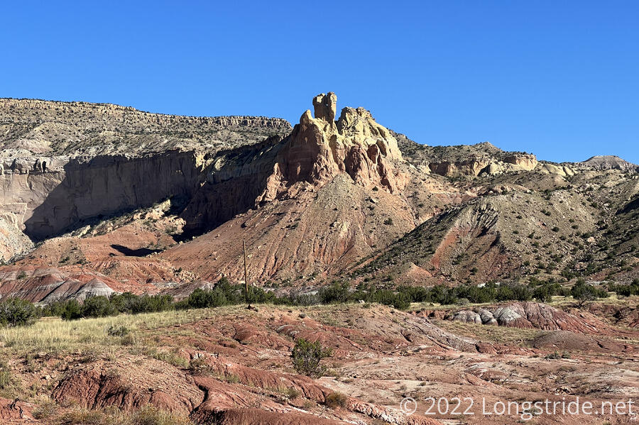
Leaving the more developed area took me past some of the sandstone formations that Ghost Ranch is famous for.
The first mile and a half from the visitor center was through dry desert, but the trail went through a narrow corridor of greenery, when it crossed a small creek over a wooden plank suspension bridge
Actually leaving Ghost Ranch was a bit of a challenge. As I mentioned before, the southbound directions were vague, bordering on unhelpful. The trail brought me to the fenced-in edge of the property, along a highway, and it wasn’t clear where to go. I didn’t want to try and jump or duck under the barb wire fence, and while there was an abandoned trail across a bridge to the old visitor center and museum, that too was fenced off.
Lacking better directions, and after checking the fence along the highway to look for a way out, I jumped over one of the metal railings to get onto the abandoned path, crossed a couple of bridges, and then (carefully!) climbed around the pole supporting barb wire across the path, which brought me to a parking lot. At least getting out of that parking lot was easy; it was just closed by a vehicle barrier, and I could easily cross that without any problem.
Briefly following the highway, the trail went through a latched gate, following an ATV trail to the west. The trail was easy to follow for a while, but at some point, I was supposed to turn off onto some fainter trail, and that was difficult to see. With the cactus and scrub, I didn’t want to just randomly bushwhack cross-country, so I stuck to the track I was on, even though it wound up a little longer than the route I was “supposed” to have taken. White fluffy clouds floated across the very blue sky. On a distant ridge ahead of me ran the CDT itself.
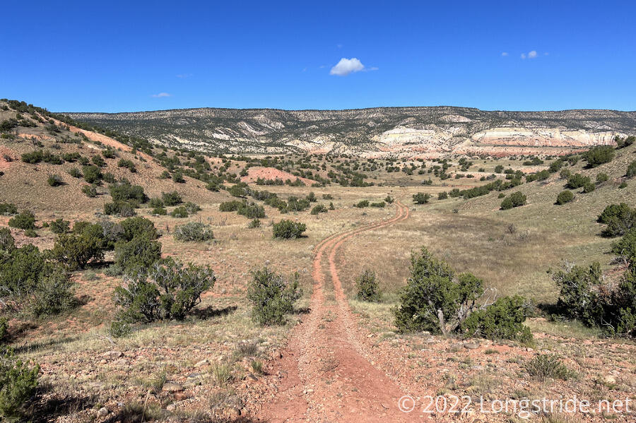
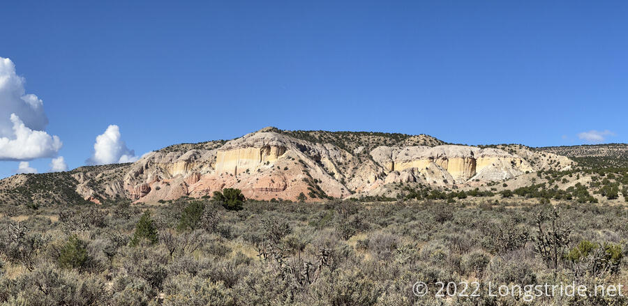
The ATV trail joined with a packed dirt road, which ran roughly parallel to the CDT’s ridge. A few pick-up trucks and SUVs passed, as well as a pair of cyclists. Along the way, I exited the Carson National Forest, entering Santa Fe National Forest. The side of the ridge, where it was steep enough to be exposed, had red, white, and yellow bandings, similar to the sandstone cliffs from yesterday.
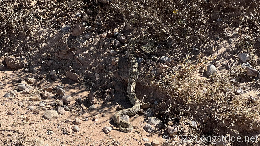
I also saw a rattlesnake on the side of the trail, which quickly retreated into the bush, shaking its tail at me.
Around noon, the trail curved around the base of the ridge, heading west and following above the valley carved by the Chama River. I stopped for a break under a conveniently placed tree that would also have served as a great dry campsite (too far from the river to use it as a water source). Clouds continued to grow behind the mountain to the south I had been hiking towards, and then gradually formed in all directions. It was clear where I was, but in every direction, behind every distant ridge, clouds were forming.
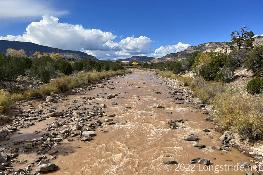
I continued along the dirt road. Several vehicles passed by. The road gradually drew near the Chama River, which was quite muddy — almost the color of chocolate milk. Following the river, it passed by a boat launch, a campground, and several smaller roads and trails that went down to the riverside. I passed the pair of cyclists I saw earlier; they must have taken a very long break at some point.
The Ghost Ranch alternate rejoined the CDT just before a bridge crossing over the Chama River.
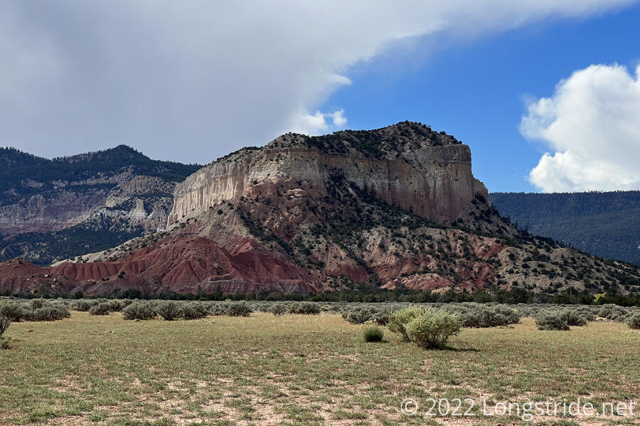
The road crossing the river quickly ended at a cattle gate, and I was again back on trail, beginning a gradual uphill. To the west, more sandstone formations stood out against the relatively wide, flat valley.
The scrub along the trail gradually got thicker (and greener) as I progressed up the valley. Rather warm out, I was sweating more than I have in a long while.
In the dirt on the trail, someone (or possibly several hikers) wrote “Let’s go sobos!”, “Where to?”, and “Mexico!”. I was glad I only needed to go as far as Grants. Another three or four weeks from here would make it fairly cold out, and it is already getting cold enough at night.
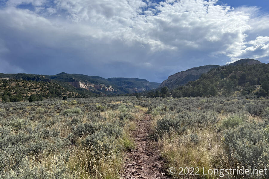
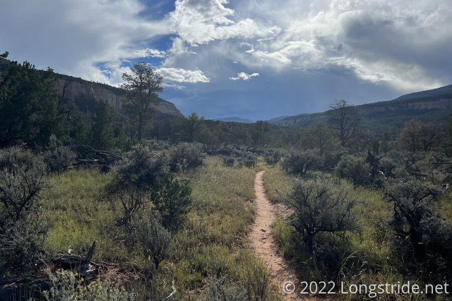
As the trail progressed, the valley split in two, gradually becoming steeper and actually becoming a canyon. While dry now, 20-30 foot deep eroded channels with steep banks crossed the trail. The dark clouds ahead, which had grown continuously over the last couple of hours, were not comforting. I wouldn’t want to be trying to cross the channels during a rainstorm.
The trail did eventually start following a creek, with both the trail and the creek zig-zagging their way up the canyon in seemingly opposite directions.
Passing several possible campsites which looked like they’d be quite problematic in the rain, I stopped at a campsite sufficiently above the creek shortly before 5. A bit of a short day, not quite 16 miles, this seemed the best place to stop given that the clouds seemed to be threatening rain, and I was near a water source. (If I continued, I’d also have a steep climb, which I’d rather do in the morning, rather than at the end of the day.)
While I was cooking dinner, Cool Joe, and Yellow Card passed. Although they left before me, they got lost on their way out of Ghost Ranch (thanks to the vague trail directions) and wound up an hour and a half behind.
Tomorrow will hopefully be a long day; the further I can go, the sooner I can get into Cuba the day after.