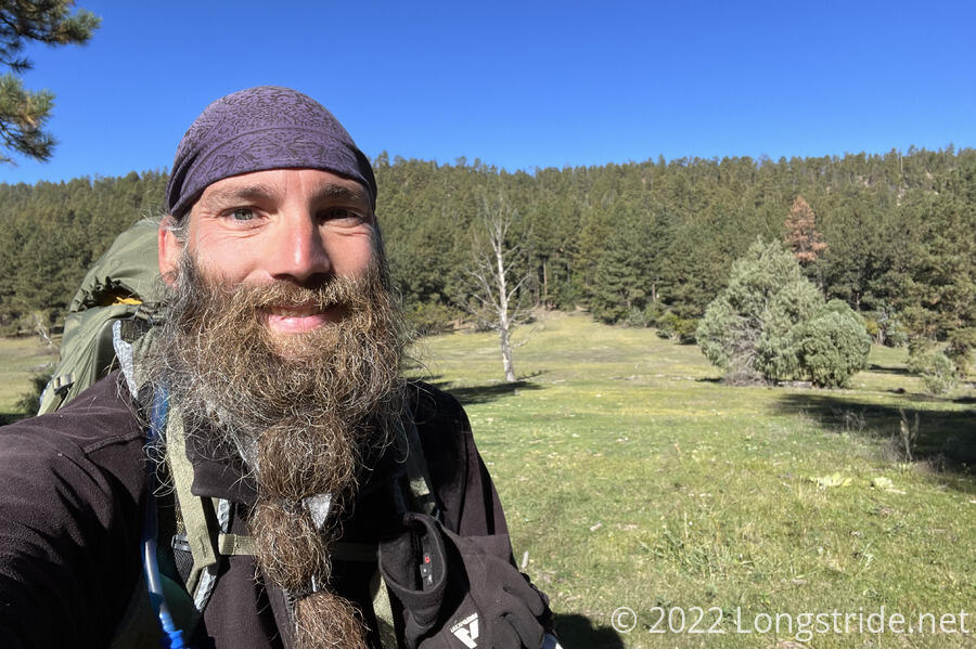
My trek towards Cuba continued, with my first (if brief) night-hike on the CDT.
I left camp around 8:30, much later than I wanted, and began a steep climb up the mountain. It was cool out, but given my proximity to a creek, it was much less humid than I expected it to be.
Once at the top of the climb, the trail gently bounced around a relatively flat plateau. Still relatively early in the day, and with a taller mountain to the east, I managed to hike over an hour before the sun started to shine on me. Once the sun did climb over the mountain, a light breeze helped keep it a little cooler.
The trail followed a dirt road for a short while, crossing no small number of other dirt roads of varying quality. Near a cow pasture, the trail turned off the road, briefly (but steeply) climbing to cross from one side of a ridge to the other.
A network of roads — some of which appeared to be abandoned logging roads — criss-crossed both sides of the ridge, and in some places, the steepness of the trail made me wonder if some of them might have made for an easier (or at least, more straightforward) hike.
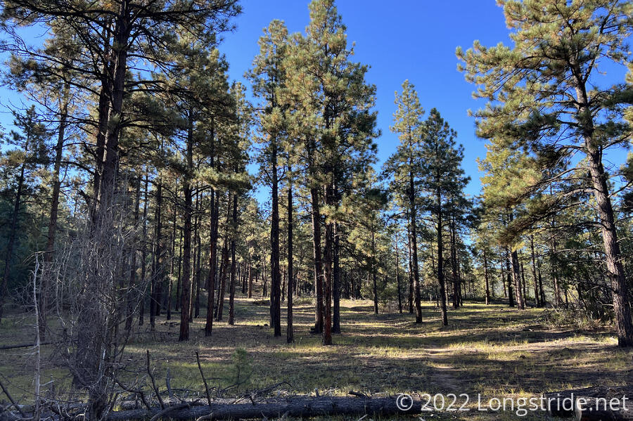
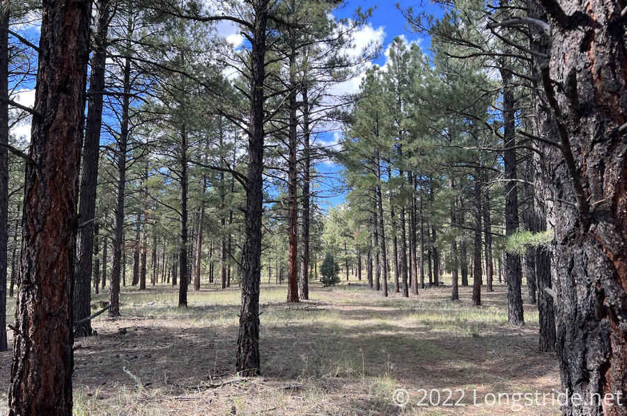
The forest itself was nice, usually somewhat thin and airy, but the trees were tall enough that they provided shade, at least for a awhile. There did seem to be more deciduous trees than I was expecting, though, given the altitude.
The trail dropped down the side of a steep slope, a bit difficult to follow at times. A sign indicated a route for an equestrian trail, which probably would have been a lot easier to follow.
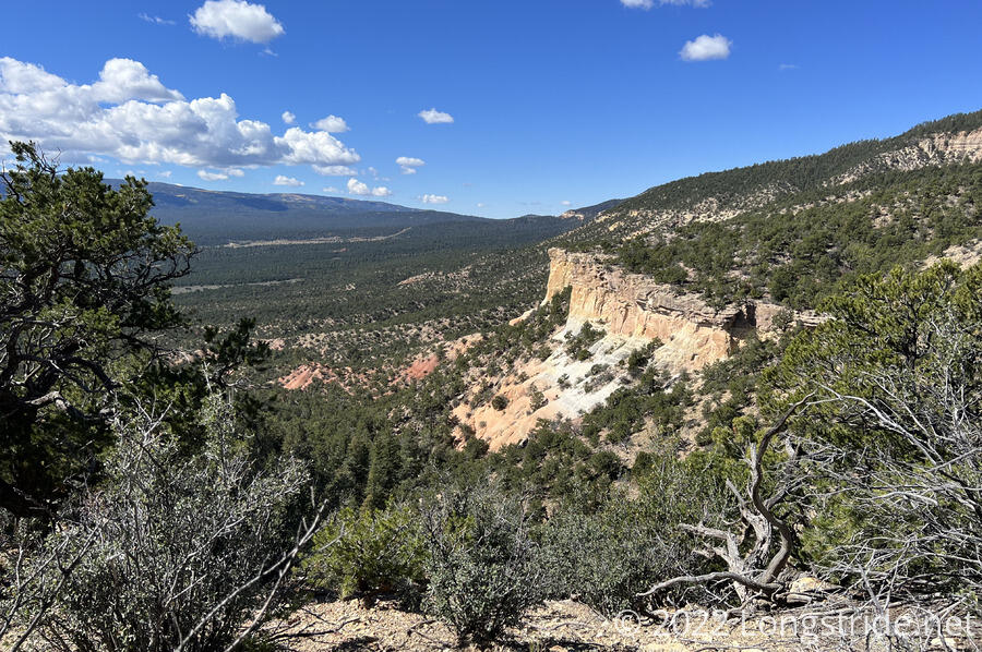
I stopped for a break at the Mesa Alta Trailhead, at the intersection of a couple of dirt roads. The trailhead had a large information sign about the area, which does have some geographical importance: the nearby Mesa Alta, and the surrounding Chama Basin, are the southeastern-most extent of the Colorado Plateau, a mostly-desert high altitude plateau, roughly centered where Arizona, Utah, Colorado, and New Mexico meet.
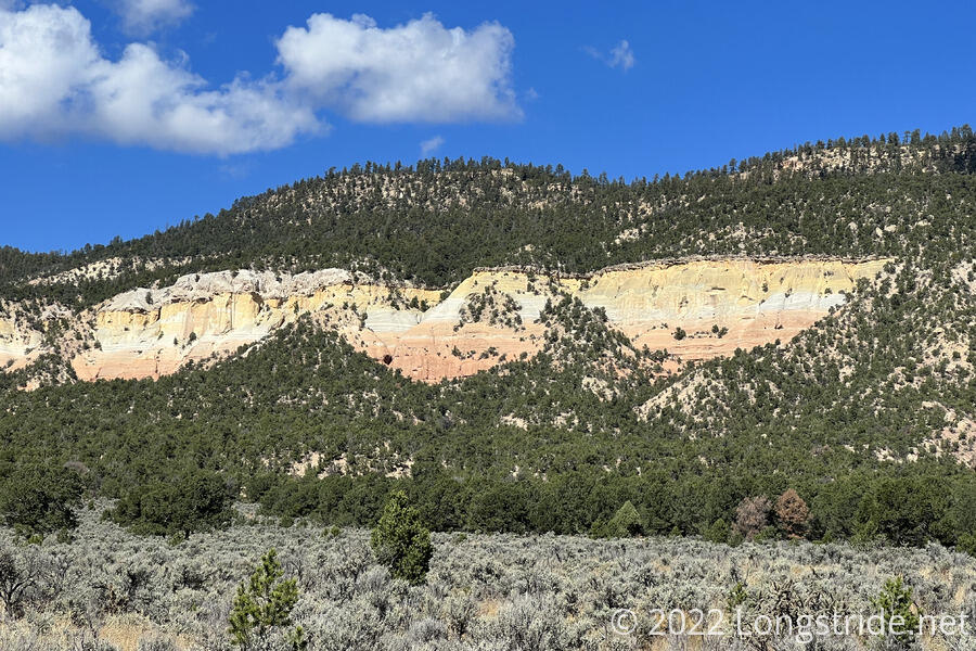
From the trailhead, I quickly descended off of the Colorado Plateau, the forest briefly thinning and the ground getting more sandy. The edge of the plateau ( or at least, what I assumed was the edge) was readily apparent on my topo map, an an exposed portion showed off the colors of its sandstone.
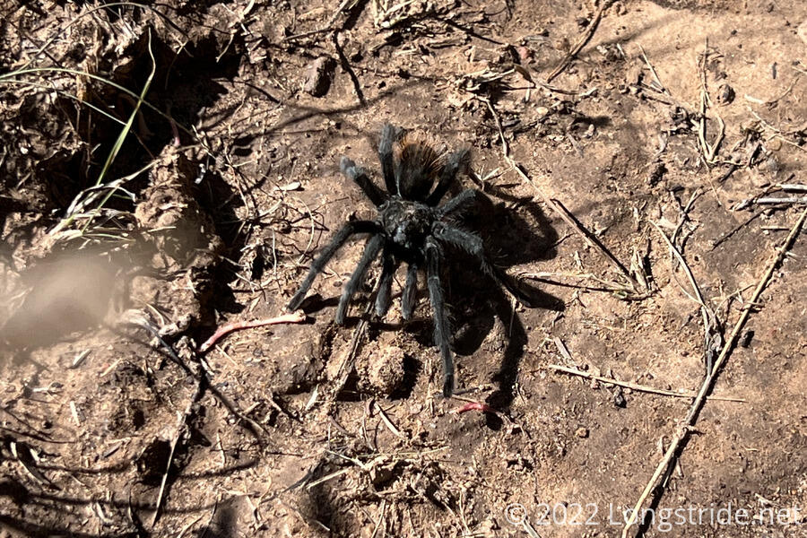
The drier, more sandy area was home to the first tarantula I’ve seen while hiking.
Crossing the highway, I began the ten mile climb into the San Pedro Mountains, northeast of Cuba. I passed Dash, sitting in the shade of a large boulder that had been heavily eroded by a water flow from long ago.
For a little while, the forest continued to thin, and plenty of small cactus plants grew next to the trail. I nearly sat down on one of them when I stopped for a second break. Clouds, which had been gradually increasing over the last few hours, finally got around to blocking the sun, easing the sun exposure that came with high sun in a thin pine forest.
As I continued to progress southwest, the forest, with its minimal underbrush, is beginning to feel much more like what I remember the forest in southern New Mexico felt like, though perhaps a bit greener.
I caught up with Dash again at a small creek. He’d stopped for dinner, and with most of the long climb still ahead of me, and water lacking past this creek, I decided to cook dinner there as well.
This provided the opportunity to have a meaningful conversation with Dash. He’s Canadian, and used to be in the military, and later, police, and retired after the job became too stressful. Now, he lives outside as much as he can. Considerably more into mountaineering than I am, he’s planning a first ascent of a mountain in the Canadian Rockies after he’s done with the CDT. Apparently, there’s so many summits in the Canadian Rockies that not all of them have been summited yet!
It grew cool and windy while I was cooking dinner. The upside to this was that I’d have dinner out of the way now, so I wouldn’t have to cook dinner with it being cold, dark, and windy later tonight. But, it did eat a bit into my mileage for the day.
Leaving the creek just before 5 (and just before Dash), I found a bottle of beer on the ground next to the trail, with an attached note: “For one lucky hiker! (Sorry about bottle)”. I assumed it had been left by a trio of equestrians I saw just before reaching the creek. I looked forward to drinking the bottle — a New Belgium 1554 — once I reached camp tonight. Dash later passed me during a steeper portion of the climb, while I stopped to take pictures.
Continuing to climb, I got another good view from a distance of the southern edge of the Colorado Plateau. After passing through a grassy meadow with a somewhat faint trail, I reached a sign at the boundary for the San Pedro Parks Wilderness. The sign described the wilderness area, which had been a protected area since 1931 and became one of the original Wilderness areas in the 1964 Wilderness Act, as “known for temperate rolling meadows and large grassy parks. … Trails are relatively gentle here, but sometimes faint”, which perfectly described my impression of the area. (The Santa Fe National Forest seems to have very good trailhead signage; I wish more forests had signs of this quality.)
The tail continued climbing, straight up what felt like it should have been a narrow ridge, but which was actually wide (and long) enough that it felt like a continuous stream of false summits.
Thanks to stopping for dinner, the sun set while I was hiking. As the sun set, I was climbing over blowdowns in a rather messy section of switchbacks. (Probably, I missed a clearer route through the mess due to the fading light.) After I’d passed the blowdowns, it quickly became actually dark, and the trail also became muddy. I finally put my headlamp on after reaching another large log lying across the trail. After having avoided it for five months, I finally night-hiked, if only for about ten minutes. (I’m not counting the just-before-dawn hiking to summit Mount Elbert, which was bright enough I didn’t really need my headlamp.)
Looking for a campsite in the dark was not easy, but I found one, a flat, slightly tilted site between the trail and a steep drop. Cold and windy, I hurried to get my tent set up. It was, unfortunately, too cold to drink the beer I found. Oh well, I’ll just have it tomorrow when I get to town. Hopefully, it won’t freeze overnight.