Today, we summited Mount Elbert, the highest mountain in Colorado — and in the Rocky Mountains.
It was much warmer than I expected, probably because the lack of wind. This really helped with getting up before sunrise; it’s still quite dark at 4 am, and it’s no fun getting out of my sleeping bag when it’s both cold and dark.
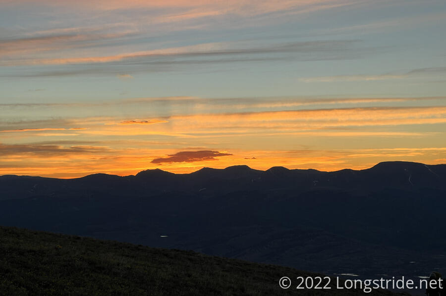
Continuing up the South Mount Elbert Trail, I left camp shortly after 5 (and a little bit after everyone else), by which point it had brightened a fair bit, though sunrise was still half an hour away. A few minutes after leaving, the trail took me above the tree line. Without the shade the trees were providing, the pre-dawn light was sufficient to see by, and I turned off my headlamp.
Climbing above the tree line, a section of the trail was marked with reflectors on tall poles, and there were a couple of short stretches of barricade fences, this time with a sign indicating they were protecting a restoration area.
As the dawn advanced, the morning wind began to blow. To the east, the sky filled with reds and oranges as the clouds began to be lit up by the rising sun.
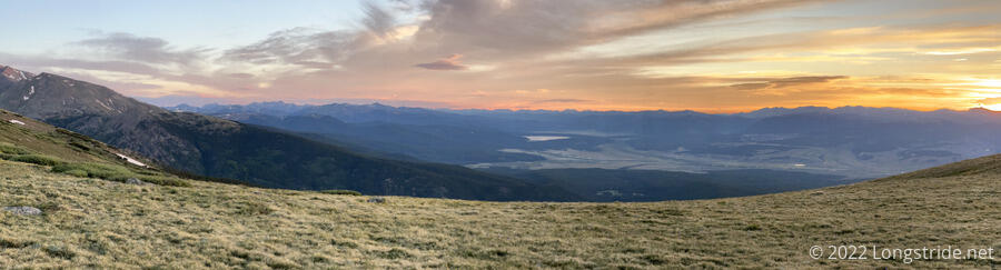
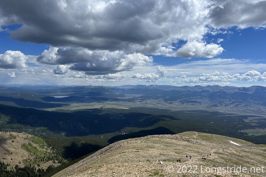
The trail, well maintained for its elevation, steepness, and remoteness, steeply climbed up from our campsite at just under 11,700 feet, up to the Elbert Summit at 14,433 ft.
As we increased in altitude, the wind started to pick up, and it became quite a bit colder. I eventually had to dig my gloves out of my pack to keep my hands warm.
The increasing altitude also very clearly made it harder to breathe. For the most part, I kept a slow but steady pace, but that pace gradually slowed as I made my way up Elbert.
Significantly further up ahead, I saw group of 20 or so people slowly making their way up the mountain. While it certainly wasn’t a competition, I decided I wanted to be on the summit before the group, mostly because I wanted to have the opportunity to enjoy the summit and take pictures without there being a whole huge group of people also there.
It turned out that, not only was my slow and steady pace stuff fast enough to leave the rest of my group far behind, but even taking a few short breaks, I was able to catch up to the large group, and passed them while they were taking a break.
Because of the way the trail wound around the mountain, I’d long lost sight of my group, and had no idea how far behind they were. Shortly before I got to the summit, I guessed they were at least half an hour behind.
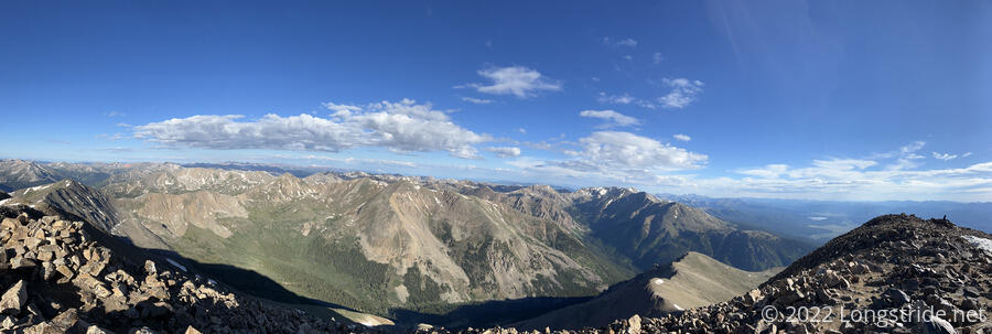
It took a little more than two and a half hours to reach the summit. By then, there had already been a few other people who had summited and were on their way down. But, as I hoped, the summit was relatively clear of people.
At 14,433 ft, Mount Elbert is both the highest mountain I’ve summited (and the highest point on land I’ve stood on), as well as the highest point in Colorado, and in the Rocky Mountains. Given that the CDT will summit Grays Peak (also a fourteener) in about a week, I wonder why it didn’t also summit Elbert.
Still on the summit was Eduardo, from Texas. He’d actually summited last night, and spent the night in his tent, which he put inside a circular wall of rocks that served as a wind break. (He said it wasn’t very comfortable, and that it was very windy last night.)
The large group reached the summit about 25 minutes after me. I briefly chatted with one of the organizers; they were Team Ascend, an organization from Texas that leads people, many who have never done anything remotely like summiting a fourteener, up to the summit of Mount Elbert. (I probably should have picked it up from the name, but I realized they are probably a religious group when they formed a prayer circle after they’d been on the summit awhile.)
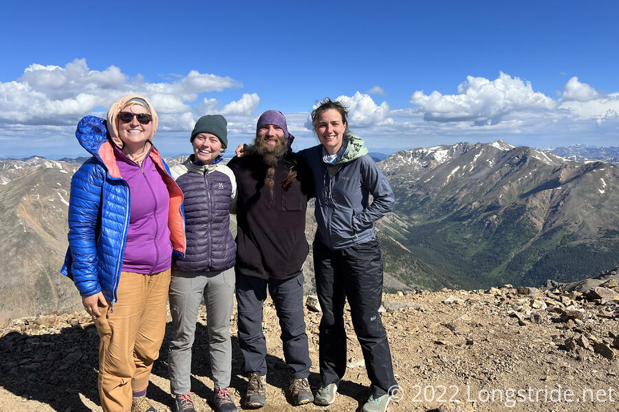
After I’d been on the summit for 50 minutes, Pale Ale, Sprouts, and Stumblebee made their way to the summit. We rested at the summit for awhile (and had our snacks), before heading down the North Mount Elbert Trail.
As compared to the south approach trail, which was relatively gentle, the North Mount Elbert Trail started off very steep and rocky. A short distance down, a huge rock cairn stood on a small shoulder; if climbing up to the summit on the north trail, from lower down, this would have looked like a rather mean false summit.
On our way down, we met an employee at Melanzana, the hoodie manufacturer in Leadville. From our present vantage point on the trail coming down from the summit, we could see the town, which at just over 10,000 feet, is the highest elevation city in the US. (I could also see the town from the summit, but I didn’t realize that’s what it was.)
The trail was fairly steep and rocky until we got down to the tree line, at which point fallen pine needles (and in general, larger variety of organic debris) made the trail a lot smoother and less rocky.
We passed a rather large group of trail maintainers with the Rocky Mountain Youth Corps, who were putting in a staircase made of rocks, and a little further down, a wooden staircase made with logs. Further down you could already see the results of prior work, with logs embedded into the trail to help control erosion.
We stopped for a long break most of the way down the mountain at a creek, shortly above a trailhead. After realizing there was a pit toilet at the trailhead, and a trash dumpster at a campground a short distance down a dirt road, I opted to take the side trail to the trailhead, and the dirt road back up to the trail a little further north.
After crossing the dirt road, the trail began climbing into the Mount Massive Wilderness. Mount Massive is the second-highest mountain in Colorado, and the Rockies. The CDT partially climbs the mountain and runs along its eastern side, but does not come anywhere near the summit. (There is also a trail that goes to the summit from the CDT, but it is a long out-and-back, so I won’t be summiting that mountain this trip.)
Unexpectedly, I ran into the woman I’d met yesterday, who was doing the Colorado Trail in out-and-back sections.
About halfway into the climb, I stopped for a snack break. I hadn’t expected to stop there, figuring I could make it to the campsite we planned to stop at today. But I was suddenly very hungry; most likely the exertion of the climb up Mount Elbert finally caught up with me.
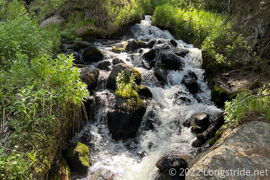
After a three-and-a-half mile climb, the trail headed downhill for a bit, past a couple of creeks and waterfalls, reaching a campsite with enough flattish areas for the four of us.
We only hiked a little more than twelve miles today; the climb up (and down) from Mount Elbert was exhausting. Tomorrow, we plan to make up for that, with a bit of a longer day that will put us only a few miles away from the road going into Leadville.