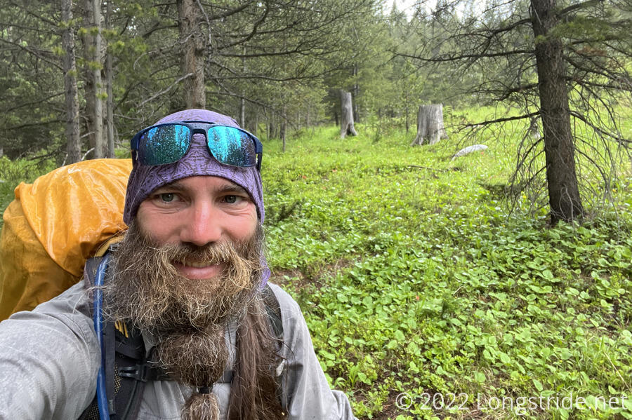
By far, today was the rainiest day on trail. But, we still had to press on, even though it was wet and uncomfortable.
There was a light rain briefly overnight. This morning, while I was getting ready (and still in my tent), there was also a light rain, which fortunately stopped long enough for me to take my tent down and get my pack packed. It started up again shortly after I left camp, and then stopped a little while later. Certainly not a very auspicious way to start the day.
About half an hour down the trail, I saw a Colorado Trail southbounder with a rancher hat much like Simple’s. While the hiker was still at a distance, I momentarily wondered what Simple was doing here, before I realized that the hat didn’t have any signatures, and so it couldn’t be Simple.
A little while later, a squirrel crossed the trail in front of me, carrying a bundle of pine needles in its mouth, probably for its nest.
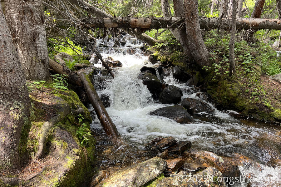
As I approached the bottom of the day’s first downhill, I began to hear a creek in the distance. As I got closer, and it got louder, I thought that the creek sounded large enough to need a bridge. I was happy to find that there indeed was a bridge over the creek (Rock Creek). It also seemed like there was lots of campsites on both sides of the creek.
After the creek, the trail climbed partially up Bald Eagle Mountain, though I did not see any eagles, bald or otherwise. After runnIng alongside the mountain for a couple of miles, the trail dropped back down the mountain’s north side. On the way down, crossing a dirt road, I saw more flags for the Leadville 100 race. I stopped for a break at a creek at the bottom.
Pale Ale, Spouts, and Stumblebee stopped briefly a little while later at Glacier Creek, a little closer to the next uphill, to get water; we planned for a longer break a few miles uphill at a creek, just before an exposed ridge.
That uphill took us into the Holy Cross Wilderness Area. A kiosk declared we needed a self-issued permit for overnight use. We expected to go far enough that we wouldn’t be camping in the wilderness area, but we weren’t entirely sure where the northern boundary was, so we decided to fill out a permit just in case. However, the kiosk was overstuffed with filled-out permits, and there were no blank ones available. We decided that having tried was sufficient, and continued on our way.
On the way uphill, I met another woman who was doing out-and-back sections of the Colorado Trail; this seems to be more popular of a thing to do than I would have guessed. (We passed quite a lot of Colorado Trail hikers today, actually.)
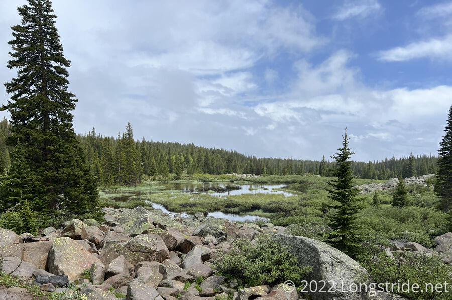
I reached the creek first, finding two creeks very close to each other. The second creek had a nice view, as the forest began to thin and become an exposed ridge. Or rather, it would have had a nice view, but rainclouds had moved in, and it started raining, with a little thunder. I quickly walked back to the first creek and sat down underneath a pine tree, which did a surprisingly good job of keeping me dry. Pale Ale, Sprouts, and Stumblebee arrived about ten minutes later, but between the creeks and the rain, it was hard to have a conversation because the ambient noise was so loud.
I sat out the rain for about an hour before continuing on. By that time, it had gotten cold out, and I needed to keep my rain jacket on to stay warm, despite there being more uphill to hike. That also helped out when it started raining again after I crossing to the other side of the mountain and began going downhill.
The consistent rain didn’t last too much longer, and the sky started to clear and the sun began to come out.
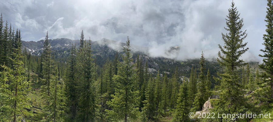
An hour later, though, it began raining on and off. It was a little bit annoying, but at least it wasn’t a consistent rain. This was, though, the first time I’d actually seen it rain on what remains of the snow fields, and the rain will help them to go away faster.
Shortly before five, I stopped for another break, just across a creek, near a field that was said to have some campsites. This was about fifteen miles into the day, and would put us about six and a half miles away from Tennessee Pass, which will take us into Leadville tomorrow. I looked around briefly to confirm we could actually camp here if we wanted (we could, but it was all grassy), and then had a very brief snack break, since it was still raining. The rest of the group passed while I was having my snack, having decided to push on another three miles to another creek with campsites.
The rain picked up a bit, and I tried to increase my pace a bit so that I’d have to spend less time in the rain. I quickly passed Sprouts. Towards the creek, I found a blue buff on the ground; recognizing it as Stumblebee’s, I picked it up to give it to her when I caught up with her.
Shortly after six, I made it to our campsite. Thankfully, the rain stoped just before I started setting up my tent, so I didn’t have to worry about my pack getting wetter while I was doing that.
In my tent, I changed out of my wet hiking clothes into my dry town clothes, and put on my fleece to stay warm. A bit tired out by the rain, I didn’t really want to cook dinner, but I forced myself to do so since I knew I’d be rather miserable only having snacks for diner. (And, actually having a warm meal helped warm me up.)
Today was, by far, the rainiest day on trail so far. It was so rainy, actually, that my phone refused to charge when I plugged it into my battery, instead complaining that there was water in the charging port.
Tomorrow: A short (and hopefully dry!) day into Leadville.