Today, I hiked the my first section of the trail southbound, doing the next section of trail as a 23-mile slackpack.
With a 6:30 am bus we need to catch, and since we needed to first move our packs to Inn the Clouds, where we are staying tonight, we got up at 5:00, and started walking at 5:30.
We were pretty efficient about everything, and made it to the bus stop fifteen minutes early. We were a bit concerned when a bus passed by just before we got there, but it turned out to not be our bus, which did arrive more-or-less on time.
Unfortunately, Pale Ale was feeling a bit under the weather, and while she accompanied us to the bus stop, she would not be hiking with us today.
Sprouts, Stumblebee, Bass, and I piled into our bus, and had an uneventful ride to the Copper Mountain ski resort. We wound up getting off the bus a littler earlier than we needed to; a cyclist talking with the driver got the bus to stop alongside the road half a mile or so before the actual bus stop.
The road the bus dropped us off at is on the Silverthorne Alternate, which departs the CDT from Copper Mountain, heads north to the town of Silverthorne, and then heads northeast to reconnect with the CDT skipping a rugged stretch of trail that includes Grays Peak, a fourteener and the high point of the CDT. (I won’t be going that way.) We followed the alternate a mile south, mostly along the ski resort’s roads, until we reached the CDT on the side of a ski slope, turned southbound, and began hiking south towards Tennessee Pass, where we finished yesterday.
When I started this hike, I expected that slackpacking opportunities were going to be extremely limited, so I wasn’t expecting to do any of the trail southbound. However, after the New Mexico fire closures, I decided that when I returned to do that segment, I’d do it southbound. (Mostly because of logistics reasons, but also because that direction is roughly downhill.) So now, having already processed both the discontinuity and acceptance of southbound sections in my northbound hike, I was happy to be able to do a longish day without my full pack.
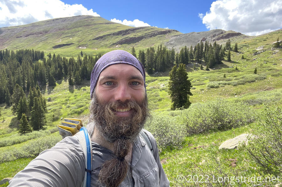
Again carrying only my water bladder pouch, which doubles as a day pack, (more than) sufficient water, a day’s worth of snacks, and my rain jacket (just in case), I was able to move faster and more easily than usual, and I bounded up the trail much quicker than I expected (and I suspect, much faster than the rest of the group expected as well). I left the rest of the group behind, assuming they’d catch up when I next stopped for a break.
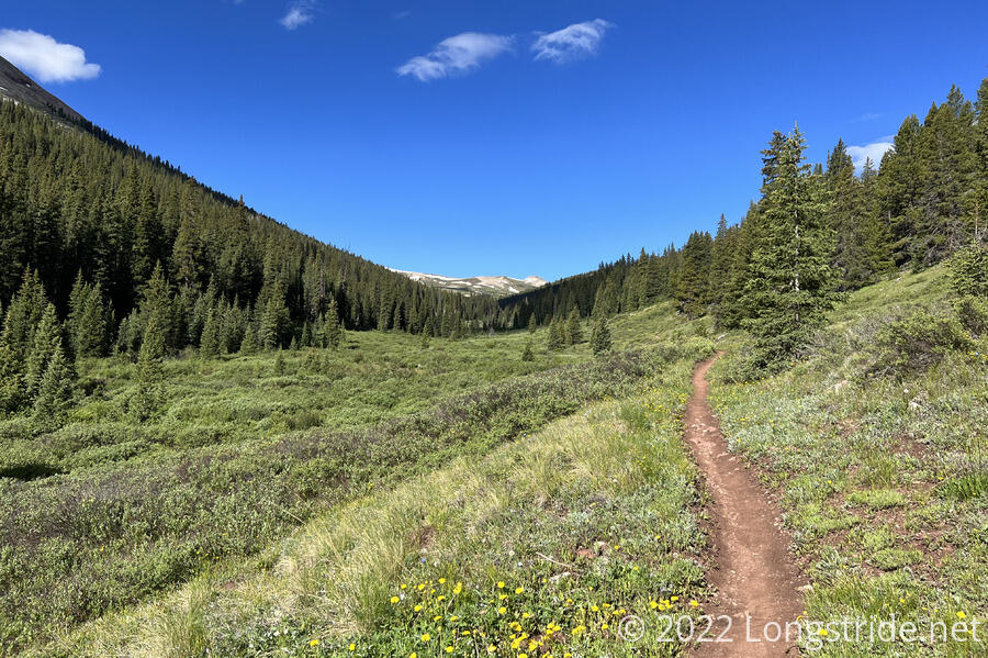
After crossing a few ski slopes, the trail turned south, climbing the stream valley for Guller Creek. The trail weaved in and out of the forest above the creek, and the forest gradually thinned as I climbed, heading towards Searle Pass.
Near Searle Pass, I passed a hiker with a large, aggressive dog. Despite attempting to give both of them a wide berth (which was a little difficult given the trail was a bit cut into the hillside at that point), the dog lunged at me, though he was able to hold the dog back. This would not be my only run-in with a dog today.
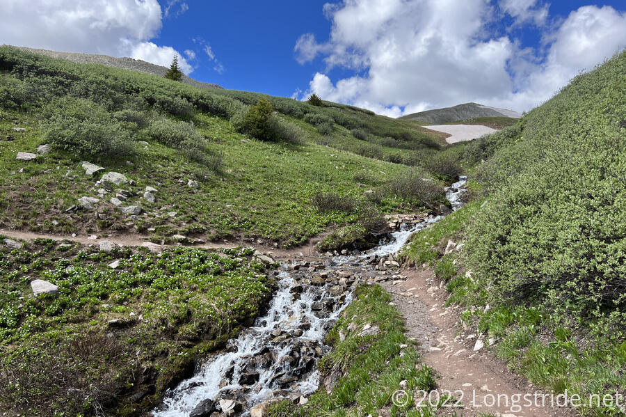
Also near the pass, the trail crossed Guller Creek, which had a waterfall flowing across the trail.
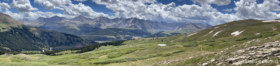
Crossing over Searle Pass, I began descending into a vast meadow. It was easily one of the most scenic valleys I’ve been in in Colorado.
After roughly nine miles, I stopped for a break. This was much further than I’d planned on going, but having the benefit of only having a day pack (and great weather), I was able to go further, faster, with much less effort than usual.
The morning started out with very few clouds, but as the day progressed, the number of clouds increased. I tried to keep my break short so I could get over the next ridge and be on my way down before any storm clouds arrived.
While I had a snack, two trail runners and three cyclists passed, heading north. Off in the distance, I could see the guy with the dog gradually approaching. But, I didn’t see any sign of Sprouts, Stumblebee, or Bass. This seemed unusual; I knew I was hiking faster than they were, but since I could see a couple of miles back to the pass, I should still have seen them somewhere, even if they didn’t catch up while I was stopped. I was a little concerned, but I figured they’d catch up eventually.
The meadow was filled with flowers, so many that I could smell them in the air without even trying.
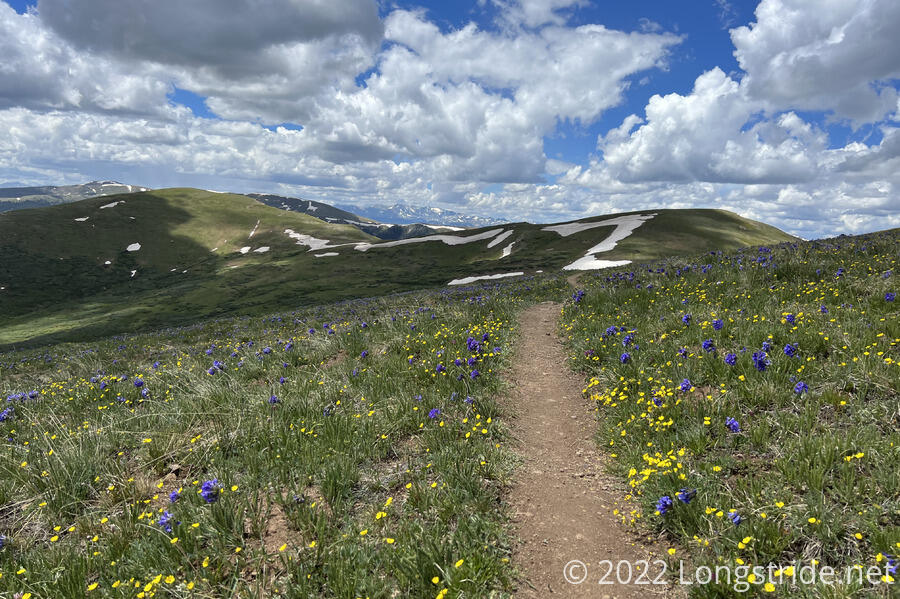
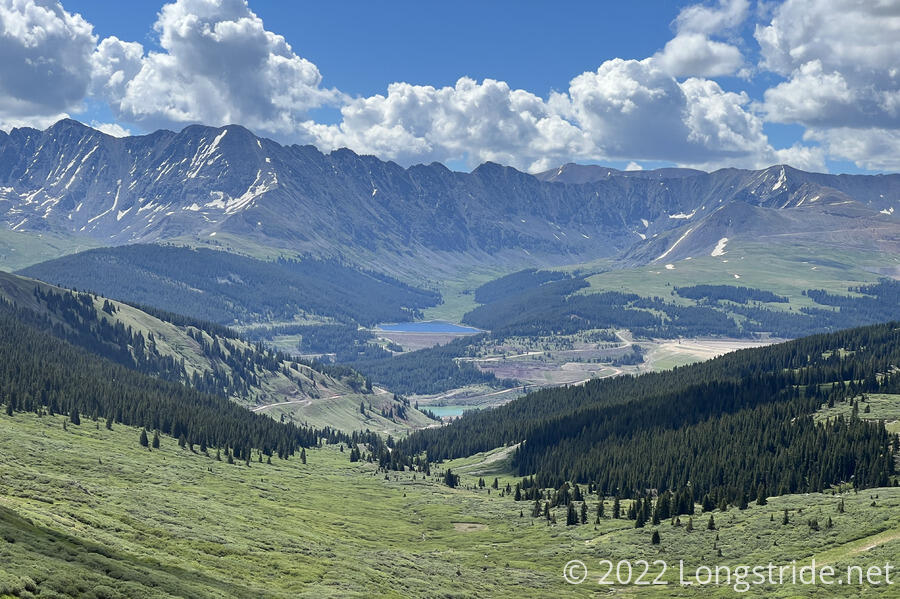
The trail climbed up along the side of a ridge for a short while, before dropping down to Kokomo Pass, in the saddle between two mountains. Since I was making good time and was way ahead of the rest of the group, I briefly considered summiting North Sheep Mountain, which was only 400 feet up and not too far from the trail. The darkening approaching clouds discouraged me from that, and I headed down the pass, hoping to stay ahead of whatever rain they might later bring.
The trail followed Cataract Creek down its stream valley. Along the way, there were a few raindrops, but, at the time, it seemed like nothing significant would come from the cloud that dropped them. As the wind picked up a bit, the cotton-like pollen from nearby cottonwood trees floated through the air.
Traveling further downstream, the creek’s valley widened to a large flat area, and began following a dirt road that led to a trailhead. Proximity to a trailhead meant more people, and a family with a somewhat out-of-control dog approached. They were calling out that the dog is “super friendly” as it tried to run towards me. Fortunately, they were able to stop if before it reached me, but if they didn’t have young kids with them, given my experience earlier in the day, I probably would have yelled at them to have better control over their dog. I don’t care how “friendly” a dog is, I don’t want any dog running over and jumping up on me, and the “they’re just friendly” excuse to me just betrays how little in control of their animal they are.
After crossing the valley on a dirt road, the trail re-entered the forest. I took another break, sitting down on the slope next to the trail. This time, I was actually somewhat tired, almost ready to take a nap. Which would have been a bad idea given where I was sitting; a mountain biker zoomed by with uncomfortably little clearance
As the day progressed, the clouds grew and darkened, and by 3 pm, it seemed as though I was walking directly towards storm clouds. The wind picked up, and I could feel a few raindrops, this time the harbinger of bad weather. Across a meadow, pine tree were visibly releasing clouds of pollen into the wind.
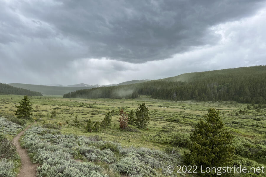
The raindrops turned into a drizzle, and then a constant light rain. Lightning flashed, and thunder rumbled occasionally. I picked up my pace a little, but with just a day pack, I was already going nearly as fast as I could without actually running.
After being rained on for nearly an hour, I made it back to the trailhead, and ducked into one of the porta-potties there briefly to get out of the rain for a few minutes.
Now that I had cell service for the first time since morning, I received a message from Sprouts that Stumblebee wasn’t feeling well and was turning back, and that she and Bass were also considering turning back. That explained why I hadn’t seen them at all.
I was not optimistic about my opportunities for a quick hitch given it was raining and I was pretty wet, but the rain lessened a bit once I went out to the road. As it turned out, it took less than five minutes to get a ride, who very generously dropped me off right at Inn the Clouds.
After a shower, I walked to Subway for dinner, and then got caught in the rain returning to Inn the Clouds.
Tomorrow, I’ll need to do my resupply for the next section to Fraser, and then catch the afternoon bus back to Copper Mountain to continue.