Today, we summited Lake Ann Pass, and made our way towards Hope Pass, which we’ll summit tomorrow on our way in to Twin Lakes.
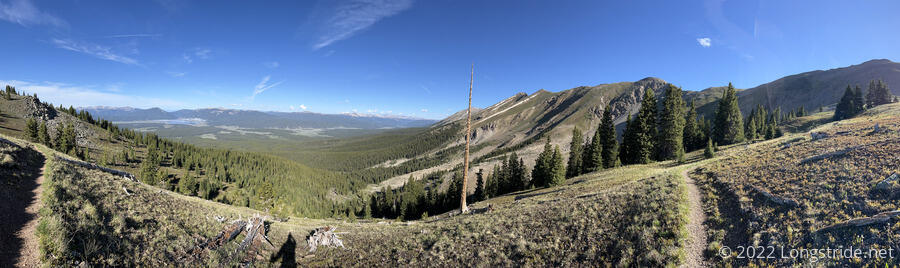
I started hiking around seven, about half an hour after Pale Ale, Sprouts, and Stumblebee took off. After a brief downhill to a larger creek than where we stayed last night, the first two miles were a gradual uphill. At a trail junction, the CDT turned and started climbing steeply uphill. I soon passed Sprouts and Pale Ale. A short while later, I rose above the tree line, which granted spectacular views of the valley to the southwest below. I passed Stumblebee admiring the view. (She was also not admiring the switchbacks that took the trail up to Lake Ann Pass in the distance.)
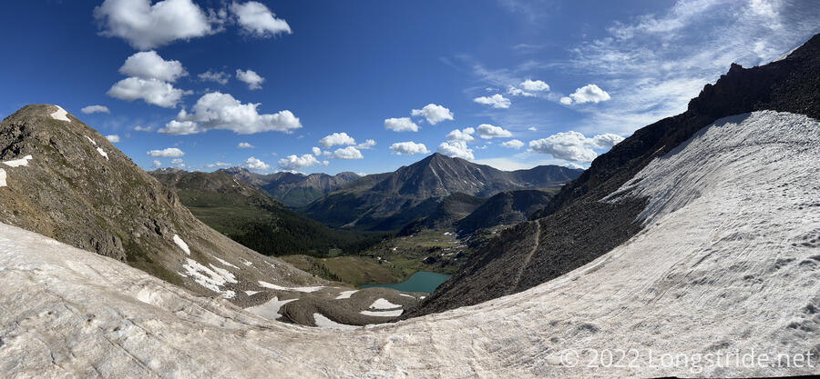
The entire southern approach to the Lake Ann Pass was entirely snow-free, which I suppose sort of balanced out the fact that the north side of the mountain still had a few annoying bits of snow lower down and a large snow field covering the trail near the top of the pass.
Reaching the pass first, I dropped my pack on an exposed flat area and walked out on the snow a bit, trying to survey the best way around the snow. On the way up, I’d met a Colorado Trail southbounder who said he’d scrambled up the rock face, avoiding the snow. He also said he wished he’d just gone through the snow.
The obstacle was a snow field spanning a section of the north face of the mountain, covering maybe fifty feet of trail. Stress lines running near the edge of the snow suggested a cornice. I avoided getting too near them.
I concluded that going through the snow was better; there were already footprints embedded in the snow, which in theory should make it easier to cross. Going around the snow on the exposed rock seemed possible, but challenging.
The main difficulty was that the trail (and the mountain, and the snow) were all very steep. Slipping from the footholds would very quickly send you down to the loose scree just below the trail. You wouldn’t slide down too far — maybe twenty feet — but there was also nothing but rocks to slow your descent once you got there.
I got my microspikes out: it was still early in the day, so the snow was still pretty hard, and spikes would help keep me from slipping.
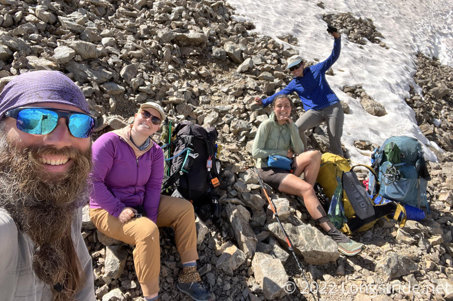
The rest of the group arrived, and concurred with my suggestion that the best route was through the already-established path. Sprouts borrowed my phone to text with her cousin, who lived “near” Twin Lakes, and started to arrange for them to pick us up so we could stay with them for a day.
Just before we started, Windchime arrived at the pass, ahead of the rest of her group (Tiempo, Almost, and Cream).
We got out our ice axes; this was the first time I’d used mine. If the cost of slipping had been less, I’d likely have used my poles. But here, falling meant a quick slide down to loose rock that would probably hurt. It seemed doubtful I’d be able to self-arrest quickly enough, but at least this way I’d actually have a chance.
We settled on a marching order — Pale Ale, me, Stumblebee, and Sprouts, and took to the snow. After a few steps, I noticed Pale Ale did not have spikes on. “Gutsy”, I thought, and then immediately also thought that that was a very bad idea, and that someone with spikes should have taken point.
Pale Ale got stuck. The slope (and consequences of falling) were really a bit terrifying. She wanted to back up. But I’d mistakenly advanced too far, and I was unable to easily back up from the position I was in. Not that I wanted to back up; that would have just negated our progress and made it harder to go forward again. And, I felt I would lose my balance and fall if I attempted to look behind me to judge where to put my feet. Backwards was not an option.
So now, I was also stuck. Pale Ale suggested I go around. If I had been able to, I’d have more easily been able to cut steps since I had better traction. But from the position I was in, and the steepness of the slope, I didn’t see that that was possible. I briefly considered whether an intentional, controlled fall using the ice axe would be a viable solution. Being in a somewhat awkward position, my leg was tiring, and though I had a good hold with my ice axe, I would not be able to stay in place indefinitely.
Windchime came to the rescue. Without her pack, she came across the snow above us, and then dropped down in front of Pale Ale and helped to make a better path for Pale Ale to follow. This allowed me to move forward. Now, with each step I took, the risk of failure decreased and I was one step closer to safety: there was less snow to slide down, and the trail was less covered with snow, meaning a slide would stop at the trail, rather than the rocks beyond.
During the traverse, my (audible) 10 am selfie alarm went off. I muttered “I don’t have time for this,” and managed to shut it off without losing my balance.
The whole ordeal to get everyone safely across the snow took about 25 minutes, far longer than it seemed in the moment.
My ice axe definitely earned its keep. It would have been much more difficult to use both poles, rather than a pole and the axe. The shape and size of the axe’s handle allowed it to plant in the snow and stay in place more easily, and being thicker and wider metal, was able to hold my weight in a way that would probably have bent or snapped my poles.
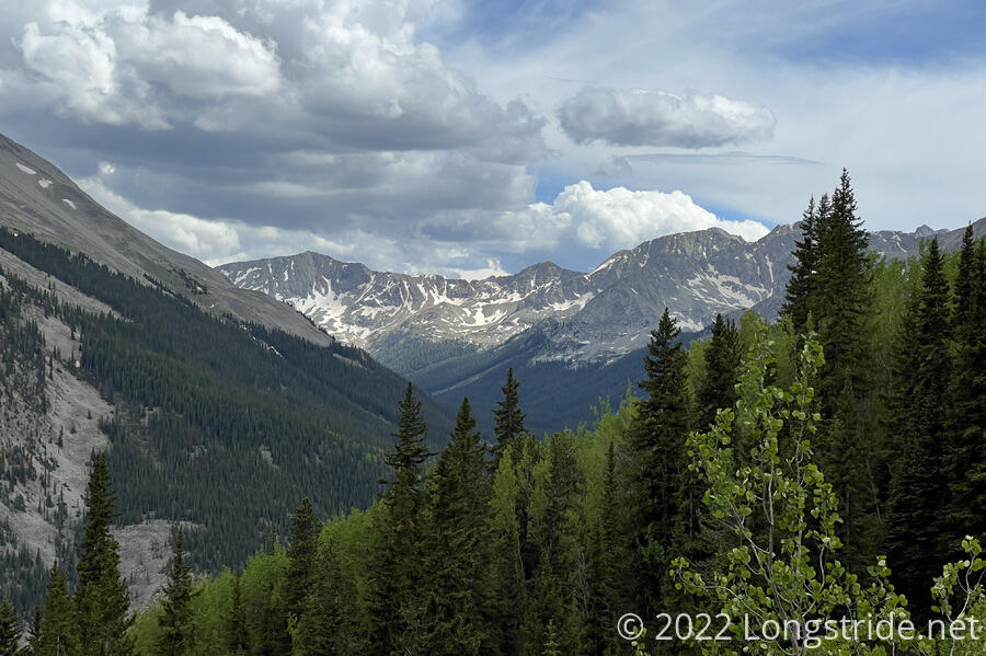
Safely across, we continued down the mountain, avoiding some snow traverses by scrambling down or across the rocky mountainside. Eventually, we dropped into the forest, and stopped for a break at a creek. Tiempo, Windchime, Cream, and Almost joined us.
With some adrenaline from the snow traverse to burn, I sped off down the mountain. A large part of the rest of the day was mostly downhill, initially steeply, and then much more gradual as the trail dropped towards the valley of Clear Creek, and followed above the creek for several miles.
After an hour and a half, I felt a few raindrops, and stopped for a very quick break while I had the opportunity.
A little surprised that Tiempo’s group hadn’t caught up once I was finished my snack, I continued on, putting on my rain jacket once the rain picked up. Naturally, this caused the rain to lessen immediately, and I took it off ten minutes later because the rain had stopped and the sun had come out a bit.
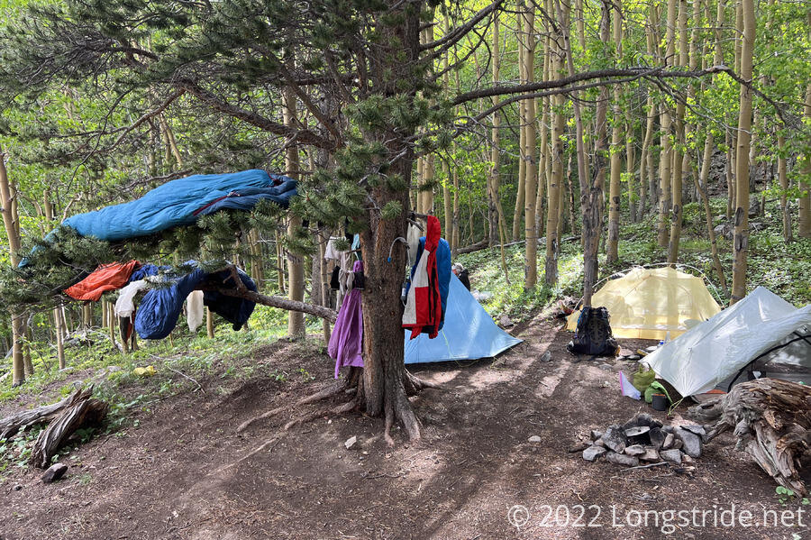
The trail turned, climbing very steeply — almost 1,250 ft/mi, possibly the steepest climb so far — up towards Hope Pass. The goal was nine tenths of a mile to a “two tent” campsite. With both my group and Tiempo’s heading for the same place, we’d need to fit eight tents.
I tried to maintain a slow and steady pace, and it took me about fifty minutes to make the climb. I thought this was quite good, given my recent poor performance on uphills. I took it as further proof I finally had my trail legs.
After resting for a few minutes, I hiked another tenth of a mile up the mountain (which, actually, was one of the flattest stretches of the day) to a creek, got water, returned to camp, began filtering, and had another snack.
The first other people arrived about 45 minutes after I did; the last person an hour after that.
Stumblebee quipped,
Q: Why is it called Hope Pass?
A: Because you hope it’s past.
Tomorrow, we’ll complete the climb we began today, climbing over Hope Pass and down to the town of Twin Lakes.