I wasn’t expecting an overly muddy road to be the most prominent feature on my penultimate day on the CDT, but if nothing else, this trail has proven that the trail can’t be predicted.
It rained overnight, though not as much as I expected. Still, everything outside was wet and soggy. By the time I left camp, a tiny patch of blue sky gave some hope that, maybe, it wouldn’t rain all day like the weather forecast claimed.
I continued down the road I camped next to yesterday, going through a long, mostly featureless plain with grass and bushes alongside the trail, and trees off in the distance. The clouds in the sky thickened, and most of the day was completely overcast.
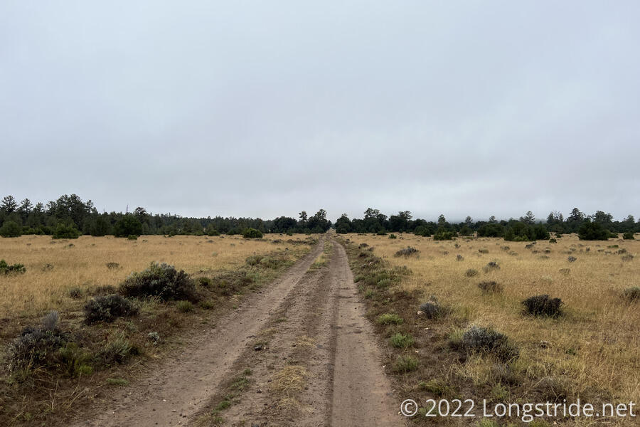
The road was almost as flat as the Great Divide Basin. With the clouds keeping the sun away, it would have been a great roadwalk, if it wasn’t for the mud.
The rain overnight soaked into the ground, and whatever it was made of resulted in the road being coated in thick, slippery mud.
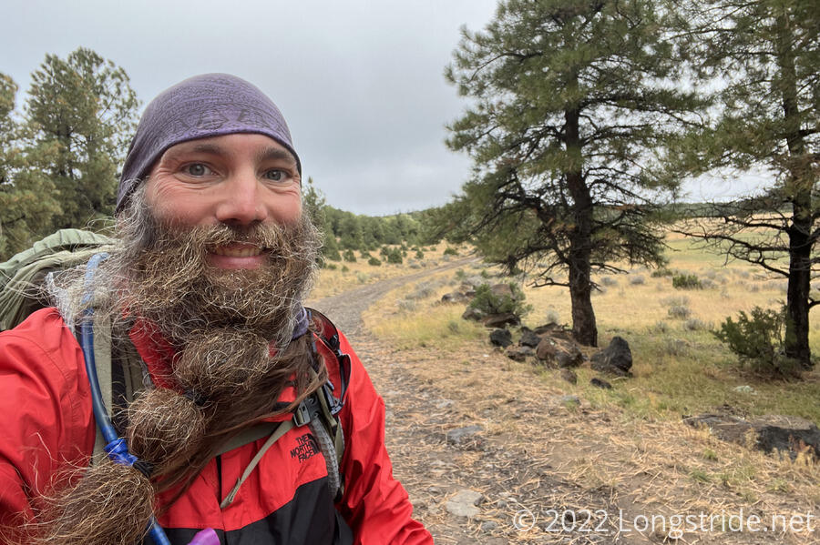
The mud was highly effective at sticking to my boots — and to itself. over the course of the morning, I had to stop several times to clear an absolutely ludicrous amount of mud stuck to my boots. At times, the mud stuck to the bottom of my boots was easily an inch or two thick. This is, of course, very heavy, and thus much more tiring than it should have been. Still, though, I managed a little more than six miles in two hours, which was pretty good given how much of that time I spent scraping mud off my boots.
While stopped for a break, Wonder Woman caught up, and mentioned a roadwalk alternate into Grants. The alternate, about 9 miles ahead, would be roughly 25 miles of roadwalk. Even if that would be shorter and faster, I didn’t want to end the hike with 25 miles of road. There’s already going to be several miles of paved road into Grants to finish the hike, I’d really rather not add more if I don’t have to.
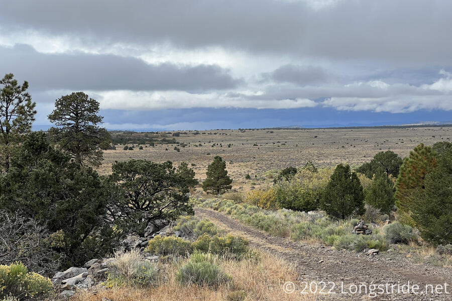
The sun seemed like it was trying to come out, with a patch of blue sky behind me, but the wind picked up and was blowing more clouds in just as fast as it was blowing the clouds overhead out.
It was already cool out, but the added wind cooled it off even more, and I had to put my gloves on. The wind, though, did seem to be helping to dry out the road. The further I went, the less muddy and sticky the road was.
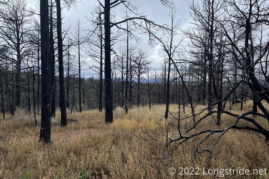
In the afternoon, there stared to be a little traffic on the road, though only a car or two per hour. After 2 pm, I finally departed from the road, committing to taking the trail, rather than the roadwalk shortcut. This took me through a short burn area. After that, the rest of the day was forested.
While stopping for a break, a light rain started, and continued for an hour or so. This made collecting water a short distance afterwards a bit annoying. The water was a cattle pond, and with the rain, its edges were all mushy silt, so it was a bit of a challenge to get water without getting my feat soaked. The water itself was some of the grossest water I’ve collected on the CDT: it was very silty, with lots of small orange swimmers. Thank goodness for water filters!
I started looking into alternates to get to town. There’s a large network of dirt roads along this stretch of trail, and if the weather continues to be bad tomorrow, one of them might make for a a good “escape route”.
Reaching the Mount Taylor Alternate, I decided that with the current rain, and the snow still forecast for tomorrow, it would be prudent to skip the summit and head for town. From here, there was still a bit of a climb up along the western side of the mountain, but not very much more.
From the alternate junction to Grants, there’s two uphills left, about 2,500 feet total of elevation gain. The next hour and a half or so, I climbed most of the first uphill. It was dreary for a while as the trail wandered along the mountainside in forest, without much of a view. Eventually, though, the ran stopped. I ran into Spice Rack, Dash, and Wheezy, who passed me a bit later when I stopped for the day.
Just after 6 pm, I stopped at a crossroads, in a flat area nestled between the trail and a dirt road. Some trees helped shade from the wind, which started to pick up again. Onion, Cool Joe and Yellow Card passed while I was setting up my tent.
Once inside my tent, I started to warm up, especially once I got dinner going. Outside, though, it continued to get colder and more windy. As a treat, I tried to use the hand warmer I still had left after the cold, rainy day in The Bob, but I couldn’t get any heat out of it.
From my campsite, there’s 24.5 miles to go on the trail to the Lava Flow Hostel in Grants, where I’d made it before having to stop due to the fire closures in May. It’s going to be a long day tomorrow, but hopefully the weather will cooperate, because, pretty much, the only practical thing to do tomorrow is hike the rest of the way into town.
Tonight is my last night on the trail. And trying to figure out what I think about that, it’s hard. This is a pretty amazing thing that I’ve been able to complete, not just the CDT, but the CDT as a culmination of over 8,800 miles of hiking long distance trails that began in 2016 on the Appalachian trail. This trail has been incredibly beautiful, but also hard and tiring, and more than anything else I’m just relieved that it’s done. And that’s not really what I was expecting.