Today, I concluded my hike of the Continental Divide Trail.
My alarm was set for six am, and rather than dither for half an hour with the snooze button as I had done so many times before, I actually got up then.
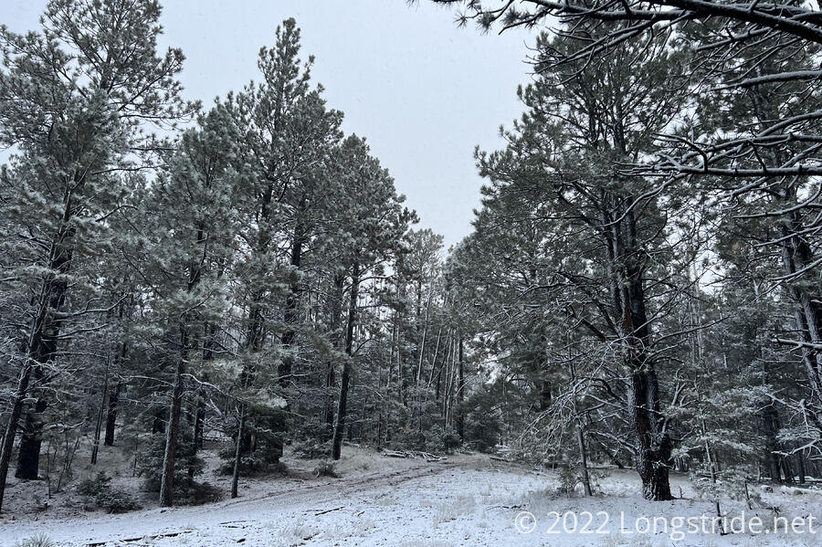
I had briefly gotten up around 3 am and noted that it was very lightly snowing. By 6 am, the snow was coming down a little harder, and had just started to stick to the ground (and my tent). I knew that the longer it took me to pack up and leave, the worse dealing with the snow was going to be. It didn’t help that my headlamp ran out of power while I was packing up. (I knew that was a possibility, since I used it heavily while cooking dinner the last two nights, but I was hoping it would last just a little bit longer than it did.)
I had a long day ahead of me: just over 20 miles if I took a shortcut, or more than 24 miles if I stuck to the official trail all the way to Grants. Either way, getting to town before sunset would require the trail to be as easy to hike as I hoped it would be. I knew the trail had a fairly favorable elevation profile, the only question was, what was the trail tread going to be like, and was the snow going to cause any problems?
I left camp shortly before 7:30, later than I wanted given the long day, but earlier than so many other days. About ten minutes later, I passed by two tents, which I suspected belonged to Spice Rack, Dash, and Wheezy.
By 8, the snowfall had started to decrease. Randomly, for about two seconds, pea-sized hail rained down, then stopped as abruptly as it started.
Around 8:30, I saw someone else’s boot prints in the snow for the first time today. I’d expected to see boot prints, of course, but I was a surprised it took an hour to see the first signs of someone else hiking ahead of me today.
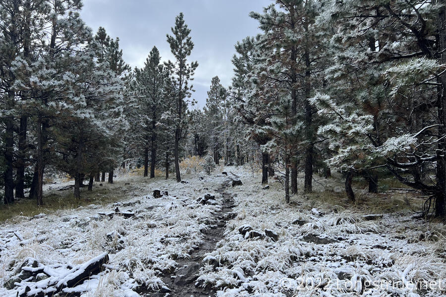
The first six miles or so of the day were a bit bumpy, as the trail lost much of the elevation it gained during the climb yesterday evening, and then turned around to regain the elevation it had just lost. It wasn’t terribly steep, but the trail was still a bit muddy, thanks to the snow. Fortunately, though, the snow hadn’t accumulated that much on the trail itself. The trail afforded me the opportunity to divert on a dirt road shortcut, but I decided to stay on the trail: I was still making good time, and after significantly shortening the trail in Montana, I wanted to push through as much as possible on the official trail, up to the end.
Around ten, near another road junction, I was again tempted to divert from the trail. Then, I realized I was nearly at the top of the climb. A little further, and the rest of the day would be all downhill. I kept going.
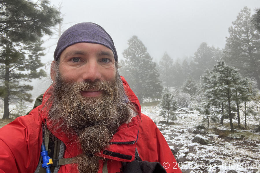
By then, the snow had stopped, but fog was setting in, as the clouds above the mountain started descending. However, it also got bit warmer than it was earlier in the morning, and with the trail soon heading downhill, I doubted I’d have much of an issue with the fog.
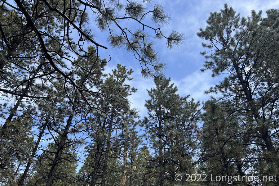
After cresting the high point of the day, I began the 3,600 foot drop to Grants with a gradual descent. The sky started to clear, at least for a little while, and I stopped for a short break while the weather was still favorable.
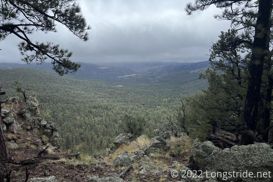
The trail continued downhill through forest uneventfully the rest of the morning. There wasn’t much for views, except when the trail skirted the edge of a cliff above a valley. The clouds overhead returned, though they were further above than before.
The forest itself changed, switching from a dense pine forest, to something containing shorter and more shrub-like trees.
Joining an ATV road, the trail continued to meander along Taylor’s plateau, gradually descending, and heading towards the desert around Grants. The trees gradually got shorter, and eventually, there started to be the occasional cactus. For the most part, it was unremarkable, until I reached an area that had a bunch of cows. The trail along that short section — maybe half a mile to a mile — was very rugged and annoying to hike, as the tread was completely wrecked by the cows. By walking on the trail when it was wet, their weight, spread over relatively small feet, gouged deep holes in the dirt. Now that it had dried out a bit, the dirt was a rock-hard uneven mess.
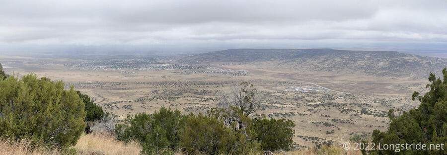
Once I made it past the worst of it, I stopped for a short standing break to book a room at the Lava Flow Hostel, where I last stayed in Grants. A little while later, on the edge of Mount Taylor’s plateau, I got my first view of Grants from above.
From that view, I began a steep descent, dropping off the plateau, reaching a parking lot and trail head two miles later.
I stopped for a break — the last break of the hike — at the trailhead. Yellow Card and Cool Joe caught up on the downhill and passed while I stopped.
At 4, I continued on, taking the gravel road from the parking lot to a two-lane paved highway that I followed for five miles to Grants. The roadwalk started off pretty terrible — there was barely any shoulder to speak of. After a few miles, I passed a prison. Just past the prison entrance, a bike lane appeared, running the rest of the way to Grants. I couldn’t imagine anyone frequently using this bike lane, but, it did increase the distance between me and the cars on the road.
Dark clouds began forming, and a cold wind picked up. I tried to hurry a bit, but there wasn’t much faster I could really go.
A car passed by me, then turned around; I suspected it was someone who saw a hiker and decided to give them a ride. I was mostly right — it was someone who’d picked Onion up somewhere behind me, and she saw me and got them to turn around to pick me up. I appreciated the offer, but I was less than three miles from being finished, and after all the other times I’d turned down rides down a road, I wasn’t going to end my hike with a car ride.
On the way into town, I passed a few housing developments, and then more homes and some businesses. Passing by a cemetery made the north end of Grants quite comparable to the north end of Rawlins, save for the prison and cemetery outside of Rawlins being across the street from each other.
At 5:27 pm, just over 5 months, 22 days, and 7 hours since I left the southern terminus, I completed my hike of the Continental Divide Trail, reaching a gas station at the intersection that took me to Lava Flow. The road, one-way, was studded with “Wrong Way” signs, which served to loudly state what I’d been feeling the whole time since leaving Chama.
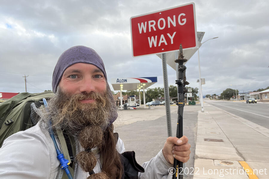
Wrong way or not, I completed my goal, a contiguous footpath from Mexico to Canada, (mostly) along the Continental Divide Trail. I grabbed a soda and ice cream from the gas station to celebrate, then went to Lava Flow to relax.
A wonderful surprise was waiting for me at Lava Flow. CareFree, who had moved to New Zealand after her visit in July, sent me a care package, including some snacks and a homemade (triple) crown with the logos of the AT, PCT, and CDT!
The rest of the evening, I hung out in the Lava Flow’s common area with Onion, Bean Man, Dash, Wheezy, and Ranger Ross, the hostel’s owner and a park ranger at the nearby El Malpais National Monument. I ordered pizza for dinner.
To mirror my original plan for getting to the trail, I’d been hoping to get a train back home from Albuquerque. But, that would have taken three days and cost more than the airplane (and I’m running a little short on patience right now). So I got a Greyhound bus ticket to Albuquerque for tomorrow evening, and an airplane ticket for Wednesday morning to return home. Onion is doing the same thing, so we decided to split a motel room in Albuquerque, near the hotel.