Today, I ventured out again with MAHG for another scenic hike in Shenandoah National Park. Starting from the Whiteoak Canyon Parking lot, the trail took us up the mountain along the waterfalls of Cedar Run, eventually leading to Hawksbill Summit for some great views, before returning along a horse trail and through Whiteoak canyon, featuring yet more waterfalls.
While the hike was originally planned with the notion of visiting a multitude of frozen waterfalls, an unseasonably warm February day made that impossible. Warm, dry air, a light breeze, and a bright sun persisted through most of the day, making for a quiet enjoyable hike. The Whiteoak Canyon parking lot was filled to capacity. There were a number of people out for camping over the long holiday weekend, and, no doubt, the exceptional weather today drew more day-hikers than a cold winter day would have.
Starting at the top of the parking lot, ten of us hiked the Cedar Run Trail as it followed the stream valley up the mountain. Although somewhat steep, and basically going straight up the mountain, the trail was fairly well maintained. Thus, even though it was a strenuous hike due to the slope and elevation gain, it was not a difficult to hike. Towards the bottom, in some areas longer-shaded from the sun, some ice remained on the ground, but it was clear that the unseasonable temperatures meant it was going to be unlikely to see a frozen waterfall. Still, the trail constantly rewarded, with waterfalls of varying size almost the entire way up the mountain.
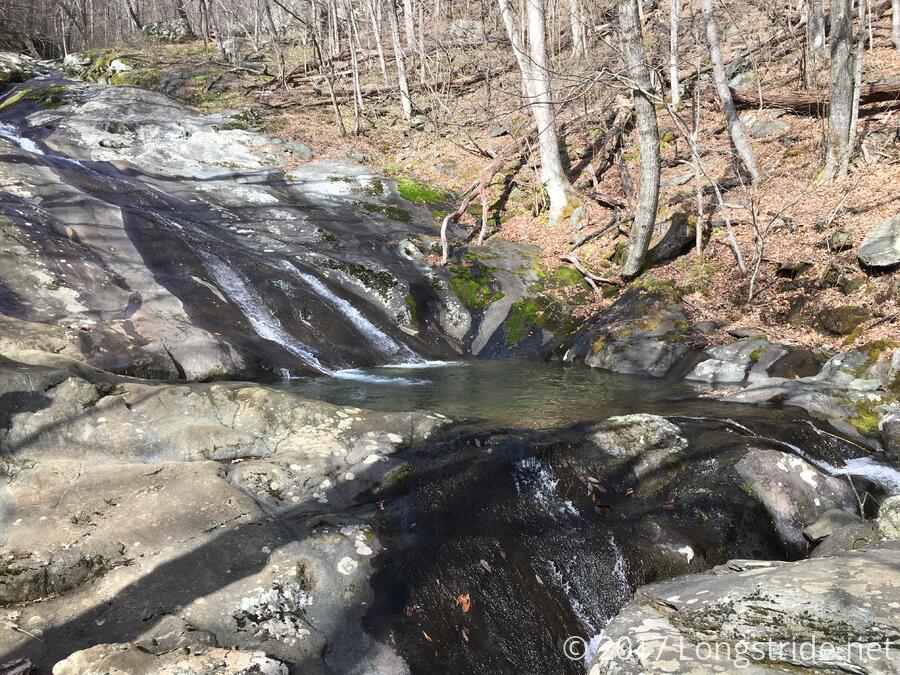
Several of the waterfalls had somewhat sizable pools at their bases that could make for nice swimming holes. One even had a fish!
After a steady three-mile climb up Cedar Run, the trail reached an intersection with the Skyland-Big Meadows Horse Trail, and was a very short distance away from the Hawksbill Gap parking area on Skyline Drive. In a first for me, I led the group from there up to the summit of Hawksbill Mountain; our hike leader opted not to take the out-and-back spur to the top of the mountain so as not to overexert himself while recovering from a cold.
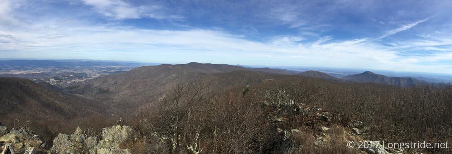
The hike up to the summit was just a little bit steeper than the hike from the parking lot. Clearly a popular destination, the Lower Hawksbill Trail was exceptionally well maintained, and could even be called “easy”, if one overlooked the 17% grade. By the time we reached the summit, we had hiked just under four miles from the base of the mountain, and gained about 3000 feet of elevation. The strenuous hike rewarded us well, though. The exposed Hawksbill Summit provided an excellent panoramic view of the valley to the west. To the east, Old Rag and other mountains blocked the view of the valley beyond.
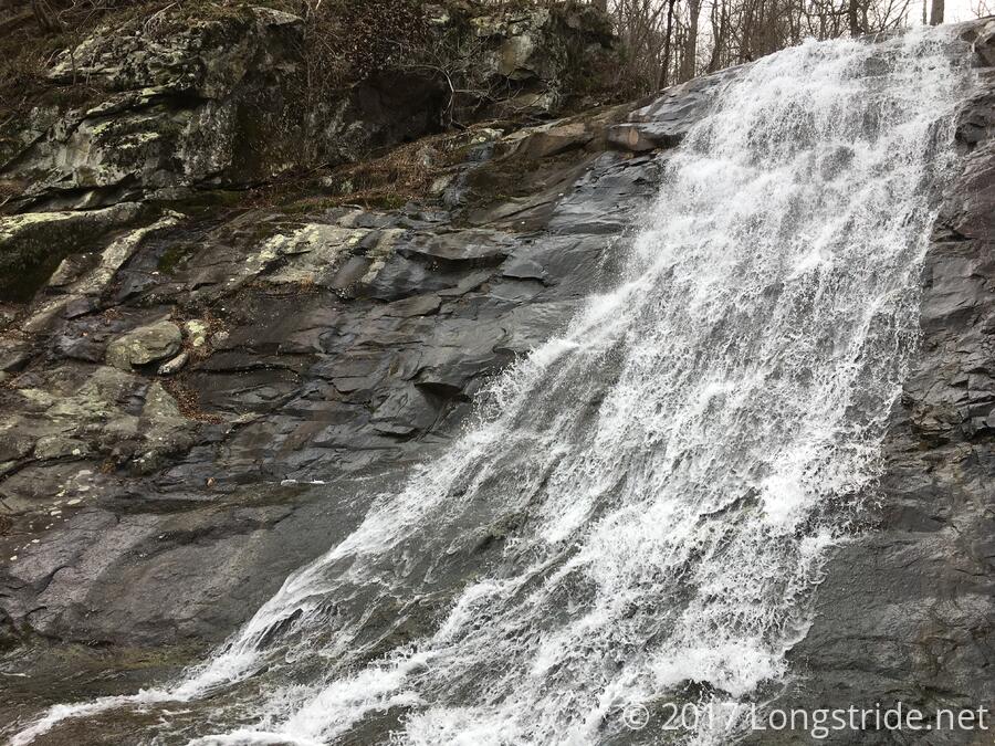
After a nice 20 minute break taking in the views, we hiked back down the Lower Hawksbill Trail (much easier than going up!) and met our hike leader where we left him, at the intersection with the Skyland-Big Meadows Horse Trail. Following the horse trail east for a bit, the horse trail joined a fire road, and after about two miles, reached the Upper Whiteoak Falls.
After crossing on a footbridge just upstream of a waterfall, the Whiteoak Canyon Trail led back downhill, following a stream and passing several more waterfalls. While not as steep as the hike up Cedar Run, this trail was rockier and a bit uneven. There was clearly quite a lot of trail maintenance that went into making the trail passable, with an incredible number of switchbacks, numerous sections with stone stairs, and even a short section where the trail was poured concrete. (Not exactly the easiest to walk down, but at least concrete doesn’t erode quickly!) The light from the sun grew more diffuse, as as thin clouds passed in front of the sun, obscuring it slightly, though its position was still clear.
We “raced” the sun down the mountain, hoping to make it to the parking lot before the sun dipped behind the mountain, though I think every time I looked up at the sky, it was further away from the slope. (No doubt, this was because we were moving away from the peak it was heading towards.) In any case, three miles of winding through the stream valley brought us back to the parking lot, still in full daylight.