Our third and final day of hiking on Gran Canaria took us from Cruz de Tejeda to the Puerto de las Nieves, on out the outskirts of Agete.
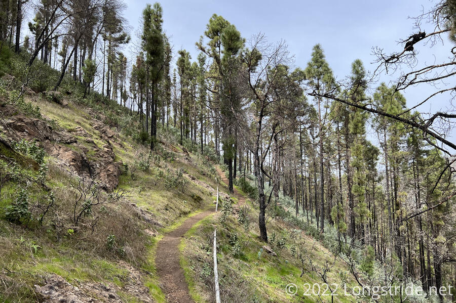
CareFree and I started off from our hotel about 45 minutes after sunrise, to overcast skies and cool temperatures. Leaving Cruz de Tejeda, we quickly found the trail taking us through a burn area. In 2019, a large swath of Gran Canaria burned as a result of a forest fire, and today, we’d be hiking through that area.
In the three years since the fire, the forest has started to regrow. The Canary Island Pines themselves, a very fire-hardy species, seemed to have survived the fire well, with charred trunks, but the majority of the underbrush in the forests today had yet to regrow.
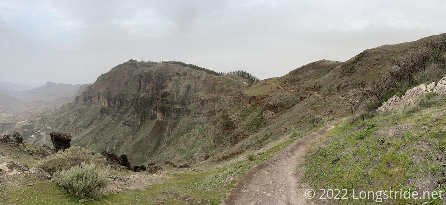
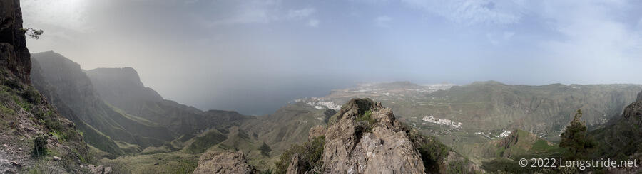
In the morning, the trail took us just below or on the rim of what we were guessing was the caldera of an ancient volcano, the interior of which was significantly eroded to produce the dramatic landscapes we saw yesterday afternoon and this morning. While I’m not entirely sure that’s factually accurate, I think it reasonably well describes what we were seeing.
As the trail wound its way around the ridge, we accidentally took a detour, making a wrong turn that turned us away from a dirt road the trail followed and instead sent us walking along a cliff, giving us more views than the described trail in our guidebook. This also took us past a few caves used by the aboriginal inhabitants, and while it would certainly be frowned upon to use them as such, at least one of the caves would have made for a good overnight campsite, complete with a mat of straw for sleeping.
Our first stop today was in Artenara, the highest town on Gran Canaria, for resupply for the rest of the day’s hike. On the way into town, we passed by a public space on a small plateau above town that had poetry written by (my guess) local schoolchildren, and a large sculpture that to me appeared to be the shadow caster of very large sundial.
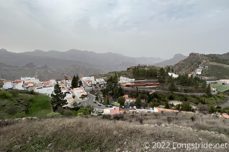
The hike out of town took us up steep streets and past a couple of displays about night sky observation. (Almost half of Gran Canaria is designated as a “StarLight Destination”, with low levels of light pollution.) We also passed a helipad with a Gran Canaria government helicopter waiting for use.
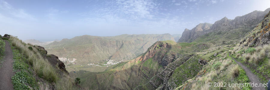
We continued to climb for awhile longer, entering another area that had been burned. As before, the pines were fine, but the ground brush had been largely cleared out.
It was in this area that we had our first blow-down, a tree that had fallen on the trail that we had to step over. (Lanzarote, Lobos, and Fuerteventura barely had any trees, so it’s not surprising it took this long.) The funny thing is I had been thinking that we hadn’t yet seen any blow-downs earlier today.
We stopped for a lunch break at a flattish area near a display sign. While there, a crow (or some similar bird) was doing a strange dance in the tree next to us, alternately clicking its beak and squatting like it wanted to lay an egg.
A bit after, the trail became a bit confusing. After crossing (but not joining) a few roads, the trail reached a junction of two roads and two other trails, and it was unclear which of the three “forward” options were correct. Since we traded road for trail earlier today, we opted to take a roadwalk this time so we wouldn’t have to figure out which trail we were actually supposed to take.
Over the next half hour or so, the trail either was on or roughly followed a road climbing a mountain, generally shorter but steeper than the road. Parts of the trail seemed to be not very frequently hiked, and were on the verge of being overgrown. (A summer without some trimming and they would probably be overgrown.)
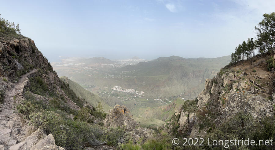
The next destination was the Tamadaba campground, in the Tamadaba Natural Park. We stopped for a quick break, before beginning the hard part of the day. After spending most of the last two days ascending the mountains of Gran Canaria, now we had to descend back to sea level, in a sustained 4100 ft (1250 m) drop over 6.5 mi (10.5 km).
Our descent from Tamadaba started easy enough, down a dirt road, and then down a slightly steeper trail. But 4100 ft is a lot of elevation to lose, and we lost it fairly quickly: the trail became very rocky, very rugged, and very steep, as it zig-zagged its way down the mountain. As anticipated, my feet did not appreciate this, and the steepness and rockiness made it slow going. This section would have been well at home on the Appalachian Trail (though without the views.) But, now essentially on the side of a cliff, we got fantastic views of the rugged landscape of northern Gran Canaria.
Thanks to the extra stress on my trekking poles from the steep terrain, the wrist strap on one of them broke where it had been frayed for quite some time. A couple of days ago, during another rugged stretch, I’d noted that it was probably going to rip apart soon, and now was the time. CareFree attempted to repair the break with duct tape, which ultimately didn’t hold, but I was rather impressed with how long the tape did manage hold the strap together.
After the steep and rough decline, the trail mellowed out slightly, following the folds of the mountain as it more gradually lost elevation. Still hiking along ridges and steep slopes, the views were no less amazing.
The trail eventually reached a dirt road that switchbacked the rest of the way down the mountain, and we soon reached Agaete. A short walk towards the ocean brought us to Puerto de las Nieves, and the ocean, now completing our hike across our fourth of the Canary Islands.
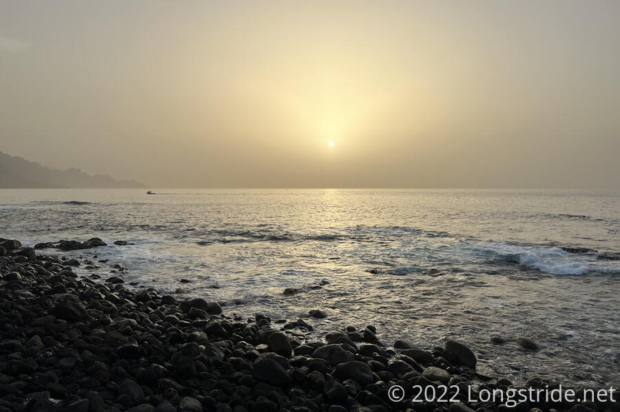
We made a quick dinner of sandwiches at a bench overlooking the ocean, savoring in the completion of our fourth Canary Island as the sun began to set on the ocean, and then walked back to the bus stop we’d passed to get to the waterfront to wait for a bus back to Las Palmas.
While we waited for the bus, a discourteous Brit played a soccer match on his phone rather loudly, almost drowning out everyone else’s conversation.
Our bus showed up and departed on time, and we headed back to Las Palmas as darkness fell. Nearly two hours and two more transfers afterwards brought us back to Eric and Amber’s doorstep, and we crashed with them for another night.
Tomorrow: we take a proper zero for the first time this hike — we’re not going anywhere — and plan for our next island: Tenerife.