We advanced two sections of the GR131 today, hiking south from El Portillo in the Teide National Park to Vilaflor.
Our bus back to El Portillo was scheduled for 10 am, so CareFree and I got to sleep in a bit longer than usual today. Ten minutes delayed, the bus took us back up the windy road up the mountain, and we resumed hiking from the visitor center around quarter to noon, our latest start so far, and fairly late given how far we had to hike today.
On the way up (and down) the mountain, the bus stopped at the gondola lift that goes most of the way to Teide’s summit. When we passed yesterday, the gondola area was mostly empty. Now, it was quite bustling, with many cars and several busses full of tourists.
It was nice out this morning, though a little cloudier and hazier, and not quite as windy as it was yesterday afternoon.
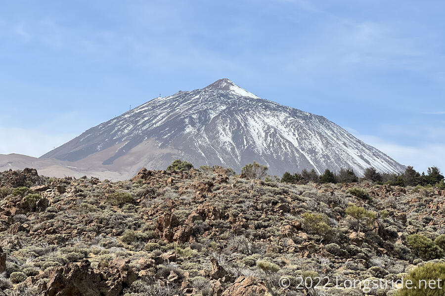
The first part of our hike today was along the floor of the La Cañada caldera, on which Teide sits. Yesterday, we climbed up the northern side of the mountain to reach the level of the caldera floor; today, we walk through it.
Teide is actually the fourth volcano within the La Cañada caldera; the previous three volcanoes all reached which reached roughly the same height as Teide before collapsing, forming the present caldera. It was like hiking through four volcanoes for the price of one.
After a short downhill on trail, the GR131 joined a dirt road, which it stayed on the entirety of our first section today. This road roughly followed the floor of the La Cañada caldera along the inside of its eastern edge, and curved around clockwise to the south. The caldera wall was a couple hundred meters high — and we’d have to climb up and over later to get out of the caldera.
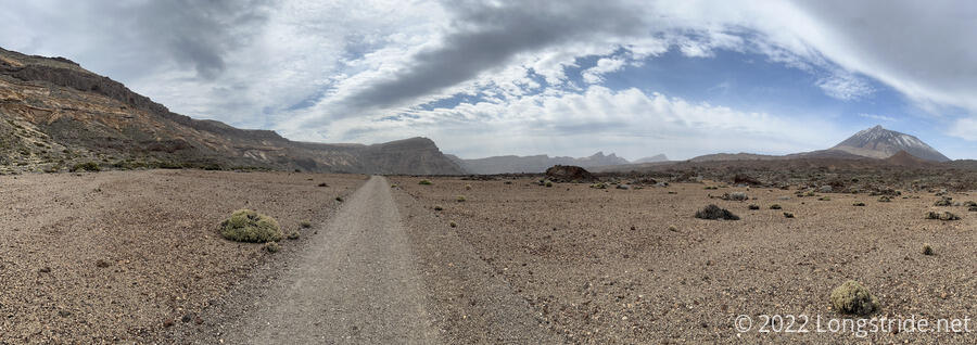
It was a fairly fascinating area to walk through. There were lava flows tens of meters thick that just stopped, leaving walls of rough volcanic rock. Between them were plains of small gravel, and it was unclear to me if they were as flat as they were due to prior human activity, or if that’s just the way they formed.
A large hole at the top of the caldera wall suggested that a large boulder had fallen out, once upon a time, but we saw no evidence of that boulder on the caldera floor.
In another place, a large column of rock looked like it was (relatively) paper-thin and hollow. Further on was an earlier stage of the same process, looking like a nest for gigantic wasps.
The trail itself, though, was a well-maintained and mostly flat dirt road, and we made far faster progress this morning than we expected. Some trail runners that passed us made even faster progress; this part of the trail was perfect for runners.
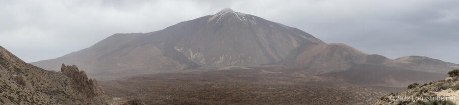
As we stopped for a break (after six miles, one of our longest stretches so far this hike), clouds began to blow in over El Teide, and the sky to the north darkened, threatening rain.
Another half hour of hiking brought us to the start of our second section of the day: the climb up and over the La Cañada caldera wall, and back down the other side to Vilaflor. On our way up, we passed maybe a dozen people coming down; at least a few of them I recognized from when our bus was stopped at the hotel in the park, and I assumed (and later confirmed) that it was possible to make a loop hike from the hotel.
In contrast to the nice mostly-flat dirt road, the climb out of the caldera started as a rougher trail with switchbacks and moderate steepness.
After first bouncing around for a bit, the trail began to drop, going through a number of quite distinct areas as it did.
Immediately, coming down from the top of the caldera was rugged and rocky, though the trail itself was easy to hike.
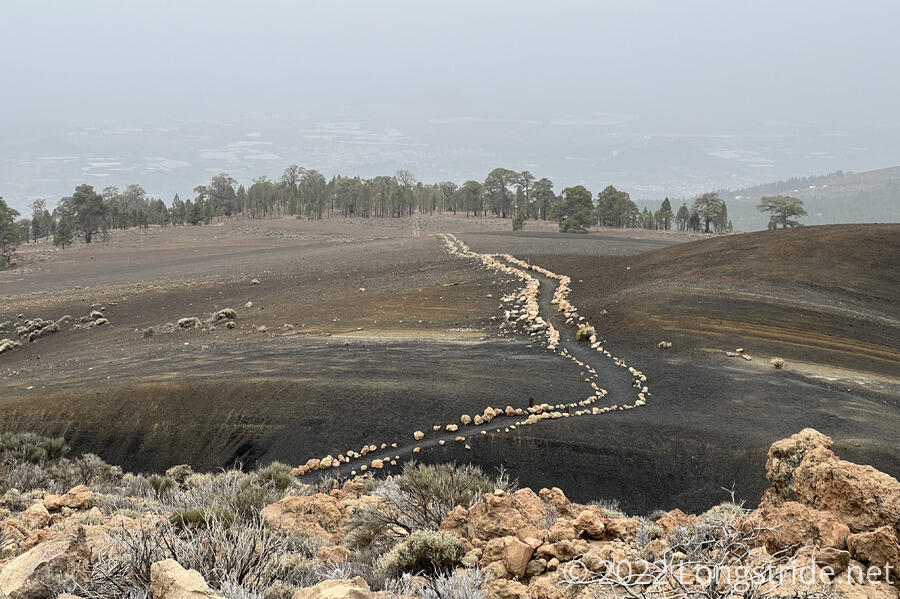
Then, we were led to an area we suspected had a fire recently. The mountains around the trail were nearly completely empty of plants, and were surprisingly smooth, covered in a layer of fine rocks. One of the mountains had one face was nearly completely covered in black rocks, instead of the reddish tint the rest had. The trail was outlined here with rocks, and had one of the longest straight stretch of trail not part of a road.
Below this, the mountains got a bit more rugged, but the trail itself was still very easy to hike, being mostly cleared of large rocks.
We stopped for a break at what had clearly been used as a campsite with a view (and a steep drop down from one edge of the flat area).
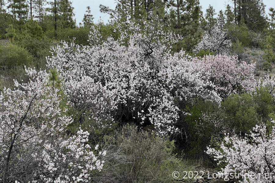
As we continued to descend, the trail followed a number of dirt roads of varying quality, eventually taking us to a road that had been so eroded by time and water that it was impassable by cars. As we continued closer to town, farms began to appear, and in one place, almond trees lined the road.
In the Teide National Park, the GR131 itself wasn’t marked especially well, but every trail junction was well signed and it was always clear where we were going. Beyond the park, and especially while we were on these dirt roads, the trail was marked remarkably well.
There were also a surprising number of campsites near the trail within five or ten minutes of Vilaflor. I guess some people like camping that close to town, but it would have been way too close for me.
Reaching town, we returned to our apartment, tired and sore from a long (and very downhill — over 4,000 feet) and collapsed for a bit.
Soured on getting restaurant food from yesterday’s experience, we went to a grocery store we saw next to the bus stop this morning and got pasta for tonight and sandwich materials for tomorrow.
Tomorrow: We finish Tenerife with a hike from Vilaflor to Arona, and then catch a bus and a ferry to our next island, La Gomera.