With another beautiful day in the works, I left camp around 8:15 to start what would become one of the most strenuous days of hiking I've ever done. (And, in retrospect, I wish I'd had gotten up earlier.)
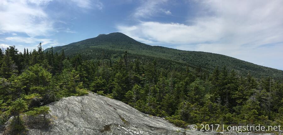
From Montclair Green, the trail started off almost immediately with a steep, rocky, uphill climb, with some rock scrambling and an annoying squeeze or two on the way to the summit of Camel's Hump Mountain. Making slow progress, I reached a rocky ridge, with great views to the east and south. Those views could have been satisfying enough, but that wasn't anywhere near the top. For most of the early morning, Camel's Hump hid its summit, but somewhere around halfway, there was a short dead-end to a thinning of trees on one side of the trail where the summit could be seen, a reminder you weren't even close to the top.
The trail continued to climb steeply, and as it approached the summit, the trees gradually gave way to a nearly bare alpine rock environment and more rock scrambling, including a particularly hairy place where you have to hug the rock and kind of leap sideways to go forward. (Or, you can backtrack slightly and about ten feet downhill, where a wider dirt path provides an alternate route.)
Over the course of the two miles to the summit, the trail only gained 1250 ft of elevation, but it felt like a whole lot more than that. It took nearly two hours to get there (which is apparently a reasonable time, given the difficulty of the terrain), though Caretaker Ben easily passed me on the way to the summit, since he was carrying a day pack and hikes between the shelter and the summit every day.
Tired from the steep two mile climb, I sat on the summit and relaxed for an hour. There were already a few people there (including Fern, who had left before me, an validated the difficulty), and as I waited, more people gradually showed up. When I finally left, there were over 20 people and a dog on the summit (apparently, a very popular mountain, even on a Wednesday), and I passed more people going up as I was going down.
On my way down (but still near the summit), I passed by a group of hikers, one of whom had thru-hiked the Long Trail last year. She gave me a bag of fresh trail-picked blueberries she had picked yesterday.
A little further down the mountain, at a trail intersection, I passed three GMC trail maintainers who had been out cutting apart some trees that had fallen on the trail. (Thanks again, for all the hard work you do to improve the trail!)
The descent from Camel's Hump was initially steep, but then turned into a long and gradual decline as the trail followed the Bamforth Ridge, a rocky alpine ridge with very little tree cover at all. The rocks (and my ankle) made this a slow, time-consuming hike, and there were a few interesting rock scrambles to contend with. The sun exposure didn't help matters. It all made for slow going, but I gradually descended the mountain, reaching the side trail to the Bamforth Ridge Shelter somewhat later in the afternoon than I had hoped for. Since the shelter was .2 miles off-trail, and given I was tired and how late in the day it was, I opted to just sit down on a rock at the trail intersection and take a break (and a snack).
With all the rocky terrain on Camel's Hump and Bamforth Ridge, part of the metal tip on one of my poles sheared off, probably due to the tip being placed in a tight space in a rock and then torqued beyond its capability to stay in one piece. There's still some metal there, though, so it's not a complete write-off yet, but I'm seeing new poles in my future.
From there, the trail improved considerably, and though it still dropped another 2,000 feet over the next two or three miles to Duckbury Road, it did so over dirt and pine needles, making for a much easier — and faster — hike. While there were a few really steep sections, it was a proverbial walk in the park compared to the ascent and decent of Camel's Hump and the trek across Bamforth Ridge.
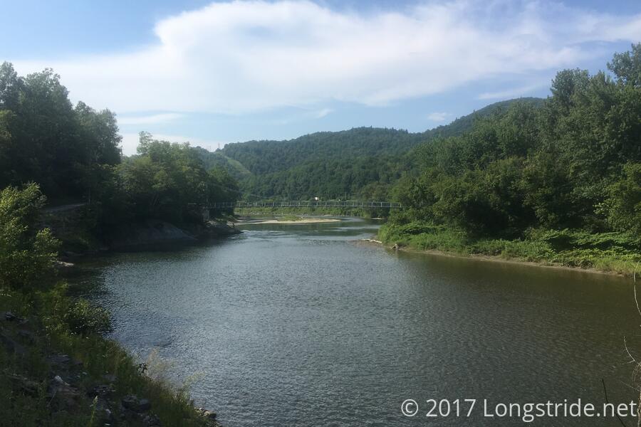
The final segment of trail today was from Duckbury Rd to US 2, utilizing a new trail relocation over the new Winooski River Footbridge, commissioned by the GMC so that hikers wouldn't need to use a ferry to cross the river. A significant part of this relocation is a road walk along Duckbury Road, which was unpleasant, but not terrible, and I made great time. Then the trail turned off the road to go through live a chicken and cow farm, which really sucked, due to the high grass, and the herd of cows standing in the trail. Then, the trail turned back onto the road for one final section, leading to the new footbridge.
Naturally, when there's a footbridge that goes over a river, people will jump off of it, even when there are signs warning against it due to hidden dangers in the water. As I approached the bridge, there were two people there in the process of jumping off, and one had even strung up a hammock underneath the bridge!
Finally, just before 4, I reached the parking area at US 2; my hike for the day was over. A call to the Old Stagecoach Inn, where I am staying tonight, yielded John, the owner, who drove the 15 minutes out of town to pick me up.
After a much needed shower (it had been a week since my last shower, at Inn at Long Trail; not the longest time I'd gone without, but fairly close), I walked into town to complete chores: laundry, food resupply, and a stop at the drug store to pick up a new charging cable for my phone.
I had dinner at The Reservoir, which has great burgers and a fairly large (and mostly Vermont) tap selection, and got two flights of samplers of local beer I'd never had before. Surprisingly, almost all of the eight beers I sampled were very good; usually I wind up with two good beers and two duds. That waitstaff was pretty nice, and put up with me despise requesting a table near a power outlet — my phone was down to less than a third charged by that point — and breaking three out of the four glasses in my first shot when I attempted to move them and the flight paddle they were on across the table.
Tomorrow: apparently, climbing mountains is now the thing I do on my birthday.


