After being on a westerly track since leaving Big Bear Lake, the trail finally turned north again as it left Hikertown. From the hiker oasis, the trail headed in a straight line due north, through some cattle farms mostly alongside a road for about a mile, before hitting the Los Angeles Aqueduct. The aqueduct, open to the air like a river, flowed east, and the trail followed along a dirt access road that paralleled the aqueduct.
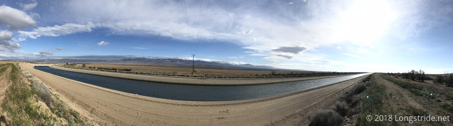
After a mile, the trail turned north again, onto a dirt road that paralleled a pipeline from (or to?) the aqueduct, half-buried in the ground. Heading straight for the Tehachapi Mountains, the trail followed the pipeline for a little over three miles, before the pipeline sank completely into the ground, and turned to the northeast.
Shortly before going underground, a warning on the pipeline advised that it was pressurized, and advised keeping a minimum of 100 feet away. Of course, the far edge of the access road was at most 30 feet from the pipeline, and the trail itself was even closer to the pipe (crossing directly over it, at one point), so it seemed like a useless cover-your-ass warning no one is actually expected to follow.
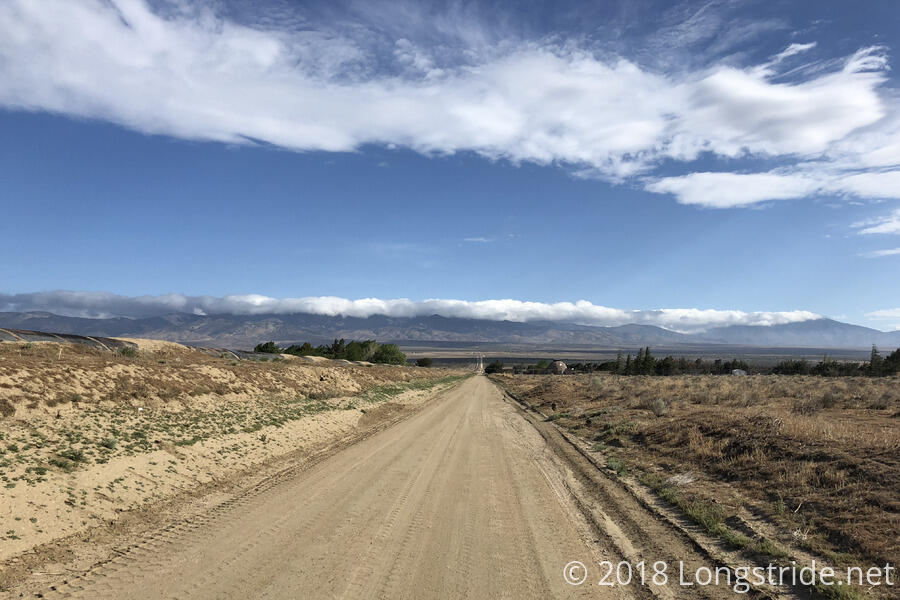
After the pipe went underground, it (and the trail) went generally northeast for another six miles, along an almost completely flat route. Although there were views of the mountains to the north and south, this was an exceedingly boring section of trail on a very hard surface.
I took a short break just after the aqueduct went underground, sitting against a raised concrete access platform to provide a little shade.
This part of the trail was so boring, actually, almost entirely flat and without views, that I resorted to a phone conversation to distract myself. Over the past few weeks, I had kept in contact with Meghan (via text message), who I last saw at Warner Springs, and who had gotten off the trail there due to foot problems. After two weeks off the trail, she got back on at Idyllwild, and has been hiking (slowly) since. Currently holed up at the Best Western at Cajon Pass trying to avoid bad weather, she was bored as well, and we moved the text conversation we had been having since my break to voice. (Which meant I didn’t have to stop every couple of minutes to reply to messages.)
While following the aqueduct, I noticed two airplanes that were circling up ahead. It seemed pretty odd since there weren’t any major airports in the immediate area. Megan and I came to the conclusion that the bad weather near Wrightwood must have also extended to LA, and the planes were in a holding pattern there to keep them away from LAX.
When the trail turned off the aqueduct route, it appeared to do so only because the aqueduct went through some fairly steep and rugged terrain (at least, that’s what it looks like on the topographical maps). The trail instead followed more dirt roads for another four miles, before rejoining the aqueduct. From Hikertown to when the trail turned off the aqueduct, it was the longest straight lines the trail has followed so far.
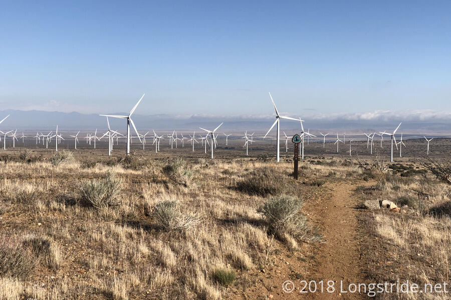
After seven miles, I stopped for a second break, just as windmills from a wind farm came into view. The airplanes were still circling, and a third one had joined them. At this point, it was pretty clear that they were doing some sort of group maneuvers; three planes, with the same overall design, but three different sizes, and all with the same livery, were performing turns and flying in very close proximity. I suspected, somewhere, there was a film crew.
I took a third break a few miles later at Cottonwood Creek. The creek itself was dry, and a water spigot connected to the aqueduct barely dripped water. Fortunately, though, a water barrel (filled courtesy of Hikertown) had a significant amount of water. I collected water from the barrel, went over to a very rudimentary lean-to (a single sheet of corrugated metal held up at an angle by some posts) and wide enough for two people, that was providing a nice shade, and cooked my dinner.
Also arriving there just after me were Bob Dog, J Dub, and The Bird. They decided to stay, aiming to get to Tehachapi on Friday; I decided to push on so I’d have a chance of making it into town tomorrow night. Just before I left, J Dub showed pictures of a Great Horned Owl and it’s nest, located under the trail bridge above the creek bed.
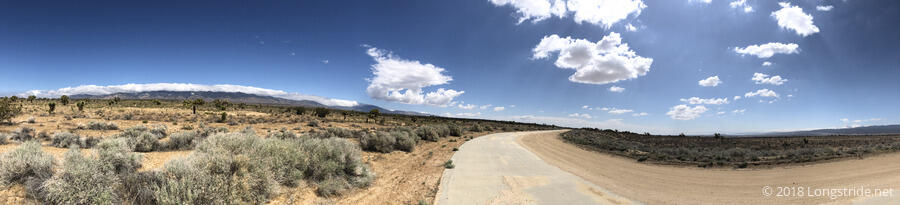
My goal was to make it to Tylerhorse Canyon, 6.5 miles ahead and just beyond the top of the uphill, the next water source with space for several tents. There was also a small campsite about 1.2 miles before that that I could use as a fallback option. From the creek, it was all uphill through the wind farm, and not surprisingly, windy as well.
This is a much larger wind farm than the wind farm I passed through a month ago. The turbines here are larger, and there are way more of them; so big and widely spaced (from necessity), it was easily a several minute walk between each one I passed.
Besides turning north, the trail was surprisingly straight, with only a few very tiny switchbacks on the way out of the wind farm. I suspect we’ll be back in switchback land tomorrow.
A long day — nearly 23 miles when I stopped at the campsite short of Tylerhorse Canyon — I was pretty tired. Tomorrow may be another long day: 26.1 miles to the Highway 58 overpass to Tehachapi. I’ll need to get up fairly early tomorrow to make that distance, because the elevation profile doesn’t look friendly.