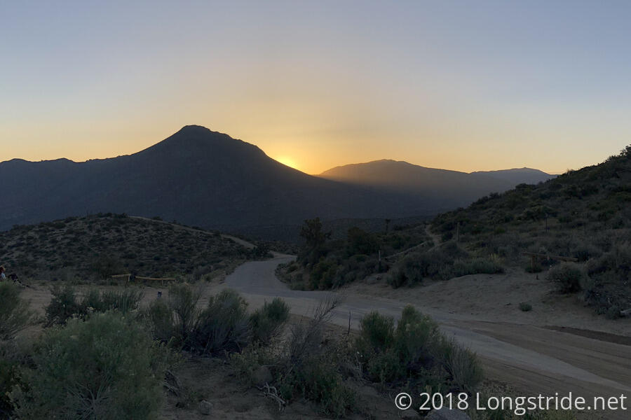
Anticipating a warm day, Bob Dog, J Dub, The Bird, Alias, and I managed to get up before sunrise, and were hiking by 6:10. It was cool and windy when we started, but that wouldn’t last long; once the sun was on us, it would warm up considerably.
The scenery is definitely becoming a bit more diverse than just hills with rocks and desert plants on them. While there was some of that this morning, there were also rolling hills with small, jagged rock outcrops.

Today, the cow pastures actually had cows in them. I had noticed some strange footprints on the trail, and then when I saw cows in the distance, it immediately made sense that the cows might walk on the trail. The cows apparently were closer to the trail earlier, but Alias said they were pretty skittish, and they ran away whenever he got even vaguely close to them on the trail.
After a little more than two hours, I arrived at a small picnic area six miles from Kelso Road, where I started. There was a picnic table, a box of trash (that looked like it might have been trail magic at one point), a map of the trails in the area, and a placard about the desert tortoise, California’s state reptile.
At the picnic area, it was still cool and windy, but once we left and continued on, the wind died down, the temperature increased, and the sun pelted us with heat.
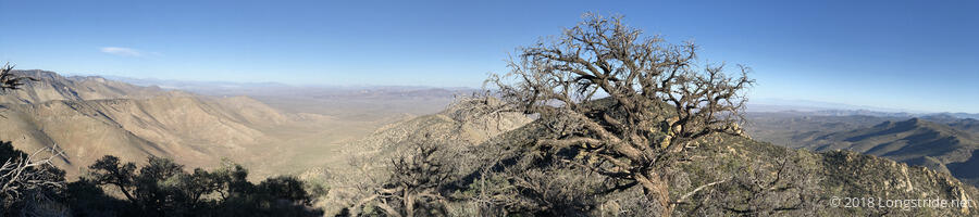
A regular feature of the late morning was a view of the desert valley to the south and east. We seem to be slowly but steadily moving away from it.
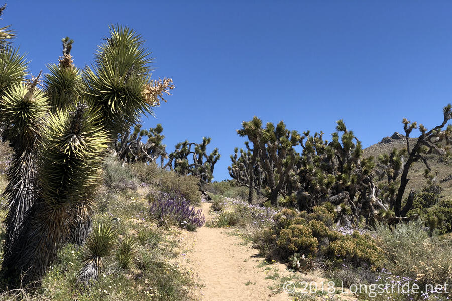
There were also lots of Joshua Trees in the area, and around 11, I took a break under a large group of them to get out of the sun for a bit.
Around 1:30, I made it to my planned destination, Bird Spring Pass, 14.9 miles from where I started. The water cache located here was plentiful, and was placed under a Joshua Tree, so it was relatively cool.
I parked in the shade provided by a pine tree in a campsite vacated by two hikers leaving just as I got there, and proceeded to cook dinner, which took a little extra work, since it started to get a bit windy.
Dylan was also there, and we chatted for a while, until he headed out with Calamity (whom I first met at Wits End).
Not content with the 14.9 miles I’d done so far, and wanting to get to Walker Pass tomorrow at a reasonable time to be able to hitch into town, I decided to move on, preferably to the next campsite near the top of the next hill, a 3.4 mile climb. (I was hoping there would be more than the one campsite the guide indicated; the next campsite after that one is another four miles further.) After saying bye to Bob Dog, J Dub, and The Bird, I continued down the trail.
After the relatively steep climb, which took a little more than an hour and a half, I found that there were easily three or four campsites, and I was the second staying there, so I didn’t have any trouble finding a place to put my tent. From where I put my tent, I have a nice view of both sides of the mountain, so I should be able to get a great sunrise tomorrow.
Thanks to a relatively small number of switchbacks, the trail feels like it’s actually going somewhere, rather than taking a long time to go a short distance. The trail also seems to be a little schizophrenic, as it continues to switch between desert, forest, and combinations of both. I take this as a good sign, and that it will continue as the trail approaches Kennedy Meadows.
Tomorrow: Walker Pass, and then in to Lake Isabella for the night.