With Donohue Pass between us and our resupply in Tuolumne Meadows, Quoi and I woke up at 3:30 am and started hiking an hour later to beat the inevitable slush, slipperiness, and postholing we expected on the north side of Donohue if we started later.
Naturally, hiking in the dark was less than desirable (for me, anyways), but it didn’t take long before the sky started to brighten ahead of sunrise. While it was still dark, we came across an expensive water filter and pump sitting next to a stream. Clearly, someone had forgotten to take it with them, but if it had been sitting out overnight (in the likely below-freezing temperatures), the filter was likely ruined. Not wanting to take something so (relatively) heavy with us, we moved it closer to the trail, hoping that whoever it belonged to was camping nearby and would see it when they left. We also asked the next few people we saw if the filter was theirs, but no one claimed it.
The morning had a number of challenging creek crossings — challenging, that is, if you wanted to keep your feet dry — which we did a mostly passable job at. At one stream crossing (barely a few feet wide), I muttered to myself that a rock I stepped on was a little icy, before easily making it across. Quoi, unfortunately, didn’t hear my mumbling, and seeing that I had crossed without issue, stepped on that same rock and slipped off.
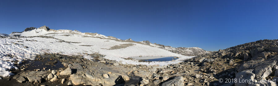
There was somewhat less snow than we were expecting going up to Donohue Pass, though we still had a fair number of places where the trail was obscured by snow and we resorted to hiking along rock islands until we reconnected with the trail.
After a bit less than three hours of uphill hiking, we made it to Donohue Pass, which was mostly under snow cover and didn’t itself present much of a view. The pass, though, marked our entrance to Yosemite National Park. Shortly after we started down, we were greeted by a ranger from Yosemite hiking up to the pass, who checked our permits (the third time so far since entering the High Sierra).
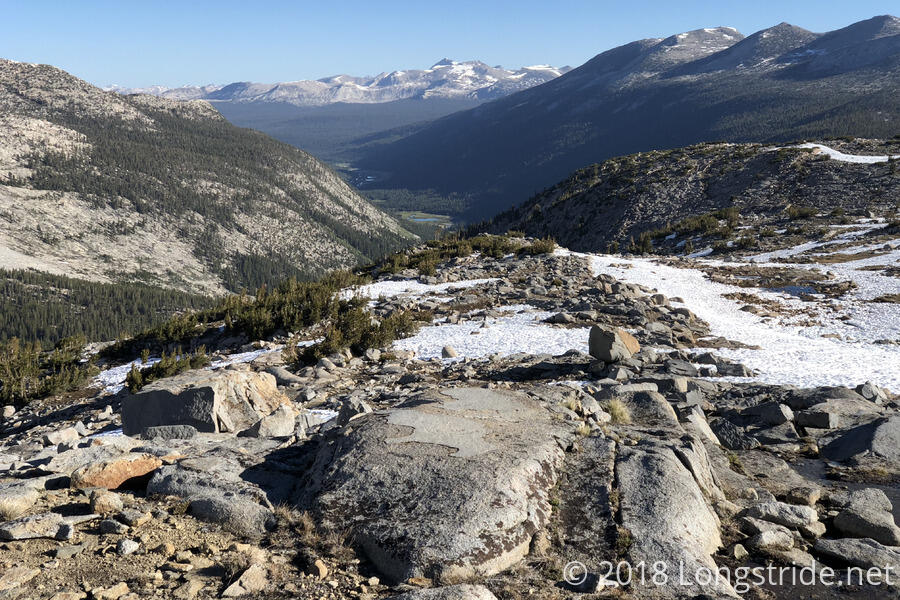
Given the trail was mostly under snow cover there, the ranger pointed us in the direction of a rocky ridge that she had hiked up, and we followed the ridge down, making our own trail and engaging in some light rock scrambling along the way. Bronco caught up with us, and joined us the rest of the morning.
While the pass itself didn’t present much of a view, once we descended a bit, we were able to see the Tuolumne Valley below, with lush green meadows. From the barren, icy rockscape we were hiking through, it seemed almost a paradise.
Making our way down the mountain, we crossed the Lyell Fork (a tributary of the Tuolumne River) near its source at a lake, and encountered three families, with quite a few young children, a couple of days into their hike of the John Muir Trail, which starts in the Yosemite Valley and, after joining with the PCT, mostly follows the PCT south, diverging near Crabtree Meadows and finishing by summiting Mount Whitney. We wished them luck on their journey.
We were finally forced to get our feet wet crossing the Lyell Fork again, a few miles downstream of our first crossing, where it had become much larger. The water was fantastically cold, and I needed to stop on the other shore to dry my feet and warm them up.
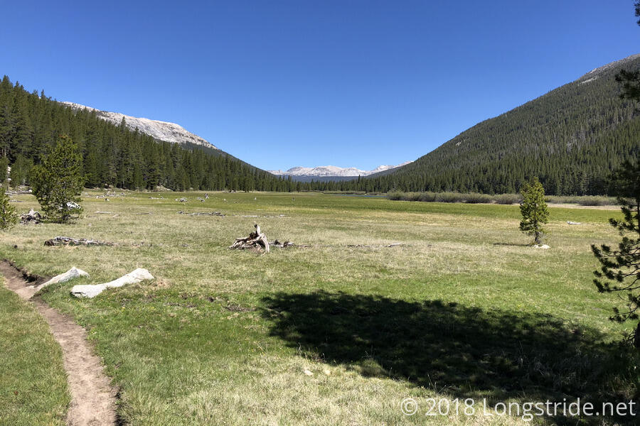
After that crossing, the trail somewhat swiftly descended into forest, before exiting out into a meadow (which I assume is Tuolumne Meadows, though lack of signs or detail on our maps make that a guess for right now). The trail then followed alongside the edge of the meadow for miles, sometimes ducking into the forest for a while. With just a slight downhill slope, and fairly easy (if somewhat muddy) trail, we picked up speed and charged forward.
Our destination for the day, and first real spot of civilization since we left Mammoth Lakes, was the Post Office, general store, and small restaurant at Tuolumne Meadows, down a road about a third of a mile off-trail.
As I hiked down the meadow and got closer to the road, I started to see more and more day hikers and others out on short hiking trips. I met a couple taking a break that was just starting an eight-day hike; they were kind enough to give me some packaged cheese, which was very tasty. (Since Quoi was behind, to be funny, I asked them to tell her that she needed to hurry up or I’d eat all the cheeseburgers at the restaurant.) Later, once the trail began to parallel a road (about 30 feet away), a car on its way to exit Yosemite pulled up and stopped. A guy ran out and over to me, and gave me some partially-used cheese that was wrapped up in a bread wrapper. (I thought that was a little weird, but I wasn’t going to say no to more cheese.)
The John Muir Trail made its final departure from the PCT, veering off to the south towards Yosemite Valley.
On the way to the post office/store/grill, I passed by the Tuolumne Meadows campground. I was kind of hoping to camp there tonight; that’d be a roughly 16 mile day, and it’d mean I’d be able to get breakfast from the grill as well. Unfortunately, the campground was not open yet; its first day of operation this year is on June 14th — two days from now. This meant that when we were done, we’d have to hike at least another four miles: camping is otherwise not permitted within four miles of that location.
Around 2:30, I made it to the (seemingly) temporary building that housed the store, post office, and grill, and the much more sturdy building that contained the restrooms. The grill was a little slow (rather, there was a long line, and only one park employee taking orders), but I ordered an (expensive) double-cheeseburger with bacon and a cup of fruit. (Fruit or potato wedges were part of a combo meal with a soda; the fruit was the more expensive (by itself), but I got it because potato wedges just felt unappetizing at the moment.) I got a bit of magic there as well: the guy who took my order gave me the cup of fruit after I paid, and then later, when my order was ready, there was another cup of fruit on the tray. Then, when I went to find a table to sit down at, a family was just leaving and gave me their extra potato wedges too!
It was about that time that Quoi arrived. Bronco arrived a little later, as well as Suzie, Ranger No-Pants, and quite a few other thru-hikers, and we wound up sitting around for three hours talking (and repacking our food from our food boxes we picked up at the post office). Suzie also picked up a box for a hiker who had to abandon the trail, and after several of us picked out some items that we wanted, Quoi repackaged it, with some extra food (including the mystery cheese I was given earlier) and got the post office to hold it for Flowers and Dylan (whom we knew would likely need more food).
We left around 5:30, returning to the trail and continuing on, hiking as fast as possible to avoid the mosquitoes that were starting to gather around us. We took a quick detour to look at Soda Springs, a naturally carbonated spring (which, according to the plaque, is naturally clean, but may be contaminated by animal or human waste, sort of like all of our other water sources on the trail).
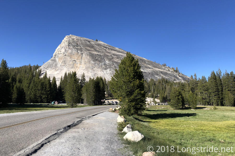
Some of the rock formations Yosemite is known for were visible as we returned it the wilderness, and we could see rock climbers still on some of them. Unfortunately, the trail doesn’t go anywhere near the very distinctive locations, like Half Dome, that are located in Yosemite Valley. (The JMT does go near Half Dome, though.)
We reached one last creek crossing for the day, too wide and deep to rock-hop, but a large tree log provided an opportunity for a dry crossing. But, I was starting to get a little tired, my pack felt unbalanced, and the log was a little too high off the water for comfort. So even though I got up on the log and started to inch my way across first, I found I couldn’t cross, and had to get back off the log. It took Quoi and Bronco to cross (and the very strong desire to not have wet feet this close to camp) before I could manage to make it across.
The mosquitoes leaving Tuolumne Meadows were bad, but they continued to get worse as we traveled down the trail, and we stopped and set up camp at the very first opportunity, 4.1 miles from the trail to the store and just a tenth of a mile outside the (unmarked) exclusion zone, a short distance away from the Tuolumne River. It wasn’t a very good campsite, but it worked. Quoi disappeared into her tent as quickly as she could to avoid the mosquitoes, which were terrible at the campsite: at one point while I was setting up my tent, six mosquitoes landed on my hand. In that regard, we were mostly lucky: Quoi only let one mosquito into her tent; I let two in, and that was because I had to get out of my tent to secure one of my tent stakes. The campsite was pretty rocky, and I couldn’t get all of my stakes sufficiently deep into the ground; that stake, I had to secure with a rock to keep that corner of the tent down.