A short day today set CareFree and I on our way to Stehekin, our final trail town. The end of the trail is almost in sight!
Exhausted after yesterday, we slept in, and didn’t get up until after 8. We made our way back to the cafe downstairs, and ate our fill from the breakfast buffet, which, though small, had everything you’d want: eggs, pancakes, French toast, three kinds of meat, biscuits, oatmeal, and a fruit plate, which had excellent strawberries and watermelon.
We returned to our room to repack our packs with the contents of our resupply boxes. I found that after letting my phone sit overnight, it dried out enough that it was able to be charged, if it and the power cable was arranged just so. I was quite relieved that my phone appeared to charge now, and if the only problem now was the cable was being finicky, that would also be easy to remedy.
Finished with our room, we moved our packs to the guest lounge downstairs. I sought out Henry (the owner of Cascadia Inn) and asked him what the best way to get back to the trail was; he said that most people go to the deli at the edge of town (across from the gas station, where I can get a new power cable for my phone), but that there was a trail angel in the restaurant who sometimes gives rides, and he’d inquire on my behalf.
Back in the lounge, CareFree and I discussed our plan for Stehekin. We originally planned for six days, and with our resupply and the dinner we packed but didn’t eat for Skykomish, now we had food for seven. With about 108 miles (plus a fire detour) to Stehekin, the question before us was, should we stick with our original plan to get there on Friday, or take an extra day and get there on Saturday. Since the post office in Stehekin is open on Saturday, delaying a day was a feasible option, but either way, we needed to make a decision now and stick to it if we wanted to reserve a room at the inn.
One of the complicating factors is the Bannock Lakes fire detour. 20 miles of the PCT is closed due to a file, with a 28 mile detour available. Aside from the detour route and a hard-to-use map with very thick lines making reading the elevation profile around the detour hard, the PCTA offered no other information on this detour, apart from the existence of a forest service campground about 11 miles into the detour, and information on Holden Village, a historic mining town turned mountain retreat. Fortunately, my trail guide had been updated with some hiker comments on water and campsites, so while it wasn’t ideal, we at least had some idea of what to expect.
After going back and forth on which would be better, we decided to stick with a Friday arrival to Stehekin: if something happened and we got delayed a day, we might lose the (quite expensive) cost of the room, but we’d still be able to get our (more important) resupply boxes. We booked a reservation for Friday night. It would be a challenging hike, but we’d find a way to make it work. After Henry returned to let us know that the trail angel wasn’t heading back to the trail, we thanked him for his hospitality and headed out of town, our packs quite heavy with food.
With the last bit of internet access we’d likely have until reaching Stehekin, CareFree checked her email, hoping to get a response back for her Canada entry application. It had only been a few days since she sent her new application in, so I wasn’t surprised there wasn’t a response yet. Hopefully, it’ll be ready when we get to Stehekin.
With leaving town, I’m also leaving behind my bounce box, which is currently at the Skykomish post office. Closed on Saturdays, there was no way to get it (and even if there was, no way to send it on to someplace more useful). I’ll have to have it bounced home when I’m done. For now, though, it’s not really important, since the only thing I wanted from it was my gloves, and CareFree has a second pair for some reason that I can borrow.
Outside, we were greeted with a warm and sunny day, a wonderful improvement on the recent dreary, rainy days. We made a quick stop at the gas station to pick up a few things (including a new phone cable for me, which worked like a charm). On Henry’s advice, we went across the street to the deli to borrow their "PCT Hiker to Stevens Pass" sign, and tried to get a ride. No one stopped for us, but a woman at the gas station waved us over. We returned the sign, and returned to the gas station.
Cecilia, whose van was in a slight state of disarray as she was in the process of moving, was happy to give us — and two other hikers — a ride to the trailhead. On our way out, we saw Jelly, Justin, and Fireman, who had also gotten into Skykomish last night.
About a half hour later, we were back at the parking lot at Stevens Pass, and after properly crossing the road via the pedestrian bridge, resumed our trek northwards.
Snow in the Sierra aside, the section between Snoqualmie and Stevens Passes was one of the toughest and most rugged on the trail, and I think, the steepest in Washington. The rain the last two days didn't help matters, either. Hopefully, the next two sections (Stevens Pass to Stehekin, and Stehekin to the border) will be easier.
At the northbound trailhead at the end of the parking lot on the north side of the road, were two bags full of sodas and beer, hanging from a tree, with a note asking hikers to pack the cans out. That certainly makes sense for southbounders, but we weren’t going to go back to the ski lodge to throw trash away, nor were we going to carry empty cans over 100 miles to Stehekin. We continued on without taking any soda.
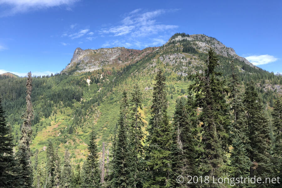
The sun continued to shine brightly, and it was nice and warm out, though a few clouds dotted the sky, adding some variety. From the trailhead, we followed along the mountainside, generally paralleling US 2 for a couple of miles before turning west, heading up the side of the valley between the mountain we were hiking along and Lichtenberg Mountain.
After four miles, we stopped for a break alongside the trail near a campsite in a clearing. Since I had more snacks than I intended (between not eating all of them on the way into Stevens Pass, and somehow having way more in my resupply box that I need to get to Stehekin), I had two breaks worth of snacks. When I have more than enough food, carrying the extra weight around on my back doesn’t help when I can just eat it instead.
As we were getting ready to leave, three locals returning to the trailhead from an overnight hike to Lake Valhalla stopped and chatted with us for a bit. They gave us some of their extra fruit — they gave each of us an orange, which we ate right then, and they also gave us a nectarine, which we saved for dinner. They were also kind enough to take our trash (which, given we just left town, was pretty minimal).
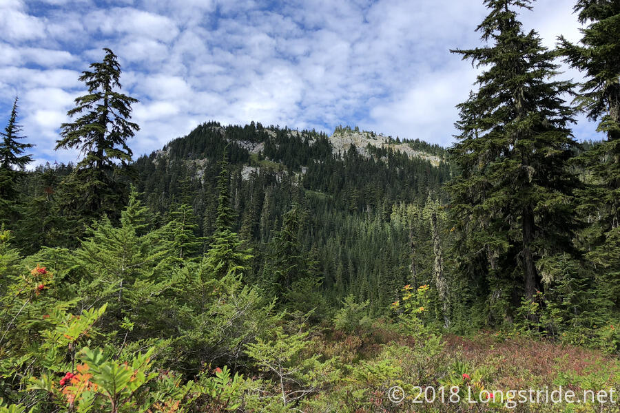
As we continued on, the trail brought us past Lake Valhalla, located on a shoulder of Lichtenberg Mountain. From Germany, CareFree was amused by the name of the mountain; -berg is a suffix meaning “mountain”, so the mountain was literally named “Lichten mountan Mountain”. It was also clear that whoever was naming the geography here was picking names randomly, with a German mountain, and a Norse lake.
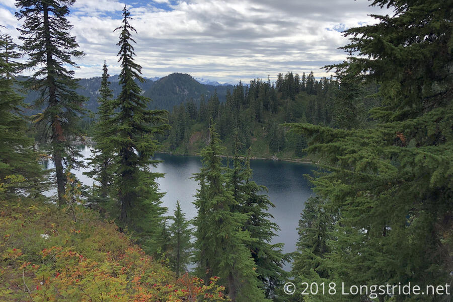
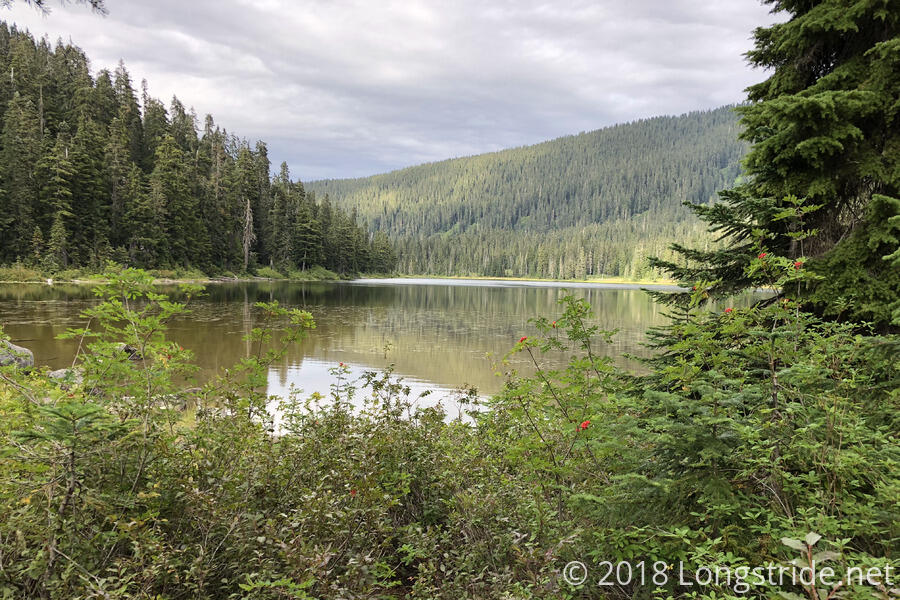
While snaking around the mountains for another couple of hours, clouds slowly began to roll in. The lack of naming coordination continued as we arrived at Lake Janus, and we stopped there for our second break.
Although we were initially only expecting to stop for dinner at Lake Janus, and then continue on, the clouds continued to blow in, covering the sky, and we weren’t looking forward to the steep uphill that was up next. So, we decided to stop here, and take the next uphill when we’re fresh tomorrow. Since we only made it a little less than ten miles today, we decided to go to sleep early and get up early tomorrow to make up for the short day.
While we were eating dinner, Caveman caught up with us. Having previously hiked this section, he offered some advice. In particular, not to camp in one of the several low areas, as they can be prone to flooding, and to be careful with camping on the ridges, since they can be prone to bad weather, and some don’t allow camping at all. The good thing, though, is that apparently, the trail is frequently on the east side of the ridge, which has drier weather. Since the weather forecast as we were leaving town didn’t look stellar, I’ll take whatever helpful terrain I can get.