Another day on the Motatapu Track took me over two saddles to Roses Hut.
I managed an early start this morning, just about a minute before sunrise. It was warmer than I expected, though still cool.
After a couple of short downhills to cross small creeks, the trail began its first of two climbs today, charging very steeply straight up a ridge. The first part of this was one of the steepest climbs I’ve ever done, at over 40% grade (!! — that’s over 2200 ft/mile). Fortunately, it wasn’t that steep for more than a couple hundred meters, but the rest of the climb was still rather steep, eventually gaining 430 meters over 2.3 km.
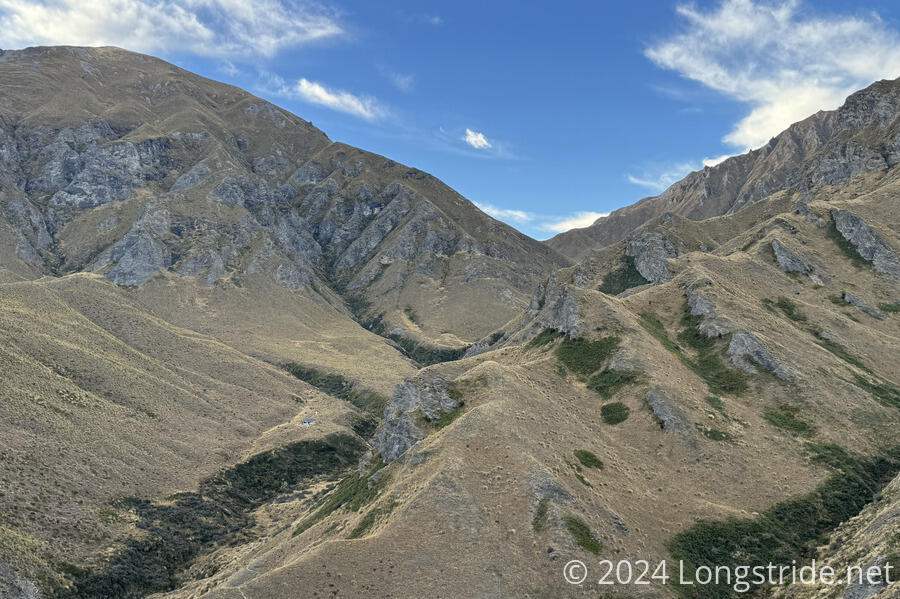
For the most part, the trail tread was fairly good for the climb, surprisingly so given its steepness. The trail climbed up a ridge for a while, then started sidling along a steep slope the rest of the way to a saddle. Near the top, some overgrown tussock hid the trail, sending me off an alternate route below the actual trail. Once or twice, the trail was fairly narrow and eroding, coupled with bushes growing above the track, making it a little challenging to safely progress.
The views up to the saddle were mainly of the nearby mountains and ridges, mostly covered with tussock, but sometimes with trees or bush in the drainages.
The descent was even steeper than the climb, 440 meters over 2.1 km. That led to a small creek in a forest, with a couple of cut logs for benches. I stopped there for a break. As I was starting to pack up to continue, a nobo passed by.
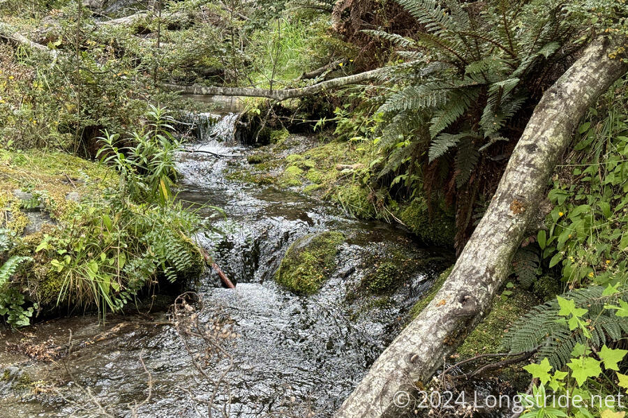
After crossing the creek, the trail continued uphill through the forest. There were a few annoying fallen trees to navigate, but the forest was over in less than ten minutes, and I was again climbing through an open landscape of tussock.
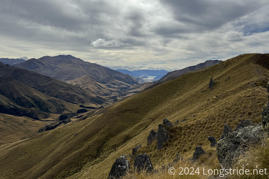
As I continued climbing towards another unnamed saddle, I had views back to Lake Wānaka.
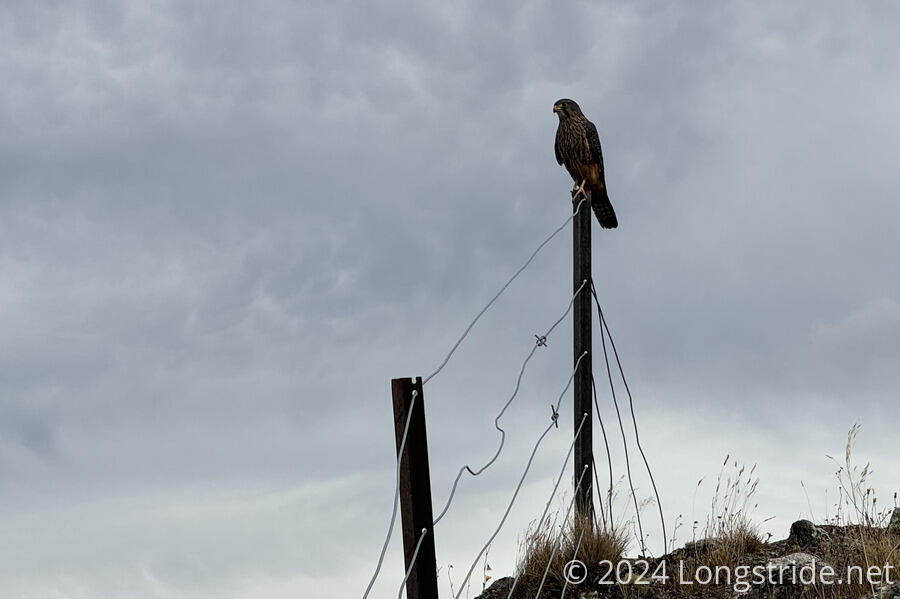
Near the top, a falcon sat on a fencepost next to the trail. I was surprised it let me get as close as I did before it flew off.
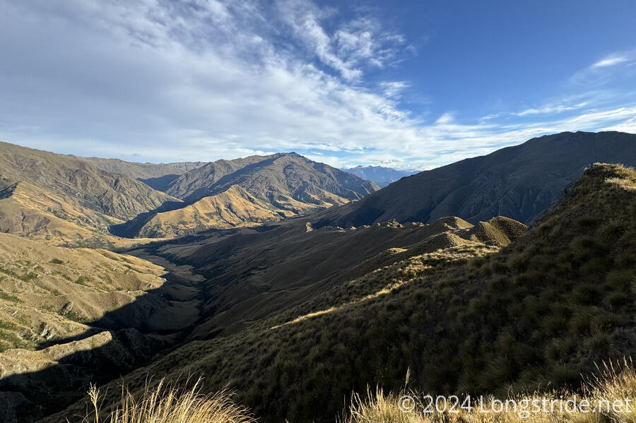
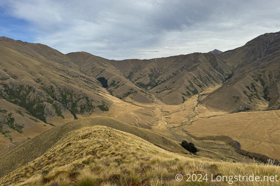
The climb to the day’s second saddle was easier. It was a little less steep, but I also stopped for short breaks more frequently to look around at the landscape. Crossing over the second saddle is when the views considerably improved.
For much of the climb, I could see a road following the Motatapu River below, on my right. Once over the saddle, I could see a large valley ahead, mostly covered in brownish grasses, but a few tinges of green still remained far up the valley. Now that it’s almost autumn (in the southern hemisphere), there isn’t that much, besides the trees and shrubs, that is still green. But I can imagine that in springtime or early summer, this would have been a lush green valley.
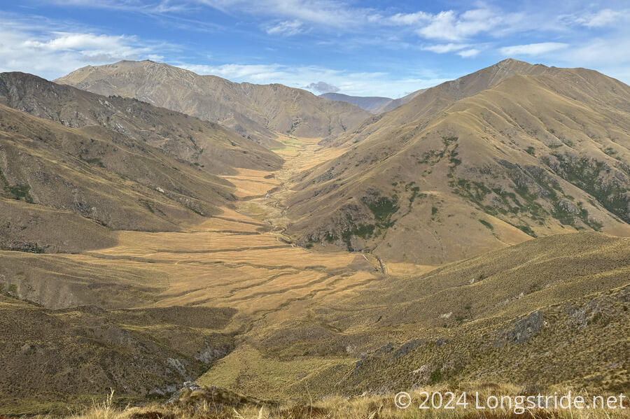
In the distance, I could also see Roses Hut, sitting in the gap between two ridges, one of which I’ll be climbing tomorrow.
From the saddle, the trail followed a ridge line for a little while, eventually dropping off the ridge to descend the hill and reach the Motatapu River. I was able to cross the river by hopping across four very large rocks, which seemed to have been planted specifically to offer a dry crossing, no matter how high the river was flowing.
I followed a farm road briefly, then turned off on a trail through a field of golden grass leading to Roses Hut.
It wasn’t quite 2 pm when I arrived at the hut, but going forward would involve a third steep climb comparable to the two I’d already done, and I could tell my legs would not be happy with me if I pushed on. (Plus, if I did, I’d likely get to the next camping opportunity at very close to sunset.) I got a weather forecast, and the chance of rain that was forecast for tomorrow seemed to have disappeared, so I didn’t feel like I needed to be in a rush. There’s going to be a walk through a river tomorrow, but if it’s not going to rain, then it should be fine.
The trail notes and DOC trail descriptions suggested this was a harder stretch than it was. It was steep, of course, and quite tiring, but I got the impression that the trail was sketchier than it actually was. If there had been more daylight, I probably would have been able to do this section yesterday as well. But now, with the available daylight, I’d probably have gotten here close to sunset.
After two short-kilometer days, though, the next two days, to Arrowtown, and then Queenstown, will be much longer. As the season continues to change, the amount of daylight is only going to decrease, and it’s only going to get colder.