One last day in the Motatapu region took me through the historic Macetown settlement and onwards to Arrowtown.
I got up fairly early this morning, to cool weather and a bit of fog outside. The fog lifted quickly, but the clouds over the ridge had an impressive red and purple tint to them before sunrise.
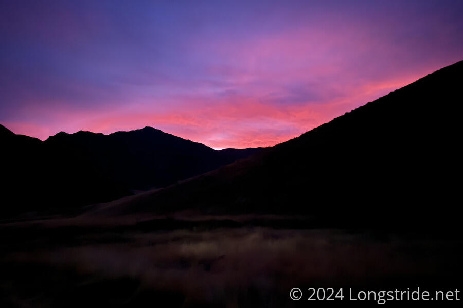
With a long (over 28 km) day today, I wanted to start hiking as early as I could, given I still had two steep climbs to complete before reaching Arrowtown. So, I actually managed to start hiking half an hour before sunrise. When I left, it was still dark enough that I needed my headlamp, but that need quickly diminished as the sun drew closer to the horizon.
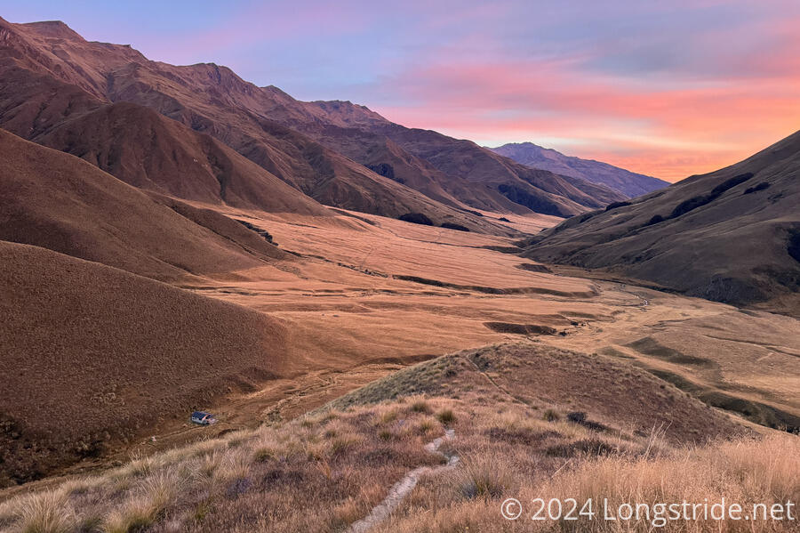
Even before sunrise, it started to get warm much faster than I was expecting, but the cool temperature did make it easier to quickly climb up the ridge to Roses Saddle. The view back to the hut and the Motatapu Valley was generally quite clear, and once I got up to the saddle, Lake Wānaka just barely peeked out from the mountains in the distance.
Of the several long uphills since I left Wānaka, this was the easiest and most straightforward.
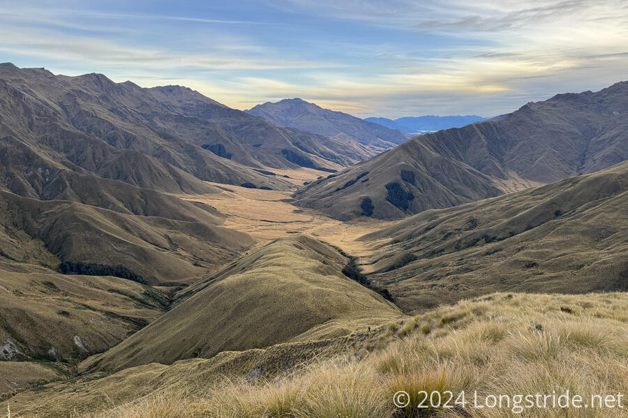
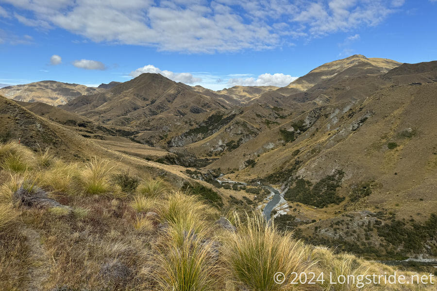
On the south side of the saddle, the trail descended, initially steeply, to the Arrow River.
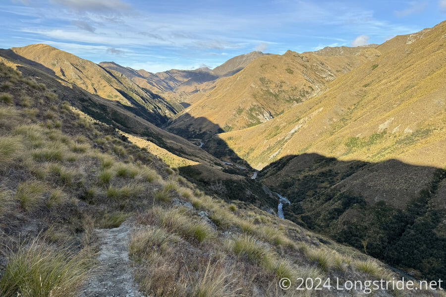
Once I reached the river level, I had a decision to make. The trail nominally goes through the river, like the Timaru River. Similarly, there is also a high-water route that takes a steep, rugged path through the side of the valley above the river.
I decided to stop for an early break to decide what to do. I didn’t really want to take the high route, since the trail notes said that travel down the river was “substantially faster”. But, remembering my experience in the Timaru, I didn’t really want to walk down another river.
I decided to go with the river, because it was supposed to be easier. I didn’t make it very far down the river, though. While the water was less deep than the Timaru, the Arrow River was cold. I only made it a few minutes down the river before deciding I had to turn back and take the high route. My feet were way too cold, and if the trail was going to stay in the river, this would not work for me. Yesterday, a nobo told me that it wasn’t entirely in the river, that there were trails on the banks. But where I was, it looked like at least another few more minutes of being in the river before there’d be any chance of there being a trail, and my feet weren’t okay with that.
The high-water trail was rather terrible. On balance, It wasn’t too steep, but it had a lot of sections that were very overgrown, where you had to push through trees with sharp pokey leaves, sometimes coinciding with badly eroded trail or short but steep climbs.
On the plus side, my feet mostly dried out and I had good views down to the river, but it was hard, slow work at times to make progress.
As I approached Macetown, an abandoned gold mining settlement, the trail seemed to follow an old road bed, which at least a little bit made up for the slowness of forcing my way through the brush.
Naturally, I had to cross the Arrow River to get to the dirt road through the “town”. I stopped for a break at one of only two semi-restored buildings remaining, the bakehouse.
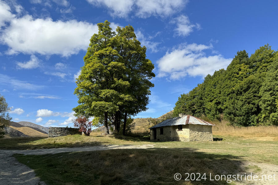
Even though I was able to sit under the shade of a tree, this was a bad choice for a break. The sandflies, which have not really been a problem for a while, were pretty awful.
From the bakehouse, I continued to follow the road away from town, crossing the river several more times, before the trail veered off to the Big Hill Track, which began one final steep uphill for this section of trail. Apparently, according to the trail notes, this was the original main road between Arrowtown and Macetown, though it was generally steep enough that I can’t imagine it would ever have gotten much traffic from “normal” people.
On the way up to Big Hill Saddle, I passed a personal milestone, 17,000 km on long-distance trails.
At the saddle, I took another break, and booked a tent site at the Arrowtown Holiday Park (since there were no rooms available anywhere in town), and a bunk at the Adventure Hostel in Queenstown for tomorrow night.
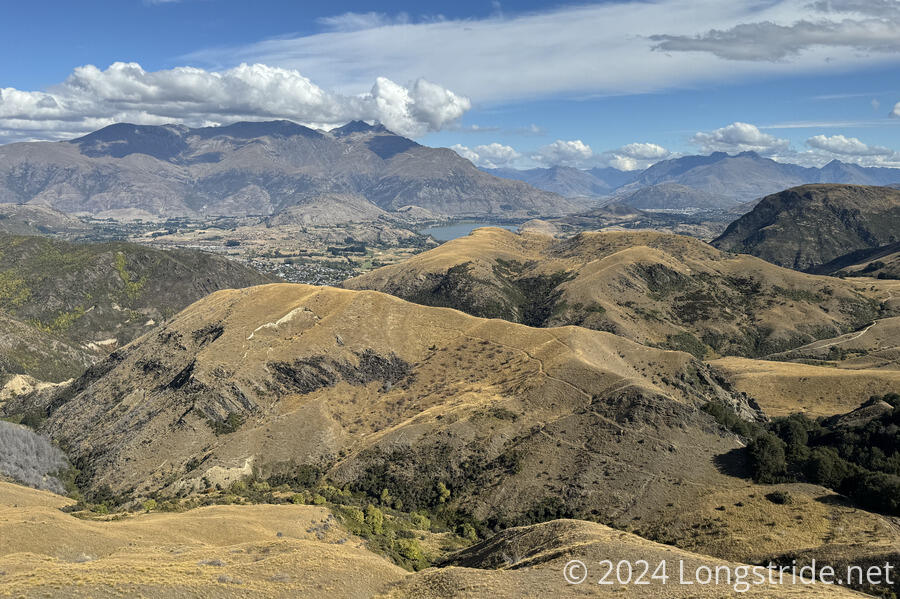
In contrast with the occasionally overgrown or boggy trail up to the saddle, the trail down towards town was quite nice, and I made excellent time. A few day-hikers passed me heading uphill to the saddle.
Once around a few bends on the mountain, I had a good view towards Arrowtown.
After being mostly exposed all day, the trail dipped into a forest for about twenty minutes, which was a nice change of pace. One last stretch of exposed trail separated the forest from another forest, through which I completed the descent to town.
As I neared town, it was clear there’d been a lot of tree work near the trail, and a few signs indicated why: they were in the the process of killing all of the exotic pines and planting beech and other native trees, to restore the forests to what they ought to be.
Now in town, I stopped at a restaurant just off-trail for pizza and beer, then made my way to the holiday park.
The holiday park seemed very nearly full; almost every site had an RV or car camper of some form on it, with just a handful of tents. My tentsite was nearly as far away from the restrooms as you could get there.
It’s going to be cool again overnight, which means I’ll probably have a wet tent tomorrow. But, I should have a reasonably easy day to Queenstown.
At the moment I’m not planning on zeroing in Queenstown, since it’s only been a few days since Wānaka, but the weather forecast for the next few days is looking iffy, and I’ll need to do a resupply and coordinate getting to the start of the next section of the TA: the trail ends at Queenstown and starts again on the other side of Lake Wakatipu, a forced discontinuity because there is no trail to get there, and the road is too dangerous to walk. This, however, will be the last discontinuity on the trail, and hitching to towns a couple of times for resupply aside, the trail after Queenstown will be pretty much a straight shot towards Bluff.