After several days of steep climbs, today was one of the flattest stretches of trail in a while, covering the distance between Arrowtown and Queenstown.
It was cool and humid this morning, which was not great for starting early. With over 28 km to Queenstown, this would still take a while, even with good track along the way. I finally left my tent site at quarter to 9, and headed back to the trail. On the way, I passed a bakery, and got an apple strudel, because why not?
Rather than following the TA immediately, I took a little detour, climbing up Feehly Hill. Besides summiting a (small) mountain, this would give me a bit of a warmup, since the trail would otherwise be mostly flat today. It was a short, but steep climb. At the top, I got great views of Arrowtown, and the surrounding basin. I was able to see most of where I’d be going through the early afternoon.
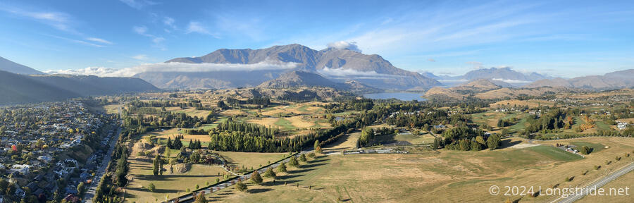
Going up and over the hill brought me back to the TA, which continued through the Millbrook Resort. Part of the trail seemed as though it was on the cart path for the resort’s golf course.
From here, and for most of the rest of the day, the trail was on a cycle path, largely part of the Queenstown Cycle Trail, a network of cycle paths in the area connecting to Queenstown.
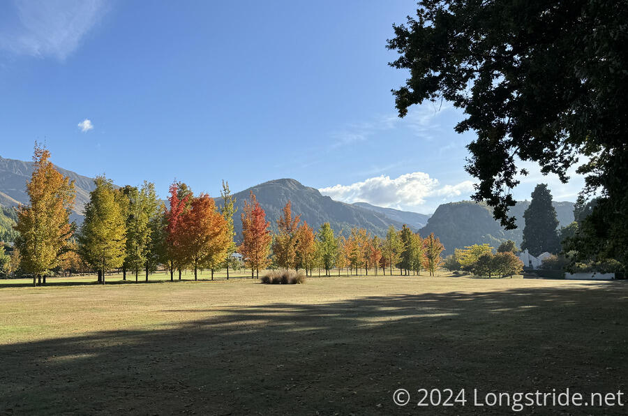
As I’ve been heading further south, and the calendar has marched towards fall, the trees have slowly started to take on fall colors. This was on display in the resort, with a line of trees in a rainbow of colors.
After leaving the resort, the trail lead to the northern shore of Lake Hayes, and I stopped for a break at a picnic table for a snack, and to decide how long the next section of trail would take. It should be doable with a four day resupply, but the weather forecast is looking a bit rainy. I’d need to decide later whether to rush out of Queenstown tomorrow, or take a day to resupply, and the weather will be a factor in that.
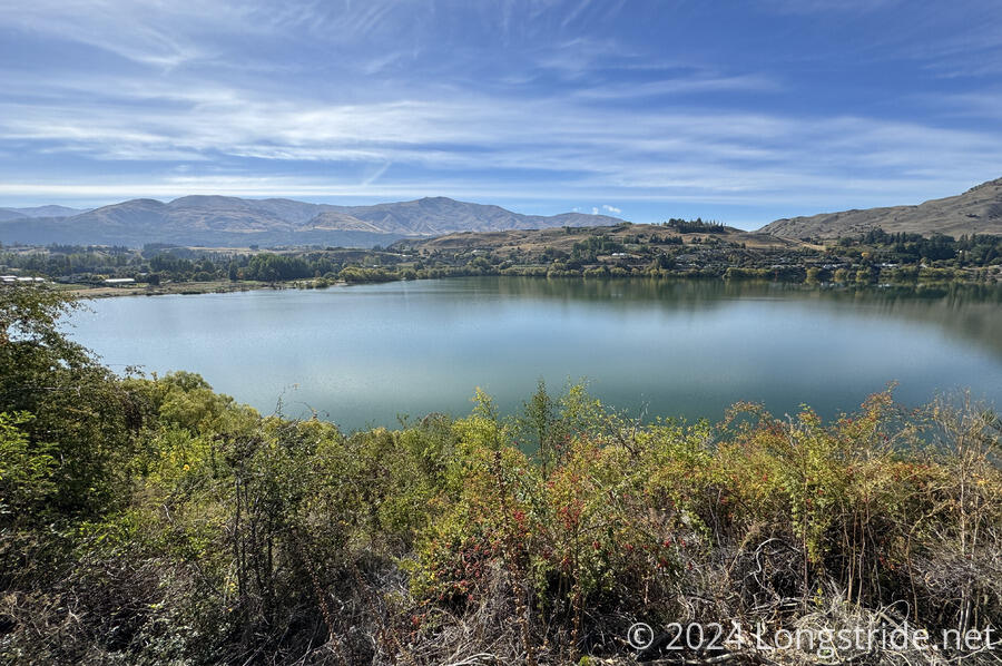
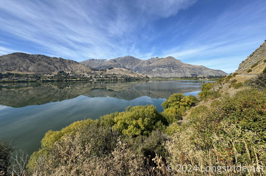
The trail/cycle path continued along the western shore of Lake Hayes. Signs described some of the region’s geological history. Lake Hayes used to be connected to Lake Wakatipu, during the last ice age when water levels were much higher. Since then, the lake has shrunk, and sediments from the Shotover River formed a delta that eventually disconnected Lake Hayes.
After departing the south side of Lake Hayes, the trail zig-zagged its way through the Hayes Estate, a suburban development. A large airplane broke the silence, soaring in front of a steep mountain range (and over the Kawarau River, though I couldn’t see that yet) on approach to the Queenstown airport.
While going through the community, I passed 45° S latitude for the first time, making me closer to the South Pole than the equator.
After leaving the Hayes Estate, the trail began following the Kawarau River upstream, towards its confluence with the Shotover River.
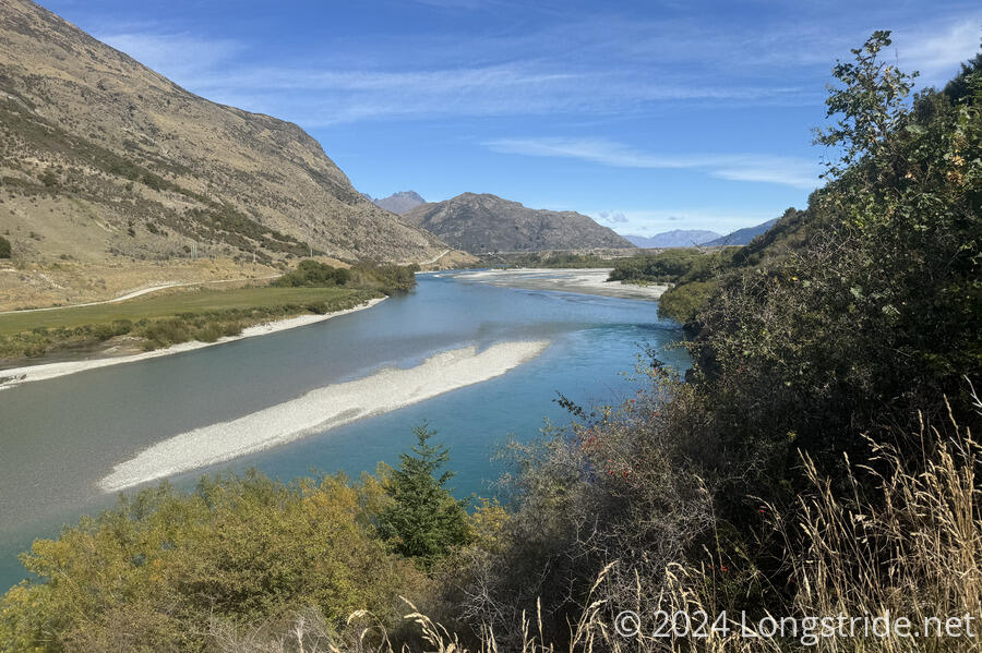
Approaching the confluence, the trail turned to follow the Shotover upstream, towards the Old Shotover Bridge, a pedestrian and cyclist bridge over the river that is a restoration of the second bridge over the river. (The current vehicle bridge, which I passed under, is the third bridge over the river.)
After crossing the river on the bridge, I stopped for a break at a picnic table near a trailhead, in the shade. The trail from there briefly followed the river downstream, before turning off to head towards Frankton, a small town just outside of Queenstown.
There had clearly been a lot of recent development along the trail’s corridor, and I went through an area with many restaurants and stores. I passed a New World and a Countdown, and could have easily done my resupply here, but I was feeling lazy and didn’t want to get food here to carry 9 km to Queenstown, when I could just resupply in Queenstown. That probably wound up being a bad idea, but I was already a bit tired and just wanted to get to my hostel sooner, rather than later.
I did though, stop for a few minutes at the Spark store that was right next to the trail. I’d gotten a voicemail a week and a half ago, but the system wasn’t letting me access it. Turned out, my prepaid plan didn’t come with voicemail; that was a $1 add-on, which the clerk added to my account for free. (Presumably they realized actually collecting $1 wasn’t going to be worth it. In any case, I appreciated it.)
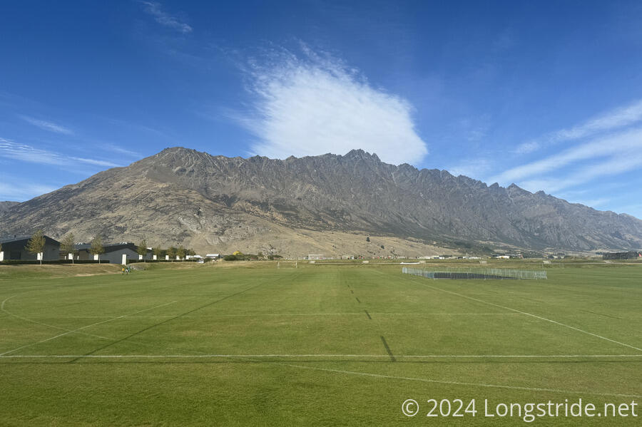
On the way out of Frankton, the trail passed by sports fields adjacent to the airport. Behind the airport was The Remarkables, a range of mountains named either because they’re one of two ranges in the world that are predominantly north-south, or because they’re remarkable in appearance. Whichever way, it’s a great backdrop for both the sports fields and the airport.
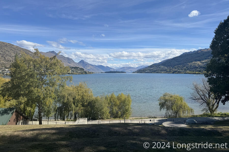
Now on the west side of Frankton, the trail began to follow along go the Frankton Arm of Lake Wakatipu. Initially going through a park, the trail then began following along the hillside above the lake and below the road between Frankton and Queenstown.
This stretch of the cycle path was usually shaded, which was nice. Not so nice was the sewage pipeline that ran next to the trail. It occasionally wafted its malodorous contents in my direction, which is probably why it also seemed to be under repair. Between the trail and the road were a very long string of houses (or vacation homes), nearly all of which had private property signs on the staircases leading between them and the cycle path.
Ahead, dark clouds formed over the mountains beyond the lake, and it felt like I might be in a race to get to town before it rained.
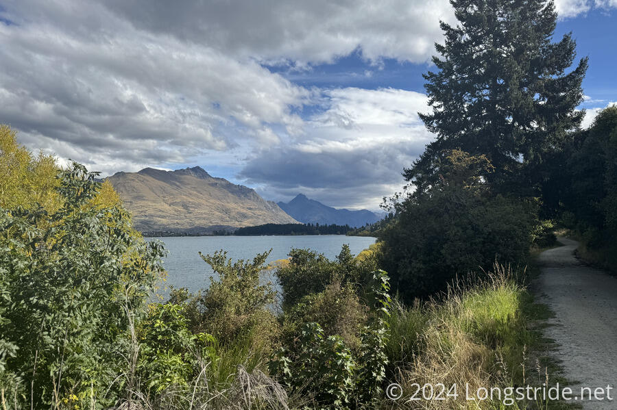
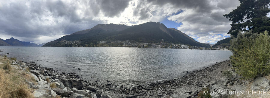
The trail eventually passed beyond the mouth of the Frankton Arm, winding around a small peninsula and arriving at Queenstown.
Once in town, I quickly arrived at my hostel and checked in. Exhausted from the long day (and sun exposure for most of it), I got a shower. Afterwards, still too tired to want to deal with resupply tonight (not that I could, since by now, the nearby grocery store had closed for the day), I decided to zero tomorrow.
As I mentioned yesterday, the trail has a hazard bypass between Queenstown and the Greenstone Station Trailhead, thanks to there being no trail and an unsafe road. So, I called a bus service to arrange for a bus on Monday to the trailhead. After arranging it, they called me back to say that they’re not running buses on Monday, on account of the public holiday. (It’s Otago Day, the anniversary of the establishment of the province of Otago.)
Not wanting to deal with trying to hitch to the trailhead, I booked a stay in another hostel for two more days (Adventure Hostel was full tomorrow and the day after), and booked the bus for Tuesday morning.
There were quite a few options to choose from for dinner tonight. I went to the first bar I passed that had a cheeseburger on the menu. It was fine, except once I’d ordered and sat down, loud, bass-thumping music started. I ignored the music and watched the rugby match that was on the TV. I still have no idea what the rules for rugby are, but compared to (American) football, I must say that it does seem much more fast-paced and entertaining.
Back at the hostel, the rest of the evening passed quietly, and I’m looking forward to my unplanned upcoming double-zero.