After a long walk along Lake Wānaka, the Motatapu Track took me through forest and high-country tussock towards some of the steepest trail Te Araroa has offered so far.
Not terribly efficient this morning, I left the hostel shortly before 9 am. It was still a bit cool out, but once I got moving in the sun, I warmed up quickly enough.
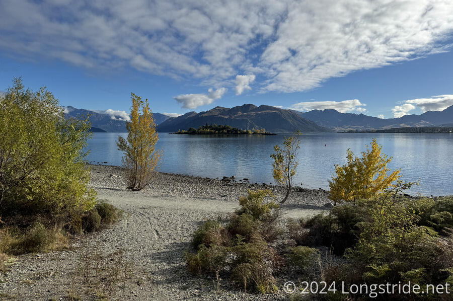
The TA continued along the Glendhu Bay Track, a cycle and walking path along Lake Wānaka, from Wānaka to the Glendhu Bay Holiday Park.
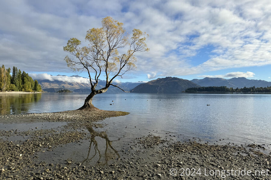
About twenty minutes later, the trail passed by “That Wānaka Tree”, a willow growing just on the edge of the lake on a small pile of dirt and gravel. (It was originally placed as a fence post, but the planted limb wasn’t quite dead, and took root.) This is apparently a very harsh environment; the tree has taken more than 80 years to reach its current size, which is not large. It’s said to be the most famous tree in New Zealand.
A little while later, I realized I forgot to check out of the hostel and return my room key. By this point, I was half an hour away from the hostel, and I wasn’t going to go back to return it. My hope was that a nobo would pass by that I could give the key to. Otherwise, I’d just take it to Queenstown and either give it to the Adventure Hostel there, or mail it back.
On the lake, a motorboat zoomed past, pulling someone on a parasail. They were very high up, and must have had incredible views. Later, I saw them flying over Roys Peak, at least 1300 meters higher than lake level, so they probably had been using the boat to get them up to speed and high enough to catch further updrafts, rather than going on a sightseeing tour around the lake.
I passed a trail maintainer, a lone individual with a shovel. Unfortunately, he’d hurt his ankle and was taking a break. This was only the third instance of trail maintainers I’d seen on the TA, and the first on the South Island. (Previously, CareFree and I passed maintainers in Wenderholm Regional Park, and just outside of Waikanae.
I took a snack break in the shade of some trees on Damper Bay, one of the many bays on Lake Wānaka. Shortly after I continued, another paraglider flew by, with a loud fan attached to propel them forward, occasionally doing aerial acrobatics. It was a bit annoying, since they seemed as though they were following me, and the sound of a lawnmower following me for a good half hour was quite irritating.
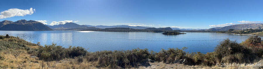
The trail around the lake a little reminded me of being a smaller-scale version of the Tahoe Rim Trail. It was a cycling path, so it was generally not rugged nor very steep, and was a lot closer to the lake than the TRT generally was, but I got that vibe here in a way I didn’t when walking (or cycling) along the other lakes in the last week.
As I neared Glendhu Bay, I passed a northbounder, the only other TA hiker I saw today. He was willing to take my room key back to the hostel when he got to town later today.
A short while later, the trail took me through the Glendhu Bay Holiday Park, a long strip of mostly car and RV campers along the lake. About halfway through, I passed by the reception, and saw the wonderful flag indicating they sold ice cream. So I got to stop for my first ice cream and soda break on trail in quite a while.
Leaving the holiday park by jumping a fence, I began walking up a gravel road towards the trailhead for the Motatapu Track, which traverses two working farms and high-country forest and tussock. It was created as a condition of the sale of the leases for those two farms to foreign investors, and links Wānaka with Arrowtown, on the outskirts of Queenstown.
The lower part of the track, through cattle paddocks, was easy to navigate and hike. There were a large number of different gates I had to go through, a few of which were like doors in a tall fence.
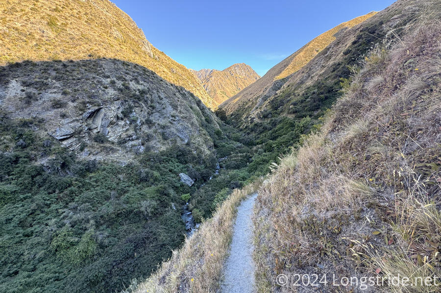
The trail generally followed the Fern Burn, a small river. Briefly leaving the farm to enter a conservation area, the trail entered a forest, and aside from a few steep and rugged sections, was fairly agreeable trail. The shade from the trees was quite welcome. Some, but not much, of the Glendhu Bay Track had trees, so it was refreshing to be able to hike for a while without the sun blasting down on me.
The trail gradually grew steeper. I thought it was going to climb above the forest, but instead, it continued to follow the Fern Burn up its valley, generally climbing higher above the river due to the ruggedness and rockiness of the valley around the river. Eventually, though, the trail exited the forest, entering into open tussock country.
After exiting the conservation area, a barely-readable sign in the bush below the trail designated private property. I’m not quite sure how anyone would have been able to walk to where that sign was placed, though.
An hour later, the Fern Burn Hut came into view. I was initially worried about the five tents placed in front of the hut, but four of them were clumped together and looked to be the same kind of tent. I suspected (correctly) that it was a large group that was camping, rather than taking up the entire space in the hut.
There were only two hikers in the hut: me and Rachel, who’d recently moved to New Zealand from the UK, and was just doing a two-day out-and-back hike from the trailhead to the hut. She’d passed me when I stopped for a break in the forest.
The hut, recently built as part of the construction of the Motatapu Track, had 12 bunks, but was large enough that quite a few more people could sleep on the floor if necessary. It also had a water tank, which has become a rare feature as of late.
Tomorrow is going to be a tough day. The plan is to go about 16.5 km to Roses Hut, but that will be a fantastically strenuous day, with over 1500 meters (nearly a full mile!) of elevation gain and loss. Fortunately, there is a hut in-between, but camping is otherwise not permitted (not that the elevation profile suggests that there’d be a flat spot to camp anyways), so making a go for Roses from the intermediate hut and stopping early is not an option.