A longer day than planned took us from Taumarunui to Ōwhango, and then on to the 42 Traverse, an ATV track through forest.
Before we left Taumarunui this morning, I made a quick trip to the food store, to get more nuts and dried fruit for the next stretch to Whakapapa. (With all the shopping yesterday and the day before to get food for three five-day stretches of trail, I’d forgotten to get those for this segment.)
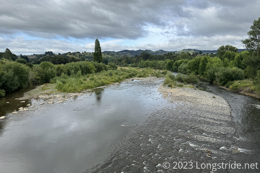
We left town shortly before 9 am to some clouds, but still nice weather. Leaving town (on a road walk, of course), we walked over the Whanganui River, which we’ll next meet in a little more than a week.
The road was fairly low-traffic, and we made good time. Initially heading south, we passed Taumarunui Canoe Hire, about 5 km outside of town.
We passed a deer farm, with a few bucks standing atop and alongside a steep hill, with a doe and some fawns siting in a lower, flatter area. Around the next bend, a driveway, a sign next to three blue trash bags advertised “Pony Poo, $4”.
Later, when we stopped for a break, at a disused community swimming pool and basketball court (but with an outhouse with a sign that it was available for TA hikers), a woman driving by stopped and asked if everything was okay, and then offered that if we needed water, to just ask at the next house.
After our break, the next farm we passed had an ostrich, which was standing at the fence at the corner of the property. When we walked past, it followed us, escorting us down the road from its side of the fence. This was probably the closest I’ve ever been to an ostrich. They are really big birds.
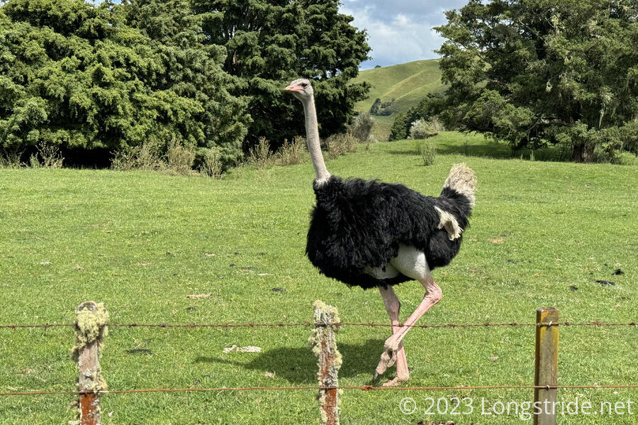
A small herd of young goats roamed the paddock next to the ostrich. The whole area was nice and green, with rolling hills.
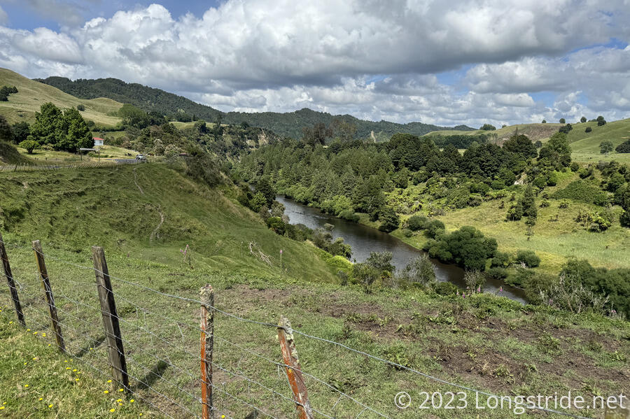
Besides the ostrich, the next while along the road was fairly nondescript. A brief glimpse of the Whanganui was timed just right to see a jet boat zoom past. We also saw one of the rock walls that had been described in yesterday’s river and safety briefing. We passed more cow and sheep farms. For a short while, there were briefly a lot of butterflies.
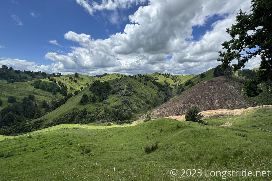
At some point, after turning to the east, the road became gravel, and we began a long climb up one side of the Hikumutu Stream valley. We had great views of the valley from the road. Near the road’s summit, we passed some logging equipment and churned up road (and forest). Thankfully, they were not doing any logging today.
More road walk brought us into Ōwhango. Being a (small) town, we hoped there would be some place we could get ice cream and soda. We saw a Petrol sign and hoped it was a gas station with a store; it wasn’t, it was just a historical artifact. We waked a bit further, to a cafe, but it had closed at 2 pm, an hour and a half earlier. We backtracked a little to another canoe rental company, thinking that they might also have a small store to sell food to their guests, but their office had also already closed.
We continued down the road, heading towards a small forest road that would lead us to the 42 Traverse. Just before we entered the forest, I spotted a water cooler on a table with two chairs outside of someone’s fence, with a sign saying there was free cold water. We weren’t especially low on water, but cold water is a luxury we don’t often have on the trail, so we stopped briefly to have some.
It was only 4 pm, and as-planned, we had less than half an hour of hiking left. With a 37 km day planned for tomorrow, if we could go further today to shorten tomorrow — especially with rain forecast — we definitely wanted to do that. Especially since we need to get to our destination tomorrow, the Tongariro Holiday Park, before 6 pm. Some digging around our trail guide found some comments pointing out a campsite about 8 km further than we’d planned for today. That’d probably take us between two and three hours, depending on how good the trail was, so we decided to go for it.
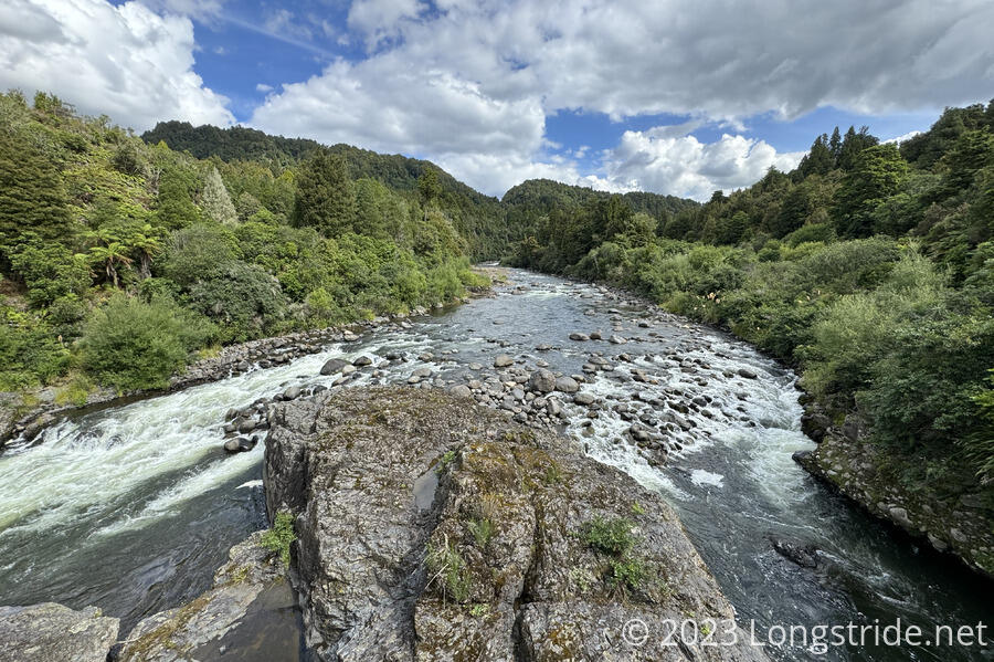
We followed a gravel road into the forest, quickly reaching the campsite we’d planned on for today, just before a bridge over the Whakapapa River, marking the beginning of the 42 Traverse.
The 42 Traverse, named because it went through what, at the time, was State Forest 42, and originally a logging road, is a multi-use (read: ATV) track, about 46 km long. The TA follows about 22 km of that track, before branching off.
We crossed the bridge, and continued on our way. The track was okay. It was wide, and in reasonably good condition for ATVs or mountain bikes, but it was a bit rough for hiking. Still, it was better trail than some of what we’ve hiked before, and we made fairly good time. We passed three other hikers already in their tents, who had set up next to and just below the road. With rain forecast overnight, we would not have wanted to camp where they did; the risk of getting flooded out seemed fairly high.
Our campsite was a little off-trail, just before Mako Stream, a small creek that was flowing just a little too much to make a dry crossing via rock-hop. If rain wasn’t forecast overnight and all day tomorrow, we might have preferred to go across the stream today, getting our feet wet now in exchange for starting tomorrow with dry feet. But, in all likelihood, we’ll have wet feet all day tomorrow (since there are a couple more stream crossings further ahead), so starting tomorrow immediately with wet feet won’t make that much of a difference for tomorrow’s hike.
We turned off the trail, following another ATV track about five minute uphill to find our campsite in a small area. It was not quite flat, but the slight downward slope would help prevent water from pooling around our tent.
We set up the tent, and CareFree went back down to the stream with most of our water bottles to filter water. I unpacked both of our packs, getting everything either into our tent or under its vestibule, then took our water bladders down to the creek to fill them up as well. This way, we collected all the water we’d need for tonight and tomorrow, and we wouldn’t need to waste time with that tomorrow morning — which would likely involve standing around in the rain.
We were able to start cooking dinner around 7:30, and a little rain fell for about ten minutes shortly before 8 pm, when we were nearly finished eating.
We were pleased with our decision to push further, especially given the campsite we got. How much rain we get overnight and tomorrow will tell whether this was as good an idea as it appears right now.