A wet, rainy day with more water crossings than can be counted brought us to the Tongariro Holiday Park, on the outskirts of Tongariro National Park and the famed Tongariro Alpine Crossing.
I woke up a bit after midnight to the sound of light rain on the tent, and again at 5:30, when heavy rain started to fall. That wasn’t ideal, but we had set an alarm around then anyway, since with rain forecast all day, the sooner we started hiking, the sooner we’d be out of the rain. (And, water crossings would have less time to swell up, and the ground less time to become muddy.) Fortunately for us, the rain briefly slowed to a light drizzle as we finished packing up, so we weren’t standing around in heavy rain trying to put a wet tent away. Still, it took us longer to get going than we would have liked.
Shortly before 8, CareFree and I were back on the trail at Mako Stream, which had noticeably swelled since yesterday evening. We knew we were going to have wet feet all day from the rain anyway (and likely some other stream crossings ahead), so we just charged through. Just because, I attempted to rock hop across, and made it most of the way dry, but the last bit before the other side was too wide and deep to make it through without getting wet.
The 42 Traverse continued much as it had yesterday, only wetter. But being wide (for a trail), and built like a road (because it originally was one), water on the trail wasn’t too bad.
That changed, though, when we detoured off the 42 Traverse. Ahead, months ago, a small slip left the road impassable. Since then, a detour made from other tracks in the forest was selected, and also a path around the slip was established, though that still required a little rock scrambling. We’d originally planned on taking the main track, but with the rain, decided we didn’t want to risk the path being unstable, and took the detour instead. (Plus, the detour was a couple of kilometers shorter, so in theory, that should also save some time.)
The detour started off well enough; it was roughly the same grade of gravel road as the 42 Traverse. After climbing up a hill, though, we reached an intersection with a pond of standing water: the trail turned, going through that water, and down a steep, muddy, slippery, rutted-out ATV track. With a stream of water in each rut, it seemed almost designed to cause maximum erosion.
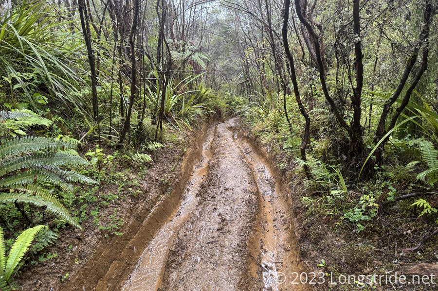
If it weren’t for the rain, this might not have been too bad. But with the rain, it was a slow kilometer and a half down the road back to the 42 Traverse.
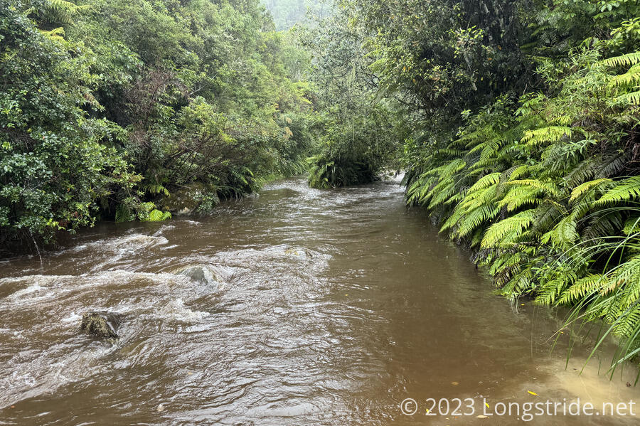
The next trial on the track was the crossing of Waione Stream. Normally an ankle to shin-deep crossing, it was a raging knee-deep river, gushing with enough force and turbulence to make my poles vibrate in the current. Thanks to all the rain and run-off, the stream was also brown, making it impossible to see beneath the surface. Still, it was a relatively straight-forward crossing, and we made it across without too much trouble. (And it’s not like our feet got any wetter than they already were.)
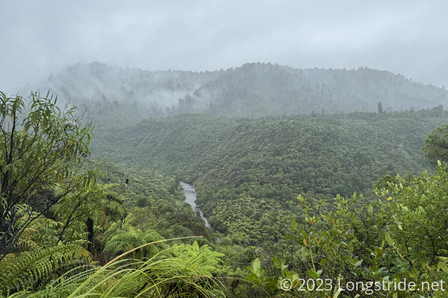
Just after the crossing, the TA left the 42 Traverse, joining the Waione/Cokers Track. this started off okay, with a nice view of the Whanganui River. It wasn’t so great after that, though.
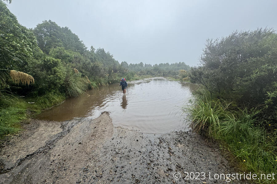
The next pair of stream crossings was significantly more challenging. We crossed a “small” stream that itself was already flooded, which itself wasn’t a big problem. But the next stream, Mangatepopo Stream, was so flooded that it overflowed its channel and ran down the trail. We had to hike up a “trail” of gushing brown water maybe 40 meters before we actually reached Mangatepopo itself. There was a lot more water flowing than our prior crossing at Waione Stream, and it was deeper — it came up to the bottom of my shorts — but it was less turbulent than Waione. Because of the force of the water (and also that we didn’t initially see where the trail resumed on the other side), we went a bit further upstream than we would have liked. And again, the muddy water made it impossible to see what was underneath, so we had to rely on our poles to safely navigate. But, we made it across safely.
Wet and cold, we pushed uphill for a few minutes to warm our feet (and eject a little bit of water from our boots), before stopping for a standing snack break, since there was really no place to sit down.
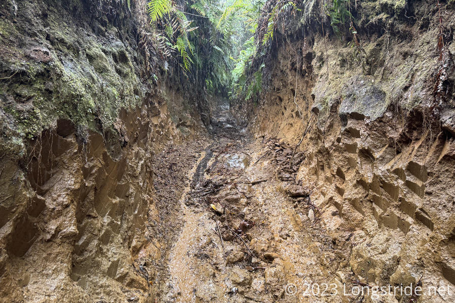
A few minutes after we continued, we got to another section of deep, muddy ATV tracks, this time carved several meters into the surrounding hill. At least we were going uphill this time. At the top, a sign reading “CAUTION” earned jeers from us.
With the rain, my pants were thoroughly soaked. Apparently, there was still some detergent in them from when we did laundry in Taumarunui, and they foamed up, giving my knees a bit of a soapy pre-shower.
About an hour later, we passed a trail bypass, with no clear indication why we would want to take it. The reason later became clear: the last part of the Waione/Coker Track was a drainage nightmare. There was a constant string of pools of standing water for about the last kilometer and a half. “Fortunately”, our feet were already soaking wet, so we just charged through these pools, most of which were more than enough to cover our boots, rather than try and go around them. In the rain, and with as much water as there was on the trail, going around wouldn’t have been worth the time or effort.
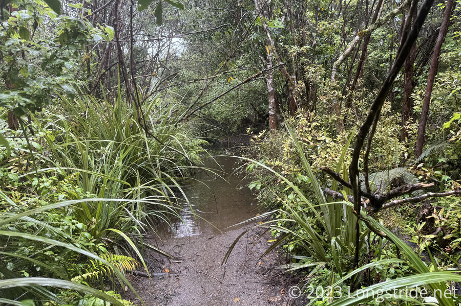
As if to add insult to injury, the ATV track ended in a short dirt road that was also flooded out, a huge pool of water between us and a paved road in sight just beyond.
Just after 2 pm, we made it to a paved road, which we followed to a highway, and from there, to the Tongariro Holiday Park, arriving there around 3:30. We were really glad we went the extra distance yesterday. Had we not, it would easily have been close to 6 pm before we got to the holiday park, and their office closed at 6.
We checked into our cabin, and got some ice cream and soda as a well-earned reward for the day’s hike. After a day in the rain, the warm showers were amazing.
I discovered that my sleeping bag’s dry sack was no longer performing its primary function; the foot of my sleeping bag was quite wet, from water that got into my pack from the rain. (My pack’s cover unfortunately doesn’t completely cover the back or top of my pack, and with sufficient rain, water gets through the cover eventually anyway.) So the next time we’re in a major town — probably Whanganui — I’ll have to get a replacement. And in the meantime, hope it doesn’t rain too much.
We booked two nights here, knowing that the weather for tomorrow wasn’t looking good. The updated forecast also says the rain on the 31st will be even worse had been called for, but January 1 is looking good for the next segment of trail: the Tongariro Alpine Crossing. So we may wind up here for a second day to wait out the rain. Fortunately, with the timing of our canoe trip down the Whanganui River, we have a few days to kill.