Today was my first day back on a long-distance trail since my partner and I finished the Benton MacKaye trail last July. It’s been entirely too long since then. It’s great to be back on trail, even if it’s not what was planned.
The start to this hike was a bit unusual, in that I actually drove myself to the trailhead (with my Mom along for the ride to drive the car back home). All of my other long-distance hikes have involved some combination of friends and public transportation. This turned out to be a good thing, because it was also my most disorganized departure: five minutes after I left home, I had to turn around because I realized I forgot to put my hiking poles in the car!
The drive to Harpers Ferry was entirely uneventful, and after a little bit of wandering around the lower town looking for a parking lot, we wound up in the visitor center’s parking lot, where signs pointed towards a 1.5 mile trail from the parking lot to the town. After saying goodbye to my mom, I was off, down a somewhat steep, rocky trail filled with no small number of day-hikers of all ages.
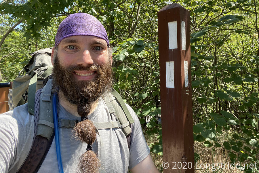
About a mile later, the trail brought me underneath the bridge for US-340’s crossing of the Shenandoah River, which I knew I’d need to be on. After consulting a map, I broke off from the trail to town, walked across a parking lot, and found myself on Shenandoah Street, across from the bridge, and next to my first white blaze: I’d reached the Appalachian Trail, and this would be the actual beginning and ending of my loop.
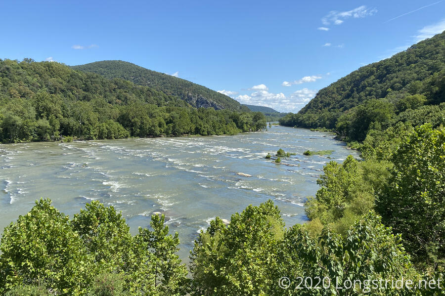
I turned south on the AT and proceeded across the quite noisy US-340, on a protected pedestrian walkway with a good view of the Shenandoah River. About a mile downstream, the Shenandoah joins the Potomac River in lower Harpers Ferry, which is roughly where I’d planned to start hiking today.
With starting in the early afternoon, it was somewhat warm and humid out, and that combined with the somewhat steep climb away from the Shenandoah left me sweat-soaked. On the way up, I forgot to look for the first view of the Shenandoah I had in 2016 when I was approaching Harpers Ferry. No matter, in less than a week, I’ll cross it again as I make my way across the Shenandoah Valley.
After about an hour of hiking, I stoped for a short ten-minute break on a rock on the side of the trail, and ate an apple I brought from home. It was an unplanned extra snack, but it was well worth bringing it.
As I was heading south, there were a fair number of day-hikers out heading north, back towards Harpers Ferry. I suspected that most of them were returning from Loudon Heights, a scenic overlook of the Shenandoah and Potomac Rivers accessible from a side trail off the AT. This suspicion seemed to be confirmed by the drastically fewer number of hikers I saw after I passed that trail.
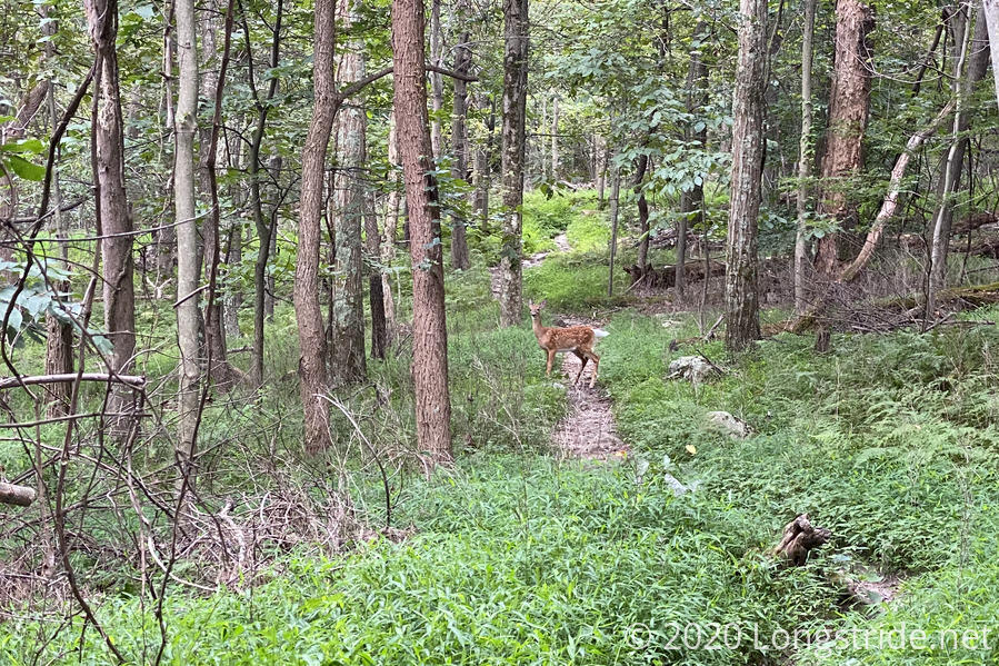
The substantial part of the day’s climb finished shortly afterwards, and while there were still some uphill sections, the trail mostly meandered along a ridge that gently bobbed up and down. There, I saw my first deer of the day. Over the rest of the day, I saw at least six deer, which might be more deer in one day than I’d seen on any single day during my entire AT hike.
Not long after that, I exited the Harpers Ferry National Historic Park, and shortly after that, passed a sign marking the Virginia-West Virginia border.
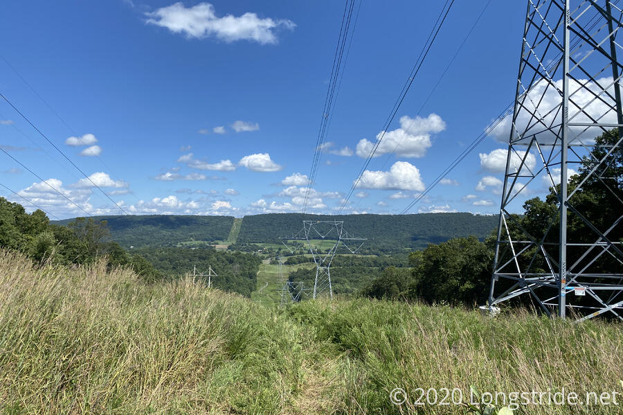
A clearing for power lines brought the only significant view of the day. That’s not a problem, though, since I know there are unmarried views to look forward to in the days ahead.
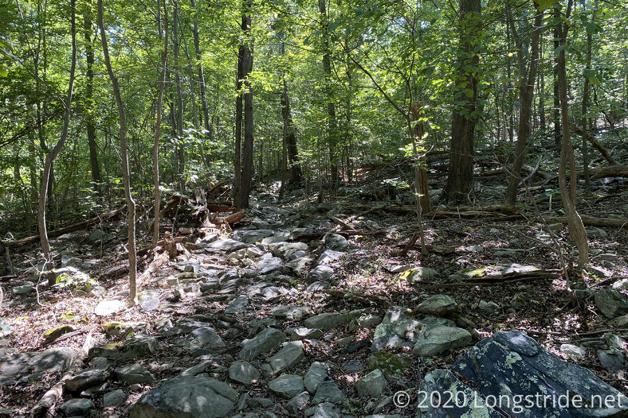
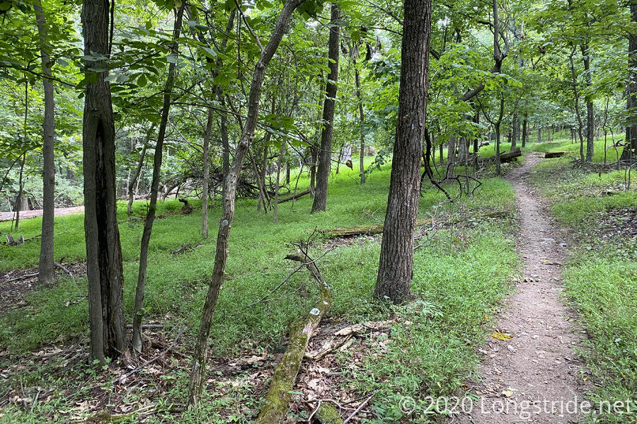
The trail quickly turned into a rocky mess; I’d forgotten how rocky this section of the trail was, but at least this time, I’m hiking on brand-new boots, instead of boots with had a thousand miles on them. My feet greatly appreciated this.
I took my second break of the day sitting on a log, perfectly sized and placed straight across the trail. By then, the trail had become substantially less rocky.
The most significant road crossing of the day was Charles Town Pike, at Keyes Gap. The last time I was here, on a Friday, the road was very busy, and waiting for a safe crossing it took some time. Today, though, a Sunday, saw much less traffic on the road, and I was able to cross it immediately without having to wait.
Especially past Keyes Gap, the rocks on the trail dropped off, and took on a much more scenic appearance. This is a mean trick the trail is playing, though I am wise to it: there’s another significantly rocky section up ahead tomorrow.
During the day, I actually passed at at least half a dozen hikers doing sections hikes along the AT of varying lengths. I wasn’t expecting to see any thru-hikers (in a normal year, it’s too late for northbounders here, and a little too early for all but the fastest southbounders), but this is roughly what I expected to see in terms of people on the AT.
Late afternoon brought me a doe and a fawn crossing the trail; these were the last of the many deer I saw today. A very, very light drizzle began to fall. On a day other than my first day on the trail, I might have picked up the pace a little, just in case, but I didn’t want to push myself too far today.
Late afternoon brought my first detour, to peak bag a minor summit just off the trail, bushwhacking maybe a tenth of a mile through low, thin brush and across an abandoned road. By then, I’d forgotten about the little bit of rain that fell, but, remembering all the deer I passed, took a minute to check myself for ticks, and was relieved to have found none.
Shortly after 5, I arrived at the David Lesser Memorial Shelter, my destination for the day, 9.3 miles from the parking lot in Harpers Ferry. I never stopped at this shelter in 2016, but it is a fantastic shelter. The main structure has a large porch lined with benches, and a separate area with a covered picnic table, fire pit, and swing. (The swing reminded me of the one at Quarry Gap Shelter in Pennsylvania, which I’lll pass by on my return leg to Harpers Ferry next month.)
At the shelter were two women from Ohio, out on a short section of the AT. (They make time each year to come out and hike a different section of the AT.) Later on, they lamented at how no one in Ohio hikes, and how they can’t get anyone to come out to the AT with them; I suggested perhaps getting their Ohio friends to join them on the Buckeye Trail, a 1000+ mile trail that encircles much of the state.
Before we talked too long, I was in dire need of cool water (I still had plenty, but it was all warm.), so I took off down the trail to the spring, which they’d pointed out was long and rocky. A quarter-mile away from the shelter, it was a bit long for a water source, and parts of it were a bit rocky, but it was far from the worst hike to a water source I’ve had. The after was cool and clear, and it was quite refreshing to rinse off my arms, legs, and face.
Each time I head back out on the trail, I usually find a way to botch dinner the first night out, since it’s been awhile since the last time I’d cooked like a hiker. This time, I forgot I needed to boil the water before adding the pasta. Rather than try and drain the water out of the pasta, I just turned the stove all the way up get the water to boiling as quickly as possible, and then turned the stove down to low to continue cooking the pasta for its expected cooking time. Dinner turned out fine in spite of the mishap, so that was good.
It was great to be able to sit and eat at a picnic table rather than sitting on the ground, as I had to do most of the time on my last two hikes. As the sun went down, it cooled off a bit, and miraculously, the humidity also seemed to drop, at least a little, so my clothes at least dried out some.
After sunset, the wildlife was much louder than I’d recalled it being on the AT. I’d expected some of that, with the Brood X cicadas making their way out this summer, but it really actually is somewhat loud out here. Still, it’s great to be out on the trail!
As I was getting ready to go to sleep, well after sunset, two men and a dog arrived at the shelter. The dog really did not like other people, and was constantly growling until it’s owners got it to settle down. In the light of my red headlamp, it almost looked like a demon, two bright red eyes reflected back at me.
Tomorrow: the start to the Roller Coaster, one of my least fun sections of trails.