An extremely hot and humid slog through the hills and valleys of northern Virginia did not at all go according to plan. But I saw some views I missed last time I was in the area, so at least I had that.
The extremely loud insect chorus last night was still going strong after midnight, and only quieted down sometime after 3 am. This made getting to sleep — and staying asleep — a bit of a challenge. But, I still work up somewhat well rested.
I ate breakfast and took another jaunt down to the spring to fill my pack up. I think I filled it very nearly full, so when I set out, I had somewhere between three and four liters of water. I’m really glad I did, because it was very hot and humid out, and by the time I got to my resupply point, I was very nearly out.
I somewhat incredibly misjudged today’s hike on account of the heat. Leaving The David Lesser Shelter around 8:15, and needing to be at Bears Den at 5 pm, I figured I would have more than enough time; and wound wind up waiting there for the office to open for several hours, since it was “only” 10.2 miles. The trail had other plans.
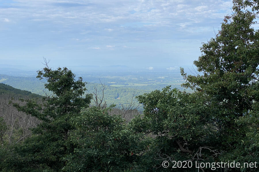
About half an hour after I started, I arrived at the side trail for the Buzzard Rocks view. At this point during my AT hike, I was about nine miles into a 19.6 mile day, and so most likely blew past the side trail without considering taking it, if I even saw it at all. (The side trail is easier to see while heading south.) Today, with “time to kill”, I stopped for the view, and was not disappointed with the short jaunt off-trail. (The deer, though, were quite startled that anyone would want to look at their view!)
The trail continued to be rocky, and being fresh on the trail, I forgot to be more careful than usual (to protect my ankles until they strengthen later in the hike). So about ten minutes after leaving Buzzard Rocks, while navigating through a particularly rocky stretch, I rolled an ankle. This forced me to hike a bit slower for the rest of the day, which was just as well, since hiking quickly so early on and in the heat and humidity that followed wasn’t going to happen anyway.
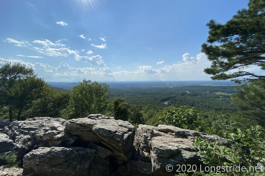
An hour later, another side trail to a view appeared. I decided this was a good time to take an early break and rest my ankle some.
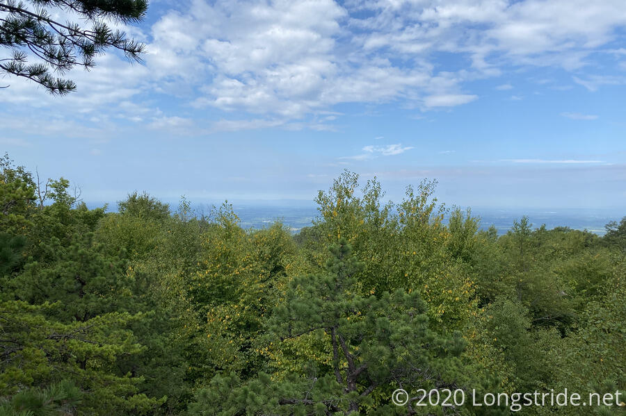
It was a little hard to tell, but I think the Tuscarora Trail runs along the ridge in the far distance. Half an hour later, as I was leaving, it looked like it may have been raining on that ridge.
But speaking of rain, as the trail descended into, and then climbed out of, Wilson Gap, it was extremely humid, and the ground and plants looked to be wet from at least a light rain. The plants looked lush and green for it.
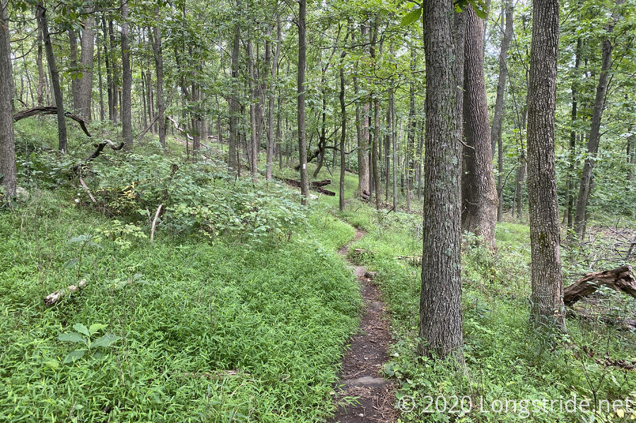
I was also clearly the first person to hike through this section of trail today. I lost count of the number of spider webs I walked through.
12:30 brought me to the north end of the “Roller Coaster”, a thirteen mile sequence of rapid ascents and descents. For someone already two and a half months into a hike, it’s mostly very annoying because you never really have time to get into “uphill get” or “downhill gear” before the trail switches direction on you. Today, it was the rocks, and the humidity, that made it especially challenging. I decided to take a break at the next convenient location, which happened to be at a small campsite at a trail junction with the “Ridge to River” trail, which did not appear on the map I had.
After a nice 20 minute break, I saw the first hikers I saw since leaving the shelter, a couple and their small (and quiet) dog.
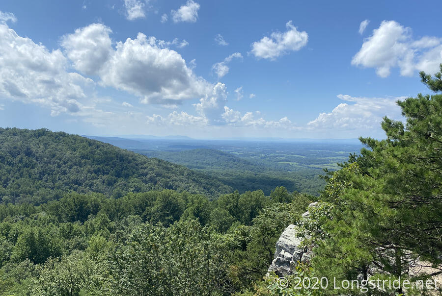
Another twenty minutes of uphill brought me to a rock outcrop and overlook, the Raven Rocks. I commented to the couple, who had followed me uphill, that if I’d known this was here, I’d have stopped here for a break instead.
I actually was surprised I didn’t remember the view. This was only a few miles from Bears Den, where I started my day the last time I was here, and since the trail went right past it, I couldn’t have missed it. Initially, I thought it must have been foggy or overcast, but, I later checked, and found that it was actually one of the only two scenic photos I took that day. Forgetting the view was simply a casualty of doing a 20-mile day on the AT.
Geographically speaking, the trail largely followed the VA-WV border today, and just about the only thing I actually recognized today was the VA-WV state line sign, located shortly after Raven Rocks. From here, I’ll be in Virginia until the Tuscarora brings me back around to West Virginia (and later, Maryland and Pennsylvania).
Another 20 minute break and a small snack on the uphill to Bears Den gave me the energy to make it there without too much further trouble, though the heat and my ankle still greatly slowed my progress. An hour later, I reached the Bears Den Rocks, a great view to the southwest that I unfortunately missed during my AT hike, having accidentally skipped a short section of trail between the two entrances to Bears Den.
My first destination for the day was the Bears Den Hostel, a hostel owned by the ATC and operated by the PATC that, in usual times, hosts many thru-hikers in a bunk room with all the usual amenities (shower, laundry, food, etc). Due to covid, however, the hostel is closed, and only the cabins and camping areas are open. But they still offer sodas, pizza, and ice cream, they just bring them outside for you. I ran into its caretaker on my way up the side trail from the AT to the hostel. It was almost 5 pm, much later than the several hours earlier I thought I would be here.
While my pizza was cooking, I got my resupply box, an unfortunate 12.75 pounds. I’m just glad I didn’t have to carry that all the way here, since I wasn’t initially planning on stopping at Bears Den. (I didn’t think stopping for several hours would be necessarily prudent, but changed my plan after deciding that I shouldn’t push so hard getting started.)
While there, I met “Princess Anne”, who is currently hiking the AT in sections. She’s previously hiked the Pacific Crest Trail as well, and it’s possible we passed each other in Northern California or southern Oregon in 2018.
Over two hours later, having stuffed myself full of a pizza and two sodas (no ice cream — I was full!) and mostly recharge my phone and battery from a power outlet behind the building, I decided it was long past time to head out to my intended target for the day, the Sam Moore Shelter, another 3 miles down the trail.
As I was leaving, I saw the two women I met at the shelter yesterday; it turns out they had parked their car at Bears Den, and got a shuttle back here after reaching Harpers Ferry.
I left Bears Den about 20 minutes to sunset, vastly underestimating how quickly the sun would set and it become dark. (The last time I’d hiked near sunset, it was on the PCT, and the general lack of complete tree cover lets useful light after sunset last much longer.) I quickly realized that I would not make it to Sam Moore, but at least there are two campsites along the way — including one about half a mile south of Bears Den. However, in the fading light, the trail became hard to follow, and (since I was most likely focusing on the trail and not on trees with blazes), I wound up making a wrong turn somewhere that took me into a terrible rocky mess of an area with private property signs and pink flags on the “trail”.
I’d hoped to backtrack to the AT and just stop at the next campsite, but in the darkness, I didn’t recognize the point where I’d gotten off-trail, so once I did make it back to the AT, I wound up heading back towards Bears Den. At that point, somewhat exhausted and nearly dripping with sweat again, I decided to just call the day there, and returned to camp on the hostel’s lawn.
After setting up my tent, I tried to get ice cream, but whoever stocks the fridge really likes chocolate. There were five different Ben & Jerry’s flavors of “Let’s see how much chocolate we can stuff into a pint of ice cream”. I’m not a huge chocolate person (Snickers bars notwithstanding), so I opted out.
With the sun set, it is much cooler, and the sky is clear, which should be great for keeping the humidity down, especially since I’m tenting on grass. Let’s hope that that holds for tomorrow as well.
Tomorrow: Highly uncertain. “To plan” would be 18 miles, which seems incredibly unlikely, especially if it is hot and humid again.