My final day on the Tuscarora Trail could hardly have gone better.
I got up at 6:30. It wasn’t terribly cold at the shelter, which helped with getting up early, and, the sooner I got going, the sooner I would get to town, which meant a nice warm shower and bed.
Yesterday, Nukon told me that one of the volunteers on the work crew that maintains the trail around the shelter liked nothing better than to smash large rocks on the trail. Pennsylvania has a (not entirely undeserved) reputation for rocks on the trail, earning it the nickname “Rocksylvania” on the AT. (There’s also the joke that the rocks are so bad because the locals come out every night to sharpen them and/or put more rocks on the trail.) Ad I’d heard stories of hikers so angry at rocks that they’d actually pick up rocks from the trail and throw them to the side.
Not long after I left the shelter, it was quite clear that Nukon was being entirely serious. There were a large number of rocks that had been clearly smashed up by someone with tools. In some places, the debris was thrown aside; in others, it was used as filler between other rocks on the trail. In any case, it brought a smile to my face to see a trail maintainer who hated the rocks with the passion of a thru-hiker and did something about it. Thank you, whomever you are!
From a short distance south of the shelter yesterday, the trail followed the borders of both the Reineman Sanctuary, as well as the border for the Audubon Hawk Watch. This morning, the trail entered the Hawk Watch, at Waggoners Gap.
The ridge I’m currently hiking along is part of an important migratory path for birds-of-prey, and raptor enthusiasts have been coming to the rocky outcrops at Waggoners Gap since the 1950s to observe (and count) the birds along their migration to winter nesting grounds.
Unfortunately, due to not really paying attention to the signs (and instead paying more attention to the rocky trail), I missed both of the views near the gap. But, it’s near enough to the road that it’d be possible to come back and check them out later.
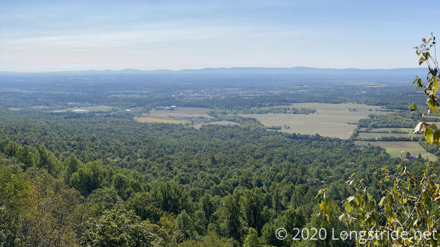
The rocks continued pretty much until the trail left the Reineman Sanctuary entirely. Shortly after, the trail came to an old road that went down both sides of the mountain. To the south, following the road away from the trail, brought me to a view to the Cumberland Valley.
The trail itself headed north on the road, which helped recover some of the time lost to the rocks earlier in the day. But only for about fifteen minutes. Then the rocks started up again, and the trail bounced up and down from the ridge several times, before finding a nice roadbed to follow.
The trail led to a power line clearing, where I decided to take a break, and then followed the clearing and access road straight down the hill. (The guidebook claimed there were switchbacks. I did not observe any. Maybe they were do-it-yourself switchbacks.)
Thankfully, the clearing had been recently mowed, so it was easy to see the short poles with blazes on them leading down the mountain.
Turning off the power line clearing, the trail joined another dirt road, leading past a cabin with a trail register and a water pump available to hikers. (There was also a privy on the property, but I would not presume the privy was intended to be used by hikers.)
The dirt, and then gravel, road eventually led to PA-34, which was quite busy, and followed it a short distance to Sterretts Gap. From the gap, the trail began climbing the ridge again, first on a small trail on private property, and then on an old road bed.
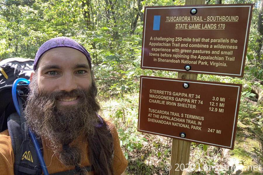
Once the trail arrived at the ridge, it was a straight, smooth, flat shot to the Tuscarora’s northern terminus at the Appalachian Trail, and it was some of the fastest hiking I’d done all day.
Finally, after twenty days on the Tuscarora Trail, I’d hiked its entire length. Some of it was slow, and hard, and annoying, and some of it was a joy to hike. I’m glad the trail ended on a high note, marking and end to the fifth long-distance trail I’ve hiked.
Now back on the Appalachian Trail again, I made a short jaunt north to the Darlington shelter, which I’d skipped visiting in 2016. I visited the shelter to take a break, but really to sign the shelter’s log with the announcement of my completion of my fifth long-distance trail.
Shortly before three, I left the shelter and began my descent from the ridge, along trail that was surprisingly good. (Having spent three weeks on the Tuscarora, I’d forgotten what a well-maintained and heavily-trafficked trail looked like!)
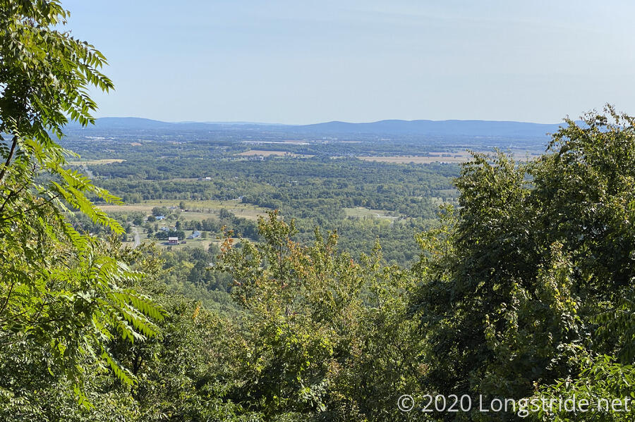
A short distance from the top was a stone bench with a great view to the valley.
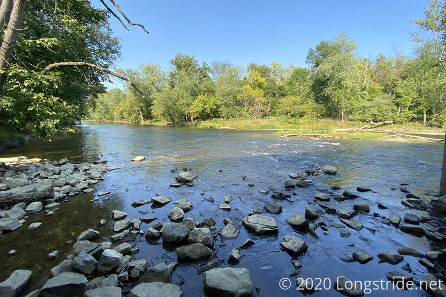
My destination for the day was the Scott Farm AT Work Center, which has a small trailhead parking lot and picnic tables. Along the way, the trail followed Conodoguinet Creek.
Trail maintenance on the section of the AT from the ridge to the creek was incredible. I don’t recall if it was this good when I was here in 2016, but at that time, I was at the tail end of a long day, charging up the mountain, rather than flying down it. I was able to maintain an impressive (for me) pace, running four miles down the mountain in less than an hour and twenty minutes, a little over three miles an hour.
On the way down, I texted my hosts at the Red Cardinal B&B, Joann and Bill, with my ETA, and they arrived at the work center a short while after I did to pick me up.
We had a nice chat on our way back to their house/B&B, and it turned out that I was their first hiker of the season. They generously offered to let me eat dinner with them (spaghetti), something they don’t normally do.
After arriving and getting a tour, I made my way to the shower, which was glorious. Before, during, and after dinner, we had wonderful conversation, and I was quite happy with my decision to stay here.
Tomorrow: I get to hike along one of the flattest sections of the entire AT, as I begin my journey back to Harpers Ferry to close the loop I started there.