Returning to Maryland, and now heading south, rather than north, the first of three days on the Appalachian Trail in Maryland this hike got me some nice views I wasn’t able to see the last time I was here.
It was relatively warm overnight, which made it very easy to get up “early”, by which I mean, at sunrise, which is marching ever later each day. It was a little foggy out; not so much at ground level, but the tops of the trees were definitely in the clouds.
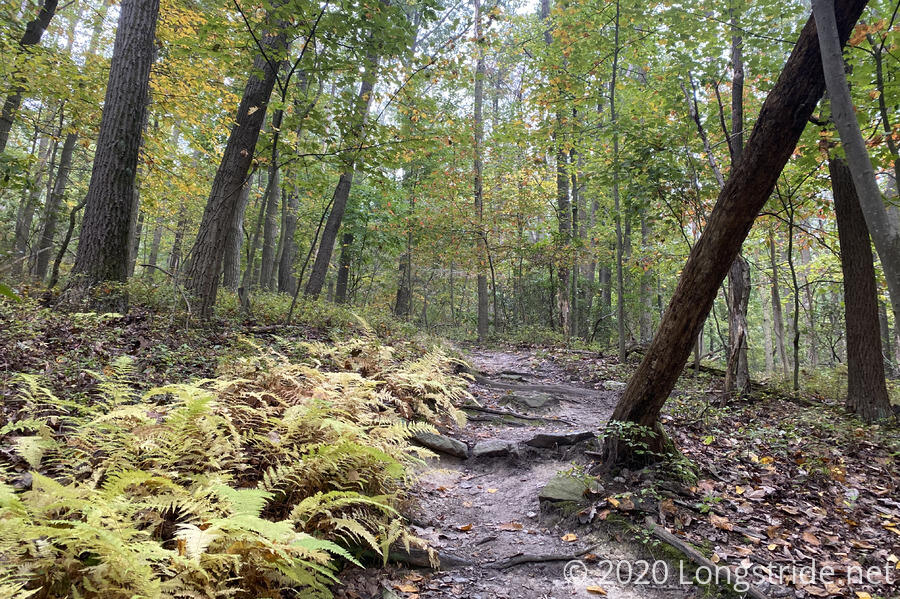
Though the trees seem a bit more resilient, at least so far, the progress of fall continues to be visible in smaller plants. Over the last couple of days, the ferns have very rapidly started to turn yellow.
A mile or so from the Maryland border, I was passed by five people running on the trail. I couldn’t tell if they were running a race or were just out for a run.
By ten am, I reached the Mason-Dixon line, the border between Maryland and Pennsylvania, completing my trek through Pennsylvania. Fortunately, I made it the rest of the way through the state without breaking my other trekking pole.
Just inside the Maryland border is Pen Mar Park. I planned to take a break there, and get water and use the restroom (which was somewhat important, since the privy at Deer Lick was barred shut). There were plenty of picnic tables under pavilions, and the water fountain was on, but the restrooms were locked. I was a bit disappointed, but, it was still “early” on a Sunday, so perhaps they just hadn’t been unlocked yet.
That turned out to be the case. After I sat down for a snack break, a reverend arrived at the pavilion — this is where he’s been holding services lately — and we chatted for a while. (Well, it was more like he was doing 95% of the talking, and I was trying to be polite while eating my snacks and massaging my feet, but in any case, it was a little bit weird to carry on a conversation with someone else from thirty feet away.) While I was waiting, the park’s caretaker showed up and unlocked the restrooms, which provided me an easy out to the conversation. Later, as I was packing up to leave, the caretaker asked if there was anything I needed. (Fortunately, there wasn’t!)
The trail on either side of the park was quite nice, until the trail had a steep, rocky climb south of the park. When I was coming down that hill in 2016, it was foggy and rainy, and I’d gotten off-trail for a little while because of inconsistent blazing and lots of rocks. So I was somewhat curious about this short section. Once I got there, it was nothing like what I’d remembered. What I remembered was a field of small rocks and difficult to follow trail with small flags on the ground to mark the trail. Now, it was a fairly easy to follow clear (and sometimes staircasey) rock path. I suspect there’s been a lot of trail maintenance work here in the last four years.
As I left the park, two of the five runners I saw earlier passed me heading back the way they came; later, the other three passed me, with considerably more distance between them and the two frontrunners.
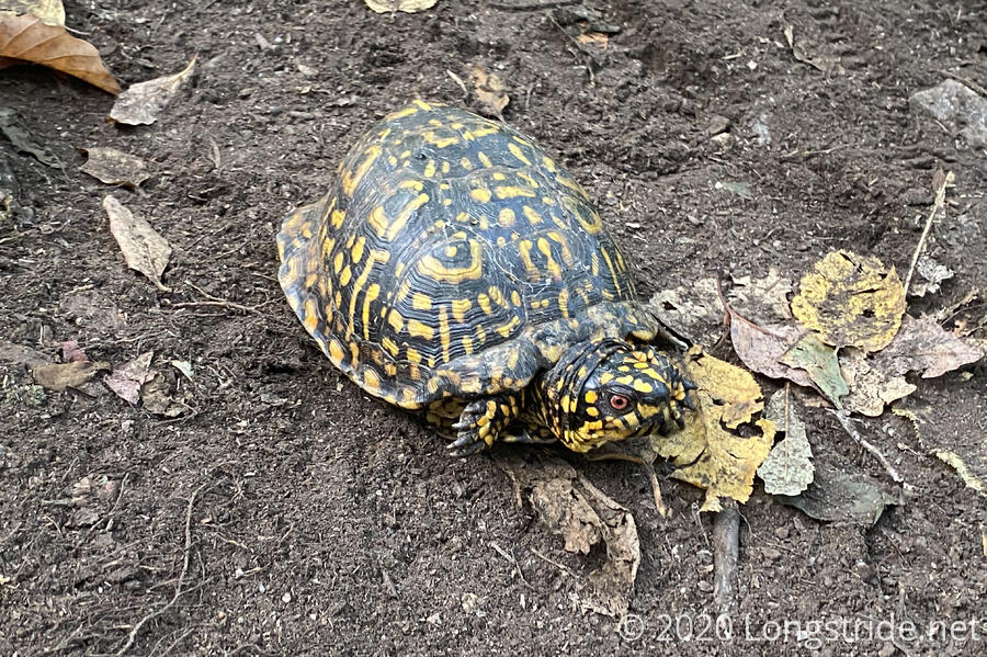
Near the top of the climb, I came across a turtle sitting on the trail. This one actually let me get close enough to it to get a good picture with its head still out of its shell.
The top of the climb brought me to a loop trail to High Rock, which I didn’t take last time I was here (because it was foggy and rainy out). This time, with better (albeit somewhat still cloudy) weather, I took the side trail, and got a nice view.
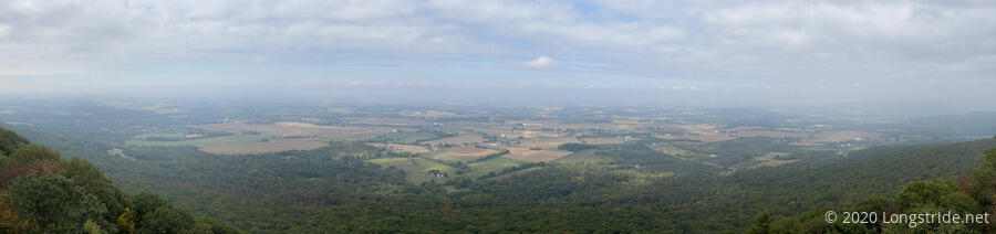
A road with parking area leads directly to the High Rock view, which can also be used (by permit) as a launch point for hang gliders. This makes it very easy to access, and as a result, the entire area has been overcome with graffiti. Nearly every surface in the vicinity (including a few tenths of a mile back on the AT) has been spray painted — including trees and rocks. It was really somewhat astonishing.
Another half hour of hiking from the High Rock view brought me to the Raven Rock Shelter, for my second break. Since it was still “early” in the day (only 1 pm), and I only had another five miles to go for the day, and since I got entirely too much water at Pen Mar Park that I was lugging around, I decided to stop at the shelter and cook dinner. Besides using up a lot of water, that’d also relieve me of carrying today’s dinner the rest of the day. (Well, carrying it in my pack, at least.) Also, my guidebook suggested that the shelter I’ll be ending at tonight, Ensign Cowell Shelter, has a spring with often stagnant water, and cooking dinner here would reduce the hassle if there wasn’t much (or good) water there.
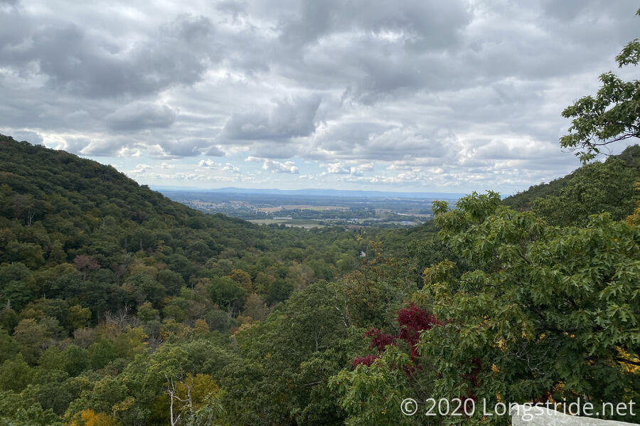
After leaving the shelter, about halfway down the relatively steep hill, descent to the next road, was a view from the Raven Rock Cliff, which provided a nice overlook towards the south that I skipped in 2016. (I’d skipped this view because I was lugging several liters of water uphill to the shelter, and with a fairly high pack weight due to having too much food leaving Harpers Ferry, felt like I was constantly on the verge of tipping over backwards on the steep climb up.)
As I left the view, I passed a couple on the way up to the view with their four-year-old daughter, who had her mother’s trekking poles (collapsed as small as they’d go). I thought it was adorable.
You know how, sometimes, you just don’t notice something, and then once someone mentions it, you start to see that thing all over the place? As I was leaving Raven Rock Shelter, another hiker arrived, who was “just checking out the shelter”. After she came back from the shelter’s campsites, she mentioned that there were a lot of chipmunks there. So far, I hadn’t seen any chipmunks at all. But now that she’d mentioned it, I started seeing lots of chipmunks in the forest. I hoped there wouldn't be many near the shelter. (Fortunately, I didn't see any there.)
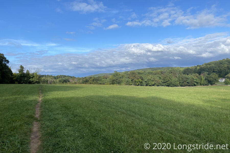
Later, as I was getting closer to Ensign Cowell Shelter, I passed through a couple of cleared fields that I’d had no recollection of passing through in 2016.
I arrived at the Ensign Cowall Shelter a bit before five. Someone else had already taken one of the nearby campsites, as evidenced by smoke from a fire, which I could see a few minutes before I got to the shelter itself.
Having already had dinner, I’d decided I was just going to have a snack tonight (replacing the snack I didn’t have at Raven Rock because I’d cooked dinner). I felt I had about enough water that I could not worry about collecting further water today, and tomorrow, use what I had left until I got to a park with a water faucet tomorrow. I did note, though, that a map on the shelter had a second water source I hadn’t been aware of, further down the hill, that may have provided a better source of water than the one on the trail.
Cody and Rita arrived a little before six, and joined me in the shelter. They, however, needed water, and Cody offered to bring back water for me if I had something to put it in, so I happily gave him my water bag. Fifteen or twenty minutes later, he returned from that second water source with plenty of water for the three of us. This enabled me to cook a second course of ramen, which let me “make up” for not having it several days ago.
Cody, Rita, and I continued our conversations from last night, and again, we were up until after ten o’clock talking. Like me, they’d been planning on stopping at the Dahlgren Backpack Campground tomorrow. I’d changed my mind, instead planning on going for the Rocky Run Shelter about two miles further. My main motivation for Dahlgren was that I could get pizza delivered there — I’d gotten pizza there in 2016, and it was fantastic. However, the pizza place is closed on Mondays, and now that I’d be getting there on a Monday, it didn’t make sense to stay there. Plus, a couple of extra miles to Rocky Run shortens how far I need to go on Tuesday, to complete my Tuscarora-AT loop.