Overnight, there was a fair amount of noise on my tent that sounded like rain. This morning, though, it looked dry out. I suspect instead, the wind last night was blowing pine needles off trees, and that’s what was hitting my tent.
I planned for 25.5 miles today, to the Rainbow Lake Campsite. With that distance, which would be my longest day so far, even a fast pace would take a long time, and I wanted to leave early. While I was one of the first out of camp, I wound up not actually leaving until 6:20. Approaching clouds gave the appearance of incoming rain, so I tried to hike as fast as possible, trying to make it as far as I could before I got wet.
Shortly past the Potaywadjo Spring Lean-to, on the shore of Pemadumcook Lake (try saying both of those quickly!) was supposed to be a view of Katahdin. The incoming clouds blocked that view, and continued to threaten rain. I kept going, stopping for a break about half an hour later at a stealth campsite, with probably a 2.5 mph pace. Rain on its way, I tried to keep the break short.
After passing the lake, the trail turned west, following the Nahmakanta Stream. At some point, I passed a trail crew working at the campsite on the other side of the trail from the stream. It appeared they were building something, possibly a privy, but given the threat of rain and the long distance I still had to cover, I didn’t want to stop and break my momentum.
The rain finally came, soaking my shoes and socks, and I slowed down a bit, allowing Slip ’n’ Slide (Good Boy’s hiking partner) to catch up to me. Her presence pushed me on a bit faster, and when she mentioned that her goal was to get to the next shelter before noon, I decided that’d be my goal as well.
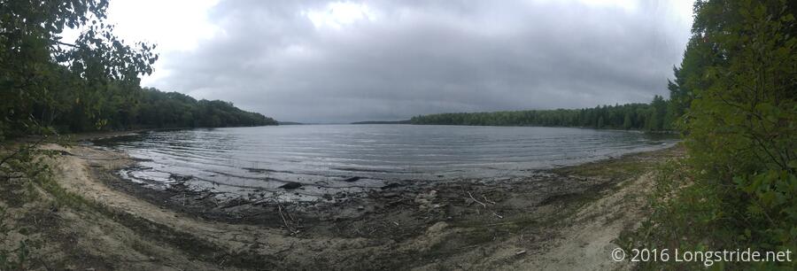
The rain subsided, and the very gradual uphill developed some (not terribly difficult) bumps, taking us along Nahmakanta Lake by both beach and cliff. We made it to the shelter just before noon, with a new milestone for both of us: 13 miles by 12 pm.
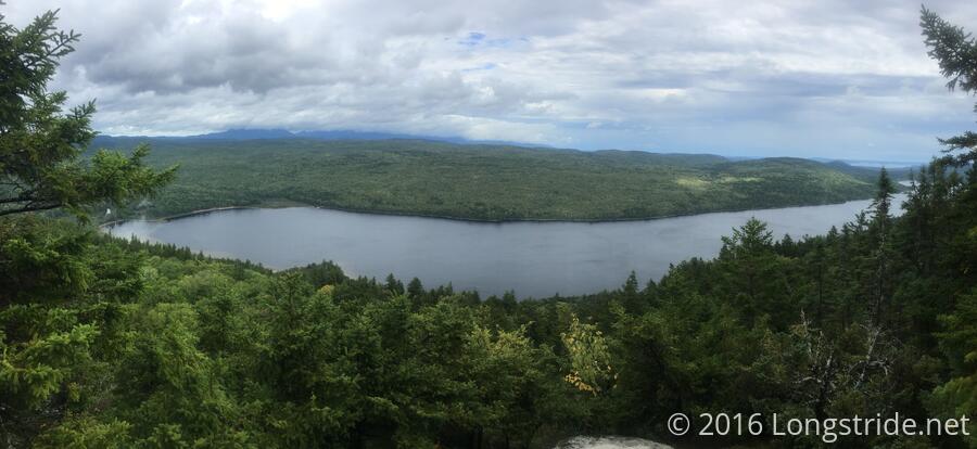
We took a well-deserved break, though drying out wasn’t really possible given the 100% humidity, and then pushed on. The trail climbed the not-very-tall-or-steep Nesuntabunt Mountain, which provided a great view of the lake, but the view of Katahdin was again blocked by the clouds.
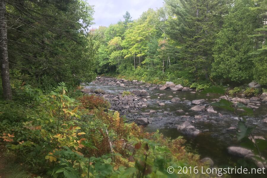
In a welcome change, we actually got to cross a stream via a logging road’s bridge (which was great, because the stream seemed a bit wide and fast to easily attempt fording). We took a break on the north side of the bridge, and Slip ’n’ Slide collected water from the stream for both of us.
While we were there, we met a SOBO who had just started, now on his second day. Stunningly, he did 30 miles yesterday! Apparently, his shuttle dropped him off at the wrong place (at Abol Bridge, at the north end of the Hundred Mile Wilderness), so he hiked the fifteen miles from there, to the Katahdin summit, and back (since camping isn’t allowed in Baxter Park).
Our break stretching on almost an hour, both with chatting with the SOBO, and also attempting to wait for Good Boy, we decided we had to push on, towards the Rainbow Stream Lean-to, about another 2.5 miles ahead.
The shelter had a wonderful view of the stream, with a swimming hole just upstream from the shelter. I made my dinner, and despite the lateness of the hour, decided I had to push on. With 25 miles from the shelter to The Birches, it would make tomorrow a hard day, and I’d rather today be the hard day so that tomorrow could have some semblance of “less difficult” before summiting Katahdin the day after tomorrow.
Leaving the shelter shortly after six, I was embarking on my first night hike: with just under four miles to go to the campsite, and sunset shortly before 7, it would be dark long before I got there.
I hiked as quickly as possible, making it about halfway there before sundown, though with the mountains and the trees, it had already gotten fairly dark.
One doesn’t realize just how much their head moves when hiking until their vision is severely limited because the spotlight from their headlamp is bouncing all over the place. Somehow, I managed to maintain over a 2 mph pace without tripping over anything, and made it to the campsite at 7:45. I was lucky: the trail went through a couple of areas that, with a little more rain (or possibly even as much rain as we got earlier today), could have been deep mud pits. Fortunately, I managed to avoid walking right into them.
Now that I’ve actually done a night hike, I’m certain that I don’t like them. There’s no view, and it’s simply more dangerous than necessary. I can see their uses, but I’d prefer to not have to do them on terrain any more rugged than this.
Several other people already at the campsite, there wasn’t much in the way of good campsites left. I took the last remaining obvious spot. With the wind starting to pick up and the temperature dropping quickly, I set my tent up as quickly as possible (and was done and inside in less than half an hour, it seems) on an uneven, somewhat rocky surface.
Tomorrow: The Birches is 21.1 miles away; I’d like to be there by 3, just in case it’s over-full by the time I get there and need a shuttle into Millinocket to stay at the hostel there. I want to leave here by 6 am.