After a week off trail, today we returned to the CDT, leaving New Mexico behind for Colorado.
I actually forgot to set my alarm last night, but woke up around 5:30 anyway. It was already relatively bright out, though the sun had not yet risen.
As I expected, no one else seemed to be getting up early for the ride Mr. Freeze supposed arranged for us. I should have gone back to sleep for at least another hour.
Everyone else eventually got up, and several people got showers, which helped wash away the hangovers they probably had from last night.
We left the RV park around 9:15, and went to Boxcar Café for breakfast (second breakfast for me). When we got there, Patches found that his drivers license and credit card were missing, and walked back to the RV park to look for them. (He found them, somehow under the picnic table in our campsite.)
Dog Bite, Plus One, Kiernan, and Kyra made a run to the post office to send some things away. Once they were done, we began walking towards the trailhead, trying to hitch into town.
Because there were seven of us, we split up into two group so as to seem less intimidating. It took about a half hour, but we finally got a ride, from an older gentleman who piled us into the bed of his pickup truck. (I lucked out and got to sit in the cab, we all couldn’t fit.) For a while, he’d been shuttling hikers to the trailhead, as well as forest workers to clear blowdowns.
We crossed into Colorado by road, rather than trail. When we got up to the trailhead at Cumbres Pass, a good two thousand feet higher than Chama, it was quite windy. We got a group photo, and then resumed hiking the CDT, now in Colorado. The trailhead is 2.8 miles into Colorado, so not only do I have a large chunk of New Mexico to do later, there is a tiny section of Colorado as well.
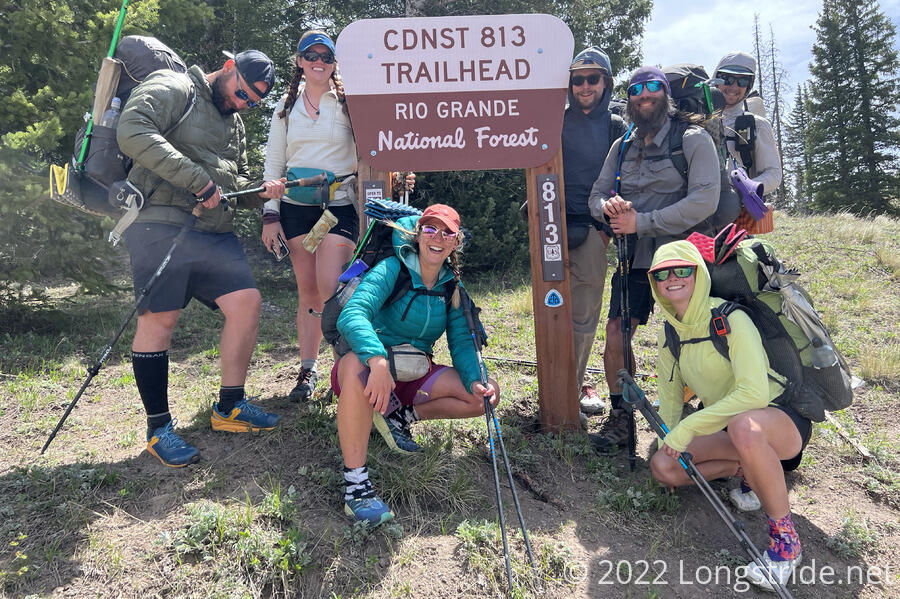
Also at the trailhead was another eight or so hikers; apparently this was a popular time to start hiking today.
The difference in the trail and scenery between Colorado and New Mexico was like night and day. Where New Mexico (at least south of Grants) was mostly desert (or very arid), Colorado is green, with forests and trees aplenty. (Granted, the transition from desert to forested mountains would have been a lot more gradual had we been able to hike here all the way from Grants.)
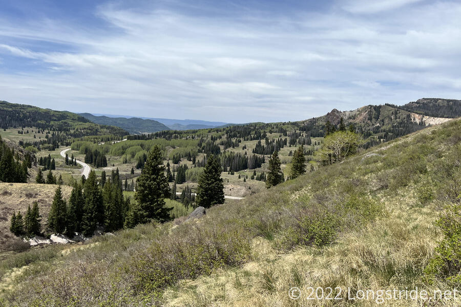
The forests were pine forests, though it wasn’t clear if there were more live trees or dead ones (due to bark beetles, is my understanding). Regardless, it was much greener than it had been anywhere else on the trail so far.
It also didn’t take very long for us to get to the first snow on the trail, in a shaded spot just a couple minutes north of the trailhead.
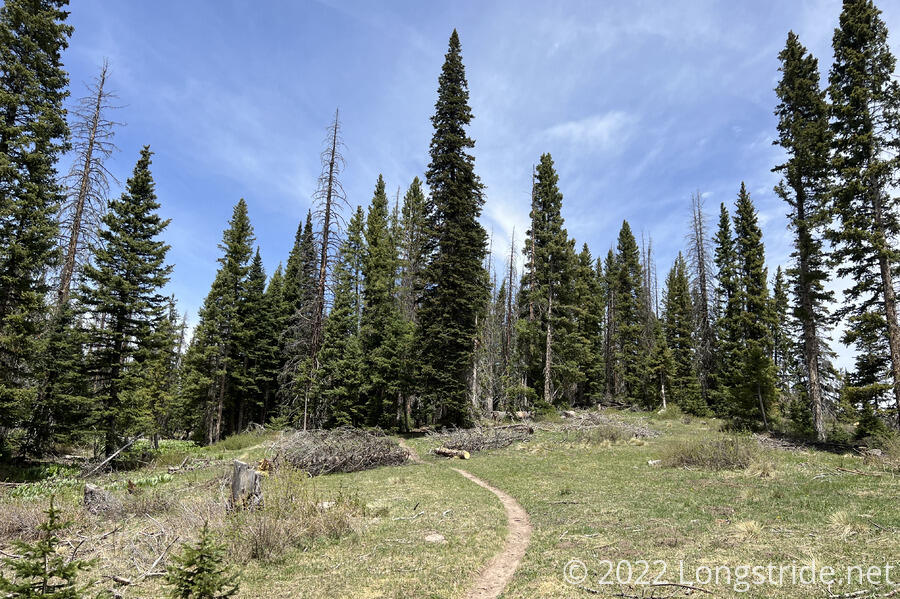
The trail wound through the hillside, passing a few creeks (flowing water on the trail, another departure from New Mexico) and waterfalls.
After not quite three miles, we stopped for a break on the side of a hill for about half an hour. Many of the other hikers that had been at Cumbres Pass with us passed by while we were there. (We later passed them while they were stopped for their own break.)
When we finished our break, everyone else zoomed off, but I was slow today. Part of it was my pack burdened with extra weight (microspikes, snow gaiters, and an ice axe), but the altitude didn’t help either. It was hard to breathe — after a week not really doing much in Albuquerque, at around 5,000 ft, jumping up to Chama at 7,800 ft for a day, and then starting hiking at 10,000 ft — I wasn’t really acclimated to the altitude at all.
But at least the views made the effort worth it.
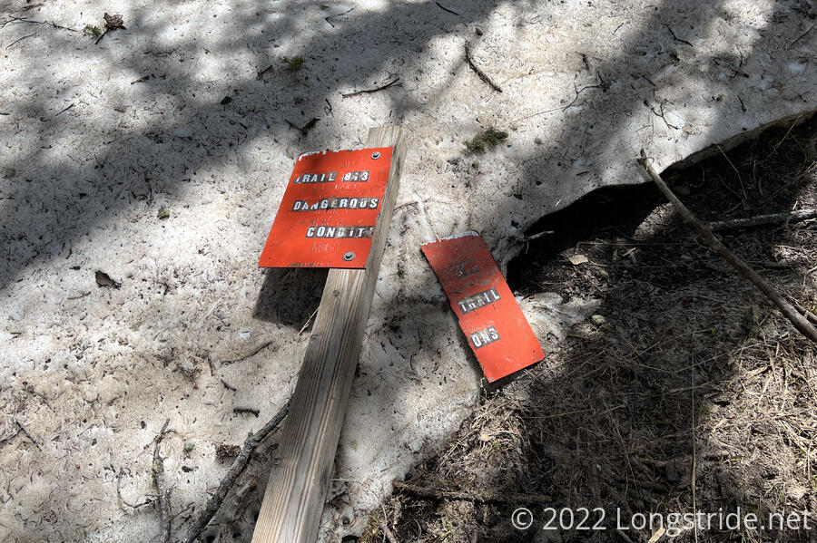
In the middle of a small snow field, a sign warning of dangerous trail conditions laid broken on the ground. Probably this referred to the number of dead trees, but the sign itself being broken seemed an ominous warning of the trail to come.
We stopped again at a creek after a couple more miles. From there, the trail ascended out of the forest.
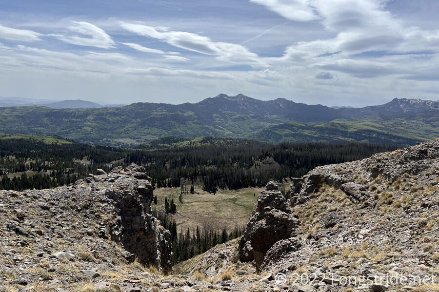
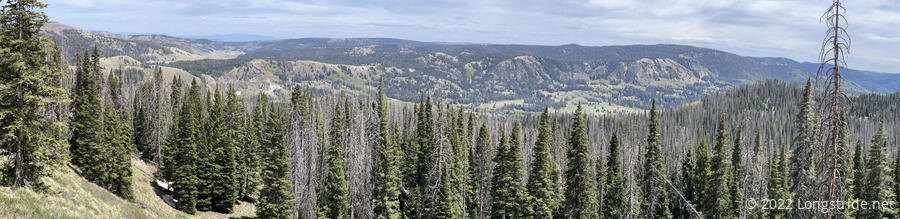
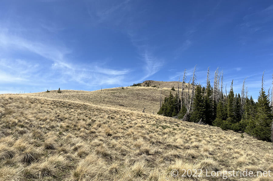
The trail followed along the edge of a cliff along a bald. With pretty high winds, I skipped walking right along the edge, and instead cut directly up the hill. Miscalculating a bit, I followed an old trail heading up, but in the wrong direction, and then corrected to head towards the trail, taking me into the forest a bit above the trail, forcing me to bushwhack down to where I needed to be.
Back in the forest, there were a number of fallen trees blocking the trail. Most weren’t that big of a deal to cross (though tiring to climb over), but one of them, a mash of two or three trees, was too much to handle, and I had to take my pack off in order to make it through.
A short while after that was the first time the trail crossed snow of any consequence. I was pretty tired by this point, which made it a bit difficult to cross. It wasn’t anything particularly dangerous; slipping would just send me into trees next to the trail, but it was more effort than I’d wanted to put in.
After stopping for a break (poorly sheltered from the wind by a couple of short pine trees), i continued climbing through the mountains, slowly, exhausted and somewhat out of breath. As I was climbing along the side of a mountain on a snow bank, I saw two tents below.
The rest of the group had found a campsite seemingly sheltered from the wind, and had set up about half an hour before I got there. I was glad they did; our original plan had been to go further, and I was happy to stop earlier than planned. Including breaks, it took six and a half hours to travel nine miles, which was incredibly slow for me.
I said “seemingly” sheltered from the wind. While it might have been less windy when everyone else stopped there, the wind shifted directions and kept gusting all evening.
Before I’d gotten there, the wind blew Patches’ air mattress away and into a bush, poking it full of holes. After I set up my tent, I went to get water, and returned to find my tent had collapsed — the wind pulled several of the stakes out. I hadn’t yet put anything in my tent to hold it down, so Patches put my pack on my tent to keep it from blowing away.
After re-staking my tent, I cooked dinner, but my macaroni and cheese didn’t turn out too well, thanks to the altitude. I was too tired (and the sun had already set) to also cook ramen.
During dinner, two fire-fighting aircraft flew overhead, one of them quite low. We suspected they were related to a fire near Pagosa Springs. (This fire is significantly west of the trail, and so shouldn’t cause us any problems.)
The wind continued. Another of my stakes pulled out, collapsing my tent again (though this time it was not in danger of blowing away). I fiddled with the staking a bit more, lowered my tent’s height, and sunk my trekking poles into the dirt, rather than using rubber pole tips, to provide extra support. (My tent is given structure by two trekking poles and six required stakes. Normally, I use rubber pole tips to prevent the metal tips on the trekking poles from being damaged by rubbing on the ground.)
We’re expecting it to be freezing tonight, and snow is forecast for tomorrow, so tonight and tomorrow look like they’re not going to be lots of fun.
My resting heart rate is somewhat elevated from normal, which I suspect is due to the altitude. I’m not terribly concerned about it now, but it’s something I’ll be keeping an eye on, and hopefully it should drop as I get acclimated to the altitude.