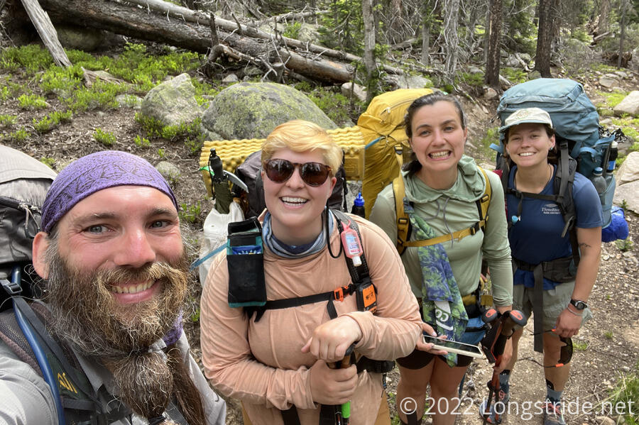
Today, four of us left the Butterfly House, resuming our northwards hike.
The Butterfly House, being a hostel, was effectively town, and thus none of us got up early or got ready to leave very quickly. Breakfast was leftover pancakes from last night. We finally left and headed back towards the trail shortly before 9 am.
I led Pale Ale, Sprouts, and Stumblebee back to the trail the way I came. (Having all gotten to the Butterfly House by other means, none of them had come this way.) Fortunately, it wasn’t a complicated route, but the signs yesterday that pointed towards the Butterfly House did not have counterparts pointing back towards the CDT.
On the snowmobile path back to the trail, we saw a hummingbird. Later, on the road leading to the Boss Lake parking area, I noticed that a couple of private driveways had gates fashioned out of a tree branch. From one direction, it appeared simply as though it was a fallen branch blocking the road; when viewed from behind, it was clear that the branch was actually hinged to a tree, and could be easily swung out of the way. I thought it was pretty clever to make the gates appear as though they were entirely natural.
About an hour after we left the hostel, we made it back to the CDT, and began an almost 2,000-foot climb up the valley of the Middle Fork South Arkansas River, to Chalk Creek Pass, starting off with a nice series of switchbacks.
The trail this morning felt like it was a lot more forested than it had been before. I didn’t see any particularly obvious reason for why; the trail wasn’t any lower elevation than it had been.
After passing through a rocky expanse, I stopped for a break at a shaded flat area adjacent to the trail. The rest of the group passed me, planning to stop at a creek on the other side of Chalk Creek Pass.
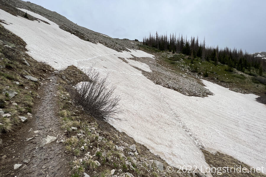
I caught up with Sprouts and Pale Ale as we neared the pass. The trail again became an expanse of rocks. The trail through the rocks was in some places a bit subtle; I thought it was fairly clear where to go, but if you tried to go too fast, it would have been easy to lose sight of where exactly the intended trail went.
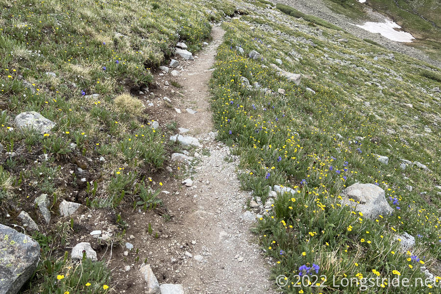
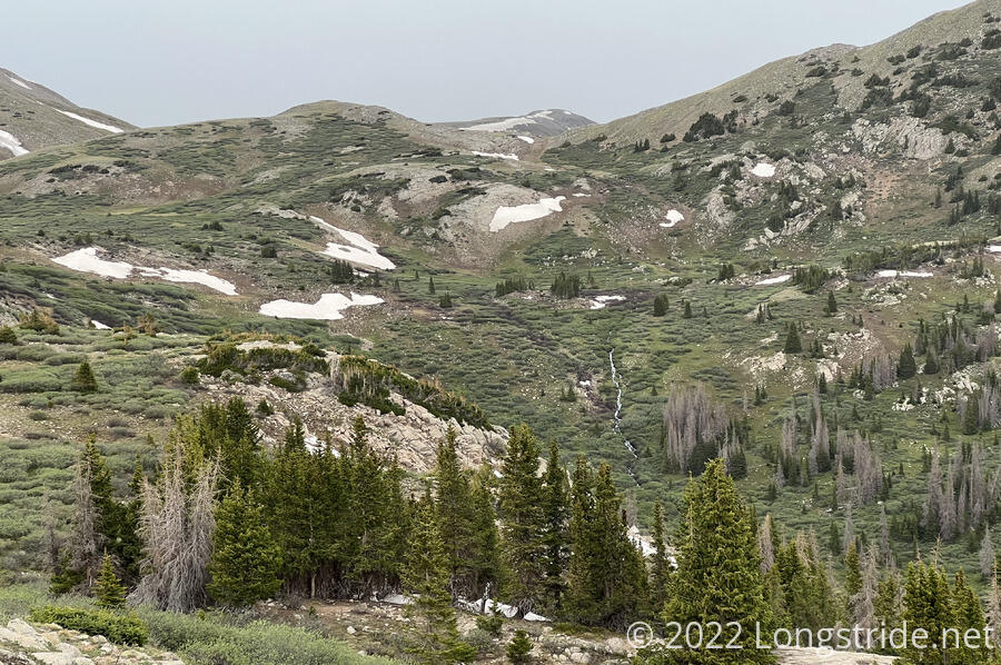
Descending the north side of the pass very quickly lead to a nice grassy area with wildflowers. Most of the valley, in fact, looked to be covered in grass, with a few lakes thrown in for good measure. Even from the top of the pass, I could see that some of the lakes had people fishing at their shores.
On the way down from the pass, Stumblebee sprained her ankle. Needing a break, she was about to sit down on a bit of a flat area, but noticed a sign facing the other direction asking people to stay on the trail to protect the alpine environment. I went ahead looking for a decent flat spot on trail below the sign we could sit down at; I found a reasonably suitable place another minute or two further down the trail.
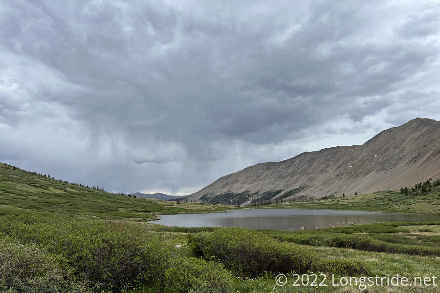
While we sat, it rained in the distance from dark clouds on the horizon, in the direction we’d be hiking. We hoped the clouds were not coming in our direction.
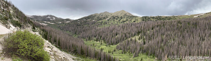
After following the valley downhill for a while, the trail joined a path that used to be an old railroad line and began climbing back up. The former railroad right-of-way appeared to have been blasted out of the steep mountainside. It reminded me a bit of the Kendall Katwalk on the Pacific Crest Trail in Washington, though the railroad cut was less dramatic.
A sign told of some of the former railroad’s history. In the area, trials were conducted for a new type of railroad snowplow to keep the tracks clear; the unfortunate new machine derailed three times during the trials (which it failed at), and again when it was sent away.
Probably due to the relatively gentle grade, much of the trail here was covered in melt water from snow. It was a challenge to keep my feet dry.
There were only two notable snow traverses today, both near each other as we continued to climb up a mountain.
The first covered the trail as it went around the inside of a curve. A few distinct paths through the snow had already been worn; I chose the middle one that had a short bit of snow and a bit over rocks.
As I was making my way across, I noticed a mountain biker very slowly walking his bike across the rocks above the snow. I wondered what he was doing all the way up there. He made it across and sat down for a rest shortly before I made it across.
This was Mark, 76 years old, who was out with his (much) younger nephew, Ian, who was somewhere ahead. Mark had walked his bike around the snow on advice of two other guys that were heading in the other direction, who said to “go to the left”. This turned out to be much more difficult than it needed to be, especially since he had bike shoes on, which don’t work so well on rough ground. It was unclear why they suggested Mark take that route.
The rest of the group caught up, taking (what I thought to be) a more difficult path through the snow, and we chatted with Mark for a bit, before heading on ahead of him.
The second snow field was a bit more of a challenge. It looked at first like we might actually want to use our microspikes and ice axes, but here, the “go to the left” suggestion actually made sense, and we found a much more reasonable path through the snow. For Mark, though, even the “easy” path through was going to be more difficult because he had a bike and shoes not at all meant for walking over rocks. We decided to wait for him; Pale Ale called out positive affirmations of encouragement.
After a little while, Ian appeared from over the ridge, coming back to check on Mark, since Mark was taking longer than expected. He walked down to where Mark was, picked up his bike, and carried it, with one arm over his head, up the hill.
Once Mark made it up the hill, we chatted a bit more, and then parted company; Mark and Ian were taking a different route over the mountain, heading south towards an old railroad tunnel, while we headed west.
We continued a bit more, stopping in a smallish flat area barely big enough for our four tents, just before a creek that crossed the trail.
While we were waiting for Mark to make it up the second snow traverse, a light rain began to fall. The rain continued for a while into the evening; we all cooked from inside our tents to stay dry.
Since we left the Butterfly House somewhat late in the morning, and had a two mile hike back to the trail, we only advanced twelve miles up the CDT. I expect tomorrow should be a lot further.