A thunderstorm and inconvenient terrain significantly shortened today’s hike.
We left our campsite around seven, continuing up the side of a mountain to go over a pass. Thanks to the rain from last night (and also the melting snow higher up), the creek near our campsite was overflowing its channel, flooding the trail. Willows adjacent to the trail made it a bit tricky to cross the creek without getting wet. (I managed by carefully, and quickly, stepping on some willow branches and a rock, before water could find its way into my shoes.)
The rain did, however, give the mountainside a bright green color, and it was an enjoyable start to the day. The soil was so saturated with water that, just below the trail, a spring emerged from a hole in the ground.
I passed Sprouts, Pale Ale, and Stumblebee separately on my way up to the pass. Afterwards, with a small bump in the middle, the trail dropped over a thousand feet over three miles, along a rather delightful stretch of very well groomed switchbacks. This made for fast hiking, with only a couple of blowdowns to slow progress.
After crossing a creek on a bridge, I followed alongside the meadow surrounding the North Fork Chalk Creek, arriving at Tincup Pass, where the trail crosses a dirt road.
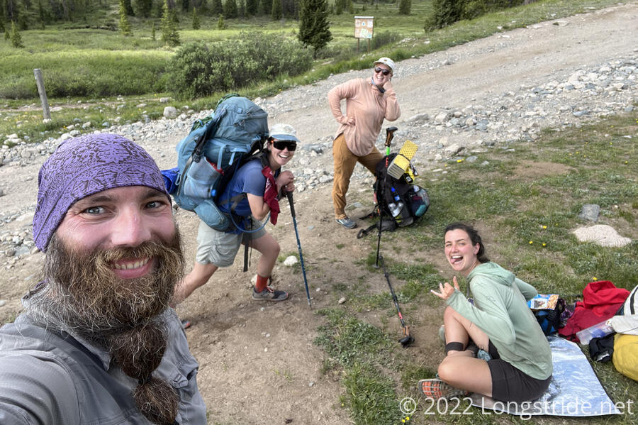
I stopped for a break at the pass. Stumblebee caught up shortly after. Pale Ale and Sprouts were further behind than we expected; Stumblebee summoned them with the time-honored trick of unpacking her pack to get her tent out to let it dry. (They showed up almost immediately afterwards.)
At Tincup Pass, the CDT heads north along a relatively high route generally on the east side of a ridge. Also from the pass is the Mirror Lake Alternate, which takes a lower route along the dirt road, generally on the valley floor on the west side of the ridge. It was here that we’d temporarily part company with Stumblebee: she had some work she needed to do, and needed some solitude to do it. So she decided to take the Mirror Lake Alternate, and will meet up with us tomorrow when the alternate rejoins the CDT. (It’s a little shorter, but only just, so hopefully, we should all get there at roughly the same time.)
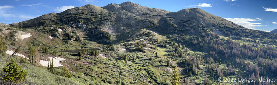
From Tincup Pass, the trail climbed up steeply. A set of switchbacks gradually brought us up above the treeline and up to a saddle.
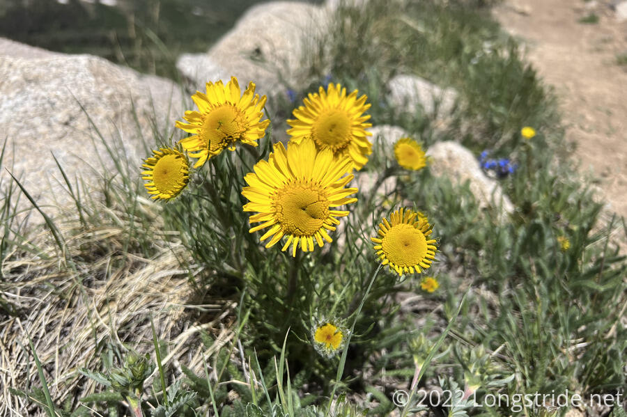
Along the way, flowers that looked like tiny sunflowers lined the trail.
After crossing the saddle, the trail followed an inside curve along a mountain, continuing to climb, and passing through a short, but sketchy, snow traverse. The main difficulty was that the snow had melted just enough that there were significant voids around rocks, requiring me to be very careful where I stepped. It was slow, but the section was short, so it was more like an interesting spice to the trail.
Less short was the rocky section that continued after the snow had been melted away from the trail, but it wasn’t long enough to cause any significant problems.
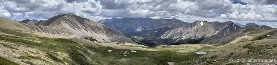
After just under 2,000 feet of climbing in just under four miles, the trail reached a pass, and I stopped for a break, mostly because there was cell service at the top, but also because it was a long climb. Pale Ale and Sprouts caught up after a while, but their break was short-lived. A dark storm cloud approached from the south, and on top of a ridge was the last place we wanted to be.
We hurried down from the ridge, stopping at a flattish area just before a creek so Pale Ale and Sprouts could actually have a break. This was the lowest we could go on the trail before it took us up towards the next ridge we needed to cross. We hoped this would be enough to keep us safe from what looked like fairly ominous clouds.
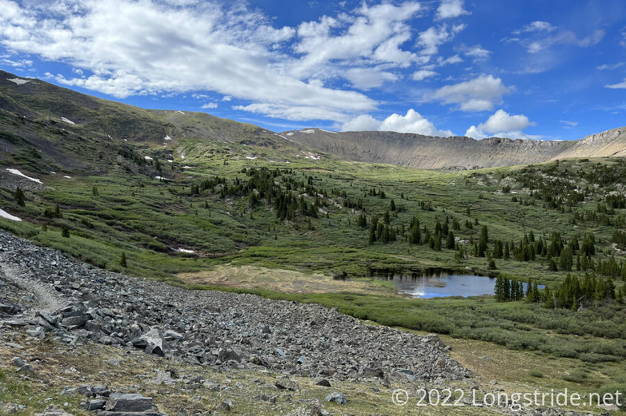
A sign nearby prohibited camping too close to a nearby lake, and asked that people stay off the fragile alpine tundra. We tried to pick a spot that would be the least impacted from us sitting down for a bit.
A light rain started as the clouds came closer, and we put on our rain jackets. In the distance, three fighter jets flew by.
The rain and the wind picked up, along with a little thunder, and we tried to find a more sheltered spot. We relocated up the hill a little, in front of a rock. Sprouts had picked up a tarp at some point, and we strung it up to form a windbreak.
The wind and rain continued to pick up, and it got fairly cold. I wished I had my gloves on, but they were buried in the bottom of my pack.
We huddled under our improvised shelter for most of an hour, until eventually, the wind and rain passed, and we started our way up to the next ridge.
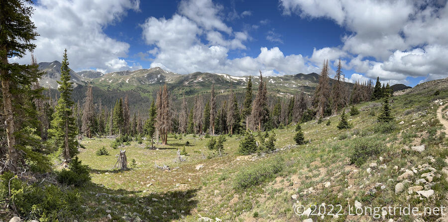
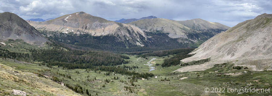
Once we made it up and over the ridge, we were treated with a scenic river valley. A portion of the trail here was rocky, and all of the rocks looked dry. It seemed as though the storm that hit us was confined to the valley that we were in at the time. If that actually was the case, then we probably could have hustled our way up and over the ridge before the storm really hit us.
However, doing that probably wouldn’t have helped us in terms of getting to a campsite.
A little after five, we passed a creek with a couple of possible campsites. Pale Ale and I continued on a little bit beyond that, but then backtracked to those campsites, and got there just as Sprouts caught up. We were able to see the trail for a few miles ahead, and it seemed pretty clear that there were no campsites anywhere we could see ahead.
Beyond that, the trail follows the ridge for several more miles, and it seemed pretty unlikely they were going to be any campsites there either.
We hiked just short of 13 miles today, which was a little disappointing, but there really wasn’t much that we could do about it.
Our short day today meant we still had 14 miles to go before we would reach the intersection with the Mirror Lake Alternate, where we planned to meet up with Stumblebee. The three of us decided that we would try to do about 19 miles tomorrow, and that we’d leave early (6 am!) so Stumblebee wouldn’t have to wait too long for us.
I set an alarm for 4:45 am, and turned in early so that I could actually be somewhat rested tomorrow morning.