A somewhat rainy day brought me to the south end of Waterton Lake for some surprising trail magic within eyesight of Canada.
It rained a little overnight, but not so much that my tent was too wet. Still, though, a little sprinkling of rain just as my alarm was going off delayed me getting out of my tent by ten minutes.
But the weather forecast was calling for rain most of the day, so once the sprinkling stopped, I finished packing everything up as quickly as possible to take best advantage of the temporary lack of rain. It was cool enough out that I kept my rain jacket on for warmth.
The climb from the campground back up to the trail went quickly, and soon I was again heading downhill. For a short while, the ground was rocky, but changed back to dirt once I got far enough away from Swiftcurrent Pass. With the clouds, it had all the makings of a dreary day, similar to last week in The Bob, but with one key difference: I’d be in Canada tomorrow, “done”.
The trail followed the folds alongside of Swiftcurrent Mountain and Iceberg Peak for several miles, gradually bouncing up and down as it took me north, and then eventually, northwest.
Starting a bit later than everyone else, I was somewhat behind. About an hour after starting, from across a valley, I could see Fuck-It’s bright orange poncho and pack cover from over two trail miles away.
For the first couple of miles, a light rain fell on and off. It wasn’t anything significant, except that the ground plants alongside the trail now had more moisture on them. After about two hours, the rain stopped, and I took the opportunity to take a quick break.
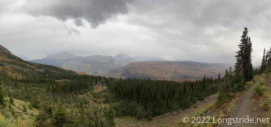
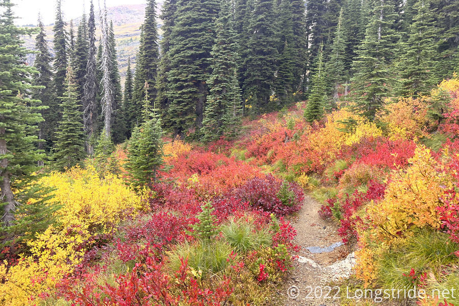
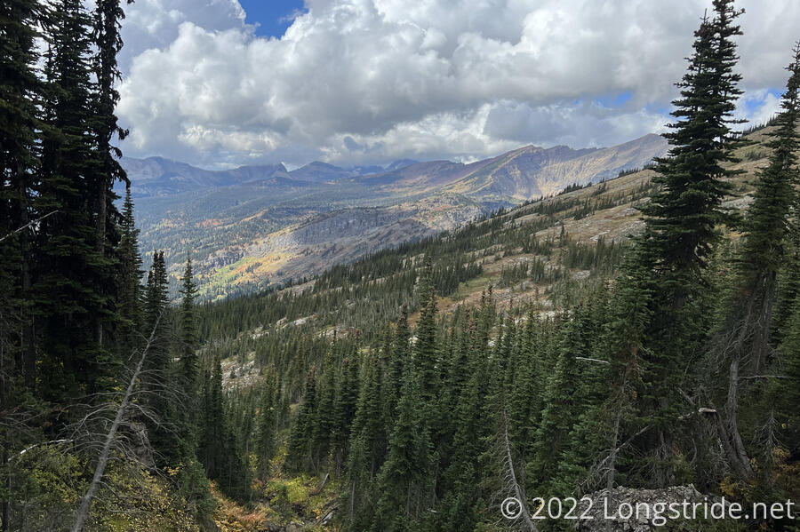
With winter gradually approaching (and the trail gradually heading northward), each day, the foliage around the trail has been taking on more fall color. With the bleakness of the sky, and perhaps enhanced by the rain, the colors today are even more vibrant then before.
As I continued to wind my way north, the rain stopped again and the clouds started to clear, little by little.
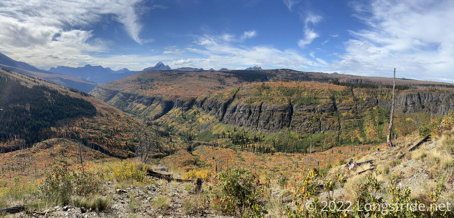
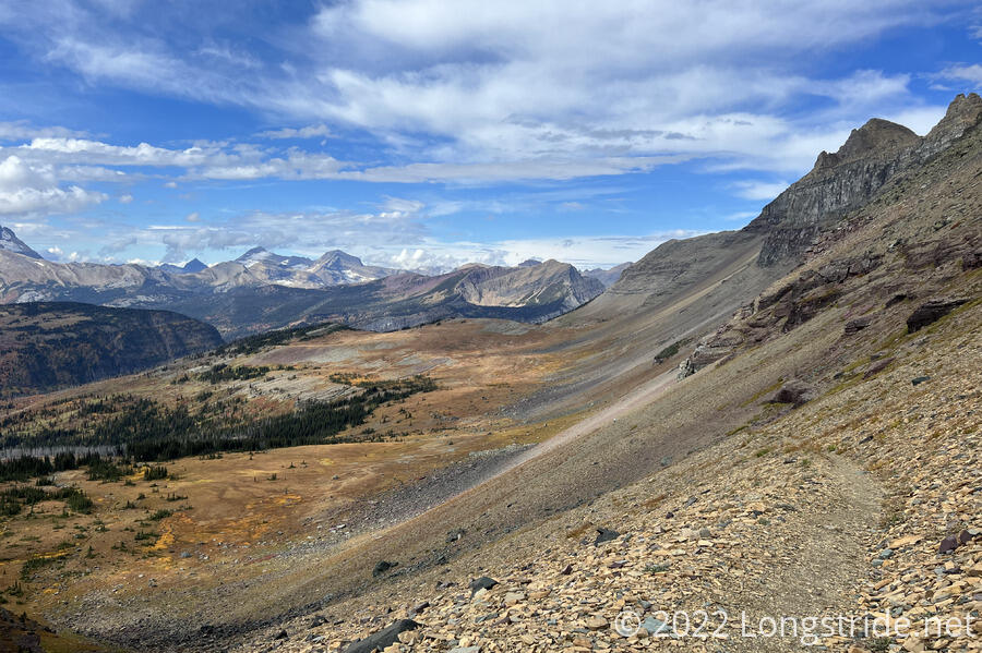
For much of the morning, the trail paralleled Flattop Mountain, a long and wide, but relatively flat mountain dropped in the middle of a larger valley. A deep valley separated the CDT from Flattop, and it looked rather striking once the trail got close enough for me to recognize it as such.
The clouds thinned enough for the sun to shine fairly brightly, and it warmed up considerably. With the rain earlier in the day, it was now quite humid, but I was happy to take the humidity over the rain.
The trail stayed above the treeline for a while, and the late morning and early afternoon had great views of Flattop and other mountains in the area, culminating in a walk along a steep rocky slope before the trail dipped lower to actually remain hikeable. The colors and slope a little bit reminded me of parts of the Pasayten Wilderness at the north end of the PCT.
I stopped for another short break just past a campground, partway up the last significant climb of the day. I saw Fuck-It and Wild Man in the distance; Sprouts and I played leapfrog. Clouds started brewing over the ridge to the west, and it seemed like it would rain again soon.
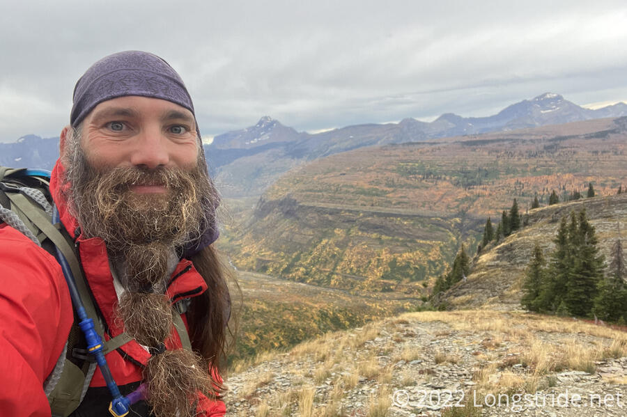
Completing the last significant climb of Montana, I tried to pick up my pace on the downhill afterwards, as the trail quickly descended into forest. Twice, I misstepped with my left foot, nearly spraining my ankle both times. It didn’t help that my shoelaces kept coming undone, being both a trip hazard and sprain risk. Just another sign that I’m mentally and physically ready to be finished the trail.
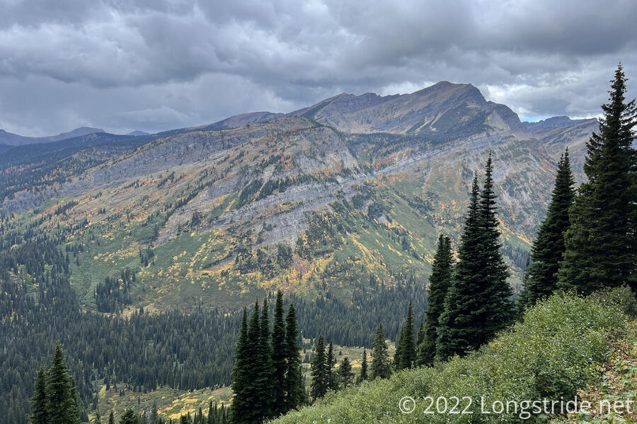
The view west to Kootenai Peak was one of the last views I got today, as clouds quickly blew in. When I had views to the south, I could see a wall of rain gradually working its way up the valley.
The trail curved around a few folds in the mountain, and I hoped I’d get a good view of Waterton Lake from above. Unfortunately, that never happened; the trail dropped too quickly to the valley floor, still several miles away from any potential viewpoint to the lake.
Light rain started, and then picked up with thunder just as I entered a forest that was over almost as soon as it began, just a thin stripe down the mountain. Respite from the rain came in the form of a forest service cabin with a roof overhang and some logs that served as stools and benches. Fuck-It and Wild Man were already there, attempting to stay dry and “dry out” their wet rain gear.
We waited out the rain there for an hour, moving on when the rain stopped, just as Sprouts arrived.
From the cabin Waterton Lake, the trail was relatively flat and gentle, but narrow and overgrown. We got soaked fairly thoroughly from the plants. The four of us started to hike as a group, but I kept having to stop to tie my shoe laces, letting Wild Man and Fuck-It sprint on ahead, and Sprouts eventually fell behind at a stream crossing.
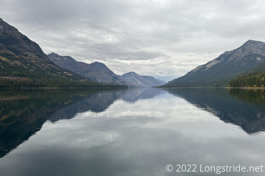
About quarter to six, I arrived arrived at Goat Haunt Ranger Station. On Waterton Lake, it had a beautiful view across the lake into Canada. The border to Canada (and the northern terminus of the CDT) was only four miles away, though the terminus itself was just out of sight, hidden behind the curvy coast of the lake.
Our plan for the day was to go a little further, to the Waterton River campground. But Wild Man and Fuck-It had already run into the ranger at Goat Haunt, and he was happy to let us stay there, in a large covered pavilion, with picnic tables and ample floor space. He even brought out a beer for us! With electricity for lighting, the pavilion was quite an unexpected and spectacular way to end the last night on the trail.
There was electricity because Goat Haunt also serves as a US border entry checkpoint. At one time, several boats per day came across the lake from Waterton Park, in Canada, bringing tourists. Those boats stopped a few years ago, and border entry is now accomplished through smartphone apps, but the customs infrastructure (and signage warning not to proceed past the ranger station without being approved) remains. Presently, he and a few wildlife researchers were the only inhabitants, but even they were leaving soon as the park shuts down for the winter.
The ranger chatted with us for a while, telling us more of the history of the area and his job here. As a bonus, he let us dry out our clothes in the complex’s power house. A pipe channeled water through a generator that provided power for the several buildings. But unused power had to go somewhere, and that somewhere was a bank of space heaters on the walls of the power house. He turned up the water flow and the room (already loud) became even more so, and very quickly heated up. We all took the opportunity to dry out our wet clothes, rain gear, and boots, and I also dried out my sleeping bag. Not even an hour and a half later, after I’d finished dinner, my clothes and sleeping bag were bone dry.
Once the opportunity to stay at the pavilion opened up, my body immediately became sore, as if to say, “Don’t even think about hiking further today!”. Tomorrow will be 19 days since my last zero in Helena (a record for this trail), and it’s past time for a break.
For the first time since that zero, I set no alarm. We’re going to wait for Bass, Recon, Stumblebee, and Velveeta tomorrow before we head out to the northern terminus, only four miles away.