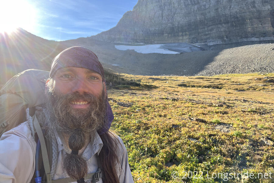
A long day over Triple Divide Pass and through glacial valleys and burn scars, the beauty of Glacier National Park continued to impress.
A bit cool out and a little damp this morning, I was a little slow getting started, but not by too much. The same couldn’t be said for most of the people who cowboy camped at the hitching post. Apparently, it was quite humid outside, and all their stuff was soaked. Wild Man was in particular rather grumpy about it. (Wild Man and Fuck-It did leave before me, but I left camp before everyone else.)
Leaving only 15 minutes after sunrise, the sun stayed below the ridge to the east for quite a while. From Atlantic Creek Campground, I continued west up the valley, soon climbing up along the steep side of Mt. James. The forest quickly thinned as the trail charged up the side of the mountain. About an hour after sunrise, I’d climbed high enough for the sun to climb above the ridge to the east. (It quickly started to warm up once I was in the sunlight.)
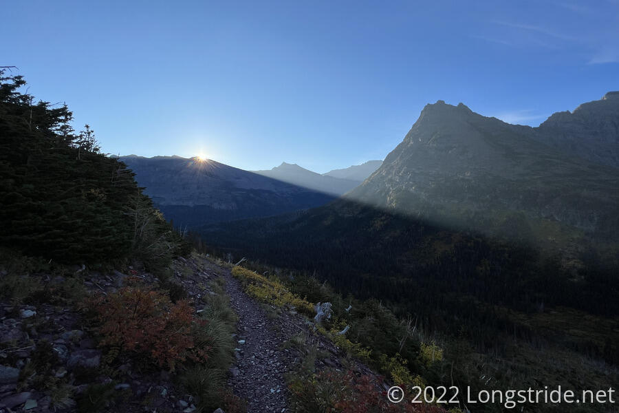
Locations further down in the valley remained in shade substantially longer; it wouldn’t surprise me if there’s some places in the park that don’t get direct sunlight at all closer to winter, as the sun’s maximum height above the horizon decreases.
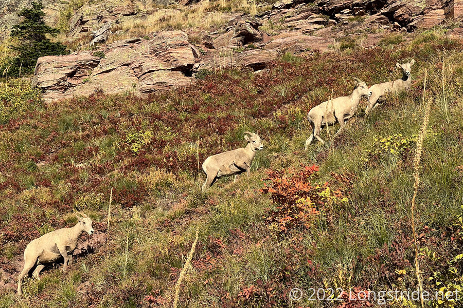
Shortly after stepping out of the shade, I saw a family of four bighorn sheep grazing on the trail. (These were the first sheep I’ve seen on this trail.) They were less skittish than I expected, but they quickly got out of the way as I got closer.
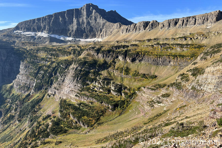
From the sheep, it took another hour to finish climbing up the valley to Triple Divide Pass. The valley’s headwall was quite interesting; it appeared to have several levels of terraces, and several long creeks and waterfalls flowing down its face towards Medicine Grizzly Lake, the valley’s tarn which drains into Atlantic Creek. Several paths cut across the headwall, and it was hard to tell if they were made by people, or perhaps sheep.
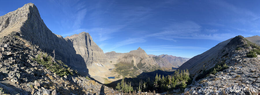
I reached Triple Divide Pass to find Wild Man taking a short break, contemplating how to accomplish a summit of Triple Divide Peak. The peak’s summit is the hydrological apex of North America, and the only place in the world which drains into three oceans (the Atlantic, Pacific, and Arctic oceans).
Before the hike, I’d contemplated summiting the peak, but it seemed too steep to accomplish. Yesterday, looking at topo maps, Wild Man got the idea that it would be possible to summit, because the peak is “only” a quarter of a mile off-trail (albeit 600 feet up, which makes it excessively steep). Looking at the topo map myself, it looked vaguely possible.
Actually being at the pass, though, made it clear that there was no way to climb up to the summit. Or rather, it looked like, maybe someone could do a very steep rock scramble to the top, but coming back down would be a much more difficult challenge.
I kept going, heading north into the valley of the peak’s arctic drainage. Wild Man consoled himself by pissing into two oceans from the pass, rather than three from the peak.
From the pass, a series of steep switchbacks led down, with faint trails leading off along this valley’s headwall. I suspected these were almost certainly from sheep, and not hikers. Further down, I could see Fuck-It, a tiny speck against the valley floor. Later, I caught up with and passed him.
Dropping down into the valley put me back in shade, with the sun below the ridge that made up Triple Divide Pass. Twenty minutes later, coincidentally as my 10 am selfie alarm rang, the sun emerged over the pass.
Once down on the valley floor, the trail followed Hudson Bay Creek, and then Red Eagle Creek, crossing those creeks and several smaller tributaries along the way, twice over long wobbly one-hiker-at-a-time suspension bridges.
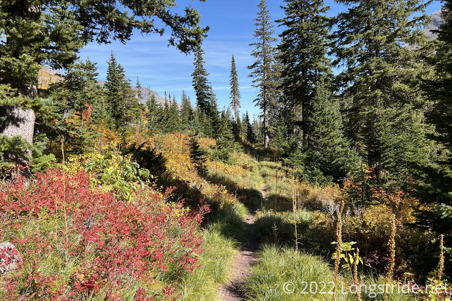
A vibrant forest with evergreens and fall colors abruptly transitioned to a devastated burn area, as the trail reached the southern extent of the burn scar from the 2006 Red Eagle Fire. 16 years later, the forest did not seem to have recovered much.
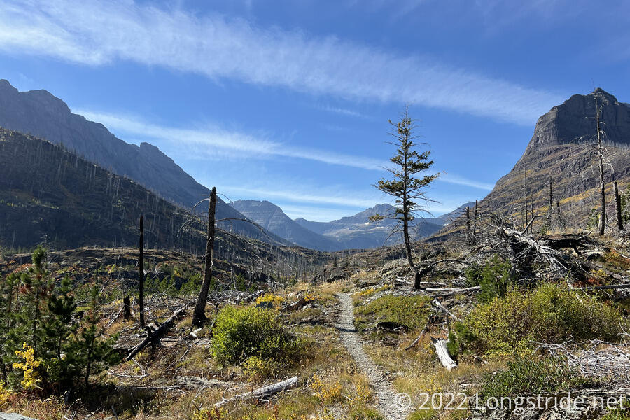
Red Eagle Creek flowed into (and out of) Red Eagle Lake, a large oasis in the burn area. A handful of trees clustered around the head of the lake provided some shade, and made for a great campground (and spot to relax). The trail skirted the eastern side of the lake, along a short but steep slope, and continued meandering through the burn scar above the creek for a while.
Tipped off by Mr. Freeze back in East Glacier Park, I took a shortcut. Departing from the CDT, I took a faint trail that led through some tall grasses and down to Red Eagle Creek, which I forded. A very steep climb up the riverbank returned me to the CDT on the other side of the river, a quarter mile shortcut to save hiking a mile further downstream (and then back upstream) to cross the creek on a bridge. The trail here was otherwise nearly flat, but skipping two miles through a burn area seemed like a smart choice.
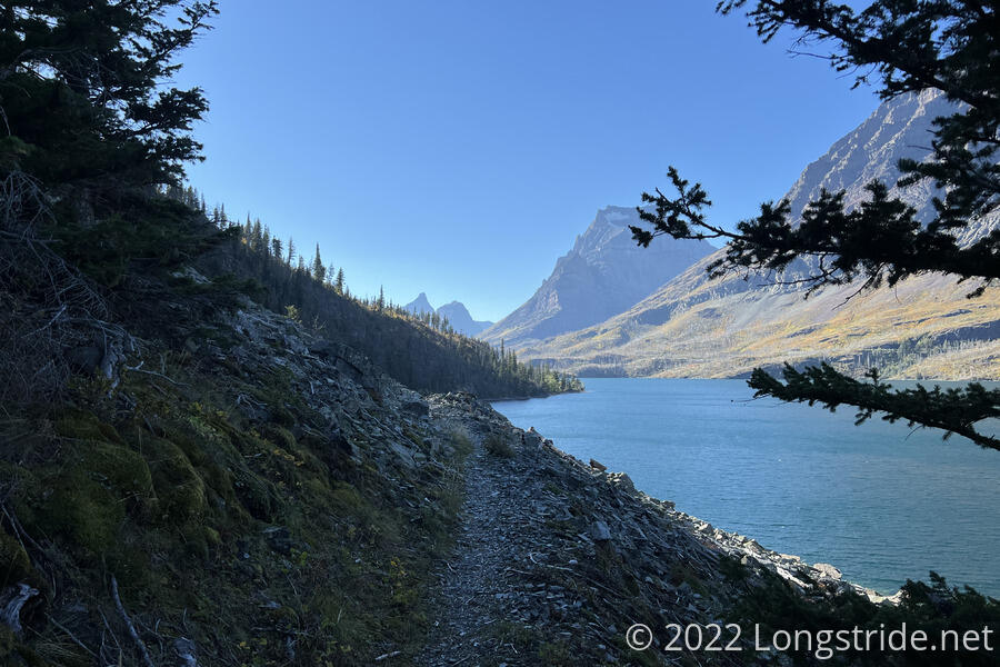
Continuing to jog through the burn area, the trail approached Saint Mary Lake, a roughly nine-mile-long lake located near the eastern boundary of Glacier. Turning west, the trail followed the lake’s southern shore, but usually from a distance, and often a couple hundred feet above the water surface.
I saw a few boats zoom past. On the far side of the lake, cars glinted in the sunlight as they drove along Going-to-the-Sun Road, a major east-west route through the park.
The trail along the lake was a significant slog. Views to the south were obscured by the side of Red Eagle Mountain. Heavy tree cover limited views the mountain didn’t block. The lake was an unchanging blue expanse, except for a small protected bay and a couple of rocky islands.
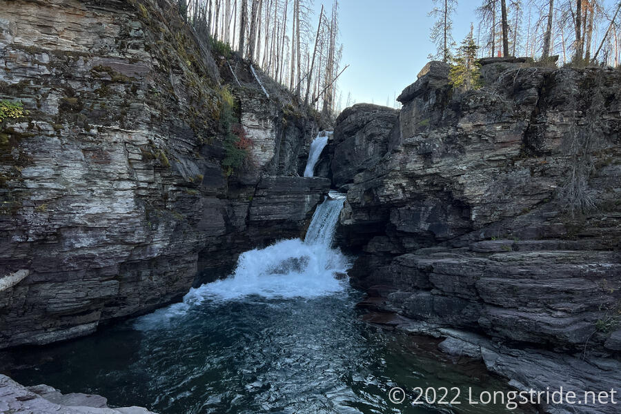
Once I passed the northern end of the lake, I saw my first day hiker of the day, at a series of waterfalls and the trailhead to a viewpoint for Virginia Falls. The view point was less than a quarter mile away, but nearly 6 pm, I was getting tired, and was ready to be done for the day.
From the waterfall, the trail was suddenly amazingly nice, a clear signal I was now in a tourist area. In short order, I passed four more day hikers, and then many more, as well as a couple more waterfalls. The waterfalls culminated with Saint Mary Falls, on the inlet for Saint Mary Lake, and then the trail took me uphill towards the trailhead off of Going-to-the-Sun Road.
Back in a burn area, the CDT turned off onto the Piegan Pass Trail, which immediately became an overgrown hiker trail and led me upstream along the Saint Mary River and across a bridge to the Reynolds Creek Campground. Along the way, there were quite impressive mountains on both sides of the valley, but it was a shame I was looking through them through so many dead trees and fading light as the sun dropped behind the mountains.
Once again, I was first to camp. Like yesterday’s campground, this one also had three tentsites. One of them was already occupied, its occupants already turned in for the night. The other two tentsites were terrible. One was small, and a little uneven; the other next to the horse hitch and bear hang pole. I again set my tent up in the least-bad spot, tight in a corner so there’d be as much space as possible for everyone else.
Wild Man was next to arrive, a good half-hour after me. The rest of the group gradually trickled in, with Bass and Stumblebee arriving almost at nine, once it had gotten cold and dark.
Tomorrow, due to campground availability, we split into two groups. Fuck-it, Wild Man, Sprouts, and I will take the lead, with a 23 mile day to a campground near Granite Park Chalet. The day after, we’ll stop at Waterton Lake, just four miles from Canada. Bass, Recon, Stumblebee, and Velveeta will have a much shorter day to the Many Glacier campground, and will meet up with us on Friday at Waterton Lake.