Today we finished the island of Lanzarote, hiking from Montaña Blanca to the port in Playa Blanca.
Last night, CareFree and I, after going over logistics for the next island, Fuerteventura, decided that if we were having a good day today when we reached Yaiza, our intended stopping point today (“only” 17 km), we’d continue on to Playa Blanca, another 15.5 km, to finish the island a day early. That would let us squeeze in a short section of trail tomorrow on Isla de Lobos, a small island just off the coast of Fuerteventura. It would be a long day early in our hike (a little over 20 miles), but otherwise we’d have to risk skipping that island due to time restrictions and the shorter winter schedule for the ferries to and from the island.
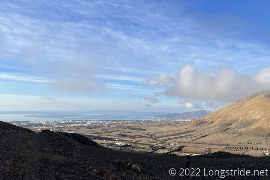
We again made as early as a start as we could, departing Montaña Blanca a little after 8:30, and almost immediately began a moderately steep climb up the mountain southwest of town.
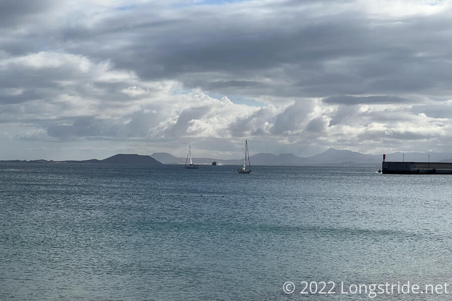
The climb led to what felt like our first really clear mountain pass. At the top, a saddle between Montaña Blanca to our left, and a smaller hump to our right, we got a view back to Arrecife. Ahead, we got our first sighting of Fuertevenura and Isla de Lobos.
The weather again was nice, in the mid-60s, though there were a few more clouds, and it felt more humid.
Descending from the pass on a dirt road, we missed where the trail turned off the road and wound up following another dirt road that roughly paralleled the trail; we rejoined the trail at its intersection with the road.
The trail then made a sharp right turn onto another dirt road, and for the next hour, ran in a roughly straight line, with houses or farms on either side of the road, and usually a clear view both to the ocean, as well as a mountain pass in the distance it looked as though the trail would cross.
As we neared the crest of the pass, a light drizzle started. Noting the weather forecast last night, we packed our rain jackets for today in case we got poured on. Thankfully, even though the rain intensified slightly, it was only a light rain for about half an hour, and we just enjoyed the slightly cooler temperature and obscured sun. We’d planned to stop for a break once we reached the top, but sitting down in the rain is no fun, so we kept going.
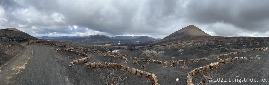
After crossing the pass, our descent went through the La Geria vineyards. Hundreds, if not thousands, of protective walls and pits had been built and dug for grape vines. I can’t even begin to guess as to how much work it was to prepare the land like this. Collecting the grapes likewise must be an enormous manual effort. It’s too bad we weren’t here later in the year, when the vines are growing; the green leaves against the black ash soil must be an incredible contrast.
On our way down the mountain, we passed the 50 km marker, and took a break once the rain around us stopped. (It was still raining further away, in the valley below distant mountains.)
The trail led us to the town of Uga, the first part of which felt like it was a vacation resort. As we went through the town center, we walked past a small grocery store that had an ice cream cooler next to the entrance. Not being people to pass up the opportunity for ice cream, we briefly stopped to get some.
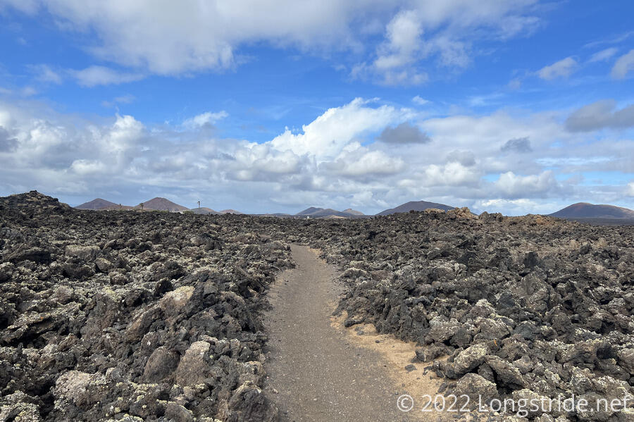
As we exited the town, the trail took us on a path through a lava field. An series of eruptions from many vents in the area near Uga between 1730 and 1736 covered a quarter of Lanzarote with lava. The only other lava fields I’ve walked through have been on the Pacific Crest Trail in Oregon, so it was nice to revisit this sort of terrain again.
The trail was cut through the lava flow, which was at least three or four feet deep above the trail (and who knows how deep below?), making the landscape a barren pile of misshapen rocks; it would be entirely impractical to hike through the lava field if not for the trail.
Leaving the lava field brought us to a paved road, which the trail followed for a mile, taking us into Yaiza. One of the busiest trail towns we’ve gone through so far, there were also lots of bikers, more than I would have expected on a Monday.
Exiting town, we climbed up a huge set of stone stairs, and followed an incredibly nice dirt road that had been built into the hillside, and which paralleled a highway on the valley floor.
The trail took us up another mountain and through a housing development overlooking the ocean, and then back down, cutting through a second lava field. My initial impression was that the lava field was “less impressive” than the one this morning, but gauging a lava field by the depth of the trail cut through it doesn’t really make much sense.
The trail reached the outskirts of Playa Blanca, and passed through an area that had been graded for roads and was in the early stages of being prepared for housing development. It’ll be interesting to see what the area looks like in five or ten years, but it probably won’t be better from a hiking and scenery point-of-view.
The dirt road ended at a sidewalk just outside the Playa Blanca town limits. We then followed the sidewalk for quite a while until we reached the town center and were deposited at the waterfront tourist area. A sign marking the end of the trail in Lanzarote was nearly obscured by a row of electric scooters.
We wandered down the oceanfront, past shops and restaurants that, even in January, had half the sidewalk taken over with seating and signs (much to the dismay of the signage and lane markers painted on the ground)
Knowing we’d need to come back here tomorrow to catch a ferry to Fuerteventura, we walked to the bus stop near the port to see where it was, and then had a quick celebratory lunch of cheeseburgers at a restaurant near the port.
We caught the (completely full) bus back to Arrecife, stopped by a food store to pick up food for dinner and tomorrow’s hike, and went out for ice cream.
Tomorrow, we head to Fuerteventura and Isla de Lobos.