We left Lanzarote today, making our way to Fuerteventura and Isla de Lobos, completing our second of the Canary Islands.
Yesterday, when CareFree and I returned to the bus stop in Playa Blanca, we found a significant line of people already there waiting, and the bus actually filled to capacity. The first several stops we passed, not everyone could get on. As a result, we decided that today, it would be a good idea to walk to the bus station one last time, rather than going to the bus stop closer to us, just to make sure we’d be able to get a seat. We were glad we did, since the bus to Playa Blanca also filled to capacity, and did not pick up passengers along its first several stops.
The section of Playa Blanca’s port used for the inter-island ferries was under construction, and had somewhat poor signage, so it took us a little while to figure out where we needed to go.
From Playa Blanca, ferries to Fuerteventura go to the port in Corralejo, a roughly 25 minute ride. Our ferry left promptly at 8:30, and by nine, we were off the boat and waiting for our 10:00 ferry to Isla de Lobos. The ride to the island also took about 25 minutes.
Isla de Lobos, “Wolf Island”, is not named for wolves, but for seals — “sea wolves”. Specifically, the Monk Seal, which is now critically endangered (and extinct in the Canary Islands), with only a small population of them off the African coast. The island now is a protected natural park, and access is limited to preserve its ecosystems, which are vital to a number of migratory sea birds.
The GR131 on the island goes from the dock at the south end of the island, up the middle, and ends at an old lighthouse at Punta Martiño, on the north end of the island. Rather than an out-and-back, we opted to begin our hike on one of the island’s other trails to the lighthouse, and then take the GR131 back to the dock.
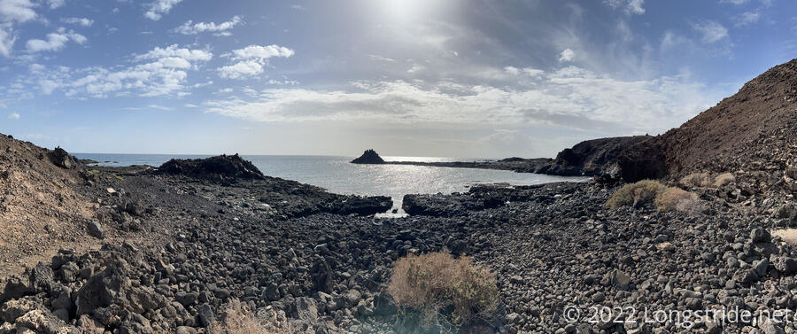
Our hike began going through a small hamlet used by local fishermen; the island is otherwise uninhabited. Beyond that, we passed one of many coves on the island.
Next, we passed a saltwater marsh. A small blind had been installed, allowing for observation of the many sea birds that make use of the area. (There were some, but not many, birds on the island while we were there.)
Further, we passed by a rock formation with nearly hexagonal-shaped cells. It reminded us somewhat of the Devils Postpile National Monument in the Sierra on the Pacific Crest Trail, where large hexagonal columns of basalt were formed from lava flows. This seemed like a smaller-scale not-as-well developed version.
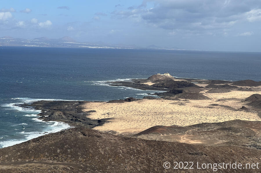
We continued on, though the arid landscape, to the north end of the island, the Faro de Punta Martiño (Martiño Point Lighthouse). The keeper of the lighthouse was the first — and last — permanent resident on the island, his presence no longer needed once the lighthouse was upgraded to be fully automated in the 1960s.
There were a fair number of people milling about the lighthouse, since it provided one of the best overlooks of the island. The side overlooking the ocean (towards Lanzarote) was shaded, and even a bit cold in the wind on the coast. We, however, had plans for a better view in mind.
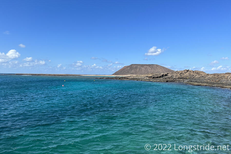
From the lighthouse, we began our return to the dock via the GR131, continuing through the dry volcanic landscape. About halfway back, a side trail leads to the summit of Montaña la Caldera, the high point on the island. Due to its proximity to the coast, the volcano’s caldera has been significantly eroded on the side facing the ocean, thanks to wind and moisture from the water, and now resembles a worn-down horseshoe.
The hike up to the top was slow; the trail tread was uneven rock, in contrast to the firm sand surface on most of the rest of the island’s trail. It was also very windy. Curiosly, the wind stopped for a minute or two during the ascent just below the summit, and then resumed as we got nearer the top.
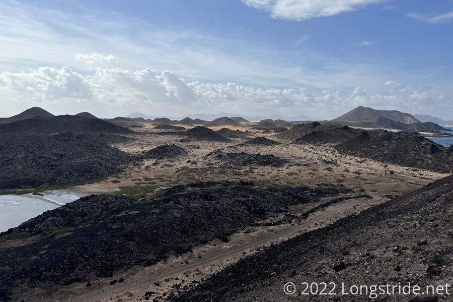
Atop the mountain, we got a panoramic view of most of the island, with Lanzarote clearly visible, and Fuerteventura peeking out from behind part of the mountain’s caldera rim.
A lot of people were milling about the summit area, which was not large, and very windy, so we didn’t stay for very long. The hike down was a bit more difficult than coming up; going down on uneven rocks is harder than going up on uneven rocks, and the wind didn’t help.
Once down the mountain, the hike back to the docks was uneventful. We passed a disused set of evaporation ponds for salt production, and a sandy beach.
Our ferry back to Fuerteventura left Isla de Lobos at 2:20 pm, and half an hour later, we were back in Corralejo. With an hour to kill before we could check into the room we rented for the next two nights, we stopped by a restaurant on the waterfront for some ice cream.
After we checked into our room, we went on a hunt for fuel canisters for our stoves. This proved far more difficult than we anticipated: we went to five different stores: two sporting goods shops and three ferreterías (hardware stores). Several had fuel cans, but with a different connection. Two of the places knew exactly what we were looking for (once we showed them pictures), but they didn’t have any in stock.
Frustrated, we stopped by a food store near where we were staying, and got food for tonight and for tomorrow’s hike.
Lack of fuel forced a re-think of our plan through Fuerteventura, and what we were hoping would be a short day of hiking and an evening relaxation wound up being a stressful run-around-the-city-and-replan-everything evening. However, since we pass small towns at least once a day, we should be able to make it work without working stoves.
Tomorrow: We’ll hike the first section of the GR131 on Fuerteventura, from Corralejo to La Oliva.


