Our third day on Fuertevenura took us over two mountain passes, through historic villages, and to the town of Pájara.
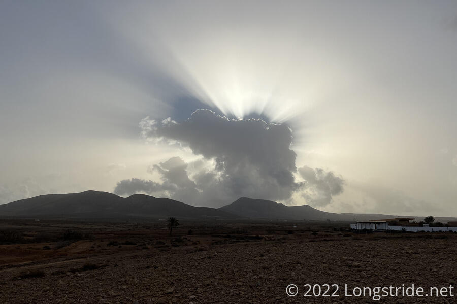
CareFree and I continued down the dirt road from yesterday, the sky noticeably more hazy than yesterday.
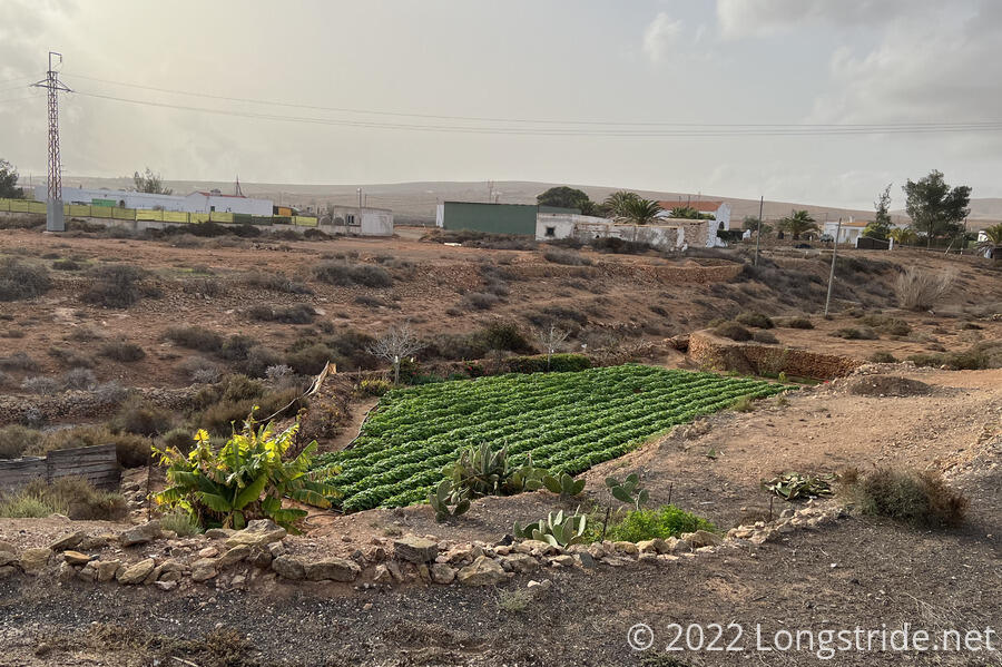
The dirt roads became paved as we went through the small village of Llanos de la Concepción. The town, originally named Llanos del Otro Valle, “Other Valley Plans” (in reference to the neighboring Valle de Santa Inés), was renamed in the late 1700s after its church was dedicated.
On our way into town, we saw a small, but very bright green field, one of the largest stretches of green we’ve seen on Fuerteventura so far.
Leaving Llanos de la Concepción, the trail turned us past a home with a camel and a donkey in the yard, both of them eyeing us suspiciously as we walked past; the camel doing its best impression of a snooty socialite, while the donkey just barely managed to peer over the fence.
Our first stop was in Valle de Santa Inés, at a convenience store right on the trail, for soda and ice cream, sitting at a shaded table in front of the store.
Leaving Valle de Santa Inés, we passed a guy who was trimming his cactus. (How’s that for sentences you never thought you’d read?)
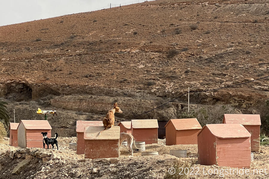
Just up the road from him was, evidentially, a dog breeder (judging by the number of dogs of the same breed, with identical houses), and the first time I’ve ever actually seen a dog sit on top of a dog house, as if it were Snoopy.
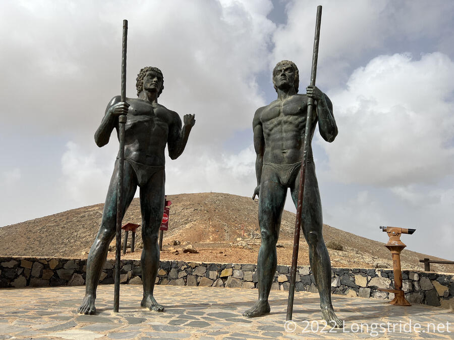
From there, the trail left roads and became a proper trail, climbing up to a mountain pass. As the trail climbed, and especially at the top, it got windier and windier, though not quite to the extent that it was on Montaña la Caldera on Isla de Lobos the other day. At the top, are two imposing statues of Guise and Ayose, the rulers of the two kingdoms of Fuerteventura prior to the Spanish conquest of the island in the early 1400s.
We stopped for a few minutes for a break, but it was too windy for CareFree, who had already been waiting at the top for a few minutes before I got there, so we quickly headed down the south side of the mountain, which would take us into Betancuria.
Betancuria, founded in 1404, was the original capital of the Kingdom of the Canary Islands (a vassal state of Spain), until it was razed by pirates in 1593. After that, it remained the capital of Fuerteventura, until the capital was moved to Antigua in the 1800s. When we got to town, though, we were surprised by how small it was! Granted it hadn’t been a capital in almost 200 years, but we still expected it to be larger. Now, it seemed very much reduced to the role of tourist attraction.
We stopped for burgers at a restaurant in town; they were considerably better than what we got in Arrecife, but they were also much rarer than we asked for.
With the sky noticeably more hazy than it had been, we asked our waiter if he knew why it was so hazy. He told us it was humidity, and I suppose it had been a little more humid than it was yesterday, but we doubted the accuracy of his answer.
We followed the road out of town, making a couple of wrong turns and short detours until the trail left the road and began climbing a mountain east out of town.
Perhaps two thirds of the way up, on the shoulder of the mountain, we passed another shelter, this one with a more sturdy roof.
From the shelter, the trail turned south and began following the ridge, a rippling series of climbs. It felt a bit like a ridge walk on the Appalachian Trail, but with less trees and more wind. Before reaching the top, the trail turned west and descended from the ridge, going through some sort of tree plantation, and descending to a large picnic area, closed due to covid.
Something striking about Fuerteventura is the sheer number of water pipes alongside the trail. The dirt roads we’ve been following make excellent routes, to be sure, but it’s surprising to me that most of the time the water pipes aren’t even trivially buried. I guess people aren’t really concerned about water pirates or freezing weather. (It’s mid-to-high 60s in January, so that seems a safe bet for now.)
The trail joined a very wide and level dirt road on the outskirts of Vega de Río Palmas, which we suspected might one day become a paved road, supplementing or replacing a paved road already nearby. (It seemed a little overkill, but trying to guess at road network plans just from the roads is a fool’s errand.)
We detoured off trail slightly to go into town for an ice cream break. The small store we were aiming for seemed to be no longer there (or is misplaced on the map, which had been somewhat common as of late), so we stopped at a seemingly upscale restaurant, in the town’s square across from the church. The waiter was suitably snooty to go with the restaurant, and asked us if we were kidding when we asked for ice cream, because apparently January was too cold for ice cream. If we hadn’t been pretty sure this was the only open restaurant, we’d have left immediately. But we persisted, and got sorbet, which was close enough.
Returning to the trail, we continued to follow the dirt road, which led us out of town and joined with a paved road, winding its way up the mountain, until it ended and a proper trail took over. Initially it appeared we might go through a tunnel or under a bridge as the trail sent us up a drainage valley, but instead we switchbacked our way up the hill, crossed the road and kept going up to a pass.
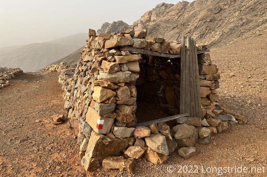
Near the top of the pass stood a small stone structure with a roof and door; a QR code nearby led to a web page that described it as being an ancient goat herders hut, used for shade during the day. On the way down, we passed by several more QR codes, including a few that had fallen off the wooden poles they had been glued to. We also passed another shelter, which faced downhill towards town, as well as two wooden bridges, the first explicit trail bridges we’ve crossed so far. (They were dry underneath, but it looked like rain could lead to pretty heavy flow.) At the bottom of the hill, shortly before joining a dirt road, a sign indicated that we had just come down an “experimental trail”.
Now on a dirt road, which led to another very wide road bed on its way into town — Pájara — we hiked as quickly as we could to get to a food store before sunset. This proved a bit more challenging than we expected (frustrating, even, since we were nearly out of water and low on food), because the store was not where the map said it would be. Fortunately, we found it around the corner, and got water and sandwich materials for tonight and tomorrow afternoon.
We stopped just outside of town at a shelter (this time facing away from town, towards not yet planted fields). After the sun fell, we noticed lots of sand in the air, illuminated by our headlamps. The air quality had considerably worsened (an app we use gave an air quality index of over 700, which is very much beyond dangerous). La calima was back. We opted to sleep with our face masks on.
Tomorrow: a shorter day than today to a hotel in La Pared.