Today brought us amazing views around Cape Bridgewater, including a pair of seal colonies on Bridgewater Bay, as the trail starts to draw to a close.
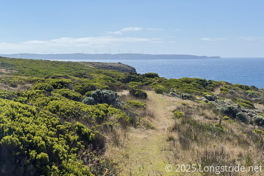
In contrast to the past couple of days, it was bright and sunny when CareFree and I left camp, continuing our trek around Cape Bridgewater. The weather was perfect for looking out at the ocean, which we could do almost immediately after leaving camp.
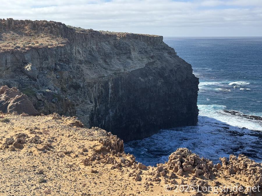
Aside from the view over Discovery Bay in general, our first view was of the freshwater springs that gave our campsite its name. The somewhat porous limestone filters water, which then hits an impermeable underlying layer of basalt and runs out, filling some pools above the ocean with freshwater. This was formerly used as a water source for cattle grazing on the cape, which in some areas, went right up to the cliff edge, and left a large area devastated and devoid of plants. Much of the trail this morning was through a rocky, orange landscape with few plants. (There has since been significant restoration work by Friends of the Great South West Walk and a local school along the trail to restore the landscape, though the extent of the damage and the weather and wind conditions mean this is a very long-term project.)
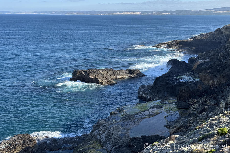
Our next viewpoint, shortly after, was a pair of pools in the exposed basalt at the bottom of the cliff we were walking atop. Formed by large gas bubbles in the lava as it cooled, these seemed like they’d make great swimming pools, if it wasn’t hazardous to get down to them. This coast was just as rocky and rugged as yesterday’s along Discovery Bay, and the surf still quite dynamic.
About half an hour further, we reached one of the main attractions of this section, the Blowholes, natural limestone pipes that channel water into high spurts. Unfortunately, with the tide going out and the ocean (relatively) calm, we didn’t really see much here; they’re apparently quite spectacular in the winter when trying winds blow in from the ocean.
We noticed lots of marker buoys out in the water. Presumably, they’re placed to alert ships to keep their distance from the rocky coast.
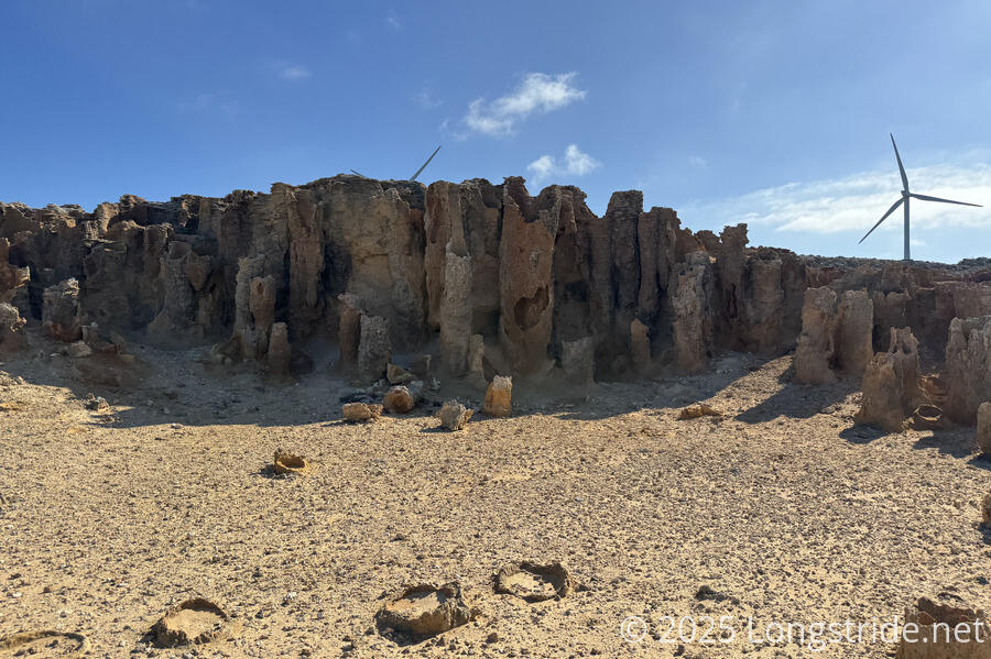
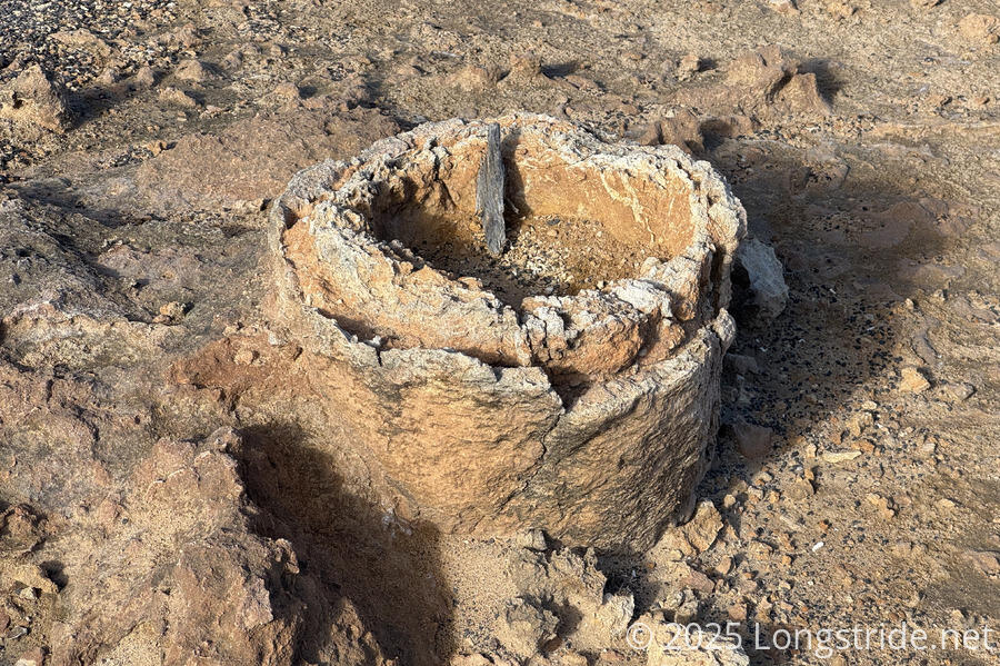
The next major attraction was the “Petrified Forest”, originally thought to be just that, but now understood to be hollow limestone pipes formed by water dissolving the interior limestone, and then hardening the outside of the formed pipe with minerals in the water.
As we continued, we regularly stopped at additional wooden viewing platforms and regular viewpoints from the trail to take in the beauty of the area.
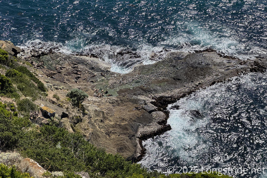
We also started to see seals, often basking on the rocks, but also occasionally swimming in the ocean.
We also got a first view of Cape Nelson, and its lighthouse, across Bridgewater Bay. We’ll pass by the lighthouse tomorrow afternoon.
As we approached the southern extent of Cape Bridgewater, we could smell something a bit malodorous in the air: seals. Too far away from the seals we saw earlier to smell them, the changing shape of the coast and relative direction of the wind (and the seals’ increasing numbers) now made their scent impossible to miss.
The trail took us uphill along the spit of land separating Discovery Bay and Bridgewater Bay, near the cliff overlooking Bridgewater Bay, leading us to two viewing platforms over two seal colonies. The first platform was at the dividing line between Australian fur seals and New Zealand fur seals. Despite their similarity, the two colonies apparently don’t mix, but both enjoy this area because it is close to bountiful feeding grounds.
The second platform, closer to the Australian colony, was much larger, and we took advantage of its shaded bench for a few minutes.
From both platforms, we could easily see several dozen seals basking on the rocks at the foot of the cliff.
According to one of the many (but sadly very sun-faded and hard to read) signs along this stretch of trail, Bridgewater Bay is part of the caldera of an enormous volcano that, at one point, stretched 350 km to Melbourne, but which has since subsided into the sea. Certainly, there’s been no shortage of volcanic rock in view today.
Continuing uphill, we passed near the high point of Cape Bridgewater, located inside a fenced-off farm with several small herds of kangaroos in the distance.
From there, we descended into the town of Cape Bridgewater, passing almost a dozen people making their way up to the seal viewing platforms.
Passing the very busy beach, we quickly made our way to the Bridgewater Bay Cafe, and ordered lunch (cheeseburgers, soda, and ice cream).
Not in any particular rush — our camp for the evening was only 6 km further — we relaxed there for two hours, recharging our electronics (my new power bank from Nelson was just about depleted), and taking advantage of the showers in the public restrooms for the beach to rinse off.
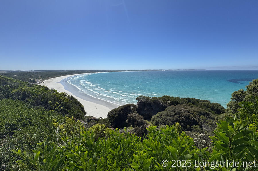
Leaving the cafe, we continued our trek along Bridgewater Bay by walking along Bridgewater Beach. It is a beautiful beach, with clear water and significantly more tame waves than what we regularly saw on Discovery Bay. Quite busy when we first arrived, the event that had been going on had packed up and left, leaving only a few beachgoers. It didn’t take more than a minute of walking to leave all the beachgoers behind, and we had the beach to ourselves and the sea birds.
This was evident from the views we had going into town, but now, hiking along the beach, it was clear that the ocean in Bridgewater Bay was much calmer than it had been in Discovery Bay, and this was a fine place for swimming.
Well, almost to ourselves. A large seal sat in the middle of the beach, enjoying the sand, and showed no inclination on moving from its spot. Fortunately, that spot was (not far) after we needed to turn off the beach and climb back up to the cliffs, so we didn’t have to worry about getting too close.
The last stretch of trail from there to Trewalla Camp alternated between views of Bridgewater Bay, and the short, stubby bush we were hiking through.
We arrived at Trewalla Camp, which has an observation platform, good for views back to Cape Bridgewater.
We discovered that the faucet on the rainwater tank was leaking, so rather than relaxing a bit first, we immediately collected and filtered all the water we’d need (just in case; but there seemed to still be plenty of water in the tank). We also let the GSWW’s hiker liaison know the faucet was leaking; a few hours later, we got a extremely terse response thanking us for letting them know and that they’d be out tomorrow to fix it. (Someone had noted in the campsite’s logbook that the faucet was leaking four days ago, but seemingly didn’t let anyone else know.)
With a largeish lunch, I didn’t cook dinner, and just had snacks (which I had in abundance). This was planned, and necessary since we’d extended our hike by a day after we had already purchased our food while in Nelson.
Wind started to pick up, and it got a bit chilly out after 7. Fortunately, our tent was pitched in a tentsite nestled inside a group of trees, so it was rather protected from the wind. The view we hoped to have from the lookout never materialized; clouds blew in behind Cape Bridgewater and obscured the sunset. But, we still had a nice, quiet evening.
