Several years ago, my family went on a cruise to Alaska. One of the things I was looking forward to was being able to see the stars: I reasoned that since the ship would be a good distance offshore, light pollution would be minimal, and the stars would be out in all their brilliant majesty, with a full field of view from the horizon to the zenith, unobscured by trees, land, or buildings. Naturally, it was cloudy every night, so I saw nothing.
So, on my Appalachian Trail thru-hike last year, I was hoping for the same thing: the ability to see an unblemished night sky. But I only rarely got to see any sky at night; usually there were trees in the way, and never did I camp on a bald or other open area that would be conducive to stargazing. So I only once or twice even got to see any amount of stars at night.
Early this morning, as I was returning from a tree-watering session, I happened to look up through the clearing in front of the shelter, and the sky was full of stars. It was beautiful — I think I even caught a glimpse of a shooting star — and I would have stayed out to watch the stars longer, had I been wearing weather-appropriate clothing.
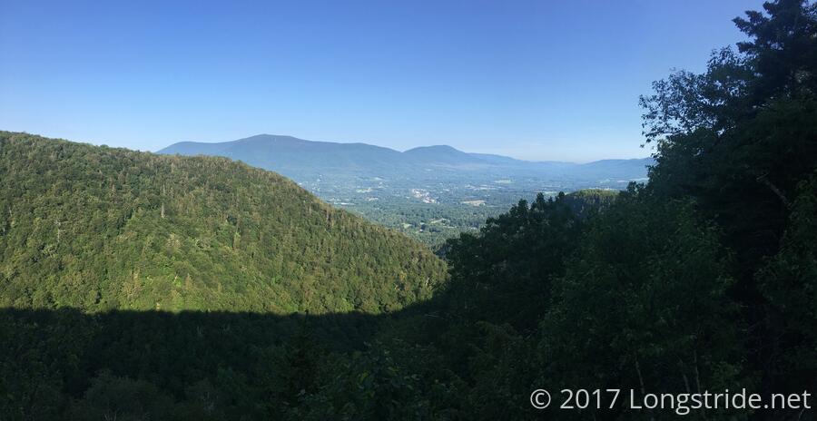
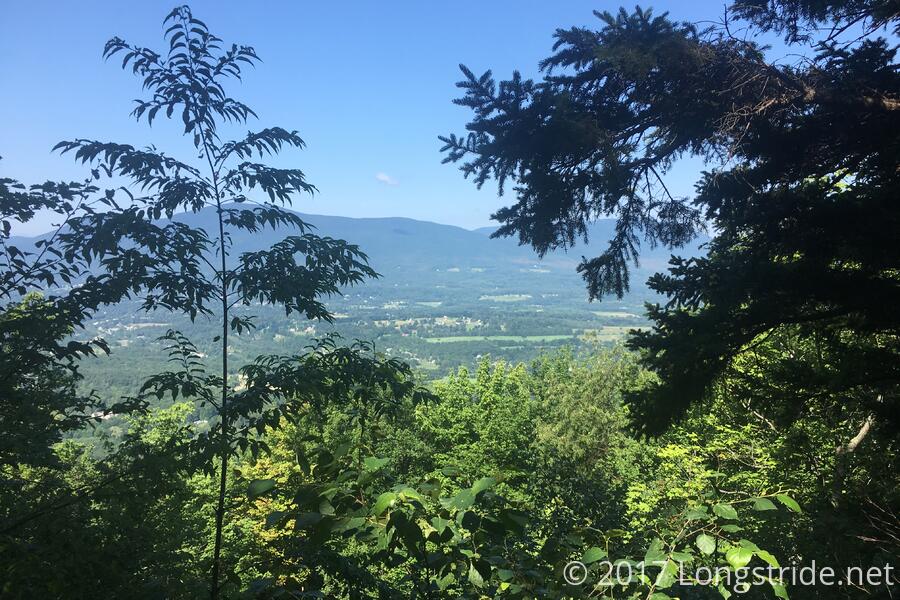
I left camp around 7:30 and began a slow, deliberate hike back down the side trail (which didn't seem quite so nice anymore since it was now gradually uphill instead of gradually downhill), to rejoin the Long Trail and continue north. Since today's hike to VT 11/30 was only about 6 miles, I felt free to take my time and not push my ankle too hard. From the trail intersection, the trail meandered through the woods briefly before joining a fire road that gave a very easy, gradual decline to Prospect Rock. Prospect Rock again provided a great view of the valley below, including Manchester Center, and and I chatted with a few hikers there who had camped there overnight.
After Prospect Rock, the trail re-entered the woods, continuing a gradual decline to the Spruce Peak Shelter. One of the more interesting shelters on the trail, Spruce Peak has a wood stove in the shelter, as well as instructions that indicate the need to use wood sparingly, as it does not take much to overheat the shelter. I took a short snack break there, chatting with an AT southbounder and some LT northbounders, before moving on.
Shortly after the shelter was a short spur trail to the Spruce Peak summit. Not being under any particular time pressure, I took the trail to the summit — which seemed a bit ill-defined, so I wound up doing a bit of rock scrambling to get to the top. The summit itself didn't have much of a view (it was completely encircled with trees), but a rock outcropping a short distance down from the summit gave a limited view of the valley below.
From the summit, it was about two bumpy miles down the mountain, and then up the next, to reach the trailhead at VT 11/30, which I reached around 11:40, giving me a slow, but reasonable average pace given I was trying to not overburden my ankle.
At the trailhead, I hitched a ride into town from a local, Tamrya, after only waiting six or seven minutes for someone willing to pick me up, so that seemed a resounding success. In town, after a false start at what seemed a "gourmet" pizzeria, I got a pizza and beer at Christos; their pizza was every bit as tasty as I remember from last year. (Honestly, I'm not sure why I didn't just make a beeline for Christos in the first place.)
I stopped by an outfitter to pick up an ankle brace, only to find that they didn't carry any! They recommended a Rite Aid, which I then looked at, but I didn't like any of the ankle braces they had. Deciding I'd just skip the brace and just overly baby my ankle, I headed to a supermarket to get food for the next leg of my hike: four days to VT 4, near Rutland.
Next to the supermarket was a sporting goods store, so I figured I'd give the ankle brace another go, and they wound up having one more to my liking. While there, I met the Krazy Kanucks, a husband and wife who thru-hiked the Appalachian Trail in 1980.
With the ankle brace and food resupply missions completed, I called Jeff to arrange for my pickup and ride to his Green Mountain House hostel on the outskirts of town. Jeff and his wife have been running the Green Mountain House for ten years, providing a nice comfy place for hikers to stay on their way up the Long and Appalachian Trails.
After a shower and change of clothes, I felt like a new hiker; days of mud and dirt that had accumulated on my legs were washed away, and I could see quite clearly the large bruise on my foot from where I sprained my ankle yesterday. (I'm unclear if the bruise was just not visible before, or if I didn't look to see it. I suspect it was probably the latter.)
So far, the superglue on my pack's hip belt extender has held, keeping the belt at its proper length and keeping the load off my shoulders, so this seems to be a win in the superglue department. I still have a little left, which is fortunate, because the bottom segment on one of my trekking poles pulled off in the (rather sparse) mud today, so I'll need to use the glue I have left to reattach it. Hopefully, it'll hold for the remainder of this hike. (I suspect I was using the poles harder than usual yesterday and today on account of my ankle, so while I'm not surprised the poles broke, I'm still disappointed they did. I had the same thing happen on the third day of my AT thru-hike, though that was with brand-new poles; these poles have closer to 1000 miles on them before they failed in the same way.)
At Green Mountain House tonight were Gas and Supe, as well as Cricket and Rockwalker, who hiked the Benton MacKaye trail earlier this year, and are currently nearing the end of their SOBO LT hike. (The BMT is just under 300 miles, and runs from Springer Mountain, southern terminus of the Appalachian Trail, west through Georgia and follows a more southerly route through the Smokies, ending near Davenport Gap, where the AT exits the smokies. The BMT was one of the hikes I was considering doing this year.)
After repacking my food resupply for the trail, I realized I had neglected to buy anything for breakfast. While I did have an oversupply of ramen that I could have used for breakfast (and which probably would have been more appetizing than Pop Tarts), I decided I really ought to pick up breakfast food (and also some more packets of tuna, which really make macaroni and cheese more flavorful). Prepared to have to walk about a mile and a half into town to get food, I asked Jeff if he had been planning on running into town at any point (on the off chance that there were hikers staying tonight that had not yet arrived, so I could ride with him into town and then walk back). He said no, but took pity on my lack of breakfast food and generously offered to give me ride into town; and then along the way, offered to give me a ride back when it became clear that it was not going to take very long for me to get breakfast, so he offered to pick me up after running an errand of his own (which I think he invented them in order to have a second reason to go into town).
During the evening group chat with all hikers staying to work out shuttle times for tomorrow, Jeff produced some Long Trail Ale for everyone staying (which surprised us, as his hostel is advertised as alcohol-free). So, cheers to Jeff, and the excellent Green Mountain House!
Tomorrow, I leave on the 8 am shuttle to the trailhead, where, ankle brace in place, I plan for what will be, so far, the longest day of the hike: 14.8 miles to the Lost Pond Shelter. With the current state of my ankle, this may be overly ambitious, since there's over 4,000 ft of elevation gain and loss, as the trail will climb and descend Bromley and Peru Mountains. Fortunately, there's ample places to stop along the way, and I have an extra day's worth of food, so I'm not worried about running out of supplies before I reach Rutland.

