The rain continued most of the night, and there was some rumbling of thunder, as well. There was so much rain that one of the tents belonging to the Farm and Wilderness group flooded, and they had to evacuate into the shelter's loft. (I've never seen a sleeping bag that wet before. They're going to be mighty uncomfortable with the extra weight on today's hike, and with however they're going to sleep tonight.)
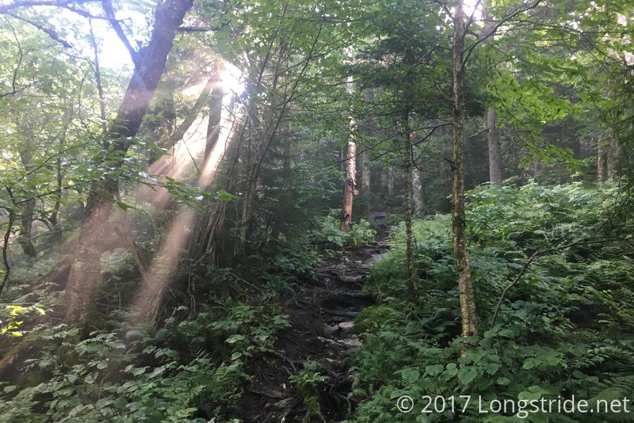
With a long day planned — my longest in ten days — I left at the (not) very early time of 7:45. The trail continued to be fairly easy to hike, though quite a bit soggy from the overnight rain. The ferns and trees lining the trail were often problematic; there were quite a few segments with overgrown plans. Ordinarily, this would just be a nuisance, but with them being wet, they were also transferring their wetness into my still-not-dry clothes. Still, I made good time, and as the morning progressed, the sun managed to free itself from the shackles of the clouds, and lend its warming (and drying) rays to my cause.
I made my first stop around 11:15 at the Spruce Ledge Camp. Unusually, this shelter featured a set of sliding doors (rather than hinged doors). There was also a nice covered picnic table, and a bench overlooking view.
From the shelter, the trail went through a short section called "Devil's Gulch". I guess someone thought it was a pretty difficult rock scramble, but after the scrambles on Camel's Hump and Mansfield (to say nothing of the Appalachian Trail's Mahoosuc Notch), and the overall ruggedness of the terrain on the Long Trail, "Devil's Gulch" just seems a cutesy name for a section that otherwise didn't seem that remarkable.
On my way up Belvidere Mountian, my feet decided that my forehead had an urgent need to have an immediate conversation with a fern lying atop a rock. The conversation did not go well. Which is to say, although it was not raining, it was still quite slippery, and though I had had numerous close calls earlier in the day, this one finally got me, and gave me a small bleeding gash on my forehead.
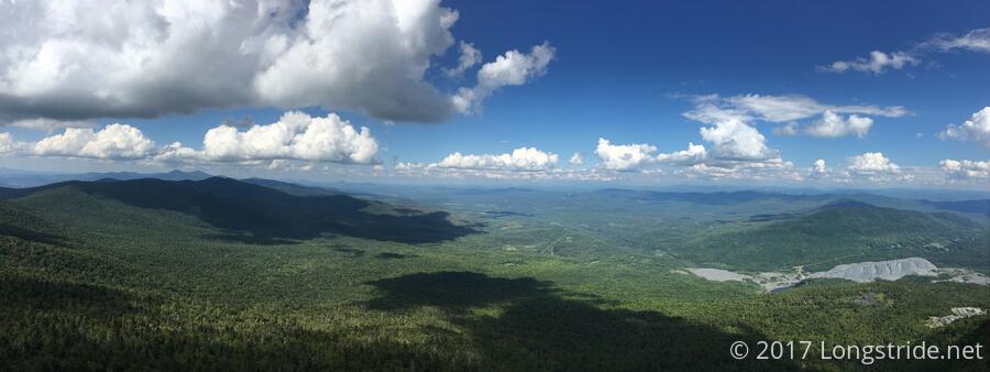
With my forehead still bleeding (or not, I couldn't really tell), I continued up Belvidere Mountain, and took the side trail to the summit and the fire tower there. From the top of the tower, there were great views of ... mountains. Lots of mountains. Lacking a map, I had no idea what was in any direction. (My Long Trail map was back in my pack, which I left at the trail junction, but it wouldn't have gone out to sufficient distance to the east or west anyway.) It'd be nice if fire towers had guides to the skyline, so you could tell what you're looking at.
There was a large flattish rocky area around the fire tower that would have are a great place to have a snack, with much the same views as the fire tower (though at lower elevation), but since I left my pack at the fork in the trail, I returned there to have my snack. When I got there, I found that Moe and Mugs had caught up and had much the same idea: have a snack a the trailhead, and then check out the fire tower.
After I finished eating, I continued along the Long Trail, headed for Tillotson Camp. The trail along this section, down Belvidere Mountain, was one of the muddiest sections of trail I've ever hiked on, and it took a fair bit longer than I expected to get to the shelter.
I got to Tillotson Camp shortly before six, and was quite surprised by the tent city that had sprung up around the shelter. I had never seen that many tents near a Long Trail shelter before, and on the Appalachian Trail, it usually meant that the shelter was full. Fortunately, it turned out that the local Trail Patrol was doing some trail work a bit south of the shelter (on the way in, I noticed some significant trail work was in progress, and a blue tarp that likely covered tools and equipment), and the tents were all theirs; the shelter was actually empty when I arrived, save for three trail patrol members using the table to cut up vegetables for dinner.
I think because I was the only hiker at the time (or maybe because of the bloody gash on my forehead I still had yet to clean up), the shelter's caretaker offered me some soup they were just heating up; I gratefully accepted: a nice vegetable soup would be a great change of pace from ramen. (Thanks again! It was quite delicious!)
It didn't take long for more hikers to show up: Moe and Mugs were next, followed by Anne and Sometime Never. Moe was kind enough to give me an alcohol pad and a more reasonably sized band-aid for my forehead than I had available.
Later in the evening, after sunset, another hiker arrived, coming from the north. He seemed to have been delayed because he got lost — or thought he got lost because of missing or unclear blazes — going so far as to call the Green Mountain Club to ask for help (and not getting any that was useful). Since it was now after dark, he wound up setting up on the floor of the now-full shelter since he felt it was too dark to set up his hammock.
Tomorrow: My penultimate day on the Long Trail.