When my 6 am alarm went off, I really did not want to get up. I didn’t sleep very well, and the slightly sore throat I had when I went to bed had not gone away. But, if I wanted to get back on the trail today, I had to get moving. There was a 7:30 bus to catch.
Normally, the hostel runs shuttles to the trailhead, but today, the driver was going to be out of town, so the shuttle service was not available. Yesterday, Papa Bear, in talking with the local bus company, determined that there was an 8:30 bus that left from the supermarket and went past the trailhead, and we could catch that bus by taking a bus leaving near the hostel at 7:30.
Breakfast again was at Teddy Bears, this time with Cool Breeze, an older hiker who had requested a wake-up knock on his door, but was already up before I got there. Getting to the restaurant shortly after opening (we were the first customers), we found a flock of ducks standing around in the parking lot. (During breakfast, they left the parking lot and headed up the street.) After breakfast, Cool Breeze, Papa Bear, Jay, and I easily caught both of our busses, and made it to the trailhead at Highway 18 shortly before 9 am.
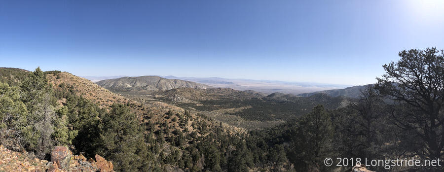
Starting from Highway 18, and for roughly the next 250 miles (nearly as far as I’ve hiked already), the trail will head due west, instead of north, following the San Bernardino and San Gabriel ranges rather than cutting immediately through the desert.
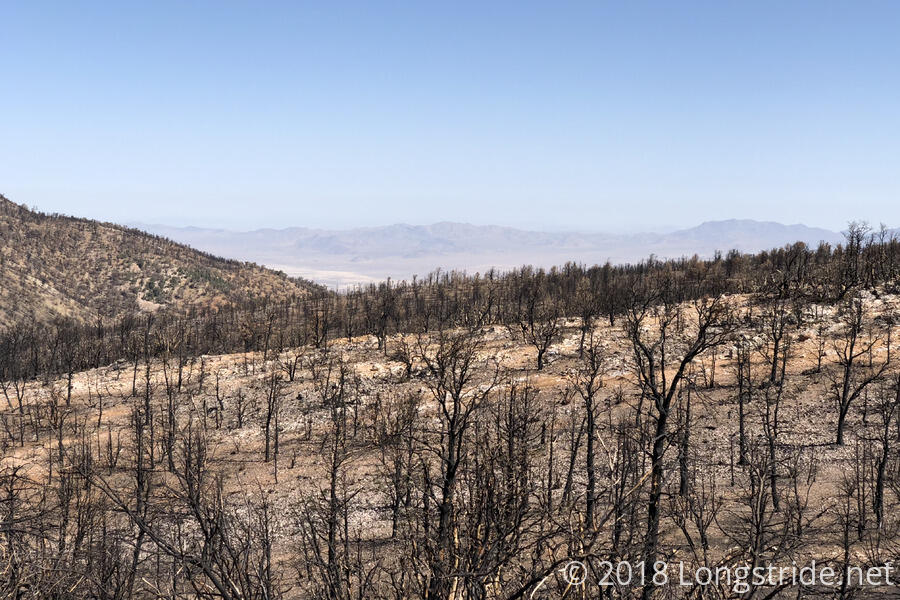
Taking a little longer than everyone else to get going from the trailhead, I quickly passed Papa Bear and Jay, only catching up to Cool Breeze about two miles from the trailhead, as the trail hit its next fire detour, from last year’s Holcomb Fire. Cool Breeze planned to go right through the fire closure, gambling that there would be no one to issue tickets, but I pointed out that that was a risky gamble, and that the fire closure wasn’t that much longer than the closed portion of the PCT.
Actually, though, that was a math error. While only about a mile of the PCT itself is within the area closed by the fire, the best available reroute, via a pair of dirt forest service roads, is actually two mile detour that skips 2.6 miles of the PCT. In this case, the fire detour was shorter than the trail being skipped. Shorter is not necessarily better: because the fire detour was shorter, that made it steeper, since it had to gain the same elevation in less distance.
It didn’t help either that I made the turn onto the first forest road a little too early, following a construction access road instead. This cut a little distance off, but made for a steep course correction up to the road we were supposed to be on.
Once back on the PCT, the trail became much nicer to hike than it had been in recent days, and by the time I had made it to the first water source at Caribou Creek, about nine miles in, I had maintained an average pace of nearly 3 mph! No doubt, being a bit cooler and there being a few clouds to lightly obscure the sun helped out a bit as well.
It was scenic, with a small wooden bridge over the creek, and I took a long lunch break there, eating part of my dinner, before finally hiking on. As the trail made its way further west, Big Bear Lake came into view. Since it actually had water (unlike Baldwin Lake), there were quite a few boats out on the lake.
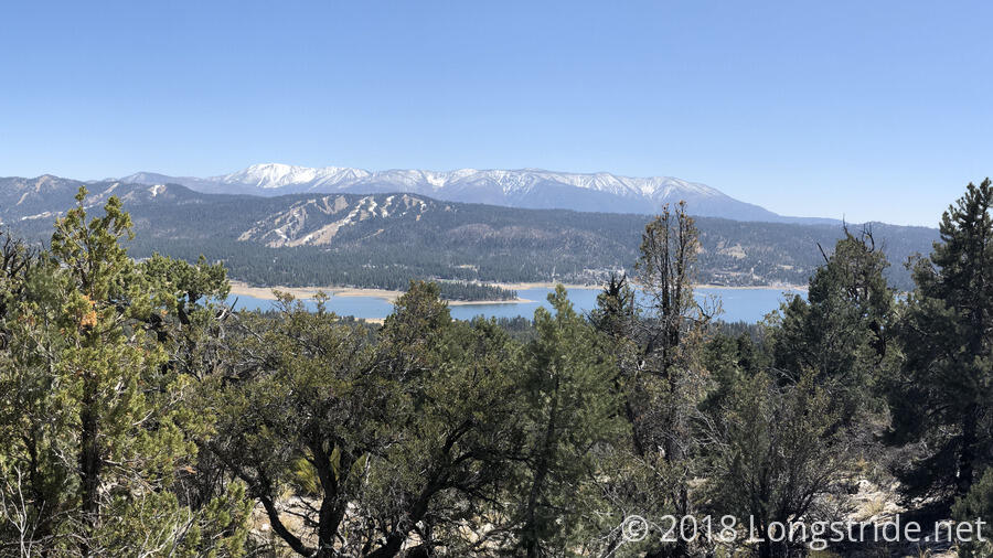
A few more miles of hiking brought me to the intersection with the Cougar Ridge Trail, which provides another access point for Big Bear Lake, from the north side of the lake. The intersection had a beautiful overlook of the lake and the mountains behind, as well as a pair of benches to sit on. Already there, were Papa Bear and Jay, who were talking with a couple of local day hikers, so I had a seat and joined in the conversation. The day hikers had apparently not realized the PCT was a thing that existed (nor that it was basically in their backyard), and so we fielded quite a few questions about the trail and long-distance hiking in general.
After a surprisingly long and unexpected break there, the three of us returned to the PCT and made our way to a campsite a few miles beyond. Although it was only 4 pm, and I had been hiking fairly quickly all day, I was feeling a bit worn out. (Perhaps from whatever was causing the sore throat.) The next campsite was “only” 6.4 miles ahead, and at the pace I had been going, I could make it there well before sundown, but feeling tapped out, I didn’t think I’d actually be able to make it there. (Well, to be clear, I’m 100% confident I could have made it there; I just would not have had a very good time doing it.)
Jay also elected to stop with me; Papa Bear stopped for a short break, and then hiked on. I picked what would turn out to be a very comfy spot to set up my tent: a nice bed of pine needles made for a fine cushion. As I cooked ramen for diner, Jay offered some beef jerky; I dropped some into the pot while the noodles were cooking, and it turned out pretty good. Hearing of my sore throat, he also offered some Miso Soup mix. It was tasty, but I’m not sure it actually helped out with the sore throat.
After dinner, I crashed in my tent, convinced I had the weirdest cold ever (tired, sore throat, inability to focus, but no nasal congestion). Not able to conjure enough mental energy to write today’s post (this was written tomorrow), I watched the two most recent episodes of Agents of Shield, and then fell asleep.