Not only did I wake up before sunrise today, I was actually out of my tent before sunrise as well. I got everything packed up and started hiking right at 7 am, and got half a mile before I realized I didn’t have my sunglasses.
After searching my pack to make sure that I hadn’t simply misplaced it somewhere, I left my pack on the side of the trail and half-hiked half-ran back to the camp to look for my sunglasses. Fortunately, I found them, near where I had hung my food bags last night. Likely, they fell off yesterday when I was throwing my food bags, and I just hadn’t noticed. That runaround cost me about 25 minutes and an extra mile of hiking.
After only a few miles of hiking, I passed 400 miles. Like with 300 miles, apparently, there was a marker on the side of the trail, but I didn’t see it, even though I was looking for it. The first stop of the day was at Camp Glenwood, a youth camp established by the Glenwood Dads Club, just under a mile after the 400 mile marker. The camp has a few picnic tables, some shade provided by a covered porch on the building, an outhouse, and a small water cache. I took a quick snack break there, chugged a liter of water, and hiked on.
A few miles later, the trail brought me to another intersection with CA 2, at Three Points, which had trash cans and toilets. (The trail’s been pretty kind with trash cans and toilets lately.) Past Three Points, the trail entered another area burned in a fire, and there was a fair amount of Poodle Dog Bush on the sides of the trail that needed to be avoided.
Shortly before noon, I came across another snake, this one lying across the trail. It was black, but I was unable to tell what kind of snake it was, so I slowly approached to see what it did. Unsurprisingly, it turned out to be a rattlesnake, and it withdrew into a coil in a bush on the side of the trail and rattled at me. Although nice that it was off the trail, it was still far too close for comfort. I wound up bowling.a short but thick piece of a beach at the snake, which then withdrew down the hill (and away from the trail) at a pretty fast speed.
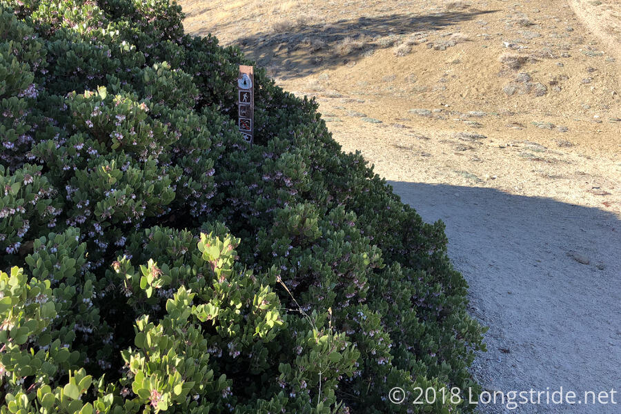
When I reached a trail intersection, in the early afternoon, I saw a set of confusing signage: the PCT appeared to go in two different directions. A closer look at the signage, though, revealed that the PCT was hikers-only in one direction, and horses-only in another. I took the hiker route, and a little while later, the equestrian trail rejoined the hiker trail, and I took a break under a tree that was just barely able to provide useful shade.
As I was putting on my socks and shoes to leave, Quoi and Dylan appeared from around the tree I was sitting under, having come down the equestrian trail. (There was a campsite shortly after the trail branched off, where they had stopped for a break, and continued along the equestrian trail rather than backtracking to the hiker trail.) After I had put suntan lotion on my face, Quoi pointed out (and not for the first time) that there was a bit still visible — not sufficiently rubbed in. This led to a very odd conversation (not verbatim):
Quoi: “But, I guess you don’t want cancer. Men are actually more likely to get skin cancer than women.”
Longstride: “I did not know that.” (I was content to let the assertion stand without further comment, though anecdotally, the only person I personally know to have had skin cancer is a woman.)
Quoi: “Like, breast cancer is more likely in women.”
Longstride: “Yes, statistically.”
Quoi: “I guess women can’t get testicular cancer.”
Longstride: “The equivalent would be ovarian cancer, I suppose.”
Quoi nods
Longstride (to Dylan, who is poking at a hole in his shoe with his trekking pole): “You know, poking at it isn’t going to help.”
Quoi (not facing Dylan, and so initially assuming my last comment was related to the conversation): “What??”
As the afternoon progressed, the trail became more desert-like, and in particular, less scenic and picturesque. It took a little while, but I eventually realized that this was because the trail was following the contours inside the mountains we were passing through, rather than following along the outside of the mountains.
A few miles of uphill later, losing Quoi and Dylan shortly after the uphill began, I caught up with Enigma, who was resting at a small spring trickling across the trail. Described somewhat unfavorably in the guide and in the water report, the spring, while not exactly gushing, was actually providing a fairly good flow, and it took barely more than a minute to fill up my 4 liter water bag.
I sat in the half-shade while my water slowly filtered and talked with Enigma for awhile. Eventually, Quoi and Dylan arrived, and also collected water. Enigma left, and I continued to chat with them, stretching my break out even longer. At some point, discussion turned to how far we were planning on going today. Quoi wanted to go another 7.5 miles to the next water source at a park adjacent to a fire station, but given the time, that would likely put us there after sunset. (It also would have made for a nearly 24 mile day for me; shorter for them, since they had started further up the trail than I did.) I didn’t think I’d be able to go that far, but suggested offhandedly that we should probably eat dinner where we were, so that we wouldn’t have to try and cook dinner after dark. Quoi thought that was a good idea and started making here dinner. And so then I found myself cooking my own dinner, on the trail, on the side of a mountain, with very little room to spare. When they were done, Quoi and Dylan hiked on; it took me a bit longer to finish my own dinner.
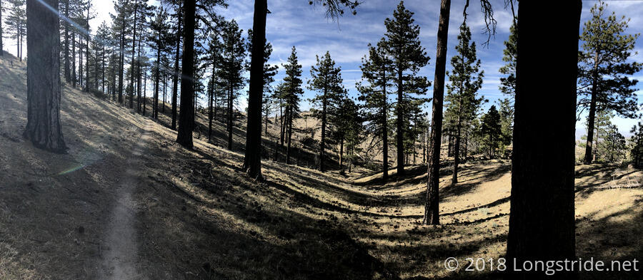
After a little more hiking to the “top” of whatever we were climbing, the surrounding forest pretty drastically changed character. Suddenly, it was a loosely populated pine forest, with gently rolling hills. It rather felt like it didn’t belong.
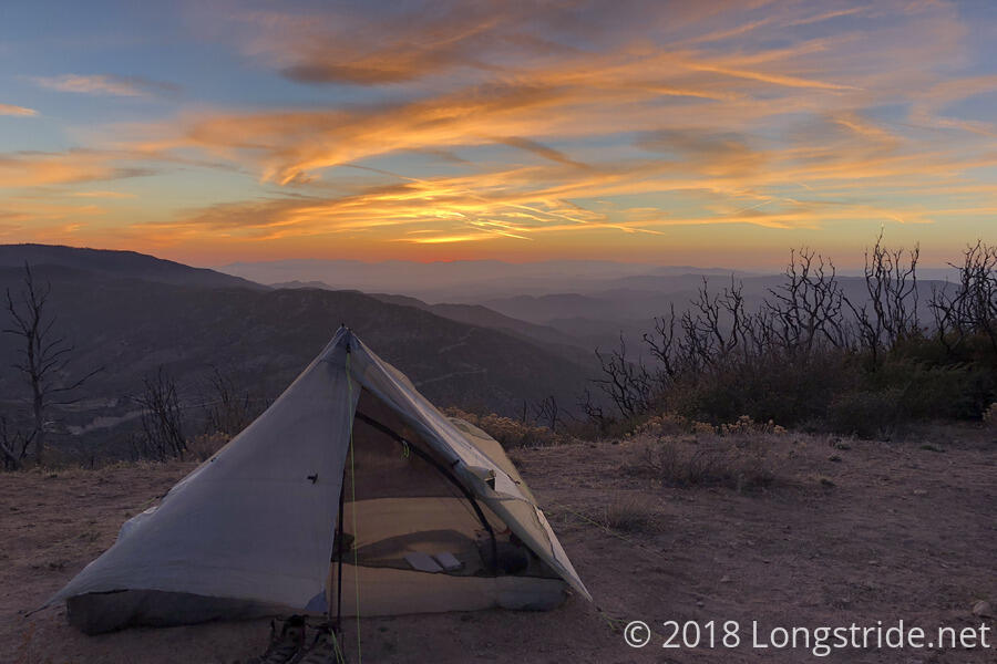
Near where the trail peaked, there was a great 180-degree view of the surrounding landscape. I contemplated stopping there, but there wasn’t anything that resembled a campsite; the ground in all the places that looked even slightly promising was incredibly lumpy.
Ultimately, I stopped at a terrific campsite shortly past there. A bit short of the campsite listed in the guide, Enigma had stopped there to cowboy camp. While a bit exposed, it wasn’t terribly windy, and it featured a great view towards the sunset.