Today, Quoi and I hiked over Selden Pass, the penultimate pass before we reach Mammoth Lakes for rest and resupply. It was not without its adventure.
As planned, I woke up at 3 am, and Quoi and I started hiking up to Selden Pass by 4:15. The frost on the grass glistened in the light of our headlamps as we made our way up the moonlit mountain.
Early on, we hit a water crossing. In the dark, armed only with our headlamps, it was pretty difficult to see where we needed to go or how we could get there. It took a little searching, but we managed to find a dry way across. It would have been unfortunate to start the day so early (even before sunrise) with wet feet.
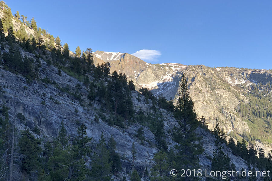
It was also unexpectedly warm; we stopped after only a mile to shed a layer of clothing (a rain jacket, in my case). It didn’t take long after that for the snow field to start, but compared to the other passes we crossed, Selden’s snow field was fairly small and not difficult to navigate.
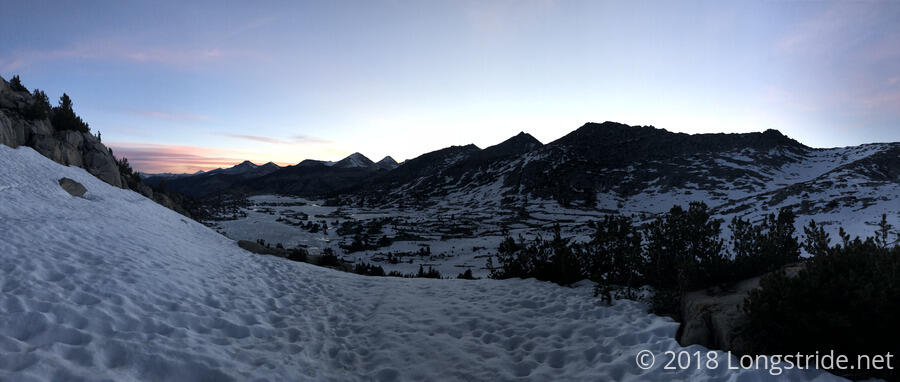
As we climbed, the sky brightened, the sun racing towards the horizon. We were successful in making it to Selden Pass before sunrise, and were rewarded with some fairly great views. Even once the sun rose, it would still be awhile to make it over the mountains, longer than we lingered at the pass.
We spent awhile at the pass, talking with the group that got there just before us, and others who got there afterwards.
The hike down from Selden Pass continued in a snow field for awhile, and like our previous passes, we had to employ our navigation skills to get to where the trail was going when we couldn’t follow the trail itself. On the way down, we ran into Tenderfoot, who joined us on the way down, and then stopped for a break with us around 7 am.
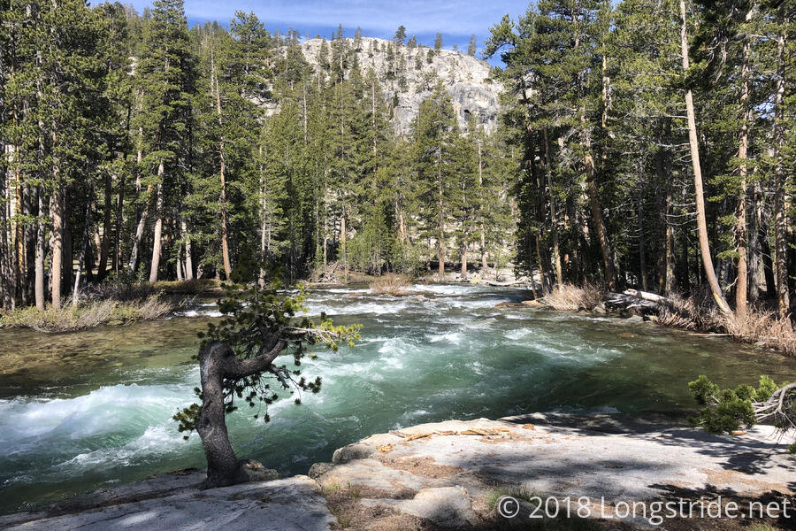
After the break, we encountered two major water crossings related to Bear Creek. The first, Quoi and I tried to cross via a fallen tree a bit downstream, but the log had deteriorated significantly from last year when Quoi used it, so instead, we crossed in the water, which was quite cold, powerful, and crotch-deep. It took us a while (well, it felt like a long time, but it was probably only a minute) to navigate the current and get far enough across to climb up on the log and finish hiking across.
We returned to the trail, and I stopped to wring out my socks and shoes; the cold water in my shoes was making my feet feel like block of ice. (My pants also got a good soak, and I took the leg bottoms off, since they weren’t going to be of much help staying warm afterwards.)
This was unfortunate because once I got my feet dried and warmed up, and my wet socks and shoes back on, there was another water crossing. While not as deep, it was still fairly fast-moving, and the bottom was extremely slippery. Not fully registering Quoi’s earlier comment about the creek being very slippery, and my feet still fairly wet, i somewhat idiotically charged into the creek, lulled into a false sense of complacency by the non-slippery rocks near the shore. When I got to the middle, somewhat predictably, I slipped, and got one of my arms wet catching myself. Fairly off-balance, Quoi had to provide a little leverage so I could stand up (though I probably could have gotten up myself with a little more time to recenter myself).
This, of course, called for another round of shoe and sock wringing. Tenderfoot, who had split from us at the first crossing to cross where the trail crossed the creek, passed us at this point.
We stopped for lunch at a large rock outcrop near the bottom of a hill around 10:45, conveniently located in the sun so we could dry our socks and shoes. As I was cooking my macaroni and cheese, Quoi commented that, since I gave her my extra day of mac & cheese when she was running out of food on the way to Bishop, she’d been dreaming (or, having nightmares) about my dinners. They’re just that tasty.
As we were getting ready to start hiking away, Caveman, who hiked the Appalachian Trail in 2012 and 2013, came by. Earlier in the day, he slipped in the water and broke his phone, and wanted to know how far it was to VVR (Vermilion Valley Resort), the second of two nearly-on-trail resupply points in this part of the Sierra. I told him, and then gave him my paper maps from where we were to Mammoth Lakes, so that he would at least have a navigational aid. (This is, I think, the first time having paper maps has been useful as something other than a paperweight.)
Quoi has a very active dislike of VVR based on her stay there last year, almost on par with Beast’s dislike of Standing Bear Farm on the Appalachian Trail, and she’s made that dislike known to pretty much everyone we’ve come across that has even suggested they were going to VVR. I won’t repeat her allegations here since I can’t personally confirm them, because I’m not planning on going to VVR. (That was a decision I made prior to starting on the trail, because it’s very expensive there.) That said, it would seem that VVR does not exemplify thru-hiker culture, rather, taking advantage of hikers by virtue of their location, and the fact that anyone who shows up there pretty much has no other recourse.
From our lunch spot, the trail climbed up via a series of switchbacks a thousand-foot-high disaster area of fallen trees. I got my dry feet wet again almost immediately, after having to go through a stream crossing the trail rather than taking a somewhat sketchy log that crossed it.
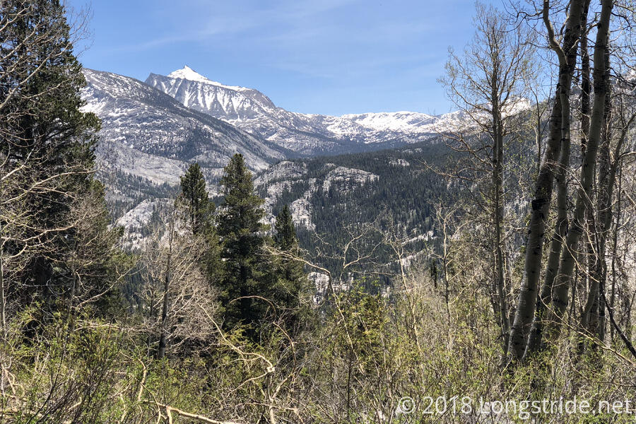
Near the top of the climb, the trail passed a side trail to VVR, then largely followed the mountain’s contour for a while, making for a very fast, easy hike. Then, the trail dropped about 2100 feet over the course of 50 (!) switchbacks while in dense forest, blocking views. That may well have been the most switchbacks I’ve followed in the course of a single climb. (Though, I’m told that the Whitney Portal trail from Lone Pine to Mount Whitney has 99 switchbacks, so I have that to look forward to later.)
I took a break once I reached the bottom, at the junction with the other side trail to VVR (which goes to a ferry on Lake Edison). I wound up waiting there much longer for Quoi than I expected: she got there nearly two hours after I did. (That wasn’t all slow hiking — she was on the phone with her boyfriend somewhere on the trail that had cell service.)
When we got going again, we had one final stream crossing, at the North Fork Mono Creek, which defied our attempt at crossing it dry. Not wanting to get my shoes wet again so late in the day, I put my Crocs on for the crossing.
From there, the trail climbed, loosely paralleling the creek. About halfway up to where we decided to camp, I went over to the river to collect water for tomorrow morning. (I would have liked to have done so when I was waiting for Quoi, but a note on the trail warned of a “very large” bear, so I decided it was probably best to not leave my pack unattended.
We got to the campsite (shared with several other hikers) around 7, and quickly got our tents pitched and got ready for tomorrow’s 4 am hike over Silver Pass, the last pass before we head into Mammoth Lakes for some well-deserved R&R.