The stars were great last night, at least for a few hours, until the moon came out and hid them. And, while it was a bit cold out last night, it wasn’t too cold, and my down jacket helped keep me nice and toasty warm.
I slept pretty well, given I was one foam pad (and a sleeping bag) away from rock, though I was still in no hurry to get up. I finally entertained the notion of getting up around 6:30, after the second group of five people hiked by and everyone else but Quoi had left. (I saw at least 12 people go by while I was hiding out in my sleeping bag; Quoi said she saw 20.)
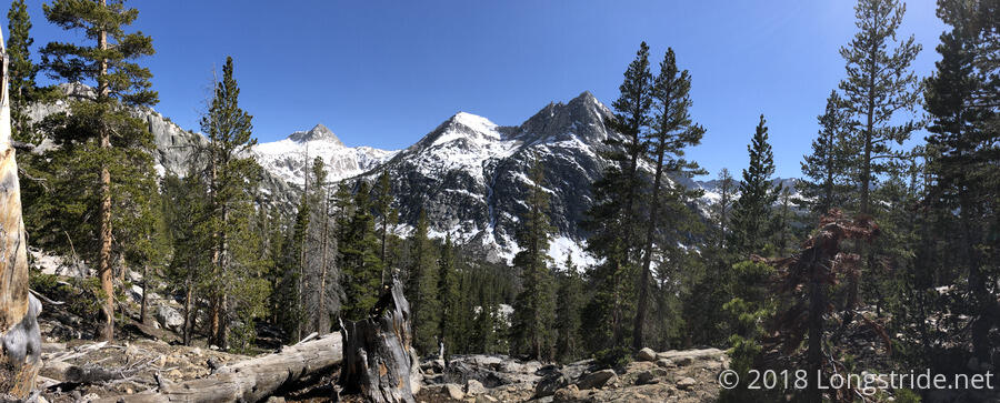
Quoi and I left our rock island around 7:30, heading up the final three miles to Muir Pass. Quoi got started first, and by the time I was ready, I had lost sight of her. Instead, I followed the giant snowshoe tracks, which stood out rather well from all the other footprints. (I suspected, and later confirmed, that they belonged to Knoxville, whom I saw with snowshoes back in Bishop.)
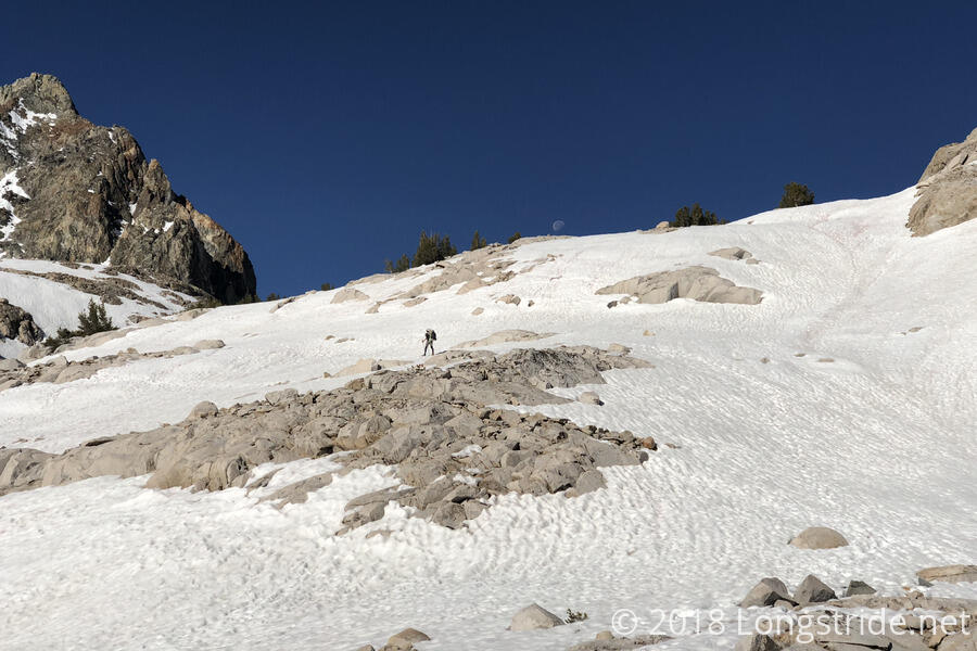
I started off with my microspikes on, and then fairly quickly took them off once I got to a rocky area and didn’t have the traction to hike up the rock with them on. I passed Quoi at some point, each of us having taken different routes, but we met up again at a creek crossing. We took a short break shortly after; my arms were quite sore; Quoi’s everything was quite sore.
Continuing up the mountain, we only occasionally postholed. Around 9:30, the top of Muir Hut came into view, and we hiked to it, reaching Muir Pass. On the way, though, I did discover the answer to a question I did not know I had: “What does a snowshoe posthole look like?” (Pretty much as you’d expect: a giant-sized several-inch-deep depression.)
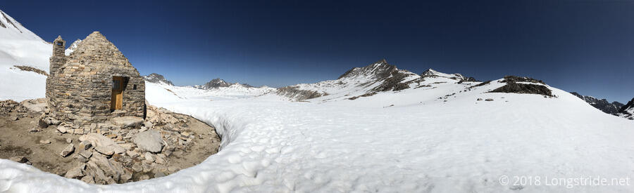
The Muir Hut, built in 1930 by the Sierra Club and named for John Muir, is an all-stone structure with a (now-filled-in) fireplace, which serves as an emergency shelter for hikers caught in storms on the otherwise completely exposed trail. Quoi had wanted to stay here last night, though I was just as glad not to. Especially with the fireplace bricked up, the interior was well-insulated from the outside, so it was quite warm, and also quite musty. We took a short break there, before pressing on along down the north face of the mountain.
There were a number of different footpaths to follow, converging and diverging across the snowy landscape. We generally split the difference, opting for the most direct route to the next rock island or other obvious waypoint. That started off well, and we made good (if snowy) progress, but as we moved forward (and downhill) and it grew into the late morning, we started postholing more and more frequently.
We took a much-needed break shortly after noon on a rock island — we could easily have fallen asleep there. As we made progress, and with the quite warm temperatures, we could really begin to feel the snow gradually having less strength. The further we made it, the harder it became.
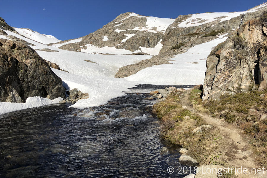
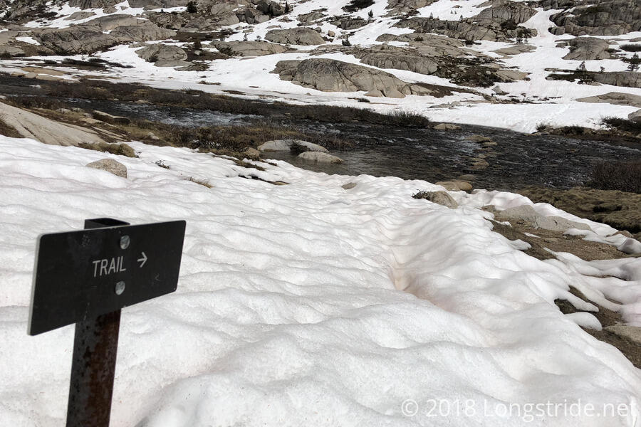
The trail was still completely buried under snow, but we opted to more closely follow the trail than the other footpaths. The trail began roughly following Evolution Creek, and also with several other lakes in the valley, we wanted to avoid unexpected water crossings. At one point a sign pointed out the trail, crossing the relatively wide Evoloution Creek along a series of stepstones.
About two miles (and two hours) later, we reached a nice campsite at Evolution Lake, where quite a few other hikers had stopped for a break. We cooked dinner there; while I was between my mac & cheese and ramen meals, an ant picked up a piece of tuna I had dropped on the ground and had climbed up a bowl I use for measuring water and was apparently attempting to go inside.
After we passed Evolution Lake and started descending again, the snow largely disappeared, much to our relief. Still, though, we had hiked through a very long snow field, and I’m glad we didn’t start any later than we did; going through any later would have been a lot more miserable. Eventually, the trail left the snow entirely, and entered a very nice pine forest.
Our progress greatly quickened by the snow-free downhill hike, we took another break about six miles later at the trailhead for the Evolution Creek Alternate. The creek’s crossing with the PCT, about three-quarters of a mile further, is a potentially dangerous deep, fast water crossing, and an alternate route crosses the creek upstream, where it’s wider, shallower, and less rapid.
Unfortunately for us, the trail junction was swarming with mosquitoes, and I had to spray myself with insect repellant to be able to (mostly) sit there in peace while I ate my snacks. While we were there, Bill, a hiker attempting a yo-yo (a northbound hike immediately followed by a return southbound hike) arrived. He had hiked with Flowers, Free, and Dylan while they were going over Mather Pass. Free was apparently planning to exit the trail at Bishop Pass (whose trail junction we passed yesterday afternoon); all three of them got “super-baked” at Mather Pass, delaying their progress, so now they’re at least two days behind us.
Our ford of Evolution Creek went well, though in spite of the more favorable conditions along the alternate, the water still went up past my knees.
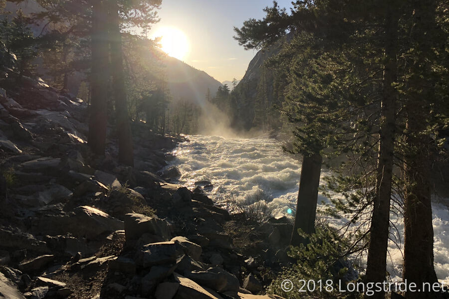
Once we rejoined the PCT, the trail continued downhill, following Evolution Creek, now a raging waterfall spewing mist into the air. As big a waterfall as it was, I could only wonder about how big it was last year, when there was much more water feeding the creeks and streams from snowmelt.
After diverging from Evolution Creek, the trail crossed on a bridge the large South Fork San Joaquin River, and passed by quite a few campsites. At one, we chatted for a short while with a couple of hikers out for the weekend, and I was able to give them the water bottle I found on the trail a few days back so I wouldn’t have to carry it all the way to Mammoth Lakes.
Starting to get late, we followed the river for another half mile or so before finding another campsite (with two other hikers) that had enough space for us.
Our campsite for today, on the South Fork San Joaquin River, is at a relatively low elevation (about 8,425 feet), it should be relatively warm overnight, allowing us a reasonably early start tomorrow.
Given the distance remaining to Selden Pass (12.4 miles), we decided that tomorrow would be a short day, getting as close to the pass as possible. If, however, the snow conditions are very favorable (which is not an unreasonable possibility, since the pass is below 11,000 feet), we might still go up to and over the pass.